![](/images/other/stat-length.png)
![Tour Wandern Opwijk - 20220416 Hyacintentocht lus 10 km via WWeg 53 - Photo](https://media.geolcdn.com/t/1900/400/ae2ac5aa-00d1-4a9a-96be-89b4020581ac.webp&format=pjpeg&maxdim=2)
20220416 Hyacintentocht lus 10 km via WWeg 53
ElGino
Benutzer
![Länge](/images/other/stat-length.png)
![Maximale Höhe](https://static1.geolcdn.com/siteimages/upload/files/1508320355ic_sort_altitude_max_24dp.png)
![Positive Höhendifferenz](https://static1.geolcdn.com/siteimages/upload/files/1508320355ic_sort_den_pos_24dp.png)
![Km-Effort](/images/other/stat-length.png)
![Min. Höhe](https://static1.geolcdn.com/siteimages/upload/files/1508320355ic_sort_altitude_min_24dp.png)
![Negative Höhendifferenz](https://static1.geolcdn.com/siteimages/upload/files/1508320355ic_sort_den_neg_24dp.png)
![Boucle](https://static1.geolcdn.com/siteimages/upload/files/16400158638029165_repeat_loop_refresh_sync_direction_icon.png)
![Wandern](https://static1.geolcdn.com/sitytour/trail-icons/101.png)
2h06
Schwierigkeit : Medium
![Scannen Sie diesen QR-Code, um die Tour in der SityTrail-Anwendung zu öffnen](https://capi.geolives.com/qq0zvz2zws4bq2lad0pu/sitytour/trails/3202592/qr.png?size=200)
Kostenlosegpshiking-Anwendung
Über SityTrail
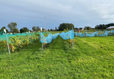
Tour Wandern von 9,9 km verfügbar auf Flandern, Flämisch-Brabant, Opwijk. Diese Tour wird von ElGino vorgeschlagen.
Beschreibung
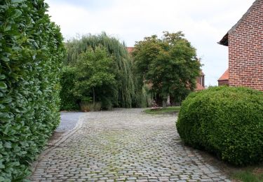
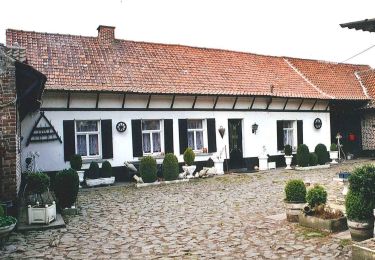
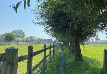
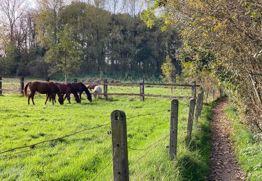
Mazenzele dorp langs Knipoog naar Waaienberg. Kerkwegje naar bosje v Willem, vervolgens rechts bosje uit maken een ruime U via veldbanen naar nieuwe Wegeltje 53. Vervolgen via Waaienberg, naar Natuurpunt knpt 200 en komen parallel met uitgang Geboortebos. Sluiten aan op eerste deel van route. Totaal 9,5 km.
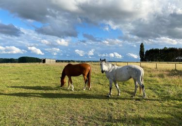
Ort
Kommentare
Touren in der Umgebung
![Tour Reiten Opwijk - Wikiloc - Meldert vanuit De Kleine Deugd - Photo](https://media.geolcdn.com/t/375/260/ext.jpg?maxdim=2&url=https%3A%2F%2Fstatic1.geolcdn.com%2Fsiteimages%2Fupload%2Ffiles%2F1524743154cheval.jpg)
![Reiten Reiten](https://static1.geolcdn.com/sitytour/trail-icons/301.png)
Reiten
![](/images/other/stat-length.png)
![](https://static1.geolcdn.com/siteimages/upload/files/16400158638029165_repeat_loop_refresh_sync_direction_icon.png)
![Tour Zu Fuß Aalst - Kersenwandeling - Photo](https://media.geolcdn.com/t/375/260/ea2bda03-7aab-439e-ac2f-d6e170d9c15f.jpeg&format=jpg&maxdim=2)
![Zu Fuß Zu Fuß](https://static1.geolcdn.com/sitytour/trail-icons/100.png)
Zu Fuß
![](/images/other/stat-length.png)
![](https://static1.geolcdn.com/siteimages/upload/files/16400158638029165_repeat_loop_refresh_sync_direction_icon.png)
![Tour Zu Fuß Lebbeke - Mennenpad - Photo](https://media.geolcdn.com/t/375/260/9ca09073-979e-439c-9e92-d1334cfb6bb5.jpeg&format=jpg&maxdim=2)
![Zu Fuß Zu Fuß](https://static1.geolcdn.com/sitytour/trail-icons/100.png)
![Tour Wandern Asse - Asse 25 km - Photo](https://media.geolcdn.com/t/375/260/93373654-1789-4a22-a980-4e4078e012f6.jpg&format=jpg&maxdim=2)
![Wandern Wandern](https://static1.geolcdn.com/sitytour/trail-icons/101.png)
![Tour Wandern Asse - S-GR Groene Gordel: Mollem - Ternat - Photo](https://media.geolcdn.com/t/375/260/6faef7af-0d0f-4faa-bb47-f1d7e98a3199.jpeg&format=jpg&maxdim=2)
![Wandern Wandern](https://static1.geolcdn.com/sitytour/trail-icons/101.png)
Wandern
![](/images/other/stat-length.png)
![](https://static1.geolcdn.com/siteimages/upload/files/16400158638029165_repeat_loop_refresh_sync_direction_icon.png)
![Tour Wandern Asse - Asse 10,7 km - Photo](https://media.geolcdn.com/t/375/260/0cbdcab9-dd9e-496b-b40e-0779d93b5c23.jpg&format=jpg&maxdim=2)
![Wandern Wandern](https://static1.geolcdn.com/sitytour/trail-icons/101.png)
Wandern
![](/images/other/stat-length.png)
![](https://static1.geolcdn.com/siteimages/upload/files/16400158638029165_repeat_loop_refresh_sync_direction_icon.png)
![Tour Wandern Asse - Asse Kravaalbos 6,1 km - Photo](https://media.geolcdn.com/t/375/260/25a33a83-112b-4dd2-b149-e23b8049088b.jpg&format=jpg&maxdim=2)
![Wandern Wandern](https://static1.geolcdn.com/sitytour/trail-icons/101.png)
Wandern
![](/images/other/stat-length.png)
![](https://static1.geolcdn.com/siteimages/upload/files/16400158638029165_repeat_loop_refresh_sync_direction_icon.png)
![Tour Wandern Asse - Asbeek 8 km - Photo](https://media.geolcdn.com/t/375/260/c9378bb3-5963-4357-b9f0-3509a536491f.jpg&format=jpg&maxdim=2)
![Wandern Wandern](https://static1.geolcdn.com/sitytour/trail-icons/101.png)
Wandern
![](/images/other/stat-length.png)
![](https://static1.geolcdn.com/siteimages/upload/files/16400158638029165_repeat_loop_refresh_sync_direction_icon.png)
![Tour Wandern Aalst - 20221204 Verkenning Baardegem Winninck - Photo](https://media.geolcdn.com/t/375/260/2707ccb6-80d7-4bb7-8678-8ecaad5c771c.jpg&format=jpg&maxdim=2)
![Wandern Wandern](https://static1.geolcdn.com/sitytour/trail-icons/101.png)
Wandern
![](/images/other/stat-length.png)
![](https://static1.geolcdn.com/siteimages/upload/files/16400158638029165_repeat_loop_refresh_sync_direction_icon.png)