


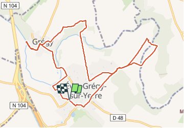

16,7 km | 18,8 km-effort


Benutzer


Kostenlosegpshiking-Anwendung
 SityTrail
IGN / Geografische Institute
SityTrail World
Die Welt öffnet sich für Sie
Tour Wandern von 11,8 km verfügbar auf Île-de-France, Seine-et-Marne, Évry-Grégy-sur-Yerre. Diese Tour wird von dmatignon vorgeschlagen.
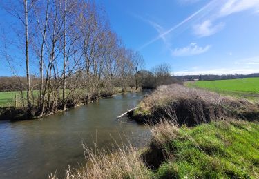
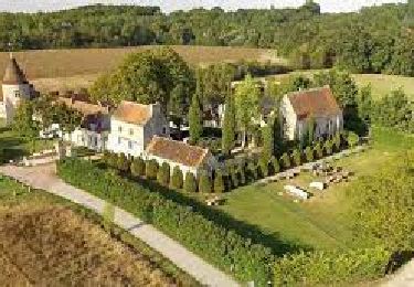
Randonnée d'une douzaine de km permettant de découvrir les ponts et passerelles sur l'Yerres au départ d'Evry-les-Châteaux, en passant par le prieuré de Vernelle.


Wandern
Wandern
Wandern

Wandern

Wandern
Wandern

Zu Fuß
Zu Fuß
Zu Fuß
Bien