![](/images/other/stat-length.png)
![Tour Hybrid-Bike Florenville - La boucle de l'Orval - Photo](https://media.geolcdn.com/t/1900/400/ext.pjpeg?maxdim=2&url=https%3A%2F%2Fstatic1.geolcdn.com%2Fsiteimages%2Fupload%2Ffiles%2F1524743154velo.jpg)
La boucle de l'Orval
mozzipsc
Benutzer
![Länge](/images/other/stat-length.png)
Länge
79 km
![Maximale Höhe](https://static1.geolcdn.com/siteimages/upload/files/1508320355ic_sort_altitude_max_24dp.png)
Maximale Höhe
368 m
![Positive Höhendifferenz](https://static1.geolcdn.com/siteimages/upload/files/1508320355ic_sort_den_pos_24dp.png)
Positive Höhendifferenz
1272 m
![Km-Effort](/images/other/stat-length.png)
Km-Effort
96 km
![Min. Höhe](https://static1.geolcdn.com/siteimages/upload/files/1508320355ic_sort_altitude_min_24dp.png)
Min. Höhe
191 m
![Negative Höhendifferenz](https://static1.geolcdn.com/siteimages/upload/files/1508320355ic_sort_den_neg_24dp.png)
Negative Höhendifferenz
1271 m
![Boucle](https://static1.geolcdn.com/siteimages/upload/files/16400158638029165_repeat_loop_refresh_sync_direction_icon.png)
Boucle
Ja
Erstellungsdatum :
2022-03-29 12:00:14.881
Letzte Änderung :
2022-03-29 12:02:39.335
![Hybrid-Bike](https://static1.geolcdn.com/sitytour/trail-icons/203.png)
0m
Schwierigkeit : Einfach
![Scannen Sie diesen QR-Code, um die Tour in der SityTrail-Anwendung zu öffnen](https://capi.geolives.com/qq0zvz2zws4bq2lad0pu/sitytour/trails/3184886/qr.png?size=200)
Kostenlosegpshiking-Anwendung
Über SityTrail
Tour Hybrid-Bike von 79 km verfügbar auf Wallonien, Luxemburg, Florenville. Diese Tour wird von mozzipsc vorgeschlagen.
Beschreibung
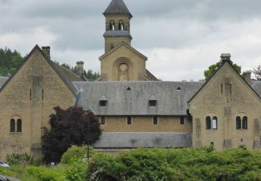
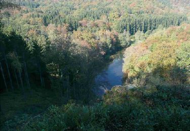
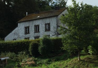
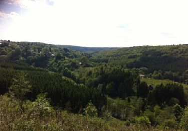
La boucle de l’Orval est l’occasion de découvrir la charmante Gaume. Ses plateaux en pente douce, appelés cuestas, vous réservent quelques grimpettes et vues remarquables sur la campagne environnante enserrée par la Semois... Pour le plus grand plaisir des yeux !
Ort
Land:
Belgium
Region :
Wallonien
Abteilung/Provinz :
Luxemburg
Kommune :
Florenville
Standort:
Florenville
Gehen Sie:(Dec)
Gehen Sie:(UTM)
666560 ; 5507610 (31U) N.
Kommentare
Touren in der Umgebung
![Wandern Wandern](https://static1.geolcdn.com/sitytour/trail-icons/101.png)
RB-Lu-19_Chameleux_via-racc-2
Wandern
Sehr leicht
(2)
Florenville,
Wallonien,
Luxemburg,
Belgium
![](/images/other/stat-length.png)
18 km | 22 km-effort
4h 43min
![](https://static1.geolcdn.com/siteimages/upload/files/16400158638029165_repeat_loop_refresh_sync_direction_icon.png)
Ja
![Tour Wandern Florenville - RB-LUX-14 - Raccourci - Dans les méandres de la Semois - Photo](https://media.geolcdn.com/t/375/260/ext.jpg?maxdim=2&url=https%3A%2F%2Fservices.sitytrail.com%2FGeolivesWS%2FDownloadMedia.ashx%3FTrailID%3D216822%26Media%3D4ddebe42-f4ef-4430-a594-18137c26d0fd.jpg)
![Wandern Wandern](https://static1.geolcdn.com/sitytour/trail-icons/101.png)
RB-LUX-14 - Raccourci - Dans les méandres de la Semois
Wandern
Sehr schwierig
(2)
Florenville,
Wallonien,
Luxemburg,
Belgium
![](/images/other/stat-length.png)
19,9 km | 25 km-effort
5h 34min
![](https://static1.geolcdn.com/siteimages/upload/files/16400158638029165_repeat_loop_refresh_sync_direction_icon.png)
Ja
![Tour Wandern Florenville - RB-LUX-14 _ Dans les méandres de la Semois - Photo](https://media.geolcdn.com/t/375/260/ext.jpg?maxdim=2&url=https%3A%2F%2Fservices.sitytrail.com%2FGeolivesWS%2FDownloadMedia.ashx%3FTrailID%3D179620%26Media%3D4ddebe42-f4ef-4430-a594-18137c26d0fd.jpg)
![Wandern Wandern](https://static1.geolcdn.com/sitytour/trail-icons/101.png)
RB-LUX-14 _ Dans les méandres de la Semois
Wandern
Medium
(4)
Florenville,
Wallonien,
Luxemburg,
Belgium
![](/images/other/stat-length.png)
24 km | 31 km-effort
6h 8min
![](https://static1.geolcdn.com/siteimages/upload/files/16400158638029165_repeat_loop_refresh_sync_direction_icon.png)
Ja
![Tour Wandern Chiny - Semois, rochers et étangs - Photo](https://media.geolcdn.com/t/375/260/aad7bb70-f961-4423-a769-93d92e58c39f.jpg&format=jpg&maxdim=2)
![Wandern Wandern](https://static1.geolcdn.com/sitytour/trail-icons/101.png)
Semois, rochers et étangs
Wandern
Schwierig
(2)
Chiny,
Wallonien,
Luxemburg,
Belgium
![](/images/other/stat-length.png)
14,8 km | 19,4 km-effort
2h 41min
![](https://static1.geolcdn.com/siteimages/upload/files/16400158638029165_repeat_loop_refresh_sync_direction_icon.png)
Ja
![Tour Wandern Chiny - Le long de la semois et sur les crêtes de Chiny - Photo](https://media.geolcdn.com/t/375/260/ext.jpg?maxdim=2&url=https%3A%2F%2Fservices.sitytrail.com%2FGeolivesWS%2FDownloadMedia.ashx%3FTrailID%3D453275%26Media%3D20150802184840.jpg)
![Wandern Wandern](https://static1.geolcdn.com/sitytour/trail-icons/101.png)
Le long de la semois et sur les crêtes de Chiny
Wandern
Sehr leicht
(1)
Chiny,
Wallonien,
Luxemburg,
Belgium
![](/images/other/stat-length.png)
6,7 km | 8,3 km-effort
1h 53min
![](https://static1.geolcdn.com/siteimages/upload/files/16400158638029165_repeat_loop_refresh_sync_direction_icon.png)
Ja
![Tour Wandern Chiny - Autour de la forêt de Chiny - Photo](https://media.geolcdn.com/t/375/260/ext.jpg?maxdim=2&url=https%3A%2F%2Fservices.sitytrail.com%2FGeolivesWS%2FDownloadMedia.ashx%3FTrailID%3D422130%26Media%3Dfix__20150517155004.jpg)
![Wandern Wandern](https://static1.geolcdn.com/sitytour/trail-icons/101.png)
Autour de la forêt de Chiny
Wandern
Einfach
(1)
Chiny,
Wallonien,
Luxemburg,
Belgium
![](/images/other/stat-length.png)
12 km | 15,3 km-effort
2h 37min
![](https://static1.geolcdn.com/siteimages/upload/files/16400158638029165_repeat_loop_refresh_sync_direction_icon.png)
Ja
![Tour Wandern Chiny - wandeling chiny - Photo](https://media.geolcdn.com/t/375/260/ext.jpg?maxdim=2&url=https%3A%2F%2Fservices.sitytrail.com%2FGeolivesWS%2FDownloadMedia.ashx%3FTrailID%3D130577%26Media%3D20120527164214.jpg)
![Wandern Wandern](https://static1.geolcdn.com/sitytour/trail-icons/101.png)
wandeling chiny
Wandern
Sehr leicht
(2)
Chiny,
Wallonien,
Luxemburg,
Belgium
![](/images/other/stat-length.png)
7,4 km | 9,5 km-effort
1h 41min
![](https://static1.geolcdn.com/siteimages/upload/files/16400158638029165_repeat_loop_refresh_sync_direction_icon.png)
Ja
![Tour Wandern Florenville - RB-Lu-19_Chameleux_via-racc-1 - Photo](https://media.geolcdn.com/t/375/260/ext.jpg?maxdim=2&url=https%3A%2F%2Fstatic1.geolcdn.com%2Fsiteimages%2Fupload%2Ffiles%2F1553511878bg_sport_marche.png)
![Wandern Wandern](https://static1.geolcdn.com/sitytour/trail-icons/101.png)
RB-Lu-19_Chameleux_via-racc-1
Wandern
Sehr leicht
(1)
Florenville,
Wallonien,
Luxemburg,
Belgium
![](/images/other/stat-length.png)
12,6 km | 16,3 km-effort
3h 32min
![](https://static1.geolcdn.com/siteimages/upload/files/16400158638029165_repeat_loop_refresh_sync_direction_icon.png)
Ja
![Tour Wandern Chiny - RF-Lu-13 - Entre Semois et Vierre : Chiny - Photo](https://media.geolcdn.com/t/375/260/ext.jpg?maxdim=2&url=https%3A%2F%2Fstatic1.geolcdn.com%2Fsiteimages%2Fupload%2Ffiles%2F1553511878bg_sport_marche.png)
![Wandern Wandern](https://static1.geolcdn.com/sitytour/trail-icons/101.png)
RF-Lu-13 - Entre Semois et Vierre : Chiny
Wandern
Sehr leicht
(2)
Chiny,
Wallonien,
Luxemburg,
Belgium
![](/images/other/stat-length.png)
10,9 km | 14,1 km-effort
3h 4min
![](https://static1.geolcdn.com/siteimages/upload/files/16400158638029165_repeat_loop_refresh_sync_direction_icon.png)
Ja