Tour Mountainbike Coutances - 1 pas, 2 pas pour Anaïs - Coutances - Photo

1 pas, 2 pas pour Anaïs - Coutances

 tracegps
tracegps

Benutzer

© OpenStreetMap contributors
Länge
Länge
39 km
Maximale Höhe
Maximale Höhe
168 m
Positive Höhendifferenz
579 m
Km-Effort
Km-Effort  
47 km
Min. Höhe
Min. Höhe
39 m
Negative Höhendifferenz
578 m
Boucle
Boucle
Ja
Erstellungsdatum :
2014-12-10 00:00:00.0
Letzte Änderung :
2014-12-10 00:00:00.0

(0 Nachricht)

Mountainbike
Mountainbike
2h45
Schwierigkeit : Schwierig

Scannen Sie diesen QR-Code, um die Tour in der SityTrail-Anwendung zu öffnen

Kostenlosegpshiking-Anwendung

Logo SityTrail SityTrail

IGN / Geografische Institute

SityTrail aus dem App Store herunterladen SityTrail von Google Play herunterladen

Logo SityTrail SityTrail World

Die Welt öffnet sich für Sie

SityTrail aus dem App Store herunterladen SityTrail von Google Play herunterladen SityTrail auf Huawei AppGallery herunterladen

Über SityTrail

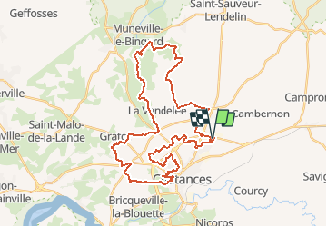
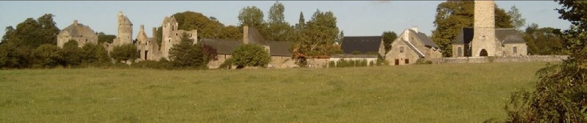
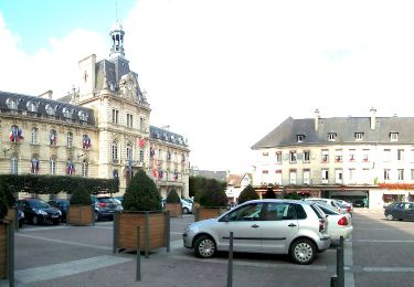
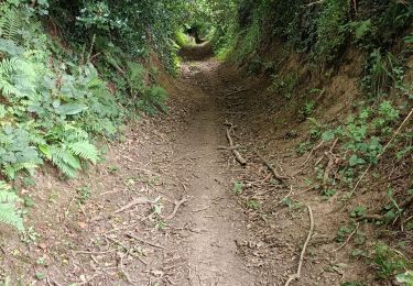
Tour Mountainbike von 39 km verfügbar auf Normandie, Manche, Coutances. Diese Tour wird von tracegps vorgeschlagen.

Beschreibung

Rando vtt dans le pays Coutançais situé en basse Normandie dans le département de la Manche. La rando était organisée pour aider l'association « 1 pas, 2 pas pour Anaïs».

Höhenprofil

Foto-Galerie

Ort

Land:
France
Region :
Normandie
Abteilung/Provinz :
Manche
Kommune :
Coutances
Standort:
Unknown
Gehen Sie:(Dec)
Gehen Sie:(UTM)
615274 ; 5436220 (30U) N.

Touren in der Umgebung

Tour Mountainbike Monthuchon - Autour de Feugères en VTT - Photo
Mountainbike
tracegps

Mountainbike

Schwierig
(1)
Monthuchon, Normandie, Manche, France
62 km | 73 km-effort
4h 30min
Ja
Tour Zu Fuß Saint-Sauveur-Villages - GRP 7 Les trésors cachés du Coutançais (Coutances - Marigny) - Photo
Zu Fuß
PRO

Zu Fuß

Einfach
Saint-Sauveur-Villages, Normandie, Manche, France
11,4 km | 13,4 km-effort
3h 3min
Nein
Tour Wandern Coutances - Coutances - Photo
Wandern
Roulland

Wandern

Einfach
Coutances, Normandie, Manche, France
10,6 km | 13,1 km-effort
2h 3min
Ja
Tour Wandern Nicorps - Pédestre - Les trois vallées - Photo
Wandern
neoroll44

Wandern

Medium
Nicorps, Normandie, Manche, France
12,4 km | 15,3 km-effort
3h 30min
Ja
Tour Mountainbike Coutances - Rando des Petits Princes de Margot 2013 - Coutances - Photo
Mountainbike
tracegps

Mountainbike

Schwierig
Coutances, Normandie, Manche, France
42 km | 50 km-effort
2h 45min
Ja
Tour Mountainbike Coutances - Rando VTT à Coutance 2012 - Photo
Mountainbike
tracegps

Mountainbike

Schwierig
Coutances, Normandie, Manche, France
68 km | 80 km-effort
5h 0min
Ja
Tour Elektrofahrrad Nicorps - boucle Nicorps - Le Pont de la Roque - Photo
Elektrofahrrad
EricVIBERT

Elektrofahrrad

Medium
Nicorps, Normandie, Manche, France
15,9 km | 18,2 km-effort
1h 32min
Ja
Tour Andere Aktivitäten Courcy - Basse Normandie - Ligne 417 - Coutances - Sottevast - Photo
Andere Aktivitäten
mich54

Andere Aktivitäten

Sehr leicht
Courcy, Normandie, Manche, France
69 km | 75 km-effort
5min
Nein
Tour Mountainbike Monthuchon - Autour de Coutances par le Mont Rainfer - Photo
Mountainbike
tracegps

Mountainbike

Schwierig
Monthuchon, Normandie, Manche, France
48 km | 59 km-effort
3h 30min
Ja


Schließen
Meine Abonnements