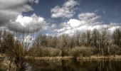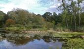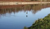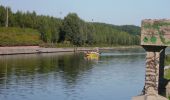

Le Marais de Beuvry

tracegps
Benutzer

Länge
12,8 km

Maximale Höhe
40 m

Positive Höhendifferenz
75 m

Km-Effort
13,8 km

Min. Höhe
15 m

Negative Höhendifferenz
74 m
Boucle
Ja
Erstellungsdatum :
2014-12-10 00:00:00.0
Letzte Änderung :
2014-12-10 00:00:00.0
3h00
Schwierigkeit : Medium

Kostenlosegpshiking-Anwendung
Über SityTrail
Tour Wandern von 12,8 km verfügbar auf Nordfrankreich, Pas-de-Calais, Beuvry. Diese Tour wird von tracegps vorgeschlagen.
Beschreibung
Balade sympathique sur des routes tranquilles au milieu d'étangs et de marais. Penser aux jumelles et à l'appareil photo. L'été le répulsif anti-moustique sera le bienvenu. Vous pouvez rallonger ce circuit (2km) en prenant la boucle du marais de Cambrin.
Ort
Land:
France
Region :
Nordfrankreich
Abteilung/Provinz :
Pas-de-Calais
Kommune :
Beuvry
Standort:
Unknown
Gehen Sie:(Dec)
Gehen Sie:(UTM)
477527 ; 5596656 (31U) N.
Kommentare
Touren in der Umgebung
Le petit-Pré - Annequin


Wandern
Einfach
(1)
Annequin,
Nordfrankreich,
Pas-de-Calais,
France

5,5 km | 6 km-effort
1h 19min
Ja
Le Rietz - Hinges


Wandern
Medium
(3)
Hinges,
Nordfrankreich,
Pas-de-Calais,
France

12,3 km | 13,4 km-effort
3h 0min
Ja
Le sentier de Catorive. - Béthune


Wandern
Medium
(2)
Béthune,
Nordfrankreich,
Pas-de-Calais,
France

8,3 km | 9 km-effort
2h 0min
Ja
Les fontaines - Cuinchy


Wandern
Medium
(3)
Cuinchy,
Nordfrankreich,
Pas-de-Calais,
France

13,2 km | 14,2 km-effort
2h 40min
Ja
randonnée labourse


Wandern
Sehr schwierig
Labourse,
Nordfrankreich,
Pas-de-Calais,
France

20 km | 22 km-effort
2h 45min
Nein

Tracé 064


Wandern
Medium
(1)
Cambrin,
Nordfrankreich,
Pas-de-Calais,
France

8,1 km | 8,5 km-effort
1h 56min
Ja

Béthune


Wandern
Sehr leicht
Béthune,
Nordfrankreich,
Pas-de-Calais,
France

5,6 km | 6,2 km-effort
2h 7min
Ja
Sentier des familles - Labourse


Wandern
Einfach
Labourse,
Nordfrankreich,
Pas-de-Calais,
France

5,3 km | 5,7 km-effort
1h 19min
Ja
Sentier des paysages - Vaudricourt


Wandern
Einfach
(2)
Vaudricourt,
Nordfrankreich,
Pas-de-Calais,
France

6,4 km | 7 km-effort
1h 34min
Ja


 SityTrail


