![](/images/other/stat-length.png)
![Tour Wandern Le Frasnois - Lac le Grand Maclu - Pic de l'Aigle - Photo](https://media.geolcdn.com/t/1900/400/ext.pjpeg?maxdim=2&url=https%3A%2F%2Fservices.sitytrail.com%2FGeolivesWS%2FDownloadMedia.ashx%3FTrailID%3D317647%26Media%3D16920_2.jpg)
Lac le Grand Maclu - Pic de l'Aigle
tracegps
Benutzer
![Länge](/images/other/stat-length.png)
Länge
7,8 km
![Maximale Höhe](https://static1.geolcdn.com/siteimages/upload/files/1508320355ic_sort_altitude_max_24dp.png)
Maximale Höhe
991 m
![Positive Höhendifferenz](https://static1.geolcdn.com/siteimages/upload/files/1508320355ic_sort_den_pos_24dp.png)
Positive Höhendifferenz
299 m
![Km-Effort](/images/other/stat-length.png)
Km-Effort
11,7 km
![Min. Höhe](https://static1.geolcdn.com/siteimages/upload/files/1508320355ic_sort_altitude_min_24dp.png)
Min. Höhe
776 m
![Negative Höhendifferenz](https://static1.geolcdn.com/siteimages/upload/files/1508320355ic_sort_den_neg_24dp.png)
Negative Höhendifferenz
287 m
![Boucle](https://static1.geolcdn.com/siteimages/upload/files/16400158638029165_repeat_loop_refresh_sync_direction_icon.png)
Boucle
Ja
Erstellungsdatum :
2014-12-10 00:00:00.0
Letzte Änderung :
2014-12-10 00:00:00.0
![Wandern](https://static1.geolcdn.com/sitytour/trail-icons/101.png)
3h00
Schwierigkeit : Medium
![Scannen Sie diesen QR-Code, um die Tour in der SityTrail-Anwendung zu öffnen](https://capi.geolives.com/qq0zvz2zws4bq2lad0pu/sitytour/trails/317647/qr.png?size=200)
Kostenlosegpshiking-Anwendung
Über SityTrail
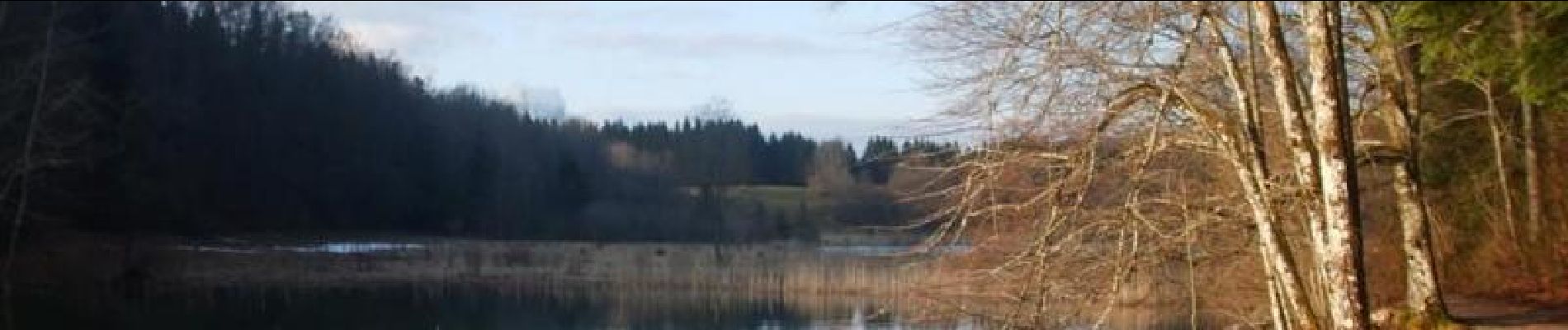
Tour Wandern von 7,8 km verfügbar auf Burgund und Freigrafschaft, Jura, Le Frasnois. Diese Tour wird von tracegps vorgeschlagen.
Beschreibung
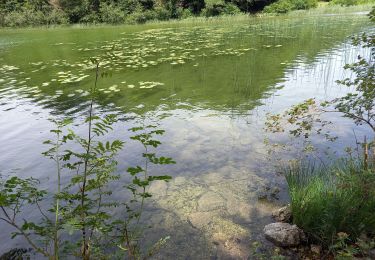
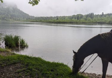
Très beau circuit passant par la crête au dessus des lacs et ensuite le long de ceux-ci. Très beaux points de vue, avec le Mont Blanc visible si le ciel est dégagé au Pic de l'Aigle. Peut être sympa dans les deux sens.
Ort
Land:
France
Region :
Burgund und Freigrafschaft
Abteilung/Provinz :
Jura
Kommune :
Le Frasnois
Standort:
Unknown
Gehen Sie:(Dec)
Gehen Sie:(UTM)
723511 ; 5168557 (31T) N.
Kommentare
Touren in der Umgebung
![Tour Wandern Le Frasnois - Cascades du Hérisson et les 4 lacs - Photo](https://media.geolcdn.com/t/375/260/21e4ab88-25e9-4626-96ca-824b99d2ef38.jpg&format=jpg&maxdim=2)
![Wandern Wandern](https://static1.geolcdn.com/sitytour/trail-icons/101.png)
Cascades du Hérisson et les 4 lacs
Wandern
Medium
(1)
Le Frasnois,
Burgund und Freigrafschaft,
Jura,
France
![](/images/other/stat-length.png)
15,4 km | 20 km-effort
4h 35min
![](https://static1.geolcdn.com/siteimages/upload/files/16400158638029165_repeat_loop_refresh_sync_direction_icon.png)
Nein
![Tour Wandern Le Frasnois - Lac de Narlay - Pic de l'Aigle - Photo](https://media.geolcdn.com/t/375/260/b7a3f0c8-5d9b-454f-b8e6-bb75ea28ecff.jpg&format=jpg&maxdim=2)
![Wandern Wandern](https://static1.geolcdn.com/sitytour/trail-icons/101.png)
Lac de Narlay - Pic de l'Aigle
Wandern
Medium
Le Frasnois,
Burgund und Freigrafschaft,
Jura,
France
![](/images/other/stat-length.png)
16,3 km | 22 km-effort
7h 1min
![](https://static1.geolcdn.com/siteimages/upload/files/16400158638029165_repeat_loop_refresh_sync_direction_icon.png)
Ja
![Tour Wandern Le Frasnois - lacs des maclut - Photo](https://media.geolcdn.com/t/375/260/ext.jpg?maxdim=2&url=https%3A%2F%2Fstatic1.geolcdn.com%2Fsiteimages%2Fupload%2Ffiles%2F1553511878bg_sport_marche.png)
![Wandern Wandern](https://static1.geolcdn.com/sitytour/trail-icons/101.png)
lacs des maclut
Wandern
Sehr leicht
(1)
Le Frasnois,
Burgund und Freigrafschaft,
Jura,
France
![](/images/other/stat-length.png)
9,6 km | 12,1 km-effort
2h 1min
![](https://static1.geolcdn.com/siteimages/upload/files/16400158638029165_repeat_loop_refresh_sync_direction_icon.png)
Nein
![Tour Wandern La Chaux-du-Dombief - pic de l''aigle - la Chaux-du-Dombief - Photo](https://media.geolcdn.com/t/375/260/ext.jpg?maxdim=2&url=https%3A%2F%2Fstatic1.geolcdn.com%2Fsiteimages%2Fupload%2Ffiles%2F1553511878bg_sport_marche.png)
![Wandern Wandern](https://static1.geolcdn.com/sitytour/trail-icons/101.png)
pic de l''aigle - la Chaux-du-Dombief
Wandern
Sehr leicht
(1)
La Chaux-du-Dombief,
Burgund und Freigrafschaft,
Jura,
France
![](/images/other/stat-length.png)
6,3 km | 9,2 km-effort
Unbekannt
![](https://static1.geolcdn.com/siteimages/upload/files/16400158638029165_repeat_loop_refresh_sync_direction_icon.png)
Nein
![Tour Wandern La Chaux-du-Dombief - Pic de l'Aigle - Photo](https://media.geolcdn.com/t/375/260/c203af9d-fb05-4002-9a9b-9cbbb8532a26.jpg&format=jpg&maxdim=2)
![Wandern Wandern](https://static1.geolcdn.com/sitytour/trail-icons/101.png)
Pic de l'Aigle
Wandern
Sehr leicht
La Chaux-du-Dombief,
Burgund und Freigrafschaft,
Jura,
France
![](/images/other/stat-length.png)
8,7 km | 12,4 km-effort
3h 4min
![](https://static1.geolcdn.com/siteimages/upload/files/16400158638029165_repeat_loop_refresh_sync_direction_icon.png)
Ja
![Tour Wandern Le Frasnois - La Fromagerie - Photo](https://media.geolcdn.com/t/375/260/8bf2dd93-4fc0-4bb5-bd59-9d9720fff72b.jpg&format=jpg&maxdim=2)
![Wandern Wandern](https://static1.geolcdn.com/sitytour/trail-icons/101.png)
La Fromagerie
Wandern
Medium
Le Frasnois,
Burgund und Freigrafschaft,
Jura,
France
![](/images/other/stat-length.png)
13,1 km | 16,4 km-effort
3h 27min
![](https://static1.geolcdn.com/siteimages/upload/files/16400158638029165_repeat_loop_refresh_sync_direction_icon.png)
Ja
![Tour Wandern Le Frasnois - Pic de l'Aigle 14.7.24 - Photo](https://media.geolcdn.com/t/375/260/0d4fe3bb-0e43-456c-9601-a5aa0df2bf07.jpg&format=jpg&maxdim=2)
![Wandern Wandern](https://static1.geolcdn.com/sitytour/trail-icons/101.png)
Pic de l'Aigle 14.7.24
Wandern
Einfach
Le Frasnois,
Burgund und Freigrafschaft,
Jura,
France
![](/images/other/stat-length.png)
9,5 km | 13,7 km-effort
3h 0min
![](https://static1.geolcdn.com/siteimages/upload/files/16400158638029165_repeat_loop_refresh_sync_direction_icon.png)
Ja
![Tour Reiten Le Frasnois - suuntoapp-HorsebackRiding-2024-05-22T07-07-14Z - Photo](https://media.geolcdn.com/t/375/260/02cd052f-9d06-4d04-8797-8cfd020cca6b.jpg&format=jpg&maxdim=2)
![Reiten Reiten](https://static1.geolcdn.com/sitytour/trail-icons/301.png)
suuntoapp-HorsebackRiding-2024-05-22T07-07-14Z
Reiten
Einfach
Le Frasnois,
Burgund und Freigrafschaft,
Jura,
France
![](/images/other/stat-length.png)
21 km | 26 km-effort
3h 27min
![](https://static1.geolcdn.com/siteimages/upload/files/16400158638029165_repeat_loop_refresh_sync_direction_icon.png)
Nein
![Tour Reiten Le Frasnois - suuntoapp-HorsebackRiding-2024-05-21T07-46-55Z - Photo](https://media.geolcdn.com/t/375/260/c798e380-307b-41ba-95e2-8a3fd2272c6f.jpg&format=jpg&maxdim=2)
![Reiten Reiten](https://static1.geolcdn.com/sitytour/trail-icons/301.png)
suuntoapp-HorsebackRiding-2024-05-21T07-46-55Z
Reiten
Einfach
Le Frasnois,
Burgund und Freigrafschaft,
Jura,
France
![](/images/other/stat-length.png)
27 km | 35 km-effort
4h 39min
![](https://static1.geolcdn.com/siteimages/upload/files/16400158638029165_repeat_loop_refresh_sync_direction_icon.png)
Ja