![](/images/other/stat-length.png)
![Tour Pferd Cournon - L'Ile aux Pies et la vallée de l'Oust - Cournon - Photo](https://media.geolcdn.com/t/1900/400/ext.pjpeg?maxdim=2&url=https%3A%2F%2Fservices.sitytrail.com%2FGeolivesWS%2FDownloadMedia.ashx%3FTrailID%3D317602%26Media%3D16871_5.jpg)
L'Ile aux Pies et la vallée de l'Oust - Cournon
tracegps
Benutzer
![Länge](/images/other/stat-length.png)
Länge
16,4 km
![Maximale Höhe](https://static1.geolcdn.com/siteimages/upload/files/1508320355ic_sort_altitude_max_24dp.png)
Maximale Höhe
54 m
![Positive Höhendifferenz](https://static1.geolcdn.com/siteimages/upload/files/1508320355ic_sort_den_pos_24dp.png)
Positive Höhendifferenz
239 m
![Km-Effort](/images/other/stat-length.png)
Km-Effort
19,6 km
![Min. Höhe](https://static1.geolcdn.com/siteimages/upload/files/1508320355ic_sort_altitude_min_24dp.png)
Min. Höhe
1 m
![Negative Höhendifferenz](https://static1.geolcdn.com/siteimages/upload/files/1508320355ic_sort_den_neg_24dp.png)
Negative Höhendifferenz
232 m
![Boucle](https://static1.geolcdn.com/siteimages/upload/files/16400158638029165_repeat_loop_refresh_sync_direction_icon.png)
Boucle
Nein
Erstellungsdatum :
2014-12-10 00:00:00.0
Letzte Änderung :
2014-12-10 00:00:00.0
![Pferd](https://static1.geolcdn.com/sitytour/trail-icons/300.png)
2h00
Schwierigkeit : Medium
![Scannen Sie diesen QR-Code, um die Tour in der SityTrail-Anwendung zu öffnen](https://capi.geolives.com/qq0zvz2zws4bq2lad0pu/sitytour/trails/317602/qr.png?size=200)
Kostenlosegpshiking-Anwendung
Über SityTrail
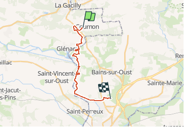
Tour Pferd von 16,4 km verfügbar auf Bretagne, Morbihan, Cournon. Diese Tour wird von tracegps vorgeschlagen.
Beschreibung
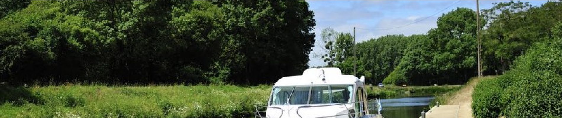
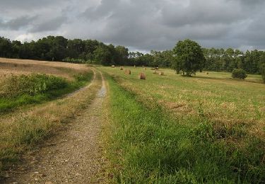
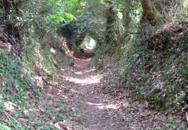
Proche du canal de Nantes à Brest et de l'Ile aux Pies, le circuit vous emmènera à proximité des sites naturels de la Roche du Theil et de la vallée de l'Oust.
Ort
Land:
France
Region :
Bretagne
Abteilung/Provinz :
Morbihan
Kommune :
Cournon
Standort:
Unknown
Gehen Sie:(Dec)
Gehen Sie:(UTM)
566677 ; 5288338 (30T) N.
Kommentare
Touren in der Umgebung
![Tour Wandern Saint-Vincent-sur-Oust - Saint Vincent sur Oust - Photo](https://media.geolcdn.com/t/375/260/ext.jpg?maxdim=2&url=https%3A%2F%2Fservices.sitytrail.com%2FGeolivesWS%2FDownloadMedia.ashx%3FTrailID%3D598192%26Media%3Dfix__20160714162616.jpg)
![Wandern Wandern](https://static1.geolcdn.com/sitytour/trail-icons/101.png)
Saint Vincent sur Oust
Wandern
Einfach
Saint-Vincent-sur-Oust,
Bretagne,
Morbihan,
France
![](/images/other/stat-length.png)
22 km | 26 km-effort
5h 25min
![](https://static1.geolcdn.com/siteimages/upload/files/16400158638029165_repeat_loop_refresh_sync_direction_icon.png)
Ja
![Tour Wandern Cournon - Cournon dolmen des tablettes - Photo](https://media.geolcdn.com/t/375/260/ext.jpg?maxdim=2&url=https%3A%2F%2Fservices.sitytrail.com%2FGeolivesWS%2FDownloadMedia.ashx%3FTrailID%3D355499%26Media%3Dfix__20141019154224.jpg)
![Wandern Wandern](https://static1.geolcdn.com/sitytour/trail-icons/101.png)
Cournon dolmen des tablettes
Wandern
Einfach
Cournon,
Bretagne,
Morbihan,
France
![](/images/other/stat-length.png)
10,7 km | 13,3 km-effort
2h 50min
![](https://static1.geolcdn.com/siteimages/upload/files/16400158638029165_repeat_loop_refresh_sync_direction_icon.png)
Ja
![Tour Wandern Cournon - Circuit du Dolmen - Cournon - Photo](https://media.geolcdn.com/t/375/260/ext.jpg?maxdim=2&url=https%3A%2F%2Fservices.sitytrail.com%2FGeolivesWS%2FDownloadMedia.ashx%3FTrailID%3D111781%26Media%3D8297_4.jpg)
![Wandern Wandern](https://static1.geolcdn.com/sitytour/trail-icons/101.png)
Circuit du Dolmen - Cournon
Wandern
Medium
Cournon,
Bretagne,
Morbihan,
France
![](/images/other/stat-length.png)
11,5 km | 14 km-effort
2h 49min
![](https://static1.geolcdn.com/siteimages/upload/files/16400158638029165_repeat_loop_refresh_sync_direction_icon.png)
Ja
![Tour Wandern Bains-sur-Oust - Circuit entre Marais et Chapelles - Bains-sur-Oust - Photo](https://media.geolcdn.com/t/375/260/ext.jpg?maxdim=2&url=https%3A%2F%2Fservices.sitytrail.com%2FGeolivesWS%2FDownloadMedia.ashx%3FTrailID%3D111754%26Media%3D8196_3.jpg)
![Wandern Wandern](https://static1.geolcdn.com/sitytour/trail-icons/101.png)
Circuit entre Marais et Chapelles - Bains-sur-Oust
Wandern
Sehr schwierig
Bains-sur-Oust,
Bretagne,
Ille-et-Vilaine,
France
![](/images/other/stat-length.png)
16,5 km | 18,9 km-effort
4h 4min
![](https://static1.geolcdn.com/siteimages/upload/files/16400158638029165_repeat_loop_refresh_sync_direction_icon.png)
Ja
![Tour Rennrad La Gacilly - De La Gacilly à Josselin - Photo](https://media.geolcdn.com/t/375/260/d9bbe035-4775-4c25-83e9-69917529804c.jpg&format=jpg&maxdim=2)
![Rennrad Rennrad](https://static1.geolcdn.com/sitytour/trail-icons/201.png)
De La Gacilly à Josselin
Rennrad
Medium
La Gacilly,
Bretagne,
Morbihan,
France
![](/images/other/stat-length.png)
56 km | 62 km-effort
2h 8min
![](https://static1.geolcdn.com/siteimages/upload/files/16400158638029165_repeat_loop_refresh_sync_direction_icon.png)
Nein
![Tour Wandern Les Fougerêts - 13.09.2019 - DES Fougerets à Glénac.Corrigé - Photo](https://media.geolcdn.com/t/375/260/3f11c453-402e-4421-a669-65de6b1e3baf.jpg&format=jpg&maxdim=2)
![Wandern Wandern](https://static1.geolcdn.com/sitytour/trail-icons/101.png)
13.09.2019 - DES Fougerets à Glénac.Corrigé
Wandern
Schwierig
Les Fougerêts,
Bretagne,
Morbihan,
France
![](/images/other/stat-length.png)
29 km | 34 km-effort
8h 33min
![](https://static1.geolcdn.com/siteimages/upload/files/16400158638029165_repeat_loop_refresh_sync_direction_icon.png)
Ja
![Tour Wandern La Gacilly - La GACILLY - Photo](https://media.geolcdn.com/t/375/260/59126016-bb66-43e6-861a-423dcf3a232a.jpg&format=jpg&maxdim=2)
![Wandern Wandern](https://static1.geolcdn.com/sitytour/trail-icons/101.png)
La GACILLY
Wandern
Einfach
La Gacilly,
Bretagne,
Morbihan,
France
![](/images/other/stat-length.png)
12,4 km | 15,3 km-effort
3h 10min
![](https://static1.geolcdn.com/siteimages/upload/files/16400158638029165_repeat_loop_refresh_sync_direction_icon.png)
Ja
![Tour Wandern Les Fougerêts - 13.04.2019 corrigé - La Gacilly sud à Glénac - Photo](https://media.geolcdn.com/t/375/260/ext.jpg?maxdim=2&url=https%3A%2F%2Fservices.sitytrail.com%2FGeolivesWS%2FDownloadMedia.ashx%3FTrailID%3D1135060%26Media%3D20190413084815.jpg)
![Wandern Wandern](https://static1.geolcdn.com/sitytour/trail-icons/101.png)
13.04.2019 corrigé - La Gacilly sud à Glénac
Wandern
Medium
Les Fougerêts,
Bretagne,
Morbihan,
France
![](/images/other/stat-length.png)
28 km | 34 km-effort
7h 26min
![](https://static1.geolcdn.com/siteimages/upload/files/16400158638029165_repeat_loop_refresh_sync_direction_icon.png)
Ja
![Tour Wandern La Gacilly - 13.04.2019 - La Gacilly sud à Glénac - Photo](https://media.geolcdn.com/t/375/260/ext.jpg?maxdim=2&url=https%3A%2F%2Fservices.sitytrail.com%2FGeolivesWS%2FDownloadMedia.ashx%3FTrailID%3D1134542%26Media%3D20190413081524.jpg)
![Wandern Wandern](https://static1.geolcdn.com/sitytour/trail-icons/101.png)
13.04.2019 - La Gacilly sud à Glénac
Wandern
Medium
La Gacilly,
Bretagne,
Morbihan,
France
![](/images/other/stat-length.png)
31 km | 38 km-effort
8h 28min
![](https://static1.geolcdn.com/siteimages/upload/files/16400158638029165_repeat_loop_refresh_sync_direction_icon.png)
Ja