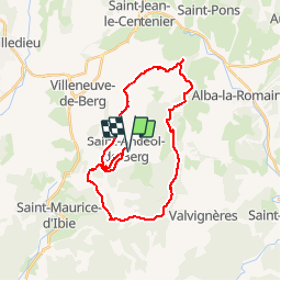
![](/images/other/stat-length.png)
![Tour Mountainbike Saint-Andéol-de-Berg - Les hauteurs de St Andéol de Berg - Photo](https://media.geolcdn.com/t/1900/400/ext.pjpeg?maxdim=2&url=https%3A%2F%2Fservices.sitytrail.com%2FGeolivesWS%2FDownloadMedia.ashx%3FTrailID%3D317417%26Media%3D16644_5.jpg)
Les hauteurs de St Andéol de Berg
tracegps
Benutzer
![Länge](/images/other/stat-length.png)
![Maximale Höhe](https://static1.geolcdn.com/siteimages/upload/files/1508320355ic_sort_altitude_max_24dp.png)
![Positive Höhendifferenz](https://static1.geolcdn.com/siteimages/upload/files/1508320355ic_sort_den_pos_24dp.png)
![Km-Effort](/images/other/stat-length.png)
![Min. Höhe](https://static1.geolcdn.com/siteimages/upload/files/1508320355ic_sort_altitude_min_24dp.png)
![Negative Höhendifferenz](https://static1.geolcdn.com/siteimages/upload/files/1508320355ic_sort_den_neg_24dp.png)
![Boucle](https://static1.geolcdn.com/siteimages/upload/files/16400158638029165_repeat_loop_refresh_sync_direction_icon.png)
![Mountainbike](https://static1.geolcdn.com/sitytour/trail-icons/202.png)
3h00
Schwierigkeit : Schwierig
![Scannen Sie diesen QR-Code, um die Tour in der SityTrail-Anwendung zu öffnen](https://capi.geolives.com/qq0zvz2zws4bq2lad0pu/sitytour/trails/317417/qr.png?size=200)
Kostenlosegpshiking-Anwendung
Über SityTrail
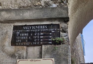
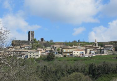
Tour Mountainbike von 29 km verfügbar auf Auvergne-Rhone-Alpen, Ardèche, Saint-Andéol-de-Berg. Diese Tour wird von tracegps vorgeschlagen.
Beschreibung
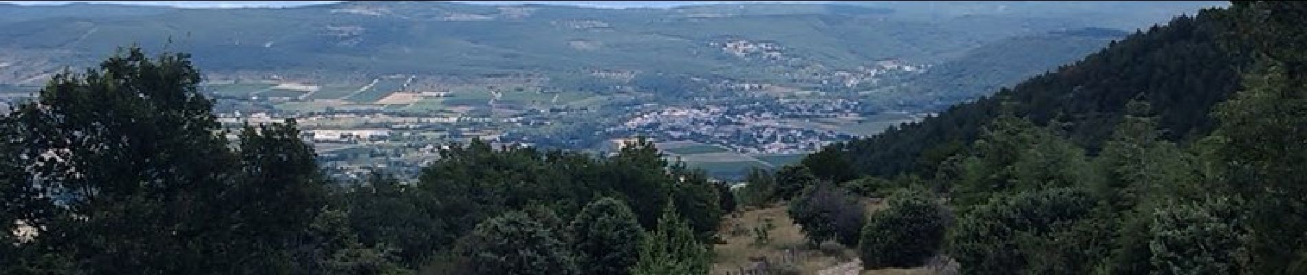
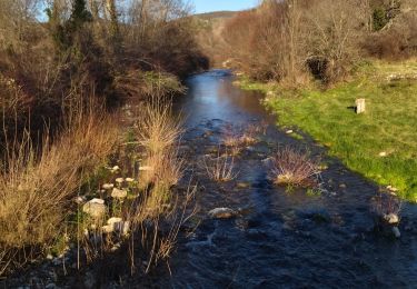
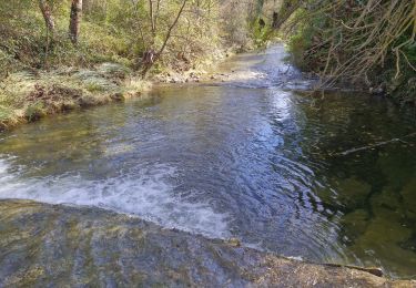
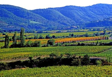
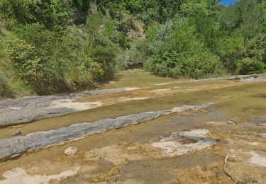
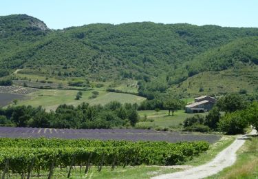
Le circuit peut se pratiquer après des pluies mais attention à la traversée de certains cours d'eau, ne loupez pas le point de vue culminant au mont Juliau. Par temps dégagé une vue à 360° s'offre à vous sur les monts d'Ardèche ainsi que le Vercors et le mont Ventoux. Pas besoin d'un gros bagage technique pour rouler sur ce parcours sportif.
Ort
Kommentare
Touren in der Umgebung
![Tour Wandern Saint-Maurice-d'Ibie - 07 st Maurice d ibis a revoir - Photo](https://media.geolcdn.com/t/375/260/0ed10fbf-b0fd-4958-865e-0a1b6897ff8f.jpg&format=jpg&maxdim=2)
![Wandern Wandern](https://static1.geolcdn.com/sitytour/trail-icons/101.png)
Wandern
![](/images/other/stat-length.png)
![](https://static1.geolcdn.com/siteimages/upload/files/16400158638029165_repeat_loop_refresh_sync_direction_icon.png)
![Tour Wandern Valvignères - Valvignères le Moulinas 15km. - Photo](https://media.geolcdn.com/t/375/260/9523a391-0be0-4cce-900d-d1de5bdd1dba.jpg&format=jpg&maxdim=2)
![Wandern Wandern](https://static1.geolcdn.com/sitytour/trail-icons/101.png)
Wandern
![](/images/other/stat-length.png)
![](https://static1.geolcdn.com/siteimages/upload/files/16400158638029165_repeat_loop_refresh_sync_direction_icon.png)
![Tour Wandern Villeneuve-de-Berg - Les Crêtes de Villeneuve-de -Berg 13km. - Photo](https://media.geolcdn.com/t/375/260/77790bd6-03c9-446a-92b5-96886f6a37ec.jpg&format=jpg&maxdim=2)
![Wandern Wandern](https://static1.geolcdn.com/sitytour/trail-icons/101.png)
Wandern
![](/images/other/stat-length.png)
![](https://static1.geolcdn.com/siteimages/upload/files/16400158638029165_repeat_loop_refresh_sync_direction_icon.png)
![Tour Wandern Valvignères - 2024-09-26_13h20m35_SityTrail - 317002 - les-cretes-de-berg-x-valvignieres - Photo](https://media.geolcdn.com/t/375/260/e03e343a-acb3-439c-ad20-4eee526aebf5.jpg&format=jpg&maxdim=2)
![Wandern Wandern](https://static1.geolcdn.com/sitytour/trail-icons/101.png)
Wandern
![](/images/other/stat-length.png)
![](https://static1.geolcdn.com/siteimages/upload/files/16400158638029165_repeat_loop_refresh_sync_direction_icon.png)
![Tour Wandern Saint-Maurice-d'Ibie - St-Maurice-d'Ibie 16km. - Photo](https://media.geolcdn.com/t/375/260/d48b08a8-b5c8-4347-b7f1-d8bc50d9b72e.jpg&format=jpg&maxdim=2)
![Wandern Wandern](https://static1.geolcdn.com/sitytour/trail-icons/101.png)
Wandern
![](/images/other/stat-length.png)
![](https://static1.geolcdn.com/siteimages/upload/files/16400158638029165_repeat_loop_refresh_sync_direction_icon.png)
![Tour Wandern Valvignères - Intras 6km - Photo](https://media.geolcdn.com/t/375/260/14c4db6a-0195-47e5-8cb8-c0866f8f01bd.jpg&format=jpg&maxdim=2)
![Wandern Wandern](https://static1.geolcdn.com/sitytour/trail-icons/101.png)
Wandern
![](/images/other/stat-length.png)
![](https://static1.geolcdn.com/siteimages/upload/files/16400158638029165_repeat_loop_refresh_sync_direction_icon.png)
![Tour Wandern Mirabel - 2022-10-24_21h55m59_Montfleury Camp Cesar 20km.gpx.xml - Photo](https://media.geolcdn.com/t/375/260/e64804fc-222d-41f8-9412-42944fc7701b.jpg&format=jpg&maxdim=2)
![Wandern Wandern](https://static1.geolcdn.com/sitytour/trail-icons/101.png)
Wandern
![](/images/other/stat-length.png)
![](https://static1.geolcdn.com/siteimages/upload/files/16400158638029165_repeat_loop_refresh_sync_direction_icon.png)
![Tour Andere Aktivitäten Villeneuve-de-Berg - FORET DES SENS - Photo](https://media.geolcdn.com/t/375/260/ext.jpg?maxdim=2&url=https%3A%2F%2Fservices.sitytrail.com%2FGeolivesWS%2FDownloadMedia.ashx%3FTrailID%3D691166%26Media%3Dfix__20170129110418.jpg)
![Andere Aktivitäten Andere Aktivitäten](https://static1.geolcdn.com/sitytour/trail-icons/900.png)
Andere Aktivitäten
![](/images/other/stat-length.png)
![](https://static1.geolcdn.com/siteimages/upload/files/16400158638029165_repeat_loop_refresh_sync_direction_icon.png)
![Tour Mountainbike Valvignères - Les Crêtes de Berg - Valvignières - Photo](https://media.geolcdn.com/t/375/260/ext.jpg?maxdim=2&url=https%3A%2F%2Fservices.sitytrail.com%2FGeolivesWS%2FDownloadMedia.ashx%3FTrailID%3D317003%26Media%3D16135_6.jpg)
![Mountainbike Mountainbike](https://static1.geolcdn.com/sitytour/trail-icons/202.png)
Mountainbike
![](/images/other/stat-length.png)
![](https://static1.geolcdn.com/siteimages/upload/files/16400158638029165_repeat_loop_refresh_sync_direction_icon.png)
Bien, varié, beaux paysages.