![](/images/other/stat-length.png)
![Tour Pferd Saint-Palais - Sentier des Contrebandiers - de St Palais à Ostabat-Asme au Pays Basque - Photo](https://media.geolcdn.com/t/1900/400/ext.pjpeg?maxdim=2&url=https%3A%2F%2Fservices.sitytrail.com%2FGeolivesWS%2FDownloadMedia.ashx%3FTrailID%3D317106%26Media%3D16255_2.jpg)
Sentier des Contrebandiers - de St Palais à Ostabat-Asme au Pays Basque
tracegps
Benutzer
![Länge](/images/other/stat-length.png)
![Maximale Höhe](https://static1.geolcdn.com/siteimages/upload/files/1508320355ic_sort_altitude_max_24dp.png)
![Positive Höhendifferenz](https://static1.geolcdn.com/siteimages/upload/files/1508320355ic_sort_den_pos_24dp.png)
![Km-Effort](/images/other/stat-length.png)
![Min. Höhe](https://static1.geolcdn.com/siteimages/upload/files/1508320355ic_sort_altitude_min_24dp.png)
![Negative Höhendifferenz](https://static1.geolcdn.com/siteimages/upload/files/1508320355ic_sort_den_neg_24dp.png)
![Boucle](https://static1.geolcdn.com/siteimages/upload/files/16400158638029165_repeat_loop_refresh_sync_direction_icon.png)
![Pferd](https://static1.geolcdn.com/sitytour/trail-icons/300.png)
5h00
Schwierigkeit : Schwierig
![Scannen Sie diesen QR-Code, um die Tour in der SityTrail-Anwendung zu öffnen](https://capi.geolives.com/qq0zvz2zws4bq2lad0pu/sitytour/trails/317106/qr.png?size=200)
Kostenlosegpshiking-Anwendung
Über SityTrail
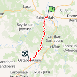
Tour Pferd von 11,6 km verfügbar auf Neu-Aquitanien, Pyrenäen-Atlantik, Saint-Palais. Diese Tour wird von tracegps vorgeschlagen.
Beschreibung
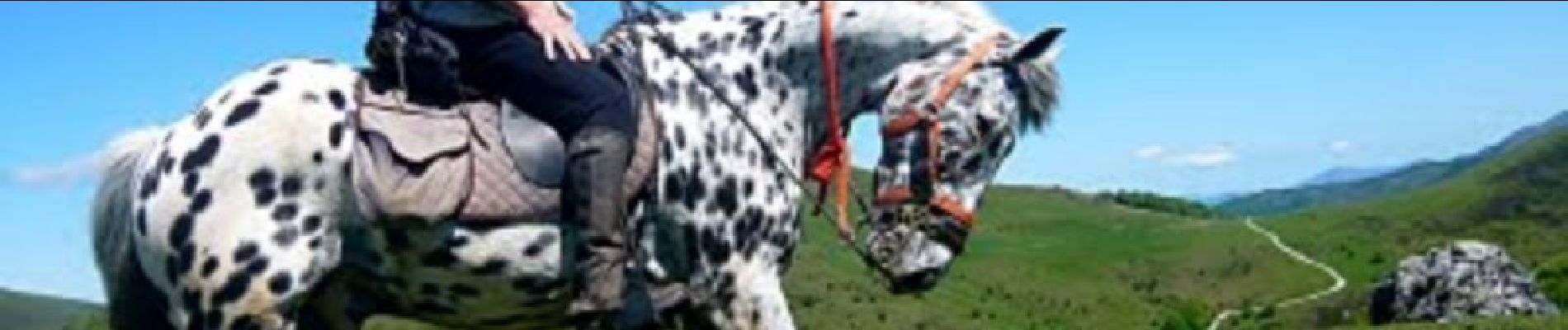
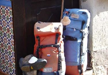
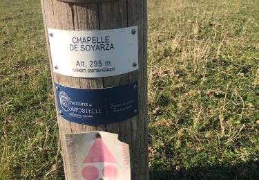
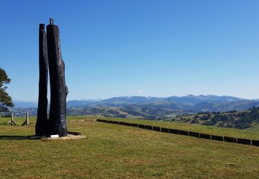
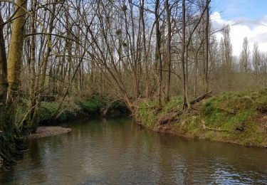
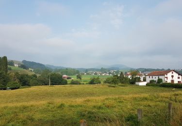
A cheval, le GR65 vous amènera à la croisée des chemins de Saint Jacques de Compostelle, Ostabat-Asme. Passant monastère et stèles, lieux de rendez-vous des pèlerins à des carrefours stratégiques, vous serez transportés dans un autre monde et en d’autres temps. Consultez une variante des 2 premières étapes ou la variante de l'étape suivante. Imaginé il y a quelques années par plusieurs passionnés de l'ACTE (A Cheval Tous Ensemble), le sentier des contrebandiers est maintenant un itinéraire dont l'aménagement et le balisage sont assurés par le Conseil Général des Pyrénées-Atlantiques. 220 km d'aventures entre Saint-Palais et Biriatou (Hendaye) à travers la montagne basque, un itinéraire sauvage, réservé à des pratiquants chevronnés et entrainés, avec une cavalerie habituée à évoluer en montagne. En cas de doute sur votre niveau, l'idéal est de se mettre en relation avec le CDTE et l'ACTE afin de vous évaluer ! Des hébergements labellisés Cheval 64 vous accueillent à chaque étape afin d'assurer notamment l'accueil des chevaux dans de bonnes conditions. Crédits photos: ©CDT64
Ort
Kommentare
Touren in der Umgebung
![Tour Mountainbike Saint-Palais - Le Sentier des Contrebandiers en VTT - De Saint Palais à Ostabat - Photo](https://media.geolcdn.com/t/375/260/ext.jpg?maxdim=2&url=https%3A%2F%2Fservices.sitytrail.com%2FGeolivesWS%2FDownloadMedia.ashx%3FTrailID%3D317571%26Media%3D16830_3.jpg)
![Mountainbike Mountainbike](https://static1.geolcdn.com/sitytour/trail-icons/202.png)
Mountainbike
![](/images/other/stat-length.png)
![](https://static1.geolcdn.com/siteimages/upload/files/16400158638029165_repeat_loop_refresh_sync_direction_icon.png)
![Tour Pferd Saint-Palais - Sentier des Contrebandiers - De St Palais à Iholdy au Pays Basque - Photo](https://media.geolcdn.com/t/375/260/ext.jpg?maxdim=2&url=https%3A%2F%2Fservices.sitytrail.com%2FGeolivesWS%2FDownloadMedia.ashx%3FTrailID%3D316991%26Media%3D16122_4.jpg)
![Pferd Pferd](https://static1.geolcdn.com/sitytour/trail-icons/300.png)
Pferd
![](/images/other/stat-length.png)
![](https://static1.geolcdn.com/siteimages/upload/files/16400158638029165_repeat_loop_refresh_sync_direction_icon.png)
![Tour Wandern Larribar-Sorhapuru - De Larribar - Sorhapuru à Ostabat - Photo](https://media.geolcdn.com/t/375/260/ext.jpg?maxdim=2&url=https%3A%2F%2Fservices.sitytrail.com%2FGeolivesWS%2FDownloadMedia.ashx%3FTrailID%3D109247%26Media%3D3349_5.jpg)
![Wandern Wandern](https://static1.geolcdn.com/sitytour/trail-icons/101.png)
Wandern
![](/images/other/stat-length.png)
![](https://static1.geolcdn.com/siteimages/upload/files/16400158638029165_repeat_loop_refresh_sync_direction_icon.png)
![Tour Pfad Beyrie-sur-Joyeuse - Pays basque 15.4kms - Photo](https://media.geolcdn.com/t/375/260/03dc2bbd-f990-446a-8a73-5d98be105ac6.jpg&format=jpg&maxdim=2)
![Pfad Pfad](https://static1.geolcdn.com/sitytour/trail-icons/104.png)
Pfad
![](/images/other/stat-length.png)
![](https://static1.geolcdn.com/siteimages/upload/files/16400158638029165_repeat_loop_refresh_sync_direction_icon.png)
![Tour Wandern Saint-Palais - stèle du mont saint sauveur - Photo](https://media.geolcdn.com/t/375/260/4a084574-1023-4271-95dd-10d421aa6265.jpg&format=jpg&maxdim=2)
![Wandern Wandern](https://static1.geolcdn.com/sitytour/trail-icons/101.png)
Wandern
![](/images/other/stat-length.png)
![](https://static1.geolcdn.com/siteimages/upload/files/16400158638029165_repeat_loop_refresh_sync_direction_icon.png)
![Tour Auto Saint-Palais - atelier 4 - Photo](https://media.geolcdn.com/t/375/260/95c15140-bac9-42a7-8702-bb53630a032e.jpg&format=jpg&maxdim=2)
![Auto Auto](https://static1.geolcdn.com/sitytour/trail-icons/401.png)
Auto
![](/images/other/stat-length.png)
![](https://static1.geolcdn.com/siteimages/upload/files/16400158638029165_repeat_loop_refresh_sync_direction_icon.png)
![Tour Radtourismus Saint-Palais - St-Palais - Bayonne - Photo](https://media.geolcdn.com/t/375/260/7b892e3e-cc4e-4ee2-8c9b-09629c9d525a.jpg&format=jpg&maxdim=2)
![Radtourismus Radtourismus](https://static1.geolcdn.com/sitytour/trail-icons/204.png)
Radtourismus
![](/images/other/stat-length.png)
![](https://static1.geolcdn.com/siteimages/upload/files/16400158638029165_repeat_loop_refresh_sync_direction_icon.png)
![Tour Elektrofahrrad Saint-Palais - Saint Palais -Saint Jean Pied de Port 26/06/2019 - Photo](https://media.geolcdn.com/t/375/260/e9aca2a3-6d45-4633-8600-553e57335836.jpg&format=jpg&maxdim=2)
![Elektrofahrrad Elektrofahrrad](https://static1.geolcdn.com/sitytour/trail-icons/205.png)
Elektrofahrrad
![](/images/other/stat-length.png)
![](https://static1.geolcdn.com/siteimages/upload/files/16400158638029165_repeat_loop_refresh_sync_direction_icon.png)
![Tour Wandern Saint-Palais - Etape 1 modifié. SAINT-PALAIS _ LARCEVEAU - MONGELOS - Photo](https://media.geolcdn.com/t/375/260/ext.jpg?maxdim=2&url=https%3A%2F%2Fstatic1.geolcdn.com%2Fsiteimages%2Fupload%2Ffiles%2F1553511878bg_sport_marche.png)
![Wandern Wandern](https://static1.geolcdn.com/sitytour/trail-icons/101.png)
Wandern
![](/images/other/stat-length.png)
![](https://static1.geolcdn.com/siteimages/upload/files/16400158638029165_repeat_loop_refresh_sync_direction_icon.png)