![](/images/other/stat-length.png)
![Tour Wandern Valloire - Le Rocher Saint-Pierre 1578m, depuis la Borgé (Valloire) - Photo](https://media.geolcdn.com/t/1900/400/ext.pjpeg?maxdim=2&url=https%3A%2F%2Fservices.sitytrail.com%2FGeolivesWS%2FDownloadMedia.ashx%3FTrailID%3D317061%26Media%3D16209_1.jpg)
Le Rocher Saint-Pierre 1578m, depuis la Borgé (Valloire)
tracegps
Benutzer
![Länge](/images/other/stat-length.png)
![Maximale Höhe](https://static1.geolcdn.com/siteimages/upload/files/1508320355ic_sort_altitude_max_24dp.png)
![Positive Höhendifferenz](https://static1.geolcdn.com/siteimages/upload/files/1508320355ic_sort_den_pos_24dp.png)
![Km-Effort](/images/other/stat-length.png)
![Min. Höhe](https://static1.geolcdn.com/siteimages/upload/files/1508320355ic_sort_altitude_min_24dp.png)
![Negative Höhendifferenz](https://static1.geolcdn.com/siteimages/upload/files/1508320355ic_sort_den_neg_24dp.png)
![Boucle](https://static1.geolcdn.com/siteimages/upload/files/16400158638029165_repeat_loop_refresh_sync_direction_icon.png)
![Wandern](https://static1.geolcdn.com/sitytour/trail-icons/101.png)
1h30
Schwierigkeit : Medium
![Scannen Sie diesen QR-Code, um die Tour in der SityTrail-Anwendung zu öffnen](https://capi.geolives.com/qq0zvz2zws4bq2lad0pu/sitytour/trails/317061/qr.png?size=200)
Kostenlosegpshiking-Anwendung
Über SityTrail
Tour Wandern von 2,6 km verfügbar auf Auvergne-Rhone-Alpen, Savoyen, Valloire. Diese Tour wird von tracegps vorgeschlagen.
Beschreibung
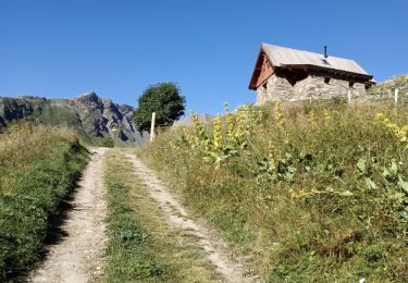
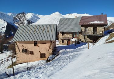
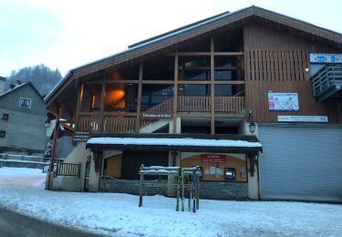
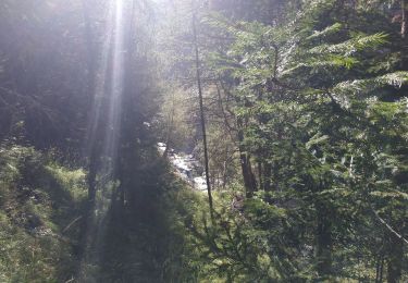
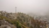
Le Rocher Saint-Pierre est une courte randonnée classique pour les estivants en vacance à Valloire. Depuis la Borgé, par le pont sur la Valloirette, le sentier du Rocher Saint-Pierre commence après la grotte, pour monter traverser le versant Ouest jusqu'à la Chapelle Saint-Pierre au Sud de la montagne. De là, le parcours de la crête traverse le sommet pour descendre par un passage rocheux escarpé trouver le sentier de la croix qui domine Valloire. Le retour par l'itinéraire normal rejoint le Pra pour retrouver rapidement le point de départ. Description complète sur sentier-nature.com : Le Rocher Saint-Pierre 1578 m, depuis la Borgé (Valloire) Avertissement [Franchissement 2/3 ; Exposition 2/3]. Certains passages de cet itinéraire de montagne sont escarpés et/ou exposés, il est déconseillé aux enfants non accompagnés et aux personnes sujettes au vertige. Pour votre sécurité, nous vous invitons à respecter les règles suivantes : être bien chaussé, ne pas s'engager par mauvais temps, ne pas s'écarter de l'itinéraire ni des sentiers.
Ort
Kommentare
Touren in der Umgebung
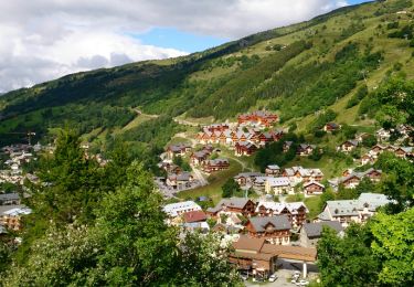
![Tour Wandern Valloire - Tour de Valloire - Photo](https://media.geolcdn.com/t/375/260/ext.jpg?maxdim=2&url=https%3A%2F%2Fservices.sitytrail.com%2FGeolivesWS%2FDownloadMedia.ashx%3FTrailID%3D336767%26Media%3Dfix__20140813165712.jpg)
![Wandern Wandern](https://static1.geolcdn.com/sitytour/trail-icons/101.png)
Wandern
![](/images/other/stat-length.png)
![](https://static1.geolcdn.com/siteimages/upload/files/16400158638029165_repeat_loop_refresh_sync_direction_icon.png)
![Tour Wandern Valloire - valloire à poingt ravier - Photo](https://media.geolcdn.com/t/375/260/ext.jpg?maxdim=2&url=https%3A%2F%2Fservices.sitytrail.com%2FGeolivesWS%2FDownloadMedia.ashx%3FTrailID%3D139009%26Media%3D20120714170941.jpeg)
![Wandern Wandern](https://static1.geolcdn.com/sitytour/trail-icons/101.png)
Wandern
![](/images/other/stat-length.png)
![](https://static1.geolcdn.com/siteimages/upload/files/16400158638029165_repeat_loop_refresh_sync_direction_icon.png)
![Tour Wandern Valloire - anticime de la Grande Chible et plus - Photo](https://media.geolcdn.com/t/375/260/6e2548aa-19ef-4b42-be36-ae13fefd106f.jpg&format=jpg&maxdim=2)
![Wandern Wandern](https://static1.geolcdn.com/sitytour/trail-icons/101.png)
Wandern
![](/images/other/stat-length.png)
![](https://static1.geolcdn.com/siteimages/upload/files/16400158638029165_repeat_loop_refresh_sync_direction_icon.png)
![Tour Skiwanderen Valloire - Col de petit Jean - Photo](https://media.geolcdn.com/t/375/260/e1f50793-9675-4ea6-9a1c-3ba4e20102bf.jpg&format=jpg&maxdim=2)
![Skiwanderen Skiwanderen](https://static1.geolcdn.com/sitytour/trail-icons/503.png)
Skiwanderen
![](/images/other/stat-length.png)
![](https://static1.geolcdn.com/siteimages/upload/files/16400158638029165_repeat_loop_refresh_sync_direction_icon.png)
![Tour Skiwanderen Valloire - Aiguille de l'épaisseur - Photo](https://media.geolcdn.com/t/375/260/77d61587-180b-4205-b36d-a83a35e6850c.jpg&format=jpg&maxdim=2)
![Skiwanderen Skiwanderen](https://static1.geolcdn.com/sitytour/trail-icons/503.png)
Skiwanderen
![](/images/other/stat-length.png)
![](https://static1.geolcdn.com/siteimages/upload/files/16400158638029165_repeat_loop_refresh_sync_direction_icon.png)
![Tour Wandern Valloire - Bonne nuit- refuge - combe des Aiguilles - Photo](https://media.geolcdn.com/t/375/260/324355e1-ed1e-44dd-bc99-5afcf7d1c974.jpg&format=jpg&maxdim=2)
![Wandern Wandern](https://static1.geolcdn.com/sitytour/trail-icons/101.png)
Wandern
![](/images/other/stat-length.png)
![](https://static1.geolcdn.com/siteimages/upload/files/16400158638029165_repeat_loop_refresh_sync_direction_icon.png)
![Tour Schneeschuhwandern Valloire - Maurienne Valloire le panomarique - Photo](https://media.geolcdn.com/t/375/260/7e18c8dc-1201-44a9-9b7d-7b79e7067d64.jpg&format=jpg&maxdim=2)
![Schneeschuhwandern Schneeschuhwandern](https://static1.geolcdn.com/sitytour/trail-icons/504.png)
Schneeschuhwandern
![](/images/other/stat-length.png)
![](https://static1.geolcdn.com/siteimages/upload/files/16400158638029165_repeat_loop_refresh_sync_direction_icon.png)
![Tour Wandern Valloire - Valloire - Photo](https://media.geolcdn.com/t/375/260/d0d671da-538a-4fe1-a4de-eca0138f6132.jpg&format=jpg&maxdim=2)
![Wandern Wandern](https://static1.geolcdn.com/sitytour/trail-icons/101.png)
Wandern
![](/images/other/stat-length.png)
![](https://static1.geolcdn.com/siteimages/upload/files/16400158638029165_repeat_loop_refresh_sync_direction_icon.png)
![Tour Wandern Valloire - VALLOIRE :serroz gorge des balais gorge d'enfer - Photo](https://media.geolcdn.com/t/375/260/3b6ac4fc-13aa-4c57-b746-3dd336efd252.jpg&format=jpg&maxdim=2)
![Wandern Wandern](https://static1.geolcdn.com/sitytour/trail-icons/101.png)
Wandern
![](/images/other/stat-length.png)
![](https://static1.geolcdn.com/siteimages/upload/files/16400158638029165_repeat_loop_refresh_sync_direction_icon.png)