![](/images/other/stat-length.png)
![Tour Wandern Sourdon - Autour d'Ainval - Sourdon - Photo](https://media.geolcdn.com/t/1900/400/ext.pjpeg?maxdim=2&url=https%3A%2F%2Fservices.sitytrail.com%2FGeolivesWS%2FDownloadMedia.ashx%3FTrailID%3D316957%26Media%3D16075_4.jpg)
Autour d'Ainval - Sourdon
tracegps
Benutzer
![Länge](/images/other/stat-length.png)
Länge
10,4 km
![Maximale Höhe](https://static1.geolcdn.com/siteimages/upload/files/1508320355ic_sort_altitude_max_24dp.png)
Maximale Höhe
142 m
![Positive Höhendifferenz](https://static1.geolcdn.com/siteimages/upload/files/1508320355ic_sort_den_pos_24dp.png)
Positive Höhendifferenz
142 m
![Km-Effort](/images/other/stat-length.png)
Km-Effort
12,3 km
![Min. Höhe](https://static1.geolcdn.com/siteimages/upload/files/1508320355ic_sort_altitude_min_24dp.png)
Min. Höhe
75 m
![Negative Höhendifferenz](https://static1.geolcdn.com/siteimages/upload/files/1508320355ic_sort_den_neg_24dp.png)
Negative Höhendifferenz
142 m
![Boucle](https://static1.geolcdn.com/siteimages/upload/files/16400158638029165_repeat_loop_refresh_sync_direction_icon.png)
Boucle
Ja
Erstellungsdatum :
2014-12-10 00:00:00.0
Letzte Änderung :
2014-12-10 00:00:00.0
![Wandern](https://static1.geolcdn.com/sitytour/trail-icons/101.png)
3h00
Schwierigkeit : Medium
![Scannen Sie diesen QR-Code, um die Tour in der SityTrail-Anwendung zu öffnen](https://capi.geolives.com/qq0zvz2zws4bq2lad0pu/sitytour/trails/316957/qr.png?size=200)
Kostenlosegpshiking-Anwendung
Über SityTrail
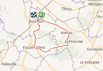
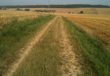
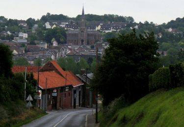
Tour Wandern von 10,4 km verfügbar auf Nordfrankreich, Somme, Sourdon. Diese Tour wird von tracegps vorgeschlagen.
Beschreibung
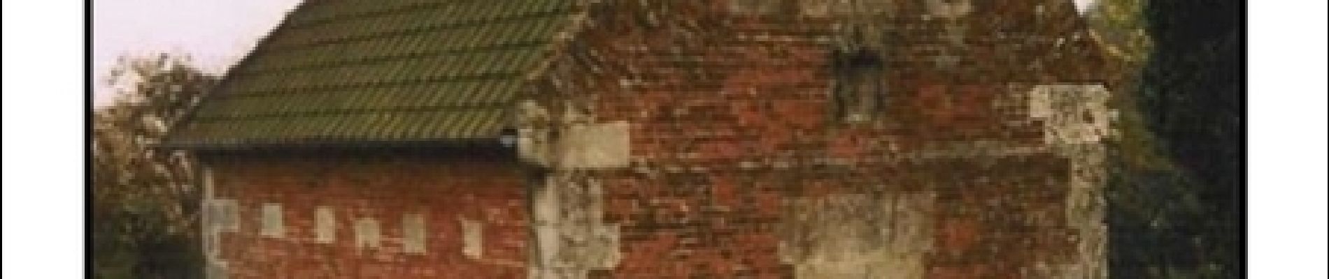
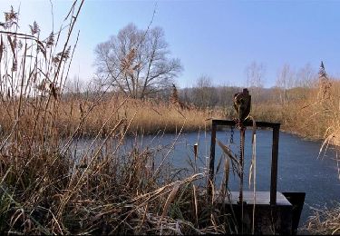
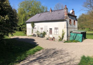
Départ de l'église de Sourdon vers Ainval. Le précieux bras reliquaire de saint Fiacre, vous indique le chemin du retour depuis l'église d'Esclainvillers. Retrouvez cette randonnée sur le site de l'Office de Tourisme de Val de Noye.
Ort
Land:
France
Region :
Nordfrankreich
Abteilung/Provinz :
Somme
Kommune :
Sourdon
Standort:
Unknown
Gehen Sie:(Dec)
Gehen Sie:(UTM)
456702 ; 5506554 (31U) N.
Kommentare
Touren in der Umgebung
![Tour Wandern Ailly-sur-Noye - Bois de Berny - Photo](https://media.geolcdn.com/t/375/260/ext.jpg?maxdim=2&url=https%3A%2F%2Fstatic1.geolcdn.com%2Fsiteimages%2Fupload%2Ffiles%2F1553511878bg_sport_marche.png)
![Wandern Wandern](https://static1.geolcdn.com/sitytour/trail-icons/101.png)
Bois de Berny
Wandern
Medium
(1)
Ailly-sur-Noye,
Nordfrankreich,
Somme,
France
![](/images/other/stat-length.png)
10,1 km | 12,1 km-effort
2h 38min
![](https://static1.geolcdn.com/siteimages/upload/files/16400158638029165_repeat_loop_refresh_sync_direction_icon.png)
Ja
![Tour Wandern Grivesnes - Le Langueron - Grivesnes - Photo](https://media.geolcdn.com/t/375/260/ext.jpg?maxdim=2&url=https%3A%2F%2Fservices.sitytrail.com%2FGeolivesWS%2FDownloadMedia.ashx%3FTrailID%3D316906%26Media%3D16004_6.jpg)
![Wandern Wandern](https://static1.geolcdn.com/sitytour/trail-icons/101.png)
Le Langueron - Grivesnes
Wandern
Medium
Grivesnes,
Nordfrankreich,
Somme,
France
![](/images/other/stat-length.png)
13,2 km | 15,6 km-effort
2h 15min
![](https://static1.geolcdn.com/siteimages/upload/files/16400158638029165_repeat_loop_refresh_sync_direction_icon.png)
Ja
![Tour Mountainbike Ailly-sur-Noye - Circuit n° 4 VTT - Ailly-sur-Noye - Photo](https://media.geolcdn.com/t/375/260/ext.jpg?maxdim=2&url=https%3A%2F%2Fservices.sitytrail.com%2FGeolivesWS%2FDownloadMedia.ashx%3FTrailID%3D111125%26Media%3D6480_2.jpg)
![Mountainbike Mountainbike](https://static1.geolcdn.com/sitytour/trail-icons/202.png)
Circuit n° 4 VTT - Ailly-sur-Noye
Mountainbike
Schwierig
Ailly-sur-Noye,
Nordfrankreich,
Somme,
France
![](/images/other/stat-length.png)
42 km | 50 km-effort
4h 0min
![](https://static1.geolcdn.com/siteimages/upload/files/16400158638029165_repeat_loop_refresh_sync_direction_icon.png)
Ja
![Tour Fahrrad Ailly-sur-Noye - Le Val de Noye - Boucle de Boves - Photo](https://media.geolcdn.com/t/375/260/ext.jpg?maxdim=2&url=https%3A%2F%2Fservices.sitytrail.com%2FGeolivesWS%2FDownloadMedia.ashx%3FTrailID%3D109972%26Media%3D5053_1.jpg)
![Fahrrad Fahrrad](https://static1.geolcdn.com/sitytour/trail-icons/200.png)
Le Val de Noye - Boucle de Boves
Fahrrad
Medium
Ailly-sur-Noye,
Nordfrankreich,
Somme,
France
![](/images/other/stat-length.png)
27 km | 30 km-effort
1h 30min
![](https://static1.geolcdn.com/siteimages/upload/files/16400158638029165_repeat_loop_refresh_sync_direction_icon.png)
Ja
![Tour Fahrrad Ailly-sur-Noye - Le Val de Noye - Boucle de Coullemelle - Photo](https://media.geolcdn.com/t/375/260/ext.jpg?maxdim=2&url=https%3A%2F%2Fservices.sitytrail.com%2FGeolivesWS%2FDownloadMedia.ashx%3FTrailID%3D109971%26Media%3D5052_1.jpg)
![Fahrrad Fahrrad](https://static1.geolcdn.com/sitytour/trail-icons/200.png)
Le Val de Noye - Boucle de Coullemelle
Fahrrad
Medium
Ailly-sur-Noye,
Nordfrankreich,
Somme,
France
![](/images/other/stat-length.png)
33 km | 38 km-effort
2h 0min
![](https://static1.geolcdn.com/siteimages/upload/files/16400158638029165_repeat_loop_refresh_sync_direction_icon.png)
Ja
![Tour Wandern Folleville - Folleville - Photo](https://media.geolcdn.com/t/375/260/ext.jpg?maxdim=2&url=https%3A%2F%2Fstatic1.geolcdn.com%2Fsiteimages%2Fupload%2Ffiles%2F1553511878bg_sport_marche.png)
![Wandern Wandern](https://static1.geolcdn.com/sitytour/trail-icons/101.png)
Folleville
Wandern
Sehr leicht
Folleville,
Nordfrankreich,
Somme,
France
![](/images/other/stat-length.png)
6,1 km | 7,5 km-effort
1h 25min
![](https://static1.geolcdn.com/siteimages/upload/files/16400158638029165_repeat_loop_refresh_sync_direction_icon.png)
Ja
![Tour Wandern Chirmont - Johnny - Photo](https://media.geolcdn.com/t/375/260/eb94b8e5-d772-4844-91a8-8dfb82f48b11.jpg&format=jpg&maxdim=2)
![Wandern Wandern](https://static1.geolcdn.com/sitytour/trail-icons/101.png)
![Tour sport Ailly-sur-Noye - Benny - Photo](https://media.geolcdn.com/t/375/260/ext.jpg?maxdim=2&url=https%3A%2F%2Fsecurestorage.geolives.com%2Fsitytour%2Ftrail-bg%2Fdefault.jpg)
Benny
sport
Sehr leicht
Ailly-sur-Noye,
Nordfrankreich,
Somme,
France
![](/images/other/stat-length.png)
9,8 km | 11,7 km-effort
Unbekannt
![](https://static1.geolcdn.com/siteimages/upload/files/16400158638029165_repeat_loop_refresh_sync_direction_icon.png)
Ja
![Tour Laufen Sourdon - sourdon ainval - Photo](https://media.geolcdn.com/t/375/260/ext.jpg?maxdim=2&url=https%3A%2F%2Fstatic1.geolcdn.com%2Fsiteimages%2Fupload%2Ffiles%2F1524743154running.jpg)
![Laufen Laufen](https://static1.geolcdn.com/sitytour/trail-icons/103.png)
sourdon ainval
Laufen
Sehr leicht
Sourdon,
Nordfrankreich,
Somme,
France
![](/images/other/stat-length.png)
11,1 km | 13,6 km-effort
1h 20min
![](https://static1.geolcdn.com/siteimages/upload/files/16400158638029165_repeat_loop_refresh_sync_direction_icon.png)
Ja