![](/images/other/stat-length.png)
![Tour Laufen Lamentin - Cascade de Bois Banane - Ravine Chaude - Photo](https://media.geolcdn.com/t/1900/400/ext.pjpeg?maxdim=2&url=https%3A%2F%2Fservices.sitytrail.com%2FGeolivesWS%2FDownloadMedia.ashx%3FTrailID%3D316820%26Media%3D14146_3.jpg)
Cascade de Bois Banane - Ravine Chaude
tracegps
Benutzer
![Länge](/images/other/stat-length.png)
![Maximale Höhe](https://static1.geolcdn.com/siteimages/upload/files/1508320355ic_sort_altitude_max_24dp.png)
![Positive Höhendifferenz](https://static1.geolcdn.com/siteimages/upload/files/1508320355ic_sort_den_pos_24dp.png)
![Km-Effort](/images/other/stat-length.png)
![Min. Höhe](https://static1.geolcdn.com/siteimages/upload/files/1508320355ic_sort_altitude_min_24dp.png)
![Negative Höhendifferenz](https://static1.geolcdn.com/siteimages/upload/files/1508320355ic_sort_den_neg_24dp.png)
![Boucle](https://static1.geolcdn.com/siteimages/upload/files/16400158638029165_repeat_loop_refresh_sync_direction_icon.png)
![Laufen](https://static1.geolcdn.com/sitytour/trail-icons/103.png)
2h00
Schwierigkeit : Medium
![Scannen Sie diesen QR-Code, um die Tour in der SityTrail-Anwendung zu öffnen](https://capi.geolives.com/qq0zvz2zws4bq2lad0pu/sitytour/trails/316820/qr.png?size=200)
Kostenlosegpshiking-Anwendung
Über SityTrail
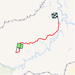
Tour Laufen von 4,6 km verfügbar auf Guadeloupe, Unbekannt, Lamentin. Diese Tour wird von tracegps vorgeschlagen.
Beschreibung
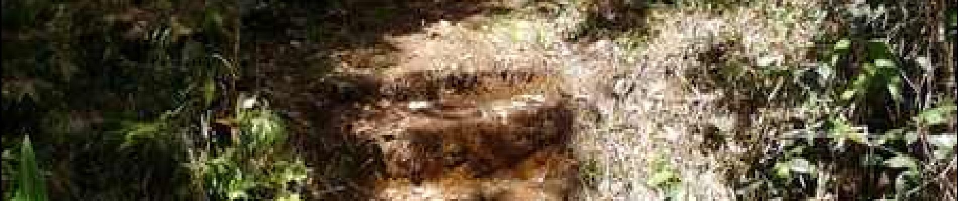
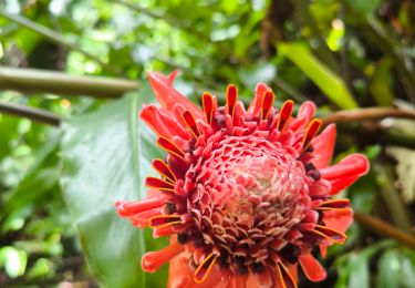
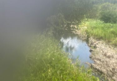
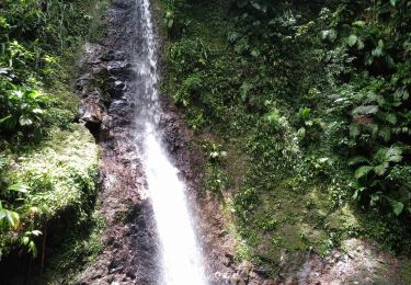
Très belle cascade dans la forêt, beau bassin pour la baignade et un pique-nique. Sur la piste forestière de Guyonneau, après 3,6 km de montée facile, prendre à gauche un sentier balisé en vert fluo sur les arbres. Le dénivelé s'accentue alors jusqu'à l'arrivée en montée puis en descente tout en restant bien praticable.
Ort
Kommentare
Touren in der Umgebung
![Tour Zu Fuß Petit-Bourg - Trace des ruisseaux - Photo](https://media.geolcdn.com/t/375/260/ext.jpg?maxdim=2&url=https%3A%2F%2Fmedia.geolcdn.com%2Ff%2Fd5056249-cb72-48a2-a972-b2191b472cd9.jpeg)
![Zu Fuß Zu Fuß](https://static1.geolcdn.com/sitytour/trail-icons/100.png)
Zu Fuß
![](/images/other/stat-length.png)
![](https://static1.geolcdn.com/siteimages/upload/files/16400158638029165_repeat_loop_refresh_sync_direction_icon.png)
![Tour Pfad Petit-Bourg - IRA - Photo](https://media.geolcdn.com/t/375/260/ext.jpg?maxdim=2&url=https%3A%2F%2Fmedia.geolcdn.com%2Ff%2F7f768d10-aac5-47c6-88ae-c34d177f63d9.jpg)
![Pfad Pfad](https://static1.geolcdn.com/sitytour/trail-icons/104.png)
![Tour Wandern Lamentin - Cascade Bois Banane - Photo](https://media.geolcdn.com/t/375/260/ext.jpg?maxdim=2&url=https%3A%2F%2Fmedia.geolcdn.com%2Ff%2F1bb992c2-4776-465a-8daf-1b693d77d88e.jpg)
![Wandern Wandern](https://static1.geolcdn.com/sitytour/trail-icons/101.png)
Wandern
![](/images/other/stat-length.png)
![](https://static1.geolcdn.com/siteimages/upload/files/16400158638029165_repeat_loop_refresh_sync_direction_icon.png)
![Tour Pfad Petit-Bourg - IRA - Photo](https://media.geolcdn.com/t/375/260/ext.jpg?maxdim=2&url=https%3A%2F%2Fmedia.geolcdn.com%2Ff%2F9cee3d8c-eef6-452d-9644-d5b0817b1884.jpg)
![Pfad Pfad](https://static1.geolcdn.com/sitytour/trail-icons/104.png)
![Tour Wandern Petit-Bourg - Piton de Bouillante - Photo](https://media.geolcdn.com/t/375/260/ext.jpg?maxdim=2&url=https%3A%2F%2Fmedia.geolcdn.com%2Ff%2F896bf328-025a-4d39-82de-8b0a45081bda.jpg)
![Wandern Wandern](https://static1.geolcdn.com/sitytour/trail-icons/101.png)
Wandern
![](/images/other/stat-length.png)
![](https://static1.geolcdn.com/siteimages/upload/files/16400158638029165_repeat_loop_refresh_sync_direction_icon.png)
![Tour Wandern Pointe-Noire - la mamelle au pigeon - Photo](https://media.geolcdn.com/t/375/260/ext.jpg?maxdim=2&url=https%3A%2F%2Fmedia.geolcdn.com%2Ff%2Fcaf8306a-8a11-441a-ab38-9ee733efe26e.jpg)
![Wandern Wandern](https://static1.geolcdn.com/sitytour/trail-icons/101.png)
Wandern
![](/images/other/stat-length.png)
![](https://static1.geolcdn.com/siteimages/upload/files/16400158638029165_repeat_loop_refresh_sync_direction_icon.png)
![Tour Pfad Petit-Bourg - Forêt de celus - Photo](https://media.geolcdn.com/t/375/260/ext.jpg?maxdim=2&url=https%3A%2F%2Fmedia.geolcdn.com%2Ff%2F549fe249-5bb3-4623-a892-6a076cb409ba.jpg)
![Pfad Pfad](https://static1.geolcdn.com/sitytour/trail-icons/104.png)
Pfad
![](/images/other/stat-length.png)
![](https://static1.geolcdn.com/siteimages/upload/files/16400158638029165_repeat_loop_refresh_sync_direction_icon.png)
![Tour Wandern Petit-Bourg - Rivière Bras David - Photo](https://media.geolcdn.com/t/375/260/ext.jpg?maxdim=2&url=https%3A%2F%2Fmedia.geolcdn.com%2Ff%2F08ac2acf-d4e6-4008-b357-f609bd93b851.jpg)
![Wandern Wandern](https://static1.geolcdn.com/sitytour/trail-icons/101.png)
Wandern
![](/images/other/stat-length.png)
![](https://static1.geolcdn.com/siteimages/upload/files/16400158638029165_repeat_loop_refresh_sync_direction_icon.png)
![Tour Pfad Petit-Bourg - Forêt de celus - Photo](https://media.geolcdn.com/t/375/260/ext.jpg?maxdim=2&url=https%3A%2F%2Fmedia.geolcdn.com%2Ff%2Fbec9d2bf-fb3e-4dcf-92a3-69ed8263459d.jpg)
![Pfad Pfad](https://static1.geolcdn.com/sitytour/trail-icons/104.png)
Pfad
![](/images/other/stat-length.png)
![](https://static1.geolcdn.com/siteimages/upload/files/16400158638029165_repeat_loop_refresh_sync_direction_icon.png)