![](/images/other/stat-length.png)
![Tour Wandern Guissény - GR 34® de Guisseny à Keridaouen (Aber Wrac'h) - Photo](https://media.geolcdn.com/t/1900/400/ext.pjpeg?maxdim=2&url=https%3A%2F%2Fservices.sitytrail.com%2FGeolivesWS%2FDownloadMedia.ashx%3FTrailID%3D316778%26Media%3D5184_1.jpg)
GR 34® de Guisseny à Keridaouen (Aber Wrac'h)
tracegps
Benutzer
![Länge](/images/other/stat-length.png)
![Maximale Höhe](https://static1.geolcdn.com/siteimages/upload/files/1508320355ic_sort_altitude_max_24dp.png)
![Positive Höhendifferenz](https://static1.geolcdn.com/siteimages/upload/files/1508320355ic_sort_den_pos_24dp.png)
![Km-Effort](/images/other/stat-length.png)
![Min. Höhe](https://static1.geolcdn.com/siteimages/upload/files/1508320355ic_sort_altitude_min_24dp.png)
![Negative Höhendifferenz](https://static1.geolcdn.com/siteimages/upload/files/1508320355ic_sort_den_neg_24dp.png)
![Boucle](https://static1.geolcdn.com/siteimages/upload/files/16400158638029165_repeat_loop_refresh_sync_direction_icon.png)
![Wandern](https://static1.geolcdn.com/sitytour/trail-icons/101.png)
5h10
Schwierigkeit : Schwierig
![Scannen Sie diesen QR-Code, um die Tour in der SityTrail-Anwendung zu öffnen](https://capi.geolives.com/qq0zvz2zws4bq2lad0pu/sitytour/trails/316778/qr.png?size=200)
Kostenlosegpshiking-Anwendung
Über SityTrail
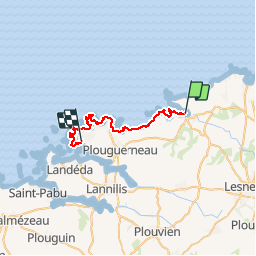
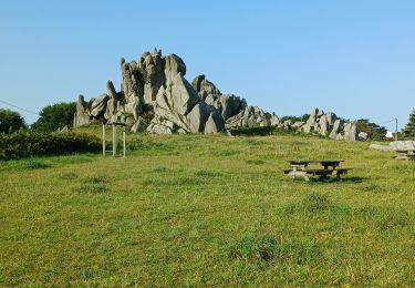
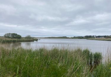
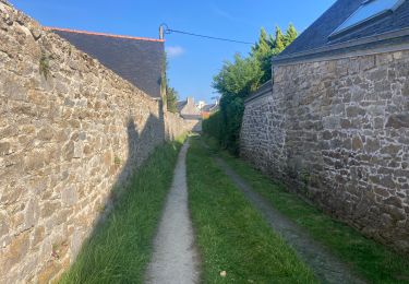
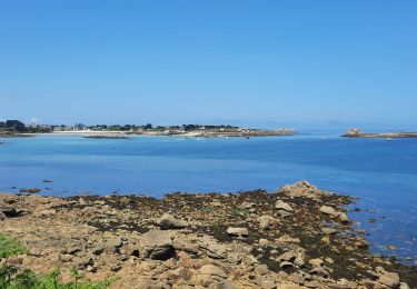
Tour Wandern von 26 km verfügbar auf Bretagne, Finistère, Guissény. Diese Tour wird von tracegps vorgeschlagen.
Beschreibung
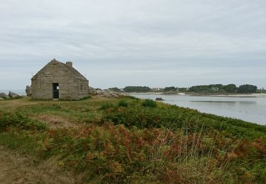
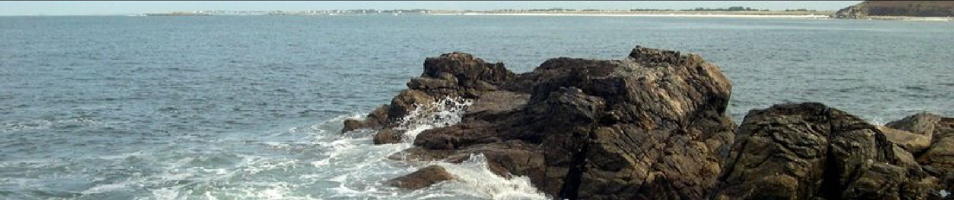
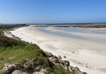
GR 34® de Guisseny à Keridaouen (Aber Wrac'h) L'Aber-Wrac'h (prononcé « Abèr Vrak », appelé An Aber Ac'h en breton) est un bras de mer du pays de Léon. L'Aber-Wrac'h est le plus long aber et le plus septentrional. L'Aber-Wrac'h tire son nom de la première roche immergée de son chenal, "Ar Grach" qui signifie "la vieille" (le poisson). L'apostrophe n'est pas justifiée historiquement. (source Wikipédia) Vous trouverez le descriptif détaillé de cette randonnée dans le Topo-guide® de la Fédération Française de la Randonnée Pédestre. Le découpage proposé ici est donné à titre indicatif pour équilibrer la distance de chaque tronçon. Chacun peut l’adapter à son niveau. Pour toute information complémentaire sur la randonnée: Comité départemental du Finistère: 4 ROUTE DE ST RENAN BP 02 29810 PLOUARZEL Tél. : 0298896006
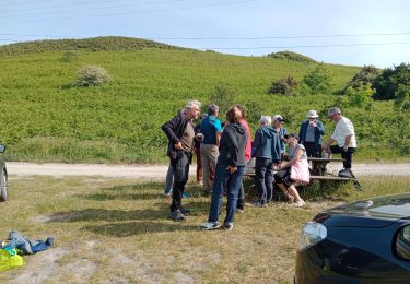
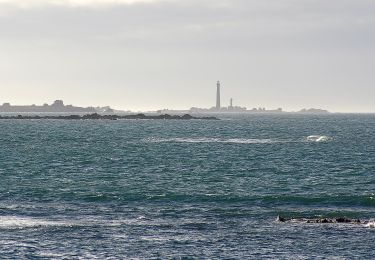
Ort
Kommentare
Touren in der Umgebung
![Tour Wandern Guissény - Milin ar rzden - Photo](https://media.geolcdn.com/t/375/260/a28b4f06-66d5-49b7-ba90-3f72194628fa.jpg&format=jpg&maxdim=2)
![Wandern Wandern](https://static1.geolcdn.com/sitytour/trail-icons/101.png)
Wandern
![](/images/other/stat-length.png)
![](https://static1.geolcdn.com/siteimages/upload/files/16400158638029165_repeat_loop_refresh_sync_direction_icon.png)
![Tour Wandern Kerlouan - 04.09.23 Guissény -- Lilia - Photo](https://media.geolcdn.com/t/375/260/76ba77c3-a923-41d6-9828-feb192ee7270.jpg&format=jpg&maxdim=2)
![Wandern Wandern](https://static1.geolcdn.com/sitytour/trail-icons/101.png)
Wandern
![](/images/other/stat-length.png)
![](https://static1.geolcdn.com/siteimages/upload/files/16400158638029165_repeat_loop_refresh_sync_direction_icon.png)
![Tour sport Guissény - Boucle Guissény / Vougot - Photo](https://media.geolcdn.com/t/375/260/35bd3d15-fd21-4f9b-9e96-2c34af716224.jpg&format=jpg&maxdim=2)
sport
![](/images/other/stat-length.png)
![](https://static1.geolcdn.com/siteimages/upload/files/16400158638029165_repeat_loop_refresh_sync_direction_icon.png)
![Tour sport Guissény - Guissény Terre/Mer - Photo](https://media.geolcdn.com/t/375/260/c93b3ac4-7de3-42df-b45e-c9c565d360f7.jpg&format=jpg&maxdim=2)
sport
![](/images/other/stat-length.png)
![](https://static1.geolcdn.com/siteimages/upload/files/16400158638029165_repeat_loop_refresh_sync_direction_icon.png)
![Tour Wandern Guissény - Guissény-Kervelt - Photo](https://media.geolcdn.com/t/375/260/7caa590c-0ac5-443a-98fe-4142efe5c7eb.jpg&format=jpg&maxdim=2)
![Wandern Wandern](https://static1.geolcdn.com/sitytour/trail-icons/101.png)
Wandern
![](/images/other/stat-length.png)
![](https://static1.geolcdn.com/siteimages/upload/files/16400158638029165_repeat_loop_refresh_sync_direction_icon.png)
![Tour Wandern Guissény - brgnogan Grève blanche 17km - Photo](https://media.geolcdn.com/t/375/260/8a620c7f-ce53-42d0-ae3e-be9b75e9273e.jpg&format=jpg&maxdim=2)
![Wandern Wandern](https://static1.geolcdn.com/sitytour/trail-icons/101.png)
Wandern
![](/images/other/stat-length.png)
![](https://static1.geolcdn.com/siteimages/upload/files/16400158638029165_repeat_loop_refresh_sync_direction_icon.png)
![Tour Wandern Plouguerneau - le vougot Plouguerneau - Photo](https://media.geolcdn.com/t/375/260/1f5cb3e5-b7a7-4947-9233-fbd030fcf668.jpg&format=jpg&maxdim=2)
![Wandern Wandern](https://static1.geolcdn.com/sitytour/trail-icons/101.png)
Wandern
![](/images/other/stat-length.png)
![](https://static1.geolcdn.com/siteimages/upload/files/16400158638029165_repeat_loop_refresh_sync_direction_icon.png)
![Tour Zu Fuß Guissény - Milin-Ar-Raden - Photo](https://media.geolcdn.com/t/375/260/48353884-ac87-4b1b-86dd-2ed0dda173a5.jpeg&format=jpg&maxdim=2)
![Zu Fuß Zu Fuß](https://static1.geolcdn.com/sitytour/trail-icons/100.png)
Zu Fuß
![](/images/other/stat-length.png)
![](https://static1.geolcdn.com/siteimages/upload/files/16400158638029165_repeat_loop_refresh_sync_direction_icon.png)
![Tour Zu Fuß Guissény - Dibennou - Photo](https://media.geolcdn.com/t/375/260/a149bb3d-a224-4f07-aeb5-e1b96df6ea37.jpeg&format=jpg&maxdim=2)
![Zu Fuß Zu Fuß](https://static1.geolcdn.com/sitytour/trail-icons/100.png)