![](/images/other/stat-length.png)
![Tour Wandern Boutigny-sur-Essonne - De Boutigny sur Essonne à Boigneville par le Bois de Malabri - Photo](https://media.geolcdn.com/t/1900/400/ext.pjpeg?maxdim=2&url=https%3A%2F%2Fservices.sitytrail.com%2FGeolivesWS%2FDownloadMedia.ashx%3FTrailID%3D316710%26Media%3D4358_1.jpg)
De Boutigny sur Essonne à Boigneville par le Bois de Malabri
tracegps
Benutzer
![Länge](/images/other/stat-length.png)
![Maximale Höhe](https://static1.geolcdn.com/siteimages/upload/files/1508320355ic_sort_altitude_max_24dp.png)
![Positive Höhendifferenz](https://static1.geolcdn.com/siteimages/upload/files/1508320355ic_sort_den_pos_24dp.png)
![Km-Effort](/images/other/stat-length.png)
![Min. Höhe](https://static1.geolcdn.com/siteimages/upload/files/1508320355ic_sort_altitude_min_24dp.png)
![Negative Höhendifferenz](https://static1.geolcdn.com/siteimages/upload/files/1508320355ic_sort_den_neg_24dp.png)
![Boucle](https://static1.geolcdn.com/siteimages/upload/files/16400158638029165_repeat_loop_refresh_sync_direction_icon.png)
![Wandern](https://static1.geolcdn.com/sitytour/trail-icons/101.png)
5h00
Schwierigkeit : Schwierig
![Scannen Sie diesen QR-Code, um die Tour in der SityTrail-Anwendung zu öffnen](https://capi.geolives.com/qq0zvz2zws4bq2lad0pu/sitytour/trails/316710/qr.png?size=200)
Kostenlosegpshiking-Anwendung
Über SityTrail
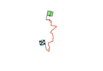
Tour Wandern von 21 km verfügbar auf Île-de-France, Essonne, Boutigny-sur-Essonne. Diese Tour wird von tracegps vorgeschlagen.
Beschreibung
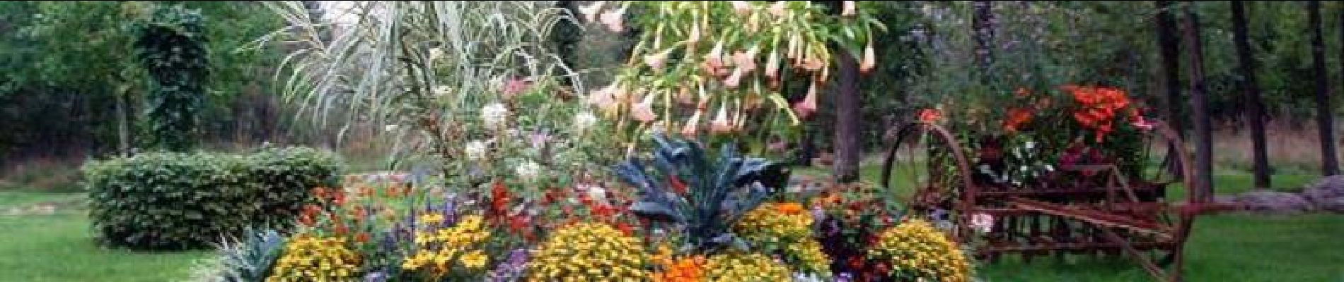
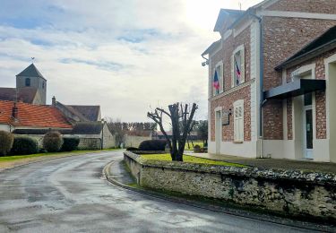
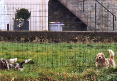
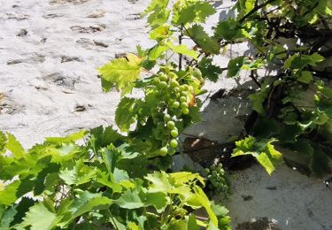
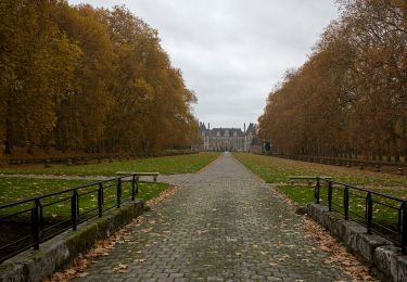
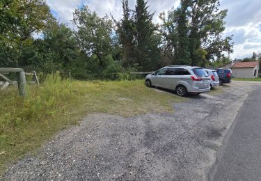
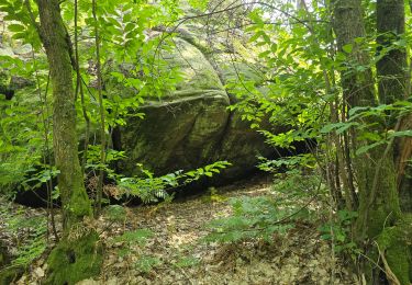
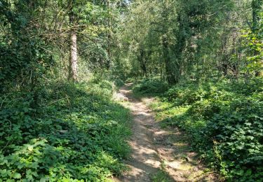
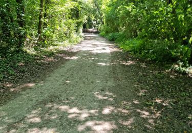
Les bois autour de Milly la Forêt sont riches en promenades avec des paysages variés et vallonnés. Les bois de Malabri et Saint Eloy prolongent les espaces boisés de Fontainebleau sur leur partie orientale: pins et bouleaux sur les reliefs qui environnent les villages. La roche ici a servi de polissoir préhistorique à Buno-Bonnevaux.
Ort
Kommentare
Touren in der Umgebung
![Tour Wandern Vayres-sur-Essonne - Boucle 22 km Boutigny Vayres Courdimanche - Photo](https://media.geolcdn.com/t/375/260/4b667bc1-98a4-484c-a9ef-d48797f8b1d6.jpg&format=jpg&maxdim=2)
![Wandern Wandern](https://static1.geolcdn.com/sitytour/trail-icons/101.png)
Wandern
![](/images/other/stat-length.png)
![](https://static1.geolcdn.com/siteimages/upload/files/16400158638029165_repeat_loop_refresh_sync_direction_icon.png)
![Tour Wandern Vayres-sur-Essonne - Boucle 30 km à partir de Vayres / Essonne - Photo](https://media.geolcdn.com/t/375/260/99723d7b-eef1-42c9-a80a-6ef415a50d61.jpg&format=jpg&maxdim=2)
![Wandern Wandern](https://static1.geolcdn.com/sitytour/trail-icons/101.png)
Wandern
![](/images/other/stat-length.png)
![](https://static1.geolcdn.com/siteimages/upload/files/16400158638029165_repeat_loop_refresh_sync_direction_icon.png)
![Tour Wandern La Ferté-Alais - Boucle Cerny - Photo](https://media.geolcdn.com/t/375/260/562ec7de-aba0-410b-b341-a4b4bf98c65c.jpg&format=jpg&maxdim=2)
![Wandern Wandern](https://static1.geolcdn.com/sitytour/trail-icons/101.png)
Wandern
![](/images/other/stat-length.png)
![](https://static1.geolcdn.com/siteimages/upload/files/16400158638029165_repeat_loop_refresh_sync_direction_icon.png)
![Tour Wandern Boutigny-sur-Essonne - Le tour du Grand Paris via le GR1 Etape 16 Boutigny /essonne - Lardy - Photo](https://media.geolcdn.com/t/375/260/120031b3-84d9-4df8-a3d3-f842b8d2e855.jpg&format=jpg&maxdim=2)
![Wandern Wandern](https://static1.geolcdn.com/sitytour/trail-icons/101.png)
Wandern
![](/images/other/stat-length.png)
![](https://static1.geolcdn.com/siteimages/upload/files/16400158638029165_repeat_loop_refresh_sync_direction_icon.png)
![Tour Zu Fuß Moigny-sur-École - Chemin des Grés et des Bruyères - Photo](https://media.geolcdn.com/t/375/260/7d52c13c-a415-4d03-a2ce-e27aab816b4f.jpeg&format=jpg&maxdim=2)
![Zu Fuß Zu Fuß](https://static1.geolcdn.com/sitytour/trail-icons/100.png)
Zu Fuß
![](/images/other/stat-length.png)
![](https://static1.geolcdn.com/siteimages/upload/files/16400158638029165_repeat_loop_refresh_sync_direction_icon.png)
![Tour Wandern Maisse - Maisse - Forêt communale de Milly-la-Forêt - Photo](https://media.geolcdn.com/t/375/260/ac13d570-05a3-405f-b57f-b7a0251ed338.jpg&format=jpg&maxdim=2)
![Wandern Wandern](https://static1.geolcdn.com/sitytour/trail-icons/101.png)
Wandern
![](/images/other/stat-length.png)
![](https://static1.geolcdn.com/siteimages/upload/files/16400158638029165_repeat_loop_refresh_sync_direction_icon.png)
![Tour Wandern Videlles - Videlles - Exploration d'un chaos rocheux au hameau](https://media.geolcdn.com/t/375/260/28cf3a42-58a0-4885-b69e-366feb563ae7.jpg&format=jpg&maxdim=2)
![Wandern Wandern](https://static1.geolcdn.com/sitytour/trail-icons/101.png)
Wandern
![](/images/other/stat-length.png)
![](https://static1.geolcdn.com/siteimages/upload/files/16400158638029165_repeat_loop_refresh_sync_direction_icon.png)
![Tour Wandern Moigny-sur-École - Moigny-sur-École - Photo](https://media.geolcdn.com/t/375/260/e39b79dd-0698-47d1-a993-eeec2e342c98.jpg&format=jpg&maxdim=2)
![Wandern Wandern](https://static1.geolcdn.com/sitytour/trail-icons/101.png)
Wandern
![](/images/other/stat-length.png)
![](https://static1.geolcdn.com/siteimages/upload/files/16400158638029165_repeat_loop_refresh_sync_direction_icon.png)
![Tour Wandern Boutigny-sur-Essonne - Boutigny-sur-Essonne - Photo](https://media.geolcdn.com/t/375/260/35e7e1a4-0e81-4101-ba61-582eb9cd50f0.jpg&format=jpg&maxdim=2)
![Wandern Wandern](https://static1.geolcdn.com/sitytour/trail-icons/101.png)
Wandern
![](/images/other/stat-length.png)
![](https://static1.geolcdn.com/siteimages/upload/files/16400158638029165_repeat_loop_refresh_sync_direction_icon.png)