![](/images/other/stat-length.png)
![Tour Wandern Paimpol - GR 34® de Paimpol à Lézardrieux - Photo](https://media.geolcdn.com/t/1900/400/ext.pjpeg?maxdim=2&url=https%3A%2F%2Fservices.sitytrail.com%2FGeolivesWS%2FDownloadMedia.ashx%3FTrailID%3D316668%26Media%3D3795_1.jpg)
GR 34® de Paimpol à Lézardrieux
tracegps
Benutzer
![Länge](/images/other/stat-length.png)
![Maximale Höhe](https://static1.geolcdn.com/siteimages/upload/files/1508320355ic_sort_altitude_max_24dp.png)
![Positive Höhendifferenz](https://static1.geolcdn.com/siteimages/upload/files/1508320355ic_sort_den_pos_24dp.png)
![Km-Effort](/images/other/stat-length.png)
![Min. Höhe](https://static1.geolcdn.com/siteimages/upload/files/1508320355ic_sort_altitude_min_24dp.png)
![Negative Höhendifferenz](https://static1.geolcdn.com/siteimages/upload/files/1508320355ic_sort_den_neg_24dp.png)
![Boucle](https://static1.geolcdn.com/siteimages/upload/files/16400158638029165_repeat_loop_refresh_sync_direction_icon.png)
![Wandern](https://static1.geolcdn.com/sitytour/trail-icons/101.png)
5h00
Schwierigkeit : Medium
![Scannen Sie diesen QR-Code, um die Tour in der SityTrail-Anwendung zu öffnen](https://capi.geolives.com/qq0zvz2zws4bq2lad0pu/sitytour/trails/316668/qr.png?size=200)
Kostenlosegpshiking-Anwendung
Über SityTrail
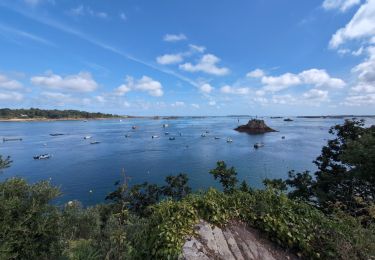
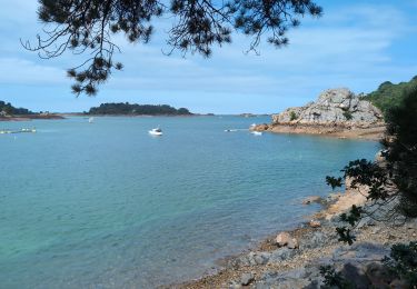
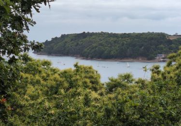
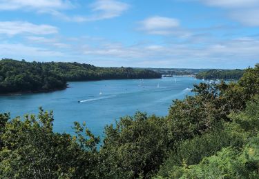
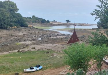
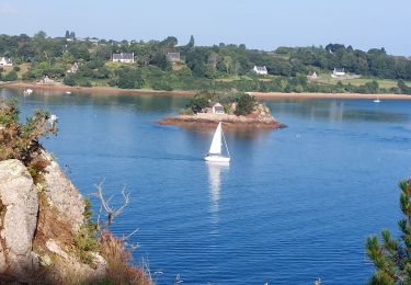
Tour Wandern von 23 km verfügbar auf Bretagne, Côtes-d'Armor, Paimpol. Diese Tour wird von tracegps vorgeschlagen.
Beschreibung
GR34® Côte de Granit Rose GR 34® de Paimpol à Lézardrieux Vous trouverez le descriptif détaillé de cette randonnée dans le Topo-guide® de la Fédération Française de la Randonnée Pédestre. Le découpage proposé ici est donné à titre indicatif pour équilibrer la distance de chaque tronçon. Chacun peut l’adapter à son niveau.
Ort
Kommentare
Touren in der Umgebung
![Tour Wandern Paimpol - Paimpol - GR34 Port Lazo - 25.5km 400m 6h15 (45mn) - 2024 06 30 - Photo](https://media.geolcdn.com/t/375/260/a1e8d6e5-d31d-477d-9229-268ec1b6062a.jpg&format=jpg&maxdim=2)
![Wandern Wandern](https://static1.geolcdn.com/sitytour/trail-icons/101.png)
Wandern
![](/images/other/stat-length.png)
![](https://static1.geolcdn.com/siteimages/upload/files/16400158638029165_repeat_loop_refresh_sync_direction_icon.png)
![Tour Wandern Ploubazlanec - Loguivy-de-la-Mer Mélus - GR34 Paimpol - 22.4km 375m 3h30 (45mn) - 2024 06 29 - Photo](https://media.geolcdn.com/t/375/260/448477d6-4d29-455f-a129-e2f273f0fc82.jpg&format=jpg&maxdim=2)
![Wandern Wandern](https://static1.geolcdn.com/sitytour/trail-icons/101.png)
Wandern
![](/images/other/stat-length.png)
![](https://static1.geolcdn.com/siteimages/upload/files/16400158638029165_repeat_loop_refresh_sync_direction_icon.png)
![Tour Wandern Paimpol - Lézardrieux Plage de Lodano - GR34 Allée couverte de Mélus PM - 15km 220m 3h45 - 2024 06 28 - Photo](https://media.geolcdn.com/t/375/260/c2f23138-3015-4fd2-ba3b-6c28291dc5f7.jpg&format=jpg&maxdim=2)
![Wandern Wandern](https://static1.geolcdn.com/sitytour/trail-icons/101.png)
Wandern
![](/images/other/stat-length.png)
![](https://static1.geolcdn.com/siteimages/upload/files/16400158638029165_repeat_loop_refresh_sync_direction_icon.png)
![Tour Wandern Lézardrieux - Lézardrieux Le Moulin à Mer - GR34 - 10.9km 185m 2h35 (50mn) - 2024 06 28 - Photo](https://media.geolcdn.com/t/375/260/b460eef9-8425-43e4-b0aa-b545ffccf8ec.jpg&format=jpg&maxdim=2)
![Wandern Wandern](https://static1.geolcdn.com/sitytour/trail-icons/101.png)
Wandern
![](/images/other/stat-length.png)
![](https://static1.geolcdn.com/siteimages/upload/files/16400158638029165_repeat_loop_refresh_sync_direction_icon.png)
![Tour Wandern Lézardrieux - Lézardrieux Bodic - Lanmodez GR34 Kermouster - 21.8km 260m 5h15 (55mn) - 2024 06 27 - Photo](https://media.geolcdn.com/t/375/260/5e039575-4c19-4df9-b59b-98b23d41b745.jpg&format=jpg&maxdim=2)
![Wandern Wandern](https://static1.geolcdn.com/sitytour/trail-icons/101.png)
Wandern
![](/images/other/stat-length.png)
![](https://static1.geolcdn.com/siteimages/upload/files/16400158638029165_repeat_loop_refresh_sync_direction_icon.png)
![Tour Wandern Lézardrieux - GR34-EtapeIII-J01 - Photo](https://media.geolcdn.com/t/375/260/ext.jpg?maxdim=2&url=https%3A%2F%2Fstatic1.geolcdn.com%2Fsiteimages%2Fupload%2Ffiles%2F1553511878bg_sport_marche.png)
![Wandern Wandern](https://static1.geolcdn.com/sitytour/trail-icons/101.png)
Wandern
![](/images/other/stat-length.png)
![](https://static1.geolcdn.com/siteimages/upload/files/16400158638029165_repeat_loop_refresh_sync_direction_icon.png)
![Tour Wandern Ploubazlanec - GR34-EtapeII-J04 - Photo](https://media.geolcdn.com/t/375/260/ext.jpg?maxdim=2&url=https%3A%2F%2Fstatic1.geolcdn.com%2Fsiteimages%2Fupload%2Ffiles%2F1553511878bg_sport_marche.png)
![Wandern Wandern](https://static1.geolcdn.com/sitytour/trail-icons/101.png)
Wandern
![](/images/other/stat-length.png)
![](https://static1.geolcdn.com/siteimages/upload/files/16400158638029165_repeat_loop_refresh_sync_direction_icon.png)
![Tour Wandern Lézardrieux - GR_34_DC_24_Lezardrieux_Pleubian_20240817 - Photo](https://media.geolcdn.com/t/375/260/5fd5ea68-1fe6-4a92-a91d-38847af10bb6.jpg&format=jpg&maxdim=2)
![Wandern Wandern](https://static1.geolcdn.com/sitytour/trail-icons/101.png)
Wandern
![](/images/other/stat-length.png)
![](https://static1.geolcdn.com/siteimages/upload/files/16400158638029165_repeat_loop_refresh_sync_direction_icon.png)
![Tour Wandern Ploubazlanec - GR_34_DB_23_Ploubazlanec_Lezardrieux_20240804 - Photo](https://media.geolcdn.com/t/375/260/035eb0c7-4ec6-4759-a713-1d9f7c3da5e8.jpg&format=jpg&maxdim=2)
![Wandern Wandern](https://static1.geolcdn.com/sitytour/trail-icons/101.png)
Wandern
![](/images/other/stat-length.png)
![](https://static1.geolcdn.com/siteimages/upload/files/16400158638029165_repeat_loop_refresh_sync_direction_icon.png)