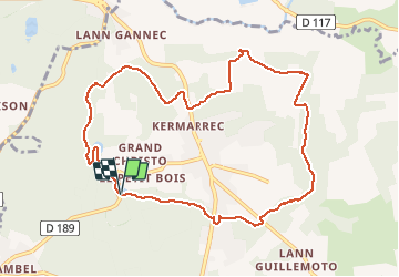
![](/images/other/stat-length.png)
![Tour Wandern Camors - Tro Bourk - Camors - Photo](https://media.geolcdn.com/t/1900/400/ext.pjpeg?maxdim=2&url=https%3A%2F%2Fservices.sitytrail.com%2FGeolivesWS%2FDownloadMedia.ashx%3FTrailID%3D316653%26Media%3D17520_2.jpg)
Tro Bourk - Camors
tracegps
Benutzer
![Länge](/images/other/stat-length.png)
![Maximale Höhe](https://static1.geolcdn.com/siteimages/upload/files/1508320355ic_sort_altitude_max_24dp.png)
![Positive Höhendifferenz](https://static1.geolcdn.com/siteimages/upload/files/1508320355ic_sort_den_pos_24dp.png)
![Km-Effort](/images/other/stat-length.png)
![Min. Höhe](https://static1.geolcdn.com/siteimages/upload/files/1508320355ic_sort_altitude_min_24dp.png)
![Negative Höhendifferenz](https://static1.geolcdn.com/siteimages/upload/files/1508320355ic_sort_den_neg_24dp.png)
![Boucle](https://static1.geolcdn.com/siteimages/upload/files/16400158638029165_repeat_loop_refresh_sync_direction_icon.png)
![Wandern](https://static1.geolcdn.com/sitytour/trail-icons/101.png)
2h45
Schwierigkeit : Medium
![Scannen Sie diesen QR-Code, um die Tour in der SityTrail-Anwendung zu öffnen](https://capi.geolives.com/qq0zvz2zws4bq2lad0pu/sitytour/trails/316653/qr.png?size=200)
Kostenlosegpshiking-Anwendung
Über SityTrail
Tour Wandern von 10,1 km verfügbar auf Bretagne, Morbihan, Camors. Diese Tour wird von tracegps vorgeschlagen.
Beschreibung
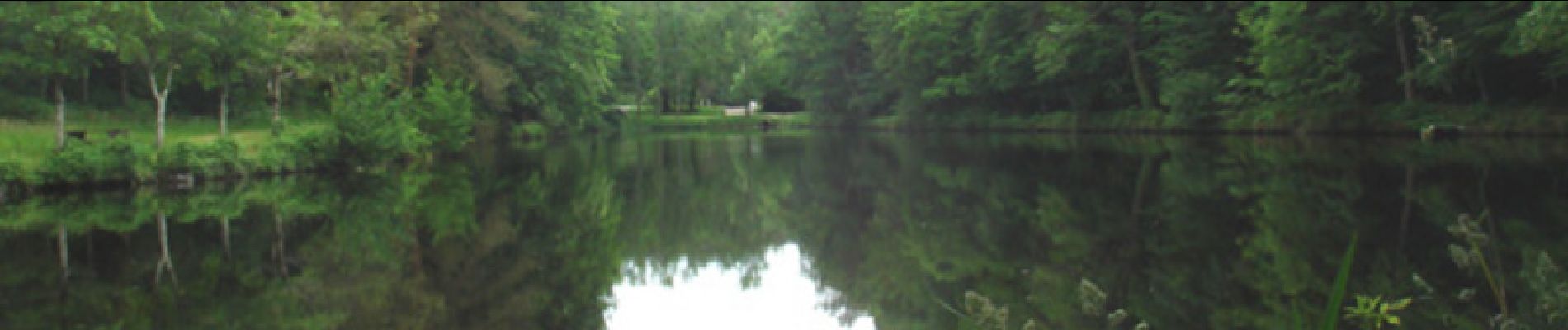
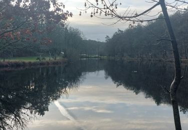
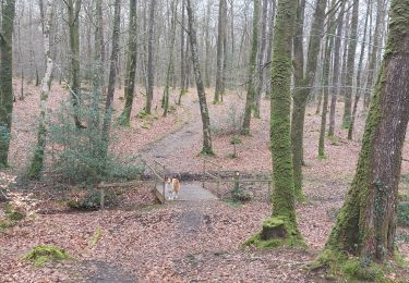
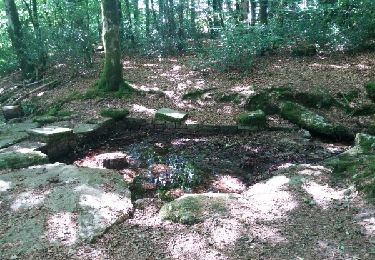
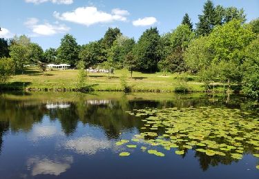
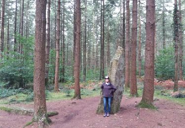
Ce circuit emprunte essentiellement des sentiers qui font le tour du bourg de Camors (Morbihan). Départ du parking sur le site du Petit-Bois. Après avoir longé deux étangs en forêt domaniale, une courte mais rude montée permet de rejoindre un autre secteur boisé avant de poursuivre la randonnée entre vergers et pâtures. Ensuite, belle et sauvage vallée encaissée des Korrigans, le long du ruisseau. Poursuite sur route secondaire qui borde le Bourg avant de s'enfoncer à nouveau dans la forêt domaniale pour retrouver le point de départ.
Ort
Kommentare
Touren in der Umgebung
![Tour Wandern Camors - PR_56_Camors_CA_03_Circuit1b_Tro-Bourk_20240126 - Photo](https://media.geolcdn.com/t/375/260/b5439ab5-6fb5-4321-891c-f40916bb8e7c.jpg&format=jpg&maxdim=2)
![Wandern Wandern](https://static1.geolcdn.com/sitytour/trail-icons/101.png)
Wandern
![](/images/other/stat-length.png)
![](https://static1.geolcdn.com/siteimages/upload/files/16400158638029165_repeat_loop_refresh_sync_direction_icon.png)
![Tour Wandern Camors - PR_56_Camors_BA_02_Circuit1b_De-L-Eau_20230218 - Photo](https://media.geolcdn.com/t/375/260/26c2393c-1d30-463e-8549-a7f32bee2231.jpg&format=jpg&maxdim=2)
![Wandern Wandern](https://static1.geolcdn.com/sitytour/trail-icons/101.png)
Wandern
![](/images/other/stat-length.png)
![](https://static1.geolcdn.com/siteimages/upload/files/16400158638029165_repeat_loop_refresh_sync_direction_icon.png)
![Tour Wandern Camors - PR_56_Camors_AA_01_Circuit1b_De-L'Etoile_20200726 - Photo](https://media.geolcdn.com/t/375/260/82aaeae4-747d-41a7-86e5-cd57c6a620aa.jpg&format=jpg&maxdim=2)
![Wandern Wandern](https://static1.geolcdn.com/sitytour/trail-icons/101.png)
Wandern
![](/images/other/stat-length.png)
![](https://static1.geolcdn.com/siteimages/upload/files/16400158638029165_repeat_loop_refresh_sync_direction_icon.png)
![Tour Wandern Camors - Circuit de l'Étoile.(forêt de Camors).11-07-16. - Photo](https://media.geolcdn.com/t/375/260/ext.jpg?maxdim=2&url=https%3A%2F%2Fservices.sitytrail.com%2FGeolivesWS%2FDownloadMedia.ashx%3FTrailID%3D596594%26Media%3Dfix__20160711170349.jpg)
![Wandern Wandern](https://static1.geolcdn.com/sitytour/trail-icons/101.png)
Wandern
![](/images/other/stat-length.png)
![](https://static1.geolcdn.com/siteimages/upload/files/16400158638029165_repeat_loop_refresh_sync_direction_icon.png)
![Tour Wandern Camors - Petit tour d'1h40 facile entre étangs, forêt et menhir - Photo](https://media.geolcdn.com/t/375/260/10e5ab03-cf10-4ae2-85ff-d3168d71a3af.jpg&format=jpg&maxdim=2)
![Wandern Wandern](https://static1.geolcdn.com/sitytour/trail-icons/101.png)
Wandern
![](/images/other/stat-length.png)
![](https://static1.geolcdn.com/siteimages/upload/files/16400158638029165_repeat_loop_refresh_sync_direction_icon.png)
![Tour Fahrrad Baud - Baud et la forêt de Camors - Photo](https://media.geolcdn.com/t/375/260/ext.jpg?maxdim=2&url=https%3A%2F%2Fservices.sitytrail.com%2FGeolivesWS%2FDownloadMedia.ashx%3FTrailID%3D832584%26Media%3Dfix__20170920114455.jpg)
![Fahrrad Fahrrad](https://static1.geolcdn.com/sitytour/trail-icons/200.png)
Fahrrad
![](/images/other/stat-length.png)
![](https://static1.geolcdn.com/siteimages/upload/files/16400158638029165_repeat_loop_refresh_sync_direction_icon.png)
![Tour Mountainbike Camors - Espace VTT FFC La vallée du Blavet - Le circuit de l'eau en forêt de Camors - Photo](https://media.geolcdn.com/t/375/260/ext.jpg?maxdim=2&url=https%3A%2F%2Fservices.sitytrail.com%2FGeolivesWS%2FDownloadMedia.ashx%3FTrailID%3D101724%26Media%3D1968_1.jpg)
![Mountainbike Mountainbike](https://static1.geolcdn.com/sitytour/trail-icons/202.png)
Mountainbike
![](/images/other/stat-length.png)
![](https://static1.geolcdn.com/siteimages/upload/files/16400158638029165_repeat_loop_refresh_sync_direction_icon.png)
![Tour Wandern Camors - Espace VTT FFC La vallée du Blavet - Le circuit de l'eau en forêt de Camors - Photo](https://media.geolcdn.com/t/375/260/ext.jpg?maxdim=2&url=https%3A%2F%2Fservices.sitytrail.com%2FGeolivesWS%2FDownloadMedia.ashx%3FTrailID%3D101723%26Media%3D1968_1.jpg)
![Wandern Wandern](https://static1.geolcdn.com/sitytour/trail-icons/101.png)
Wandern
![](/images/other/stat-length.png)
![](https://static1.geolcdn.com/siteimages/upload/files/16400158638029165_repeat_loop_refresh_sync_direction_icon.png)
![Tour sport Camors - M - Photo](https://media.geolcdn.com/t/375/260/ad7d5461-0e70-4f75-b943-b3472a85a1e9.jpg&format=jpg&maxdim=2)