![](/images/other/stat-length.png)
![Tour Wandern Fougerolles-Saint-Valbert - parc animalier - Photo](https://media.geolcdn.com/t/1900/400/ext.pjpeg?maxdim=2&url=https%3A%2F%2Fservices.sitytrail.com%2FGeolivesWS%2FDownloadMedia.ashx%3FTrailID%3D315617%26Media%3Dd8bed445-f3c7-4237-a9a7-c328448dc861.jpg)
parc animalier
fbertrand
Benutzer
![Länge](/images/other/stat-length.png)
Länge
6 km
![Maximale Höhe](https://static1.geolcdn.com/siteimages/upload/files/1508320355ic_sort_altitude_max_24dp.png)
Maximale Höhe
415 m
![Positive Höhendifferenz](https://static1.geolcdn.com/siteimages/upload/files/1508320355ic_sort_den_pos_24dp.png)
Positive Höhendifferenz
196 m
![Km-Effort](/images/other/stat-length.png)
Km-Effort
8,6 km
![Min. Höhe](https://static1.geolcdn.com/siteimages/upload/files/1508320355ic_sort_altitude_min_24dp.png)
Min. Höhe
317 m
![Negative Höhendifferenz](https://static1.geolcdn.com/siteimages/upload/files/1508320355ic_sort_den_neg_24dp.png)
Negative Höhendifferenz
196 m
![Boucle](https://static1.geolcdn.com/siteimages/upload/files/16400158638029165_repeat_loop_refresh_sync_direction_icon.png)
Boucle
Ja
Erstellungsdatum :
2014-12-10 00:00:00.0
Letzte Änderung :
2014-12-10 00:00:00.0
![Wandern](https://static1.geolcdn.com/sitytour/trail-icons/101.png)
1h40
Schwierigkeit : Einfach
![Scannen Sie diesen QR-Code, um die Tour in der SityTrail-Anwendung zu öffnen](https://capi.geolives.com/qq0zvz2zws4bq2lad0pu/sitytour/trails/315617/qr.png?size=200)
Kostenlosegpshiking-Anwendung
Über SityTrail
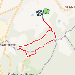
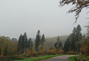
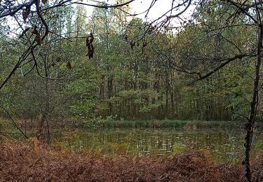
Tour Wandern von 6 km verfügbar auf Burgund und Freigrafschaft, Haute-Saône, Fougerolles-Saint-Valbert. Diese Tour wird von fbertrand vorgeschlagen.
Beschreibung
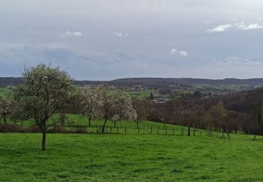
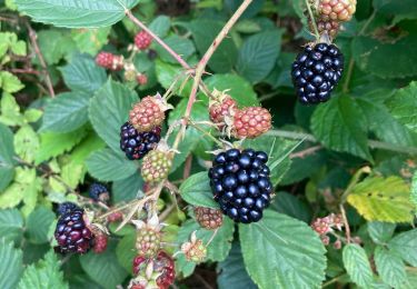
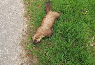
Depuis le centre les granges, jusqu'à l'entrée de blanzey, le tour du parc animalier.
Ort
Land:
France
Region :
Burgund und Freigrafschaft
Abteilung/Provinz :
Haute-Saône
Kommune :
Fougerolles-Saint-Valbert
Standort:
Fougerolles
Gehen Sie:(Dec)
Gehen Sie:(UTM)
306177 ; 5305574 (32T) N.
Kommentare
Touren in der Umgebung
![Tour Fahrrad Fougerolles-Saint-Valbert - La route des Chalots - Fougerolles - Photo](https://media.geolcdn.com/t/375/260/ext.jpg?maxdim=2&url=https%3A%2F%2Fservices.sitytrail.com%2FGeolivesWS%2FDownloadMedia.ashx%3FTrailID%3D172377%26Media%3D13720_6.jpg)
![Fahrrad Fahrrad](https://static1.geolcdn.com/sitytour/trail-icons/200.png)
La route des Chalots - Fougerolles
Fahrrad
Schwierig
Fougerolles-Saint-Valbert,
Burgund und Freigrafschaft,
Haute-Saône,
France
![](/images/other/stat-length.png)
105 km | 134 km-effort
6h 0min
![](https://static1.geolcdn.com/siteimages/upload/files/16400158638029165_repeat_loop_refresh_sync_direction_icon.png)
Ja
![Tour Elektrofahrrad Fougerolles-Saint-Valbert - 13-04-24 Maison - la Corre(St Bresson) - Photo](https://media.geolcdn.com/t/375/260/6c43d492-5726-4143-be24-de302b2e6d3b.jpg&format=jpg&maxdim=2)
![Elektrofahrrad Elektrofahrrad](https://static1.geolcdn.com/sitytour/trail-icons/205.png)
13-04-24 Maison - la Corre(St Bresson)
Elektrofahrrad
Medium
Fougerolles-Saint-Valbert,
Burgund und Freigrafschaft,
Haute-Saône,
France
![](/images/other/stat-length.png)
32 km | 41 km-effort
2h 42min
![](https://static1.geolcdn.com/siteimages/upload/files/16400158638029165_repeat_loop_refresh_sync_direction_icon.png)
Ja
![Tour Wandern Fougerolles-Saint-Valbert - 07-04-24 marche Téléthon Fougerolles - Photo](https://media.geolcdn.com/t/375/260/ff0ccb95-3851-49ed-8376-f2b6c407d22d.jpg&format=jpg&maxdim=2)
![Wandern Wandern](https://static1.geolcdn.com/sitytour/trail-icons/101.png)
07-04-24 marche Téléthon Fougerolles
Wandern
Einfach
Fougerolles-Saint-Valbert,
Burgund und Freigrafschaft,
Haute-Saône,
France
![](/images/other/stat-length.png)
9,7 km | 12,3 km-effort
2h 0min
![](https://static1.geolcdn.com/siteimages/upload/files/16400158638029165_repeat_loop_refresh_sync_direction_icon.png)
Nein
![Tour Wandern Fougerolles-Saint-Valbert - 1-04-24 Ramouse - Pierres de rouges - le Bout - Photo](https://media.geolcdn.com/t/375/260/721cb593-9e27-45f8-9de9-7c4617c70f84.jpg&format=jpg&maxdim=2)
![Wandern Wandern](https://static1.geolcdn.com/sitytour/trail-icons/101.png)
1-04-24 Ramouse - Pierres de rouges - le Bout
Wandern
Einfach
Fougerolles-Saint-Valbert,
Burgund und Freigrafschaft,
Haute-Saône,
France
![](/images/other/stat-length.png)
6,6 km | 8,6 km-effort
1h 44min
![](https://static1.geolcdn.com/siteimages/upload/files/16400158638029165_repeat_loop_refresh_sync_direction_icon.png)
Ja
![Tour Wandern Raddon-et-Chapendu - Raddon et Chapendu - Photo](https://media.geolcdn.com/t/375/260/9eab562e-9fe2-4647-8762-18a781bf654a.jpg&format=jpg&maxdim=2)
![Wandern Wandern](https://static1.geolcdn.com/sitytour/trail-icons/101.png)
Raddon et Chapendu
Wandern
Medium
Raddon-et-Chapendu,
Burgund und Freigrafschaft,
Haute-Saône,
France
![](/images/other/stat-length.png)
18,2 km | 23 km-effort
4h 36min
![](https://static1.geolcdn.com/siteimages/upload/files/16400158638029165_repeat_loop_refresh_sync_direction_icon.png)
Ja
![Tour Wandern Raddon-et-Chapendu - 30-04-23 Chapendu - Photo](https://media.geolcdn.com/t/375/260/b611f2f4-5172-4645-a6ec-ecaba909cfae.jpg&format=jpg&maxdim=2)
![Wandern Wandern](https://static1.geolcdn.com/sitytour/trail-icons/101.png)
30-04-23 Chapendu
Wandern
Einfach
Raddon-et-Chapendu,
Burgund und Freigrafschaft,
Haute-Saône,
France
![](/images/other/stat-length.png)
8,7 km | 10,6 km-effort
2h 28min
![](https://static1.geolcdn.com/siteimages/upload/files/16400158638029165_repeat_loop_refresh_sync_direction_icon.png)
Ja
![Tour Wandern Fougerolles-Saint-Valbert - 13-11-22 autour du sapin - Photo](https://media.geolcdn.com/t/375/260/214124a8-0d94-4633-abab-b5a80a8c2fca.jpg&format=jpg&maxdim=2)
![Wandern Wandern](https://static1.geolcdn.com/sitytour/trail-icons/101.png)
13-11-22 autour du sapin
Wandern
Einfach
Fougerolles-Saint-Valbert,
Burgund und Freigrafschaft,
Haute-Saône,
France
![](/images/other/stat-length.png)
6,8 km | 9,1 km-effort
1h 44min
![](https://static1.geolcdn.com/siteimages/upload/files/16400158638029165_repeat_loop_refresh_sync_direction_icon.png)
Ja
![Tour Elektrofahrrad Fougerolles-Saint-Valbert - 02-11-22 vae - Photo](https://media.geolcdn.com/t/375/260/68bdb7e6-11d8-4fdf-93c6-38e93a4a68a9.jpg&format=jpg&maxdim=2)
![Elektrofahrrad Elektrofahrrad](https://static1.geolcdn.com/sitytour/trail-icons/205.png)
02-11-22 vae
Elektrofahrrad
Medium
Fougerolles-Saint-Valbert,
Burgund und Freigrafschaft,
Haute-Saône,
France
![](/images/other/stat-length.png)
26 km | 31 km-effort
1h 48min
![](https://static1.geolcdn.com/siteimages/upload/files/16400158638029165_repeat_loop_refresh_sync_direction_icon.png)
Ja
![Tour Wandern Fougerolles-Saint-Valbert - Fougeroles - Photo](https://media.geolcdn.com/t/375/260/a1ddd368-4e3b-4443-8195-2d83a72051e8.jpg&format=jpg&maxdim=2)
![Wandern Wandern](https://static1.geolcdn.com/sitytour/trail-icons/101.png)
Fougeroles
Wandern
Schwierig
Fougerolles-Saint-Valbert,
Burgund und Freigrafschaft,
Haute-Saône,
France
![](/images/other/stat-length.png)
9,5 km | 13,1 km-effort
3h 21min
![](https://static1.geolcdn.com/siteimages/upload/files/16400158638029165_repeat_loop_refresh_sync_direction_icon.png)
Nein
excellent