10,8 km | 13,8 km-effort
Marais vernier PR
JMCMoreau
Benutzer
Länge
5,5 km
Maximale Höhe
26 m
Positive Höhendifferenz
36 m
Km-Effort
6 km
Min. Höhe
-1 m
Negative Höhendifferenz
35 m
Boucle
Ja
Erstellungsdatum :
2022-03-05 09:41:05.02
Letzte Änderung :
2022-03-05 09:42:25.077
1h30
Schwierigkeit : Sehr leicht
Kostenlosegpshiking-Anwendung
Über SityTrail
Tour Wandern von 5,5 km verfügbar auf Normandie, Eure, Marais-Vernier. Diese Tour wird von JMCMoreau vorgeschlagen.
Beschreibung
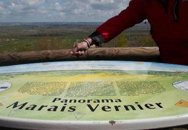
Petite boucle au départ de la Mairie de Marais Vernier
Ort
Land:
France
Region :
Normandie
Abteilung/Provinz :
Eure
Kommune :
Marais-Vernier
Standort:
Unknown
Gehen Sie:(Dec)
Gehen Sie:(UTM)
315449 ; 5477064 (31U) N.
Kommentare
Touren in der Umgebung
2022-04-08_19h09m39_SityTrail - 3194311 - 20220409xmarais-vernier-10km
Wandern
Schwierig
(1)
Marais-Vernier,
Normandie,
Eure,
France
3h 7min
Ja
Boucle de Bouquelon V2 variante
Wandern
Medium
(1)
Bouquelon,
Normandie,
Eure,
France
9,1 km | 11,1 km-effort
2h 31min
Ja
Boucle de Bouquelon V1
Wandern
Schwierig
(1)
Bouquelon,
Normandie,
Eure,
France
13,3 km | 16,6 km-effort
3h 46min
Ja
Boucle de Bouquelon V2
Wandern
Medium
(1)
Bouquelon,
Normandie,
Eure,
France
9,4 km | 11,4 km-effort
2h 35min
Ja
20220409-marais vernier
Wandern
Schwierig
Marais-Vernier,
Normandie,
Eure,
France
10,8 km | 13,8 km-effort
2h 58min
Ja
marais vernier
Wandern
Einfach
(1)
Marais-Vernier,
Normandie,
Eure,
France
11 km | 13,6 km-effort
3h 1min
Ja
La Roque
Wandern
Sehr leicht
Saint-Samson-de-la-Roque,
Normandie,
Eure,
France
14,9 km | 17,7 km-effort
3h 25min
Nein
Sentier découverte du marais vernier
Wandern
Einfach
Marais-Vernier,
Normandie,
Eure,
France
5,4 km | 5,7 km-effort
1h 39min
Ja
La Route des chaumières
Wandern
Medium
Bouquelon,
Normandie,
Eure,
France
9,3 km | 11,4 km-effort
2h 58min
Ja