![](/images/other/stat-length.png)
![Tour Wandern Val-d'Aigoual - 30 sentier des chars et Bonperrier - Photo](https://media.geolcdn.com/t/1900/400/b32b2a64-7519-4a76-b3e8-c311d4068a55.jpg&format=pjpeg&maxdim=2)
30 sentier des chars et Bonperrier
silvestreclaudine
Benutzer
![Länge](/images/other/stat-length.png)
Länge
14,9 km
![Maximale Höhe](https://static1.geolcdn.com/siteimages/upload/files/1508320355ic_sort_altitude_max_24dp.png)
Maximale Höhe
917 m
![Positive Höhendifferenz](https://static1.geolcdn.com/siteimages/upload/files/1508320355ic_sort_den_pos_24dp.png)
Positive Höhendifferenz
646 m
![Km-Effort](/images/other/stat-length.png)
Km-Effort
24 km
![Min. Höhe](https://static1.geolcdn.com/siteimages/upload/files/1508320355ic_sort_altitude_min_24dp.png)
Min. Höhe
351 m
![Negative Höhendifferenz](https://static1.geolcdn.com/siteimages/upload/files/1508320355ic_sort_den_neg_24dp.png)
Negative Höhendifferenz
668 m
![Boucle](https://static1.geolcdn.com/siteimages/upload/files/16400158638029165_repeat_loop_refresh_sync_direction_icon.png)
Boucle
Nein
Erstellungsdatum :
2022-03-04 09:31:31.0
Letzte Änderung :
2022-03-05 07:15:20.061
![Wandern](https://static1.geolcdn.com/sitytour/trail-icons/101.png)
5h19
Schwierigkeit : Einfach
![Scannen Sie diesen QR-Code, um die Tour in der SityTrail-Anwendung zu öffnen](https://capi.geolives.com/qq0zvz2zws4bq2lad0pu/sitytour/trails/3155158/qr.png?size=200)
Kostenlosegpshiking-Anwendung
Über SityTrail
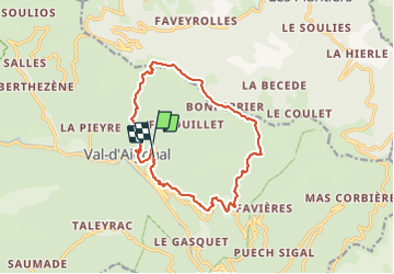
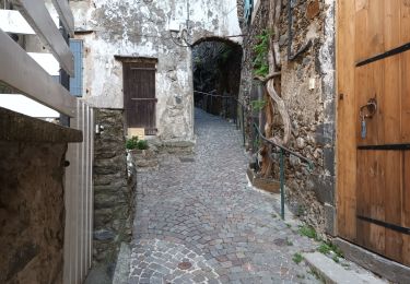
Tour Wandern von 14,9 km verfügbar auf Okzitanien, Gard, Val-d'Aigoual. Diese Tour wird von silvestreclaudine vorgeschlagen.
Beschreibung
Départ du moulinet
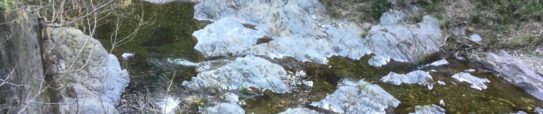
Montée raide après le hameau de Figairol.
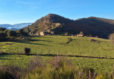
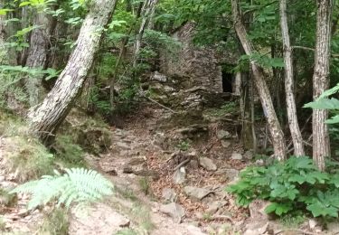
Retour traverser la coupe de bois et continuer tout droit ,le sentier descend il est peu visible au départ et pas très marqué.
Ort
Land:
France
Region :
Okzitanien
Abteilung/Provinz :
Gard
Kommune :
Val-d'Aigoual
Standort:
Valleraugue
Gehen Sie:(Dec)
Gehen Sie:(UTM)
553894 ; 4881076 (31T) N.
Kommentare
Touren in der Umgebung
![Tour Wandern Les Plantiers - Sentier de Saint Marcel de Fontfouillouse - Les Plantiers - Photo](https://media.geolcdn.com/t/375/260/ext.jpg?maxdim=2&url=https%3A%2F%2Fservices.sitytrail.com%2FGeolivesWS%2FDownloadMedia.ashx%3FTrailID%3D112875%26Media%3D12764_6.jpg)
![Wandern Wandern](https://static1.geolcdn.com/sitytour/trail-icons/101.png)
Sentier de Saint Marcel de Fontfouillouse - Les Plantiers
Wandern
Sehr schwierig
(1)
Les Plantiers,
Okzitanien,
Gard,
France
![](/images/other/stat-length.png)
13,6 km | 21 km-effort
4h 0min
![](https://static1.geolcdn.com/siteimages/upload/files/16400158638029165_repeat_loop_refresh_sync_direction_icon.png)
Ja
![Tour Wandern Les Plantiers - Vallée Borgne - Photo](https://media.geolcdn.com/t/375/260/f18dfe3f-f9df-4e1d-8dc9-6aeab33ebafe.jpg&format=jpg&maxdim=2)
![Wandern Wandern](https://static1.geolcdn.com/sitytour/trail-icons/101.png)
Vallée Borgne
Wandern
Schwierig
Les Plantiers,
Okzitanien,
Gard,
France
![](/images/other/stat-length.png)
19,7 km | 32 km-effort
5h 19min
![](https://static1.geolcdn.com/siteimages/upload/files/16400158638029165_repeat_loop_refresh_sync_direction_icon.png)
Ja
![Tour Wandern Les Plantiers - vallée Borgne - Photo](https://media.geolcdn.com/t/375/260/723c78ed-c83c-47da-b656-ffd3f2d24b35.jpg&format=jpg&maxdim=2)
![Wandern Wandern](https://static1.geolcdn.com/sitytour/trail-icons/101.png)
vallée Borgne
Wandern
Schwierig
Les Plantiers,
Okzitanien,
Gard,
France
![](/images/other/stat-length.png)
25 km | 36 km-effort
6h 15min
![](https://static1.geolcdn.com/siteimages/upload/files/16400158638029165_repeat_loop_refresh_sync_direction_icon.png)
Ja
![Tour Wandern Bassurels - Aire de Côte - Mas Corbières - Photo](https://media.geolcdn.com/t/375/260/ext.jpg?maxdim=2&url=https%3A%2F%2Fstatic1.geolcdn.com%2Fsiteimages%2Fupload%2Ffiles%2F1553511878bg_sport_marche.png)
![Wandern Wandern](https://static1.geolcdn.com/sitytour/trail-icons/101.png)
Aire de Côte - Mas Corbières
Wandern
Medium
(1)
Bassurels,
Okzitanien,
Lozère,
France
![](/images/other/stat-length.png)
13,9 km | 20 km-effort
4h 5min
![](https://static1.geolcdn.com/siteimages/upload/files/16400158638029165_repeat_loop_refresh_sync_direction_icon.png)
Nein
![Tour Wandern Les Plantiers - Les Plantiers et st Marcel de Fontfouillouse - Photo](https://media.geolcdn.com/t/375/260/ext.jpg?maxdim=2&url=https%3A%2F%2Fstatic1.geolcdn.com%2Fsiteimages%2Fupload%2Ffiles%2F1553511878bg_sport_marche.png)
![Wandern Wandern](https://static1.geolcdn.com/sitytour/trail-icons/101.png)
Les Plantiers et st Marcel de Fontfouillouse
Wandern
Schwierig
(1)
Les Plantiers,
Okzitanien,
Gard,
France
![](/images/other/stat-length.png)
13,6 km | 21 km-effort
4h 33min
![](https://static1.geolcdn.com/siteimages/upload/files/16400158638029165_repeat_loop_refresh_sync_direction_icon.png)
Ja
![Tour Wandern Les Plantiers - Sentier du Mouflon - Les Plantiers - Photo](https://media.geolcdn.com/t/375/260/ext.jpg?maxdim=2&url=https%3A%2F%2Fservices.sitytrail.com%2FGeolivesWS%2FDownloadMedia.ashx%3FTrailID%3D223509%26Media%3D802317c0-3594-4820-adb2-76eafc969123.jpg)
![Wandern Wandern](https://static1.geolcdn.com/sitytour/trail-icons/101.png)
Sentier du Mouflon - Les Plantiers
Wandern
Schwierig
Les Plantiers,
Okzitanien,
Gard,
France
![](/images/other/stat-length.png)
11,2 km | 18,6 km-effort
3h 30min
![](https://static1.geolcdn.com/siteimages/upload/files/16400158638029165_repeat_loop_refresh_sync_direction_icon.png)
Ja
![Tour Wandern Les Plantiers - la Becede - Photo](https://media.geolcdn.com/t/375/260/c63ee19f-e327-4605-afa8-b6997f966226.jpg&format=jpg&maxdim=2)
![Wandern Wandern](https://static1.geolcdn.com/sitytour/trail-icons/101.png)
la Becede
Wandern
Einfach
Les Plantiers,
Okzitanien,
Gard,
France
![](/images/other/stat-length.png)
6,1 km | 10,3 km-effort
2h 44min
![](https://static1.geolcdn.com/siteimages/upload/files/16400158638029165_repeat_loop_refresh_sync_direction_icon.png)
Ja
![Tour Wandern Val-d'Aigoual - Cascade d'Orgon-15-06-22 - Photo](https://media.geolcdn.com/t/375/260/49ac4d00-981a-43cf-b1d1-af4b0eb1b9db.jpg&format=jpg&maxdim=2)
![Wandern Wandern](https://static1.geolcdn.com/sitytour/trail-icons/101.png)
Cascade d'Orgon-15-06-22
Wandern
Schwierig
Val-d'Aigoual,
Okzitanien,
Gard,
France
![](/images/other/stat-length.png)
22 km | 40 km-effort
6h 17min
![](https://static1.geolcdn.com/siteimages/upload/files/16400158638029165_repeat_loop_refresh_sync_direction_icon.png)
Ja
![Tour Wandern Val-d'Aigoual - 4000 marches-14-06-22 - Photo](https://media.geolcdn.com/t/375/260/d1c0910b-e80d-4616-bf52-2645b3da4871.jpg&format=jpg&maxdim=2)
![Wandern Wandern](https://static1.geolcdn.com/sitytour/trail-icons/101.png)
4000 marches-14-06-22
Wandern
Sehr schwierig
Val-d'Aigoual,
Okzitanien,
Gard,
France
![](/images/other/stat-length.png)
30 km | 50 km-effort
7h 47min
![](https://static1.geolcdn.com/siteimages/upload/files/16400158638029165_repeat_loop_refresh_sync_direction_icon.png)
Ja