![](/images/other/stat-length.png)
![Tour Wandern Lieuche - Le grand Palier par Lieuche et Arsilane - Photo](https://media.geolcdn.com/t/1900/400/e9d7f8eb-f5a9-4d3b-b5d4-6b9bca14989f.jpg&format=pjpeg&maxdim=2)
Le grand Palier par Lieuche et Arsilane
GrouGary
Benutzer
![Länge](/images/other/stat-length.png)
![Maximale Höhe](https://static1.geolcdn.com/siteimages/upload/files/1508320355ic_sort_altitude_max_24dp.png)
![Positive Höhendifferenz](https://static1.geolcdn.com/siteimages/upload/files/1508320355ic_sort_den_pos_24dp.png)
![Km-Effort](/images/other/stat-length.png)
![Min. Höhe](https://static1.geolcdn.com/siteimages/upload/files/1508320355ic_sort_altitude_min_24dp.png)
![Negative Höhendifferenz](https://static1.geolcdn.com/siteimages/upload/files/1508320355ic_sort_den_neg_24dp.png)
![Boucle](https://static1.geolcdn.com/siteimages/upload/files/16400158638029165_repeat_loop_refresh_sync_direction_icon.png)
![Wandern](https://static1.geolcdn.com/sitytour/trail-icons/101.png)
3h14
Schwierigkeit : Medium
![Scannen Sie diesen QR-Code, um die Tour in der SityTrail-Anwendung zu öffnen](https://capi.geolives.com/qq0zvz2zws4bq2lad0pu/sitytour/trails/3154508/qr.png?size=200)
Kostenlosegpshiking-Anwendung
Über SityTrail
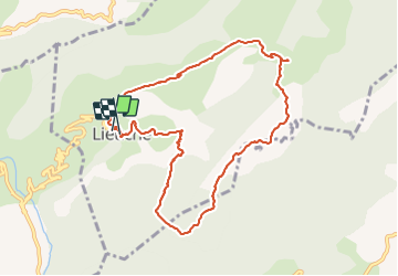
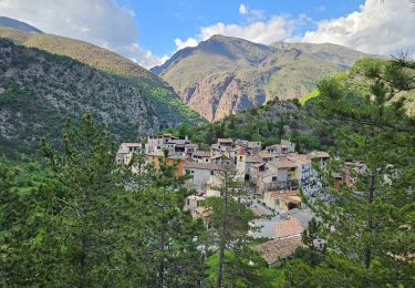
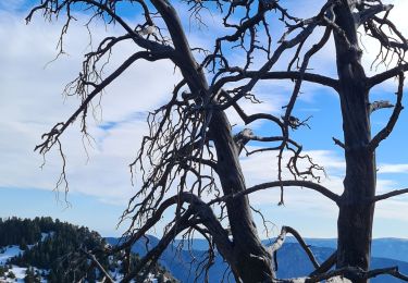
Tour Wandern von 9,9 km verfügbar auf Provence-Alpes-Côte d'Azur, Seealpen, Lieuche. Diese Tour wird von GrouGary vorgeschlagen.
Beschreibung
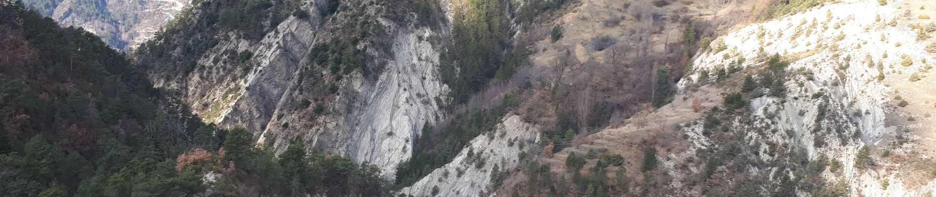
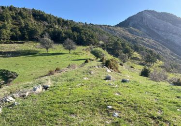
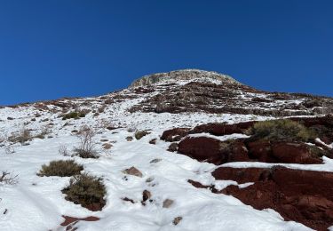
Boucle de 10 km et 400, par la baisse du Grand Palier et vue sur Thiery. Passage sur GR510 dans les alternances marnes noires et calcaires prenant la forme de curieuses écailles de dinosaures, notamment en arrivant sur Arsilane.
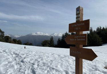
le sentier est parfois peu marqué dans les marnes du GR 510.
Ort
Kommentare
Touren in der Umgebung
![Tour Zu Fuß Pierlas - Tour du Mont de Lieuche - Photo](https://media.geolcdn.com/t/375/260/21b88e85-708c-4489-9ada-9348a7269087.jpeg&format=jpg&maxdim=2)
![Zu Fuß Zu Fuß](https://static1.geolcdn.com/sitytour/trail-icons/100.png)
Zu Fuß
![](/images/other/stat-length.png)
![](https://static1.geolcdn.com/siteimages/upload/files/16400158638029165_repeat_loop_refresh_sync_direction_icon.png)
![Tour Wandern Rigaud - Mairola de Rigaud, chapelles St Julien et St Sauveur - Photo](https://media.geolcdn.com/t/375/260/bfd975e4-5b26-4452-b5c4-4e8903bf1886.jpg&format=jpg&maxdim=2)
![Wandern Wandern](https://static1.geolcdn.com/sitytour/trail-icons/101.png)
Wandern
![](/images/other/stat-length.png)
![](https://static1.geolcdn.com/siteimages/upload/files/16400158638029165_repeat_loop_refresh_sync_direction_icon.png)
![Tour Wandern Thiéry - Brec d’ Ilonse - Photo](https://media.geolcdn.com/t/375/260/371e8790-f558-4bbf-8168-94a56f4b21b9.jpg&format=jpg&maxdim=2)
![Wandern Wandern](https://static1.geolcdn.com/sitytour/trail-icons/101.png)
Wandern
![](/images/other/stat-length.png)
![](https://static1.geolcdn.com/siteimages/upload/files/16400158638029165_repeat_loop_refresh_sync_direction_icon.png)
![Tour Schneeschuhwandern Rigaud - Tête de Rigaud - Photo](https://media.geolcdn.com/t/375/260/2195a5b9-410c-4db3-8586-4f5db2113ca9.jpg&format=jpg&maxdim=2)
![Schneeschuhwandern Schneeschuhwandern](https://static1.geolcdn.com/sitytour/trail-icons/504.png)
Schneeschuhwandern
![](/images/other/stat-length.png)
![](https://static1.geolcdn.com/siteimages/upload/files/16400158638029165_repeat_loop_refresh_sync_direction_icon.png)
![Tour Schneeschuhwandern Ilonse - Lauvet d’Ilonse - Photo](https://media.geolcdn.com/t/375/260/27d6716b-7948-437f-a217-9ca86aa8eff9.jpg&format=jpg&maxdim=2)
![Schneeschuhwandern Schneeschuhwandern](https://static1.geolcdn.com/sitytour/trail-icons/504.png)
Schneeschuhwandern
![](/images/other/stat-length.png)
![](https://static1.geolcdn.com/siteimages/upload/files/16400158638029165_repeat_loop_refresh_sync_direction_icon.png)
![Tour Wandern Thiéry - thiery Villa Soubere - Photo](https://media.geolcdn.com/t/375/260/152e54b1-7917-4f58-90c1-fbc432530c5c.jpg&format=jpg&maxdim=2)
![Wandern Wandern](https://static1.geolcdn.com/sitytour/trail-icons/101.png)
Wandern
![](/images/other/stat-length.png)
![](https://static1.geolcdn.com/siteimages/upload/files/16400158638029165_repeat_loop_refresh_sync_direction_icon.png)
![Tour Wandern Thiéry - Pointe de Chavanette Par chapelle Ste Madeleine/Thiery - Photo](https://media.geolcdn.com/t/375/260/bf4c4b25-1f2c-4c16-b282-1fd0acf4f8e0.jpg&format=jpg&maxdim=2)
![Wandern Wandern](https://static1.geolcdn.com/sitytour/trail-icons/101.png)
Wandern
![](/images/other/stat-length.png)
![](https://static1.geolcdn.com/siteimages/upload/files/16400158638029165_repeat_loop_refresh_sync_direction_icon.png)
![Tour Wandern Lieuche - Lieuche brec d ilonse - Photo](https://media.geolcdn.com/t/375/260/b5e77ab5-d74f-4c03-aaca-8053a1eeae4f.jpg&format=jpg&maxdim=2)
![Wandern Wandern](https://static1.geolcdn.com/sitytour/trail-icons/101.png)
Wandern
![](/images/other/stat-length.png)
![](https://static1.geolcdn.com/siteimages/upload/files/16400158638029165_repeat_loop_refresh_sync_direction_icon.png)
![Tour Wandern Thiéry - mont fracha et brec d illons - Photo](https://media.geolcdn.com/t/375/260/7a352f20-95c8-4db5-abd7-afa376ae4d13.jpg&format=jpg&maxdim=2)
![Wandern Wandern](https://static1.geolcdn.com/sitytour/trail-icons/101.png)
Wandern
![](/images/other/stat-length.png)
![](https://static1.geolcdn.com/siteimages/upload/files/16400158638029165_repeat_loop_refresh_sync_direction_icon.png)