![](/images/other/stat-length.png)
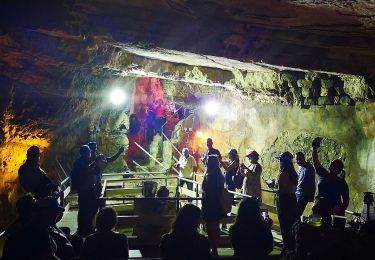
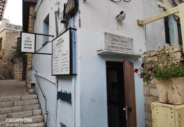
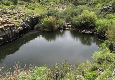
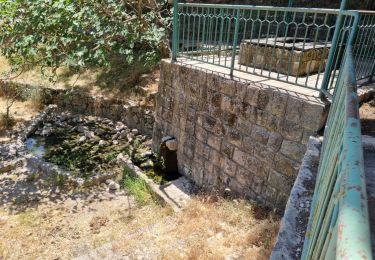
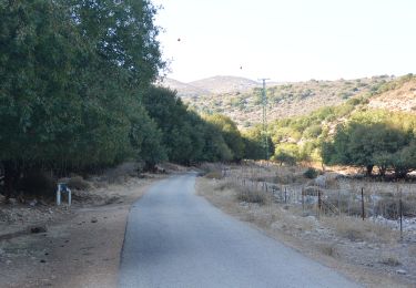
![Tour Zu Fuß מועצה אזורית גליל עליון - שביל נחל עכברה - Photo](https://media.geolcdn.com/t/1900/400/a29880e9-218f-4f28-a049-7463f7132538.jpeg&format=pjpeg&maxdim=2)
שביל נחל עכברה
SityTrail - itinéraires balisés pédestres
Tous les sentiers balisés d’Europe GUIDE+
![Länge](/images/other/stat-length.png)
Länge
8,6 km
![Maximale Höhe](https://static1.geolcdn.com/siteimages/upload/files/1508320355ic_sort_altitude_max_24dp.png)
Maximale Höhe
823 m
![Positive Höhendifferenz](https://static1.geolcdn.com/siteimages/upload/files/1508320355ic_sort_den_pos_24dp.png)
Positive Höhendifferenz
815 m
![Km-Effort](/images/other/stat-length.png)
Km-Effort
16,8 km
![Min. Höhe](https://static1.geolcdn.com/siteimages/upload/files/1508320355ic_sort_altitude_min_24dp.png)
Min. Höhe
28 m
![Negative Höhendifferenz](https://static1.geolcdn.com/siteimages/upload/files/1508320355ic_sort_den_neg_24dp.png)
Negative Höhendifferenz
26 m
![Boucle](https://static1.geolcdn.com/siteimages/upload/files/16400158638029165_repeat_loop_refresh_sync_direction_icon.png)
Boucle
Nein
Kennzeichnung
Erstellungsdatum :
2022-02-22 08:22:59.887
Letzte Änderung :
2022-03-09 05:33:13.596
![Zu Fuß](https://static1.geolcdn.com/sitytour/trail-icons/100.png)
3h49
Schwierigkeit : Einfach
![Scannen Sie diesen QR-Code, um die Tour in der SityTrail-Anwendung zu öffnen](https://capi.geolives.com/qq0zvz2zws4bq2lad0pu/sitytour/trails/3141998/qr.png?size=200)
Kostenlosegpshiking-Anwendung
Über SityTrail
Tour Zu Fuß von 8,6 km verfügbar auf Nordbezirk, Unbekannt, מועצה אזורית גליל עליון. Diese Tour wird von SityTrail - itinéraires balisés pédestres vorgeschlagen.
Beschreibung
Trail created by itc.
Ort
Land:
Israel
Region :
Nordbezirk
Abteilung/Provinz :
Unbekannt
Kommune :
מועצה אזורית גליל עליון
Standort:
Unknown
Gehen Sie:(Dec)
Gehen Sie:(UTM)
732478 ; 3644203 (36S) N.
Kommentare
Touren in der Umgebung
![Tour Zu Fuß Rosch Pina - תל חצור למערת עלמה - Photo](https://media.geolcdn.com/t/375/260/aa345b89-3bd6-4878-a1ef-0711b3f45b7b.jpeg&format=jpg&maxdim=2)
![Zu Fuß Zu Fuß](https://static1.geolcdn.com/sitytour/trail-icons/100.png)
תל חצור למערת עלמה
Zu Fuß
Einfach
Rosch Pina,
Nordbezirk,
Unbekannt,
Israel
![](/images/other/stat-length.png)
7,3 km | 11,9 km-effort
2h 42min
![](https://static1.geolcdn.com/siteimages/upload/files/16400158638029165_repeat_loop_refresh_sync_direction_icon.png)
Nein
![Tour Zu Fuß بيت جن - IL-2361 - Photo](https://media.geolcdn.com/t/375/260/31e179e0-65f2-4f33-9bcf-4fc11ccd44f7.jpeg&format=jpg&maxdim=2)
![Zu Fuß Zu Fuß](https://static1.geolcdn.com/sitytour/trail-icons/100.png)
![Tour Zu Fuß מועצה אזורית מרום הגליל - שביל הלוחמים - Photo](https://media.geolcdn.com/t/375/260/c7d69f27-1c4e-4e1a-8971-937e0edba358.jpeg&format=jpg&maxdim=2)
![Zu Fuß Zu Fuß](https://static1.geolcdn.com/sitytour/trail-icons/100.png)
שביל הלוחמים
Zu Fuß
Einfach
מועצה אזורית מרום הגליל,
Nordbezirk,
Unbekannt,
Israel
![](/images/other/stat-length.png)
6,3 km | 8,7 km-effort
1h 58min
![](https://static1.geolcdn.com/siteimages/upload/files/16400158638029165_repeat_loop_refresh_sync_direction_icon.png)
Nein
![Tour Zu Fuß Katzrin - קצרין-זויתן-חניון יהודיה - Photo](https://media.geolcdn.com/t/375/260/06d32215-9acc-4733-862e-db39976a1691.jpeg&format=jpg&maxdim=2)
![Zu Fuß Zu Fuß](https://static1.geolcdn.com/sitytour/trail-icons/100.png)
קצרין-זויתן-חניון יהודיה
Zu Fuß
Einfach
Katzrin,
Nordbezirk,
Unbekannt,
Israel
![](/images/other/stat-length.png)
4,7 km | 5,3 km-effort
1h 12min
![](https://static1.geolcdn.com/siteimages/upload/files/16400158638029165_repeat_loop_refresh_sync_direction_icon.png)
Nein
![Tour Zu Fuß מועצה אזורית מרום הגליל - IL-2156 - Photo](https://media.geolcdn.com/t/375/260/aa345b89-3bd6-4878-a1ef-0711b3f45b7b.jpeg&format=jpg&maxdim=2)
![Zu Fuß Zu Fuß](https://static1.geolcdn.com/sitytour/trail-icons/100.png)
IL-2156
Zu Fuß
Einfach
מועצה אזורית מרום הגליל,
Nordbezirk,
Unbekannt,
Israel
![](/images/other/stat-length.png)
7,5 km | 11,2 km-effort
2h 32min
![](https://static1.geolcdn.com/siteimages/upload/files/16400158638029165_repeat_loop_refresh_sync_direction_icon.png)
Nein
![Tour Zu Fuß מועצה אזורית מרום הגליל - דרך נוף יער עמוקה - Photo](https://media.geolcdn.com/t/375/260/fd6a2495-3f31-4bca-8b36-6426bee10274.jpeg&format=jpg&maxdim=2)
![Zu Fuß Zu Fuß](https://static1.geolcdn.com/sitytour/trail-icons/100.png)
דרך נוף יער עמוקה
Zu Fuß
Einfach
מועצה אזורית מרום הגליל,
Nordbezirk,
Unbekannt,
Israel
![](/images/other/stat-length.png)
5,3 km | 7,4 km-effort
1h 40min
![](https://static1.geolcdn.com/siteimages/upload/files/16400158638029165_repeat_loop_refresh_sync_direction_icon.png)
Nein
![Tour Zu Fuß מועצה אזורית גליל עליון - IL-2136 - Photo](https://media.geolcdn.com/t/375/260/dcb9584a-3e95-45f3-95a6-1b351ed8e881.jpeg&format=jpg&maxdim=2)
![Zu Fuß Zu Fuß](https://static1.geolcdn.com/sitytour/trail-icons/100.png)
IL-2136
Zu Fuß
Einfach
מועצה אזורית גליל עליון,
Nordbezirk,
Unbekannt,
Israel
![](/images/other/stat-length.png)
6,3 km | 7,1 km-effort
1h 36min
![](https://static1.geolcdn.com/siteimages/upload/files/16400158638029165_repeat_loop_refresh_sync_direction_icon.png)
Nein
![Tour Zu Fuß מועצה אזורית גליל עליון - IL-2347 - Photo](https://media.geolcdn.com/t/375/260/8d965b97-813e-4e0e-b239-722aaff2ff8e.jpeg&format=jpg&maxdim=2)
![Zu Fuß Zu Fuß](https://static1.geolcdn.com/sitytour/trail-icons/100.png)
IL-2347
Zu Fuß
Einfach
מועצה אזורית גליל עליון,
Nordbezirk,
Unbekannt,
Israel
![](/images/other/stat-length.png)
3,3 km | 4,1 km-effort
55min
![](https://static1.geolcdn.com/siteimages/upload/files/16400158638029165_repeat_loop_refresh_sync_direction_icon.png)
Nein
![Tour Zu Fuß מועצה אזורית גליל עליון - IL-2071 - Photo](https://media.geolcdn.com/t/375/260/437b69f2-1549-448e-bf66-df86080cd1e1.jpeg&format=jpg&maxdim=2)
![Zu Fuß Zu Fuß](https://static1.geolcdn.com/sitytour/trail-icons/100.png)
IL-2071
Zu Fuß
Einfach
מועצה אזורית גליל עליון,
Nordbezirk,
Unbekannt,
Israel
![](/images/other/stat-length.png)
5,3 km | 7,5 km-effort
1h 42min
![](https://static1.geolcdn.com/siteimages/upload/files/16400158638029165_repeat_loop_refresh_sync_direction_icon.png)
Nein