![](/images/other/stat-length.png)
![Tour Wandern Neufchâteau - Le Sentier du Bois d'Ospôt - Photo](https://media.geolcdn.com/t/1900/400/ext.pjpeg?maxdim=2&url=https%3A%2F%2Fservices.sitytrail.com%2FGeolivesWS%2FDownloadMedia.ashx%3FTrailID%3D314177%26Media%3Da3f0c943-b6aa-42ba-a976-375fc630bff4.jpg)
Le Sentier du Bois d'Ospôt
tompaulet
Benutzer
![Länge](/images/other/stat-length.png)
![Maximale Höhe](https://static1.geolcdn.com/siteimages/upload/files/1508320355ic_sort_altitude_max_24dp.png)
![Positive Höhendifferenz](https://static1.geolcdn.com/siteimages/upload/files/1508320355ic_sort_den_pos_24dp.png)
![Km-Effort](/images/other/stat-length.png)
![Min. Höhe](https://static1.geolcdn.com/siteimages/upload/files/1508320355ic_sort_altitude_min_24dp.png)
![Negative Höhendifferenz](https://static1.geolcdn.com/siteimages/upload/files/1508320355ic_sort_den_neg_24dp.png)
![Boucle](https://static1.geolcdn.com/siteimages/upload/files/16400158638029165_repeat_loop_refresh_sync_direction_icon.png)
![Wandern](https://static1.geolcdn.com/sitytour/trail-icons/101.png)
1h48
Schwierigkeit : Einfach
![Scannen Sie diesen QR-Code, um die Tour in der SityTrail-Anwendung zu öffnen](https://capi.geolives.com/qq0zvz2zws4bq2lad0pu/sitytour/trails/314177/qr.png?size=200)
Kostenlosegpshiking-Anwendung
Über SityTrail
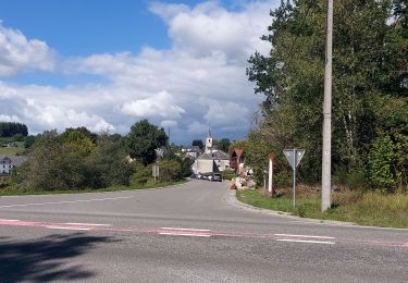
Tour Wandern von 6,6 km verfügbar auf Wallonien, Luxemburg, Neufchâteau. Diese Tour wird von tompaulet vorgeschlagen.
Beschreibung
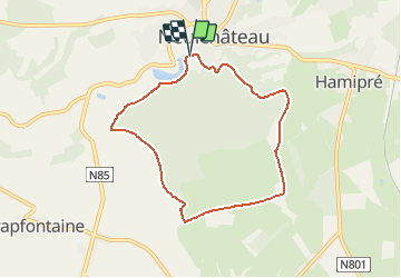
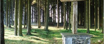
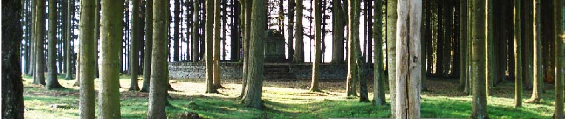
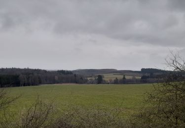
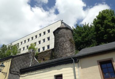
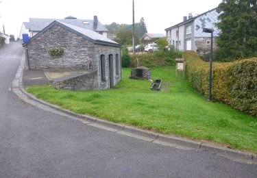
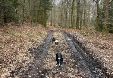
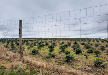
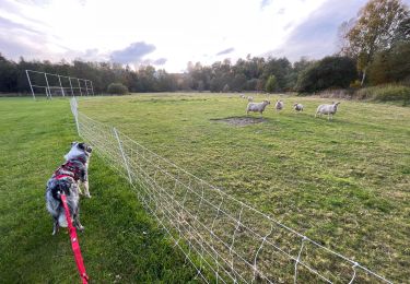
La randonnée prend son départ au Moulin Klepper, bâtisse restaurée du XVIIIe siècle. En traversant forêts et prairies, vous pourrez découvrir le riche passé archéologique et historique de Neufchâteau (le polissoir néolithique, tombelles celtiques, vestiges du château, mausolée de la guerre 14-18).
Longue de 6,5 km, sa durée est de 1h45 et elle se parcourt uniquement à pied.
Ort
Kommentare
Touren in der Umgebung
![Wandern Wandern](https://static1.geolcdn.com/sitytour/trail-icons/101.png)
Wandern
![](/images/other/stat-length.png)
![](https://static1.geolcdn.com/siteimages/upload/files/16400158638029165_repeat_loop_refresh_sync_direction_icon.png)
![Wandern Wandern](https://static1.geolcdn.com/sitytour/trail-icons/101.png)
Wandern
![](/images/other/stat-length.png)
![](https://static1.geolcdn.com/siteimages/upload/files/16400158638029165_repeat_loop_refresh_sync_direction_icon.png)
![Tour Wandern Neufchâteau - Marche ADEPS 8K500?? à (Namoussart) Neufchateau - Photo](https://media.geolcdn.com/t/375/260/394ab4a5-c5a6-43e2-b98b-c33bbaf2a33e.jpg&format=jpg&maxdim=2)
![Wandern Wandern](https://static1.geolcdn.com/sitytour/trail-icons/101.png)
Wandern
![](/images/other/stat-length.png)
![](https://static1.geolcdn.com/siteimages/upload/files/16400158638029165_repeat_loop_refresh_sync_direction_icon.png)
![Tour Zu Fuß Neufchâteau - Promenade des Vannettes - Photo](https://media.geolcdn.com/t/375/260/c94cab10-49b6-4e98-8b22-803163741678.jpeg&format=jpg&maxdim=2)
![Zu Fuß Zu Fuß](https://static1.geolcdn.com/sitytour/trail-icons/100.png)
Zu Fuß
![](/images/other/stat-length.png)
![](https://static1.geolcdn.com/siteimages/upload/files/16400158638029165_repeat_loop_refresh_sync_direction_icon.png)
![Wandern Wandern](https://static1.geolcdn.com/sitytour/trail-icons/101.png)
Wandern
![](/images/other/stat-length.png)
![](https://static1.geolcdn.com/siteimages/upload/files/16400158638029165_repeat_loop_refresh_sync_direction_icon.png)
![Tour Wandern Neufchâteau - marche adeps Tournay - Photo](https://media.geolcdn.com/t/375/260/35c4aa2c-8320-436a-a267-b854bb22564b.jpg&format=jpg&maxdim=2)
![Wandern Wandern](https://static1.geolcdn.com/sitytour/trail-icons/101.png)
Wandern
![](/images/other/stat-length.png)
![](https://static1.geolcdn.com/siteimages/upload/files/16400158638029165_repeat_loop_refresh_sync_direction_icon.png)
![Tour Wandern Neufchâteau - Molinfaing observatoire - Photo](https://media.geolcdn.com/t/375/260/b919928e-52d2-473c-aa25-425059cdb9d1.jpg&format=jpg&maxdim=2)
![Wandern Wandern](https://static1.geolcdn.com/sitytour/trail-icons/101.png)
Wandern
![](/images/other/stat-length.png)
![](https://static1.geolcdn.com/siteimages/upload/files/16400158638029165_repeat_loop_refresh_sync_direction_icon.png)
![Tour Wandern Herbeumont - Straimont 200922 - Photo](https://media.geolcdn.com/t/375/260/b3c2a5a0-1362-451a-a26f-fc2bc2d9246e.jpg&format=jpg&maxdim=2)
![Wandern Wandern](https://static1.geolcdn.com/sitytour/trail-icons/101.png)
Wandern
![](/images/other/stat-length.png)
![](https://static1.geolcdn.com/siteimages/upload/files/16400158638029165_repeat_loop_refresh_sync_direction_icon.png)
![Tour Wandern Herbeumont - rando straimont 20-09-2022 - Photo](https://media.geolcdn.com/t/375/260/d61fe14e-bb41-4191-a06d-961fd07f4395.jpg&format=jpg&maxdim=2)
![Wandern Wandern](https://static1.geolcdn.com/sitytour/trail-icons/101.png)
Wandern
![](/images/other/stat-length.png)
![](https://static1.geolcdn.com/siteimages/upload/files/16400158638029165_repeat_loop_refresh_sync_direction_icon.png)