![](/images/other/stat-length.png)
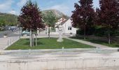
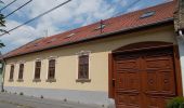
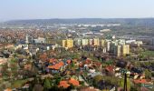
![Tour Zu Fuß Wudersch - P+ (Piktortégla-üregek - Farkas-hegy - Budaörs, városháza am.) - Photo](https://media.geolcdn.com/t/1900/400/af42295e-623a-4c05-b81d-b1c5c2e0f862.jpeg&format=pjpeg&maxdim=2)
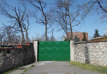
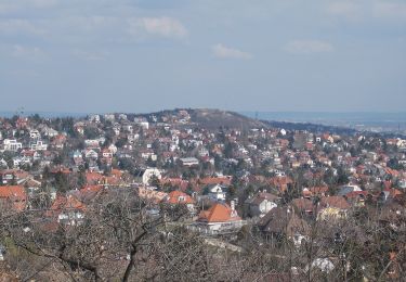
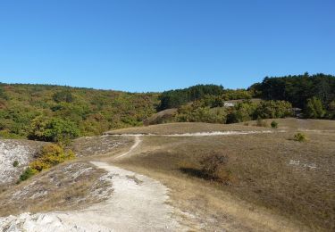
P+ (Piktortégla-üregek - Farkas-hegy - Budaörs, városháza am.)
SityTrail - itinéraires balisés pédestres
Tous les sentiers balisés d’Europe GUIDE+
![Länge](/images/other/stat-length.png)
Länge
3,1 km
![Maximale Höhe](https://static1.geolcdn.com/siteimages/upload/files/1508320355ic_sort_altitude_max_24dp.png)
Maximale Höhe
350 m
![Positive Höhendifferenz](https://static1.geolcdn.com/siteimages/upload/files/1508320355ic_sort_den_pos_24dp.png)
Positive Höhendifferenz
206 m
![Km-Effort](/images/other/stat-length.png)
Km-Effort
5,1 km
![Min. Höhe](https://static1.geolcdn.com/siteimages/upload/files/1508320355ic_sort_altitude_min_24dp.png)
Min. Höhe
143 m
![Negative Höhendifferenz](https://static1.geolcdn.com/siteimages/upload/files/1508320355ic_sort_den_neg_24dp.png)
Negative Höhendifferenz
2 m
![Boucle](https://static1.geolcdn.com/siteimages/upload/files/16400158638029165_repeat_loop_refresh_sync_direction_icon.png)
Boucle
Nein
Kennzeichnung
Erstellungsdatum :
2022-02-21 10:31:45.78
Letzte Änderung :
2022-03-08 21:17:07.235
![Zu Fuß](https://static1.geolcdn.com/sitytour/trail-icons/100.png)
1h10
Schwierigkeit : Einfach
![Scannen Sie diesen QR-Code, um die Tour in der SityTrail-Anwendung zu öffnen](https://capi.geolives.com/qq0zvz2zws4bq2lad0pu/sitytour/trails/3138741/qr.png?size=200)
Kostenlosegpshiking-Anwendung
Über SityTrail
Tour Zu Fuß von 3,1 km verfügbar auf Mittelungarn, Komitat Pest, Wudersch. Diese Tour wird von SityTrail - itinéraires balisés pédestres vorgeschlagen.
Beschreibung
Trail created by BTSSZ.
Ort
Land:
Hungary
Region :
Mittelungarn
Abteilung/Provinz :
Komitat Pest
Kommune :
Wudersch
Standort:
Unknown
Gehen Sie:(Dec)
Gehen Sie:(UTM)
345166 ; 5258474 (34T) N.
Kommentare
Touren in der Umgebung
![Tour Zu Fuß Unbekannt - Kamaraerdei tanösvény (Susulyka utca - Nagy-rét - Kamara-erdő, erdészház) - Photo](https://media.geolcdn.com/t/375/260/0f4aab0b-17bb-417f-87c3-5ca13643cb99.jpeg&format=jpg&maxdim=2)
![Zu Fuß Zu Fuß](https://static1.geolcdn.com/sitytour/trail-icons/100.png)
Kamaraerdei tanösvény (Susulyka utca - Nagy-rét - Kamara-erdő, erdészház)
Zu Fuß
Einfach
Unbekannt,
Mittelungarn,
Budapest,
Hungary
![](/images/other/stat-length.png)
4 km | 5,9 km-effort
1h 19min
![](https://static1.geolcdn.com/siteimages/upload/files/16400158638029165_repeat_loop_refresh_sync_direction_icon.png)
Ja
![Tour Zu Fuß Wudersch - P↺ (Nagykapos utca-Irhás árok-Kakukkhegyi út-Csillebérci út-Kakukkhegyi erdősor-Frankhegyi th) - Photo](https://media.geolcdn.com/t/375/260/b72c54f6-0b86-4454-a4bf-172c0d947e76.jpeg&format=jpg&maxdim=2)
![Zu Fuß Zu Fuß](https://static1.geolcdn.com/sitytour/trail-icons/100.png)
P↺ (Nagykapos utca-Irhás árok-Kakukkhegyi út-Csillebérci út-Kakukkhegyi erdős...
Zu Fuß
Einfach
Wudersch,
Mittelungarn,
Komitat Pest,
Hungary
![](/images/other/stat-length.png)
4,7 km | 7 km-effort
1h 35min
![](https://static1.geolcdn.com/siteimages/upload/files/16400158638029165_repeat_loop_refresh_sync_direction_icon.png)
Ja
![Tour Zu Fuß Unbekannt - P■ (Csillebérc, KFKI am. - Frankhegyi th. - Irhás-árok, am.) - Photo](https://media.geolcdn.com/t/375/260/8381ba48-9375-4458-82e3-5a96c5b5732a.jpeg&format=jpg&maxdim=2)
![Zu Fuß Zu Fuß](https://static1.geolcdn.com/sitytour/trail-icons/100.png)
P■ (Csillebérc, KFKI am. - Frankhegyi th. - Irhás-árok, am.)
Zu Fuß
Einfach
Unbekannt,
Mittelungarn,
Budapest,
Hungary
![](/images/other/stat-length.png)
3,6 km | 6,1 km-effort
1h 23min
![](https://static1.geolcdn.com/siteimages/upload/files/16400158638029165_repeat_loop_refresh_sync_direction_icon.png)
Nein
![Tour Zu Fuß Wudigeß - Z+ (Normafa - Budakeszi - Fekete-hegyek, tisztás) - Photo](https://media.geolcdn.com/t/375/260/a02267f8-1ee7-4b43-8007-3699d6c5003e.jpeg&format=jpg&maxdim=2)
![Zu Fuß Zu Fuß](https://static1.geolcdn.com/sitytour/trail-icons/100.png)
Z+ (Normafa - Budakeszi - Fekete-hegyek, tisztás)
Zu Fuß
Einfach
Wudigeß,
Mittelungarn,
Komitat Pest,
Hungary
![](/images/other/stat-length.png)
8,7 km | 12,2 km-effort
2h 47min
![](https://static1.geolcdn.com/siteimages/upload/files/16400158638029165_repeat_loop_refresh_sync_direction_icon.png)
Nein
![Tour Zu Fuß Wudersch - P ( Csillaghegy - Dömös - Budaörs ) - Photo](https://media.geolcdn.com/t/375/260/6d8cf642-bd55-4637-a65c-30e21675a7c6.jpeg&format=jpg&maxdim=2)
![Zu Fuß Zu Fuß](https://static1.geolcdn.com/sitytour/trail-icons/100.png)
P ( Csillaghegy - Dömös - Budaörs )
Zu Fuß
Sehr schwierig
Wudersch,
Mittelungarn,
Komitat Pest,
Hungary
![](/images/other/stat-length.png)
82 km | 121 km-effort
27h 27min
![](https://static1.geolcdn.com/siteimages/upload/files/16400158638029165_repeat_loop_refresh_sync_direction_icon.png)
Nein
![Tour Zu Fuß Unbekannt - Z↺ Széchenyi-hegy - Photo](https://media.geolcdn.com/t/375/260/4c1fcd99-d361-4805-a5f5-a5e6fdb063ea.jpeg&format=jpg&maxdim=2)
![Zu Fuß Zu Fuß](https://static1.geolcdn.com/sitytour/trail-icons/100.png)
Z↺ Széchenyi-hegy
Zu Fuß
Einfach
Unbekannt,
Mittelungarn,
Budapest,
Hungary
![](/images/other/stat-length.png)
4,4 km | 6,3 km-effort
1h 25min
![](https://static1.geolcdn.com/siteimages/upload/files/16400158638029165_repeat_loop_refresh_sync_direction_icon.png)
Ja
![Tour Zu Fuß Unbekannt - Z▲ (Széchenyi-hegy, - Márton Áron tér) - Photo](https://media.geolcdn.com/t/375/260/3241e1b3-6f46-40cd-9012-f645f82eb2a4.jpeg&format=jpg&maxdim=2)
![Zu Fuß Zu Fuß](https://static1.geolcdn.com/sitytour/trail-icons/100.png)
Z▲ (Széchenyi-hegy, - Márton Áron tér)
Zu Fuß
Einfach
Unbekannt,
Mittelungarn,
Budapest,
Hungary
![](/images/other/stat-length.png)
3,8 km | 5 km-effort
1h 8min
![](https://static1.geolcdn.com/siteimages/upload/files/16400158638029165_repeat_loop_refresh_sync_direction_icon.png)
Nein
![Tour Zu Fuß Wudersch - S↺ (Csillebérc, KFKI aut. vá. - Piktortégla-üregek - Csillebérc, KFKI aut. vá.) - Photo](https://media.geolcdn.com/t/375/260/a6d0a3e0-271e-4e78-8e9e-f2ac81db8748.jpeg&format=jpg&maxdim=2)
![Zu Fuß Zu Fuß](https://static1.geolcdn.com/sitytour/trail-icons/100.png)
S↺ (Csillebérc, KFKI aut. vá. - Piktortégla-üregek - Csillebérc, KFKI aut. vá.)
Zu Fuß
Einfach
Wudersch,
Mittelungarn,
Komitat Pest,
Hungary
![](/images/other/stat-length.png)
3,1 km | 4,2 km-effort
57min
![](https://static1.geolcdn.com/siteimages/upload/files/16400158638029165_repeat_loop_refresh_sync_direction_icon.png)
Ja
![Tour Flugzeug Großturwall - Budapest Nice - Photo](https://media.geolcdn.com/t/375/260/ext.jpg?maxdim=2&url=https%3A%2F%2Fsecurestorage.geolives.com%2Fsitytour%2Ftrail-bg%2Fdefault.jpg)
![Flugzeug Flugzeug](https://static1.geolcdn.com/sitytour/trail-icons/601.png)
Budapest Nice
Flugzeug
Sehr leicht
Großturwall,
Mittelungarn,
Komitat Pest,
Hungary
![](/images/other/stat-length.png)
1114 km | 0 m-effort
1h 38min
![](https://static1.geolcdn.com/siteimages/upload/files/16400158638029165_repeat_loop_refresh_sync_direction_icon.png)
Nein