![](/images/other/stat-length.png)
![Tour Zu Fuß Bärnbach - Wanderweg 6 - Photo](https://media.geolcdn.com/t/1900/400/ext.pjpeg?maxdim=2&url=https%3A%2F%2Fmedia.geolcdn.com%2Ff%2F73c1c12a-b3f4-4a9c-954c-a764948ca781.jpeg)
Wanderweg 6
SityTrail - itinéraires balisés pédestres
Tous les sentiers balisés d’Europe PRO
![Länge](/images/other/stat-length.png)
Länge
5,8 km
![Maximale Höhe](https://static1.geolcdn.com/siteimages/upload/files/1508320355ic_sort_altitude_max_24dp.png)
Maximale Höhe
760 m
![Positive Höhendifferenz](https://static1.geolcdn.com/siteimages/upload/files/1508320355ic_sort_den_pos_24dp.png)
Positive Höhendifferenz
347 m
![Km-Effort](/images/other/stat-length.png)
Km-Effort
9,3 km
![Min. Höhe](https://static1.geolcdn.com/siteimages/upload/files/1508320355ic_sort_altitude_min_24dp.png)
Min. Höhe
425 m
![Negative Höhendifferenz](https://static1.geolcdn.com/siteimages/upload/files/1508320355ic_sort_den_neg_24dp.png)
Negative Höhendifferenz
16 m
![Boucle](https://static1.geolcdn.com/siteimages/upload/files/16400158638029165_repeat_loop_refresh_sync_direction_icon.png)
Boucle
Nein
Kennzeichnung
Erstellungsdatum :
2022-02-16 17:35:18.228
Letzte Änderung :
2022-03-03 22:01:48.474
![Zu Fuß](https://static1.geolcdn.com/sitytour/trail-icons/100.png)
2h07
Schwierigkeit : Einfach
![Scannen Sie diesen QR-Code, um die Tour in der SityTrail-Anwendung zu öffnen](https://capi.geolives.com/qq0zvz2zws4bq2lad0pu/sitytour/trails/3129991/qr.png?size=200)
Kostenlosegpshiking-Anwendung
Über SityTrail
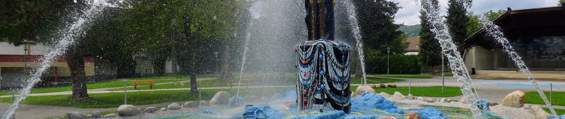
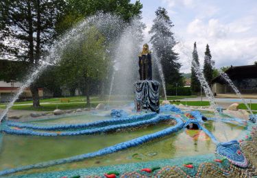
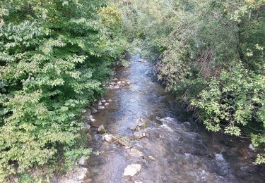
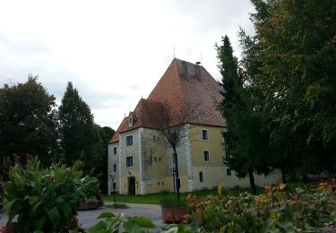
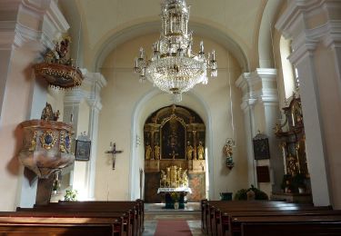
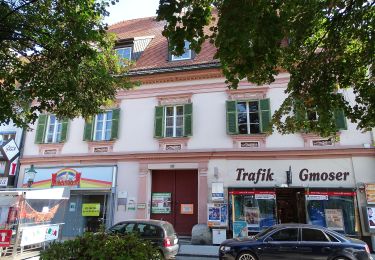
Tour Zu Fuß von 5,8 km verfügbar auf Steiermark, Bezirk Voitsberg, Bärnbach. Diese Tour wird von SityTrail - itinéraires balisés pédestres vorgeschlagen.
Beschreibung
Trail created by NF Bärnbach.
http://wiki.openstreetmap.org/index.php?title=WikiProject_Austria/Wanderwege
Symbol: weiss-grün
Ort
Land:
Austria
Region :
Steiermark
Abteilung/Provinz :
Bezirk Voitsberg
Kommune :
Bärnbach
Standort:
Unknown
Gehen Sie:(Dec)
Gehen Sie:(UTM)
509698 ; 5213226 (33T) N.
Kommentare
Touren in der Umgebung
![Tour Zu Fuß Bärnbach - Wanderweg 2](https://media.geolcdn.com/t/375/260/ext.jpg?maxdim=2&url=https%3A%2F%2Fmedia.geolcdn.com%2Ff%2F73c1c12a-b3f4-4a9c-954c-a764948ca781.jpeg)
![Zu Fuß Zu Fuß](https://static1.geolcdn.com/sitytour/trail-icons/100.png)
Wanderweg 2 "Hochtregist Rundweg"
Zu Fuß
Einfach
Bärnbach,
Steiermark,
Bezirk Voitsberg,
Austria
![](/images/other/stat-length.png)
3,7 km | 7,3 km-effort
1h 39min
![](https://static1.geolcdn.com/siteimages/upload/files/16400158638029165_repeat_loop_refresh_sync_direction_icon.png)
Nein
![Tour Zu Fuß Bärnbach - Wanderweg 1](https://media.geolcdn.com/t/375/260/ext.jpg?maxdim=2&url=https%3A%2F%2Fmedia.geolcdn.com%2Ff%2F3ba2ffbd-19b3-43f2-9fcb-7d009c07ac25.jpeg)
![Zu Fuß Zu Fuß](https://static1.geolcdn.com/sitytour/trail-icons/100.png)
Wanderweg 1 "Tregist Rundweg"
Zu Fuß
Einfach
Bärnbach,
Steiermark,
Bezirk Voitsberg,
Austria
![](/images/other/stat-length.png)
8 km | 12,8 km-effort
2h 54min
![](https://static1.geolcdn.com/siteimages/upload/files/16400158638029165_repeat_loop_refresh_sync_direction_icon.png)
Ja
![Tour Zu Fuß Bärnbach - Wanderweg 5](https://media.geolcdn.com/t/375/260/ext.jpg?maxdim=2&url=https%3A%2F%2Fmedia.geolcdn.com%2Ff%2Fefbf577a-b7a2-4628-bf5e-388494a4c653.jpeg)
![Zu Fuß Zu Fuß](https://static1.geolcdn.com/sitytour/trail-icons/100.png)
Wanderweg 5 "Erzherzog Johann"
Zu Fuß
Einfach
Bärnbach,
Steiermark,
Bezirk Voitsberg,
Austria
![](/images/other/stat-length.png)
4,3 km | 6,5 km-effort
1h 29min
![](https://static1.geolcdn.com/siteimages/upload/files/16400158638029165_repeat_loop_refresh_sync_direction_icon.png)
Ja
![Tour Zu Fuß Maria Lankowitz - Wanderweg L2 - Photo](https://media.geolcdn.com/t/375/260/ext.jpg?maxdim=2&url=https%3A%2F%2Fmedia.geolcdn.com%2Ff%2F85706fca-1604-4776-a65a-64a60ca24d8f.jpeg)
![Zu Fuß Zu Fuß](https://static1.geolcdn.com/sitytour/trail-icons/100.png)
Wanderweg L2
Zu Fuß
Einfach
Maria Lankowitz,
Steiermark,
Bezirk Voitsberg,
Austria
![](/images/other/stat-length.png)
5,3 km | 7,8 km-effort
1h 46min
![](https://static1.geolcdn.com/siteimages/upload/files/16400158638029165_repeat_loop_refresh_sync_direction_icon.png)
Nein
![Tour Zu Fuß Voitsberg - Wanderweg 85 - Photo](https://media.geolcdn.com/t/375/260/ext.jpg?maxdim=2&url=https%3A%2F%2Fmedia.geolcdn.com%2Ff%2F8feb09c4-acd2-4be0-beac-bfe65fb1d2b9.jpeg)
![Zu Fuß Zu Fuß](https://static1.geolcdn.com/sitytour/trail-icons/100.png)
Wanderweg 85
Zu Fuß
Einfach
Voitsberg,
Steiermark,
Bezirk Voitsberg,
Austria
![](/images/other/stat-length.png)
3,5 km | 5,8 km-effort
1h 18min
![](https://static1.geolcdn.com/siteimages/upload/files/16400158638029165_repeat_loop_refresh_sync_direction_icon.png)
Nein
![Tour Zu Fuß Voitsberg - Wanderweg 83 - Photo](https://media.geolcdn.com/t/375/260/ext.jpg?maxdim=2&url=https%3A%2F%2Fmedia.geolcdn.com%2Ff%2Fcfafd3ba-d308-4410-a74e-d289303b0c87.jpeg)
![Zu Fuß Zu Fuß](https://static1.geolcdn.com/sitytour/trail-icons/100.png)
Wanderweg 83
Zu Fuß
Medium
Voitsberg,
Steiermark,
Bezirk Voitsberg,
Austria
![](/images/other/stat-length.png)
17,9 km | 27 km-effort
6h 3min
![](https://static1.geolcdn.com/siteimages/upload/files/16400158638029165_repeat_loop_refresh_sync_direction_icon.png)
Nein
![Tour Zu Fuß Köflach - Wanderweg 92 - Photo](https://media.geolcdn.com/t/375/260/ext.jpg?maxdim=2&url=https%3A%2F%2Fmedia.geolcdn.com%2Ff%2Ff6f8fe3c-c10c-4e64-90d8-b22b97a26c5c.jpeg)
![Zu Fuß Zu Fuß](https://static1.geolcdn.com/sitytour/trail-icons/100.png)
Wanderweg 92
Zu Fuß
Einfach
Köflach,
Steiermark,
Bezirk Voitsberg,
Austria
![](/images/other/stat-length.png)
8,2 km | 12,9 km-effort
2h 55min
![](https://static1.geolcdn.com/siteimages/upload/files/16400158638029165_repeat_loop_refresh_sync_direction_icon.png)
Nein
![Tour Zu Fuß Edelschrott - Hans Klöpfer Rundwanderweg - Photo](https://media.geolcdn.com/t/375/260/ext.jpg?maxdim=2&url=https%3A%2F%2Fmedia.geolcdn.com%2Ff%2Fcb098207-3790-463c-8541-3659c5faa29c.jpeg)
![Zu Fuß Zu Fuß](https://static1.geolcdn.com/sitytour/trail-icons/100.png)
Hans Klöpfer Rundwanderweg
Zu Fuß
Sehr schwierig
Edelschrott,
Steiermark,
Bezirk Voitsberg,
Austria
![](/images/other/stat-length.png)
33 km | 50 km-effort
11h 15min
![](https://static1.geolcdn.com/siteimages/upload/files/16400158638029165_repeat_loop_refresh_sync_direction_icon.png)
Nein
![Tour Zu Fuß Voitsberg - Auf der Sonnenseite der Stadt Voitsberg - Photo](https://media.geolcdn.com/t/375/260/ext.jpg?maxdim=2&url=https%3A%2F%2Fmedia.geolcdn.com%2Ff%2F7f762d84-dc66-4d1a-9181-be1a8ae9fda9.jpeg)
![Zu Fuß Zu Fuß](https://static1.geolcdn.com/sitytour/trail-icons/100.png)
Auf der Sonnenseite der Stadt Voitsberg
Zu Fuß
Einfach
Voitsberg,
Steiermark,
Bezirk Voitsberg,
Austria
![](/images/other/stat-length.png)
8,1 km | 11,9 km-effort
2h 42min
![](https://static1.geolcdn.com/siteimages/upload/files/16400158638029165_repeat_loop_refresh_sync_direction_icon.png)
Nein