![](/images/other/stat-length.png)
![Tour Zu Fuß Lang - Hengist Kulturwanderweg Lang Jößer Runde - Photo](https://media.geolcdn.com/t/1900/400/ext.pjpeg?maxdim=2&url=https%3A%2F%2Fmedia.geolcdn.com%2Ff%2F38fa8bac-755e-437c-962a-da45bec641b6.jpeg)
Hengist Kulturwanderweg Lang Jößer Runde
SityTrail - itinéraires balisés pédestres
Tous les sentiers balisés d’Europe PRO
![Länge](/images/other/stat-length.png)
Länge
9,9 km
![Maximale Höhe](https://static1.geolcdn.com/siteimages/upload/files/1508320355ic_sort_altitude_max_24dp.png)
Maximale Höhe
300 m
![Positive Höhendifferenz](https://static1.geolcdn.com/siteimages/upload/files/1508320355ic_sort_den_pos_24dp.png)
Positive Höhendifferenz
104 m
![Km-Effort](/images/other/stat-length.png)
Km-Effort
11,3 km
![Min. Höhe](https://static1.geolcdn.com/siteimages/upload/files/1508320355ic_sort_altitude_min_24dp.png)
Min. Höhe
276 m
![Negative Höhendifferenz](https://static1.geolcdn.com/siteimages/upload/files/1508320355ic_sort_den_neg_24dp.png)
Negative Höhendifferenz
114 m
![Boucle](https://static1.geolcdn.com/siteimages/upload/files/16400158638029165_repeat_loop_refresh_sync_direction_icon.png)
Boucle
Nein
Kennzeichnung
Erstellungsdatum :
2022-02-16 17:23:52.474
Letzte Änderung :
2022-03-03 19:50:23.16
![Zu Fuß](https://static1.geolcdn.com/sitytour/trail-icons/100.png)
2h34
Schwierigkeit : Einfach
![Scannen Sie diesen QR-Code, um die Tour in der SityTrail-Anwendung zu öffnen](https://capi.geolives.com/qq0zvz2zws4bq2lad0pu/sitytour/trails/3129533/qr.png?size=200)
Kostenlosegpshiking-Anwendung
Über SityTrail
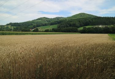
Tour Zu Fuß von 9,9 km verfügbar auf Steiermark, Bezirk Leibnitz, Lang. Diese Tour wird von SityTrail - itinéraires balisés pédestres vorgeschlagen.
Beschreibung
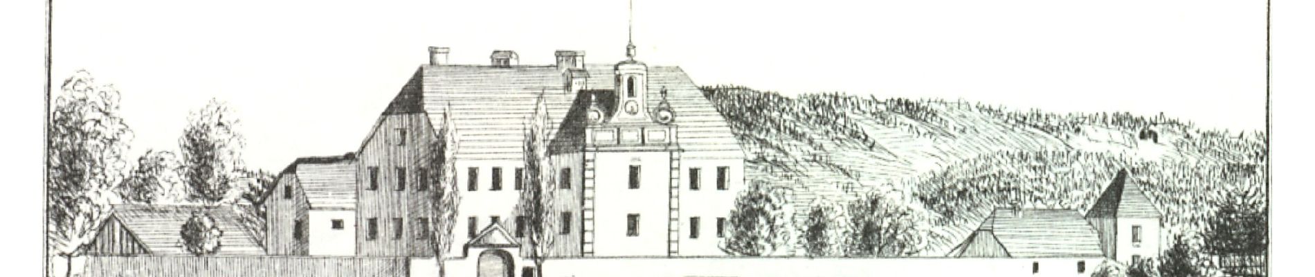
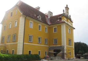
Archäologie, Geschichte und Kultur der Mittelsteiermark
Website: http://www.hengist.at/projekte/kulturwanderweg.html
Ort
Land:
Austria
Region :
Steiermark
Abteilung/Provinz :
Bezirk Leibnitz
Kommune :
Lang
Standort:
Unknown
Gehen Sie:(Dec)
Gehen Sie:(UTM)
540190 ; 5187551 (33T) N.
Kommentare
Touren in der Umgebung
![Tour Zu Fuß Sankt Nikolai im Sausal - Sankt Nikolaier Panoramaweg - Photo](https://media.geolcdn.com/t/375/260/ext.jpg?maxdim=2&url=https%3A%2F%2Fmedia.geolcdn.com%2Ff%2F33fdc3b6-b554-4244-940f-a65186848cfa.jpeg)
![Zu Fuß Zu Fuß](https://static1.geolcdn.com/sitytour/trail-icons/100.png)
Sankt Nikolaier Panoramaweg
Zu Fuß
Einfach
Sankt Nikolai im Sausal,
Steiermark,
Bezirk Leibnitz,
Austria
![](/images/other/stat-length.png)
5 km | 6,8 km-effort
1h 32min
![](https://static1.geolcdn.com/siteimages/upload/files/16400158638029165_repeat_loop_refresh_sync_direction_icon.png)
Nein
![Tour Zu Fuß Lebring-Sankt Margarethen - Hengist Kulturwanderweg Buchkogel-Runde - Photo](https://media.geolcdn.com/t/375/260/ext.jpg?maxdim=2&url=https%3A%2F%2Fmedia.geolcdn.com%2Ff%2Facf9bff5-530b-49a2-b80b-108004eb9671.jpeg)
![Zu Fuß Zu Fuß](https://static1.geolcdn.com/sitytour/trail-icons/100.png)
Hengist Kulturwanderweg Buchkogel-Runde
Zu Fuß
Einfach
Lebring-Sankt Margarethen,
Steiermark,
Bezirk Leibnitz,
Austria
![](/images/other/stat-length.png)
7,2 km | 10 km-effort
2h 16min
![](https://static1.geolcdn.com/siteimages/upload/files/16400158638029165_repeat_loop_refresh_sync_direction_icon.png)
Nein
![Tour Zu Fuß Lebring-Sankt Margarethen - Hengist Kulturwanderweg Teufelsgrabenrunde - Photo](https://media.geolcdn.com/t/375/260/ext.jpg?maxdim=2&url=https%3A%2F%2Fmedia.geolcdn.com%2Ff%2F947900b8-9df7-433d-bfd8-19395bd94b70.jpeg)
![Zu Fuß Zu Fuß](https://static1.geolcdn.com/sitytour/trail-icons/100.png)
Hengist Kulturwanderweg Teufelsgrabenrunde
Zu Fuß
Einfach
Lebring-Sankt Margarethen,
Steiermark,
Bezirk Leibnitz,
Austria
![](/images/other/stat-length.png)
8,9 km | 9,6 km-effort
2h 11min
![](https://static1.geolcdn.com/siteimages/upload/files/16400158638029165_repeat_loop_refresh_sync_direction_icon.png)
Nein
![Tour Zu Fuß Lang - Hengist Kulturwanderweg Lang Lechenbergrunde - Photo](https://media.geolcdn.com/t/375/260/ext.jpg?maxdim=2&url=https%3A%2F%2Fmedia.geolcdn.com%2Ff%2Fc4ad3a25-d457-4930-aac4-c28026f9f3be.jpeg)
![Zu Fuß Zu Fuß](https://static1.geolcdn.com/sitytour/trail-icons/100.png)
Hengist Kulturwanderweg Lang Lechenbergrunde
Zu Fuß
Einfach
Lang,
Steiermark,
Bezirk Leibnitz,
Austria
![](/images/other/stat-length.png)
8,6 km | 10,7 km-effort
2h 26min
![](https://static1.geolcdn.com/siteimages/upload/files/16400158638029165_repeat_loop_refresh_sync_direction_icon.png)
Ja
![Tour Zu Fuß Lang - Hengist Kulturwanderweg Lang Dexenbergrunde - Photo](https://media.geolcdn.com/t/375/260/ext.jpg?maxdim=2&url=https%3A%2F%2Fmedia.geolcdn.com%2Ff%2F0c08efcc-e6f9-4dea-9f13-c8ee0e2609c4.jpeg)
![Zu Fuß Zu Fuß](https://static1.geolcdn.com/sitytour/trail-icons/100.png)
Hengist Kulturwanderweg Lang Dexenbergrunde
Zu Fuß
Einfach
Lang,
Steiermark,
Bezirk Leibnitz,
Austria
![](/images/other/stat-length.png)
9,4 km | 12,1 km-effort
2h 45min
![](https://static1.geolcdn.com/siteimages/upload/files/16400158638029165_repeat_loop_refresh_sync_direction_icon.png)
Nein
![Tour Zu Fuß Wildon - Hengist Kulturwanderweg Weitendorf - Photo](https://media.geolcdn.com/t/375/260/ext.jpg?maxdim=2&url=https%3A%2F%2Fmedia.geolcdn.com%2Ff%2F8af69402-f2ec-43c5-b5b1-1e39d32c5639.jpeg)
![Zu Fuß Zu Fuß](https://static1.geolcdn.com/sitytour/trail-icons/100.png)
Hengist Kulturwanderweg Weitendorf
Zu Fuß
Einfach
Wildon,
Steiermark,
Bezirk Leibnitz,
Austria
![](/images/other/stat-length.png)
5,2 km | 6,7 km-effort
1h 31min
![](https://static1.geolcdn.com/siteimages/upload/files/16400158638029165_repeat_loop_refresh_sync_direction_icon.png)
Nein
![Tour Zu Fuß Wildon - Hengist Kulturwanderweg Wildon - Photo](https://media.geolcdn.com/t/375/260/ext.jpg?maxdim=2&url=https%3A%2F%2Fmedia.geolcdn.com%2Ff%2Fc116d777-f6c5-437e-9a39-5ace5fc42fc6.jpeg)
![Zu Fuß Zu Fuß](https://static1.geolcdn.com/sitytour/trail-icons/100.png)
Hengist Kulturwanderweg Wildon
Zu Fuß
Einfach
Wildon,
Steiermark,
Bezirk Leibnitz,
Austria
![](/images/other/stat-length.png)
6 km | 8,5 km-effort
1h 55min
![](https://static1.geolcdn.com/siteimages/upload/files/16400158638029165_repeat_loop_refresh_sync_direction_icon.png)
Nein
![Tour Zu Fuß Lebring-Sankt Margarethen - Rundwanderweg Lebring - Photo](https://media.geolcdn.com/t/375/260/ext.jpg?maxdim=2&url=https%3A%2F%2Fmedia.geolcdn.com%2Ff%2F0b18ef80-8e33-4f75-8f39-ffc3870fa07f.jpeg)
![Zu Fuß Zu Fuß](https://static1.geolcdn.com/sitytour/trail-icons/100.png)
Rundwanderweg Lebring
Zu Fuß
Einfach
Lebring-Sankt Margarethen,
Steiermark,
Bezirk Leibnitz,
Austria
![](/images/other/stat-length.png)
7,9 km | 10,8 km-effort
2h 27min
![](https://static1.geolcdn.com/siteimages/upload/files/16400158638029165_repeat_loop_refresh_sync_direction_icon.png)
Ja