![](/images/other/stat-length.png)
![Tour Zu Fuß Unknown - Treppelweg - Photo](https://media.geolcdn.com/t/1900/400/f52d64c4-80b0-469f-9cf8-2227055028ed.jpeg&format=pjpeg&maxdim=2)
Treppelweg
SityTrail - itinéraires balisés pédestres
Tous les sentiers balisés d’Europe GUIDE+
![Länge](/images/other/stat-length.png)
Länge
9,4 km
![Maximale Höhe](https://static1.geolcdn.com/siteimages/upload/files/1508320355ic_sort_altitude_max_24dp.png)
Maximale Höhe
270 m
![Positive Höhendifferenz](https://static1.geolcdn.com/siteimages/upload/files/1508320355ic_sort_den_pos_24dp.png)
Positive Höhendifferenz
57 m
![Km-Effort](/images/other/stat-length.png)
Km-Effort
10,1 km
![Min. Höhe](https://static1.geolcdn.com/siteimages/upload/files/1508320355ic_sort_altitude_min_24dp.png)
Min. Höhe
254 m
![Negative Höhendifferenz](https://static1.geolcdn.com/siteimages/upload/files/1508320355ic_sort_den_neg_24dp.png)
Negative Höhendifferenz
53 m
![Boucle](https://static1.geolcdn.com/siteimages/upload/files/16400158638029165_repeat_loop_refresh_sync_direction_icon.png)
Boucle
Nein
Kennzeichnung
Erstellungsdatum :
2022-02-16 16:58:03.553
Letzte Änderung :
2022-03-03 14:52:21.92
![Zu Fuß](https://static1.geolcdn.com/sitytour/trail-icons/100.png)
2h17
Schwierigkeit : Einfach
![Scannen Sie diesen QR-Code, um die Tour in der SityTrail-Anwendung zu öffnen](https://capi.geolives.com/qq0zvz2zws4bq2lad0pu/sitytour/trails/3128444/qr.png?size=200)
Kostenlosegpshiking-Anwendung
Über SityTrail
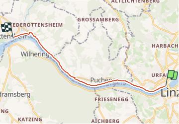
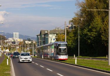
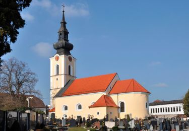
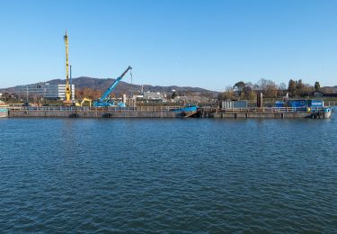
Tour Zu Fuß von 9,4 km verfügbar auf Oberösterreich, Linz. Diese Tour wird von SityTrail - itinéraires balisés pédestres vorgeschlagen.
Beschreibung
Symbol: gelber Hinweispfeil mit schwarzem Text "1 Treppelweg" oder nur "1" oder auch mit Ortsangaben wie Urfahr, Puchenau, Ottensheim
Ort
Land:
Austria
Region :
Oberösterreich
Abteilung/Provinz :
Linz
Kommune :
Unknown
Standort:
Unknown
Gehen Sie:(Dec)
Gehen Sie:(UTM)
446807 ; 5350859 (33U) N.
Kommentare
Touren in der Umgebung
![Tour Zu Fuß Steyregg - AV 50 Daxleitner - Photo](https://media.geolcdn.com/t/375/260/ac8aab2e-87f4-4c25-ae1f-c0ffc1bf5d02.jpeg&format=jpg&maxdim=2)
![Zu Fuß Zu Fuß](https://static1.geolcdn.com/sitytour/trail-icons/100.png)
AV 50 Daxleitner
Zu Fuß
Einfach
Steyregg,
Oberösterreich,
Bezirk Urfahr-Umgebung,
Austria
![](/images/other/stat-length.png)
4,7 km | 8 km-effort
1h 49min
![](https://static1.geolcdn.com/siteimages/upload/files/16400158638029165_repeat_loop_refresh_sync_direction_icon.png)
Nein
![Tour Zu Fuß - Altenberg-Auhof - Photo](https://media.geolcdn.com/t/375/260/4c757075-6574-4a1d-905a-4024b18f0607.jpeg&format=jpg&maxdim=2)
![Zu Fuß Zu Fuß](https://static1.geolcdn.com/sitytour/trail-icons/100.png)
![Tour Zu Fuß Leonding - Zaubertalrunde - Photo](https://media.geolcdn.com/t/375/260/362dfadb-f1f7-45fc-9bd6-a2aa5cac1847.jpeg&format=jpg&maxdim=2)
![Zu Fuß Zu Fuß](https://static1.geolcdn.com/sitytour/trail-icons/100.png)
Zaubertalrunde
Zu Fuß
Einfach
Leonding,
Oberösterreich,
Bezirk Linz-Land,
Austria
![](/images/other/stat-length.png)
12,5 km | 15,7 km-effort
3h 34min
![](https://static1.geolcdn.com/siteimages/upload/files/16400158638029165_repeat_loop_refresh_sync_direction_icon.png)
Ja
![Tour Zu Fuß Leonding - Stadtwanderweg Leonding - Photo](https://media.geolcdn.com/t/375/260/f189d68d-38ea-4941-8054-2e2b8cf0c43d.jpeg&format=jpg&maxdim=2)
![Zu Fuß Zu Fuß](https://static1.geolcdn.com/sitytour/trail-icons/100.png)
Stadtwanderweg Leonding
Zu Fuß
Einfach
Leonding,
Oberösterreich,
Bezirk Linz-Land,
Austria
![](/images/other/stat-length.png)
3,2 km | 3,8 km-effort
52min
![](https://static1.geolcdn.com/siteimages/upload/files/16400158638029165_repeat_loop_refresh_sync_direction_icon.png)
Ja
![Tour Zu Fuß Leonding - Kürnbergrunde - Photo](https://media.geolcdn.com/t/375/260/04a4a75c-6b8b-4c91-8f6b-0acbe9b667e6.jpeg&format=jpg&maxdim=2)
![Zu Fuß Zu Fuß](https://static1.geolcdn.com/sitytour/trail-icons/100.png)
Kürnbergrunde
Zu Fuß
Einfach
Leonding,
Oberösterreich,
Bezirk Linz-Land,
Austria
![](/images/other/stat-length.png)
8,1 km | 9,1 km-effort
2h 4min
![](https://static1.geolcdn.com/siteimages/upload/files/16400158638029165_repeat_loop_refresh_sync_direction_icon.png)
Nein
![Tour Zu Fuß Leonding - Staudacherrunde - Photo](https://media.geolcdn.com/t/375/260/b885cb65-5f79-4b28-b4a0-37349ff05ef9.jpeg&format=jpg&maxdim=2)
![Zu Fuß Zu Fuß](https://static1.geolcdn.com/sitytour/trail-icons/100.png)
Staudacherrunde
Zu Fuß
Einfach
Leonding,
Oberösterreich,
Bezirk Linz-Land,
Austria
![](/images/other/stat-length.png)
6,6 km | 7,3 km-effort
1h 39min
![](https://static1.geolcdn.com/siteimages/upload/files/16400158638029165_repeat_loop_refresh_sync_direction_icon.png)
Nein
![Tour Zu Fuß Puchenau - Puchenau-Ottensheim - Photo](https://media.geolcdn.com/t/375/260/4b75b8fa-cf2f-4307-929c-22b5577c599a.jpeg&format=jpg&maxdim=2)
![Zu Fuß Zu Fuß](https://static1.geolcdn.com/sitytour/trail-icons/100.png)
Puchenau-Ottensheim
Zu Fuß
Einfach
Puchenau,
Oberösterreich,
Bezirk Urfahr-Umgebung,
Austria
![](/images/other/stat-length.png)
5,4 km | 7,6 km-effort
1h 44min
![](https://static1.geolcdn.com/siteimages/upload/files/16400158638029165_repeat_loop_refresh_sync_direction_icon.png)
Nein
![Tour Zu Fuß Steyregg - Stadtwanderweg Pfenningberg - Photo](https://media.geolcdn.com/t/375/260/ac8aab2e-87f4-4c25-ae1f-c0ffc1bf5d02.jpeg&format=jpg&maxdim=2)
![Zu Fuß Zu Fuß](https://static1.geolcdn.com/sitytour/trail-icons/100.png)
Stadtwanderweg Pfenningberg
Zu Fuß
Einfach
Steyregg,
Oberösterreich,
Bezirk Urfahr-Umgebung,
Austria
![](/images/other/stat-length.png)
6,6 km | 10,4 km-effort
2h 22min
![](https://static1.geolcdn.com/siteimages/upload/files/16400158638029165_repeat_loop_refresh_sync_direction_icon.png)
Nein
![Tour Zu Fuß Steyregg - Stadtwanderweg Plesching - Photo](https://media.geolcdn.com/t/375/260/2cb10a17-9e4b-49b4-91b3-3a2e20f0f647.jpeg&format=jpg&maxdim=2)
![Zu Fuß Zu Fuß](https://static1.geolcdn.com/sitytour/trail-icons/100.png)
Stadtwanderweg Plesching
Zu Fuß
Einfach
Steyregg,
Oberösterreich,
Bezirk Urfahr-Umgebung,
Austria
![](/images/other/stat-length.png)
5,6 km | 6,1 km-effort
1h 23min
![](https://static1.geolcdn.com/siteimages/upload/files/16400158638029165_repeat_loop_refresh_sync_direction_icon.png)
Nein