![](/images/other/stat-length.png)
![Tour Zu Fuß Gemeinde Neuberg an der Mürz - Schutzsteig - Photo](https://media.geolcdn.com/t/1900/400/5836395b-5cbc-4721-abf5-8cb43e2d7a1d.jpeg&format=pjpeg&maxdim=2)
Schutzsteig
SityTrail - itinéraires balisés pédestres
Tous les sentiers balisés d’Europe GUIDE+
![Länge](/images/other/stat-length.png)
![Maximale Höhe](https://static1.geolcdn.com/siteimages/upload/files/1508320355ic_sort_altitude_max_24dp.png)
![Positive Höhendifferenz](https://static1.geolcdn.com/siteimages/upload/files/1508320355ic_sort_den_pos_24dp.png)
![Km-Effort](/images/other/stat-length.png)
![Min. Höhe](https://static1.geolcdn.com/siteimages/upload/files/1508320355ic_sort_altitude_min_24dp.png)
![Negative Höhendifferenz](https://static1.geolcdn.com/siteimages/upload/files/1508320355ic_sort_den_neg_24dp.png)
![Boucle](https://static1.geolcdn.com/siteimages/upload/files/16400158638029165_repeat_loop_refresh_sync_direction_icon.png)
![Zu Fuß](https://static1.geolcdn.com/sitytour/trail-icons/100.png)
1h49
Schwierigkeit : Einfach
![Scannen Sie diesen QR-Code, um die Tour in der SityTrail-Anwendung zu öffnen](https://capi.geolives.com/qq0zvz2zws4bq2lad0pu/sitytour/trails/3128309/qr.png?size=200)
Kostenlosegpshiking-Anwendung
Über SityTrail
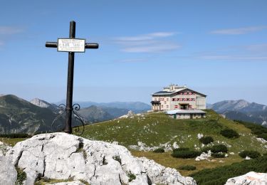
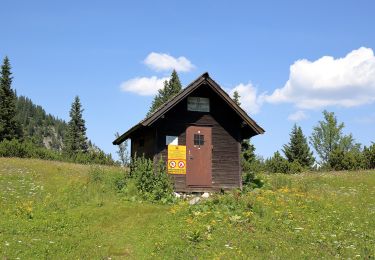
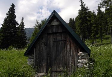
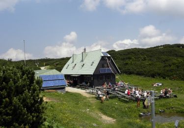
Tour Zu Fuß von 5 km verfügbar auf Steiermark, Bezirk Bruck-Mürzzuschlag, Gemeinde Neuberg an der Mürz. Diese Tour wird von SityTrail - itinéraires balisés pédestres vorgeschlagen.
Beschreibung
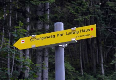
Trail created by Alpine Gesellschaft Reißtaler.
http://wiki.openstreetmap.org/wiki/WikiProject_Austria/Wanderwege
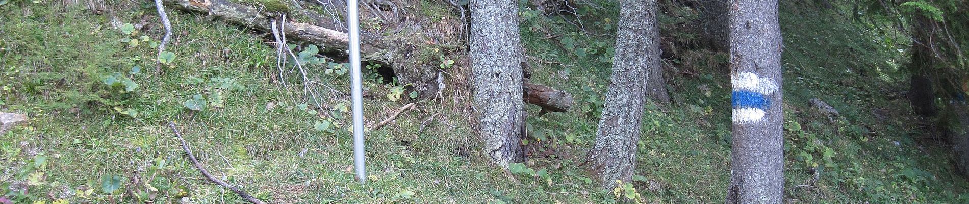
Symbol: roter, waagrechter Balken
Ort
Kommentare
Touren in der Umgebung
![Tour Zu Fuß Gemeinde Neuberg an der Mürz - Wanderweg 824b: Ochsenhaltweg - Photo](https://media.geolcdn.com/t/375/260/9f5f3bea-2df0-4520-8ac2-6c624cee4450.jpeg&format=jpg&maxdim=2)
![Zu Fuß Zu Fuß](https://static1.geolcdn.com/sitytour/trail-icons/100.png)
Zu Fuß
![](/images/other/stat-length.png)
![](https://static1.geolcdn.com/siteimages/upload/files/16400158638029165_repeat_loop_refresh_sync_direction_icon.png)
![Tour Zu Fuß Gemeinde Neuberg an der Mürz - Wanderweg 442 - Photo](https://media.geolcdn.com/t/375/260/e20a7124-9ae4-45d3-9c07-29f824897014.jpeg&format=jpg&maxdim=2)
![Zu Fuß Zu Fuß](https://static1.geolcdn.com/sitytour/trail-icons/100.png)
Zu Fuß
![](/images/other/stat-length.png)
![](https://static1.geolcdn.com/siteimages/upload/files/16400158638029165_repeat_loop_refresh_sync_direction_icon.png)
![Tour Zu Fuß Gemeinde Schwarzau im Gebirge - Schüttersteig - Photo](https://media.geolcdn.com/t/375/260/a716fd13-1ea0-4f7f-9010-4c0d59118b6c.jpeg&format=jpg&maxdim=2)
![Zu Fuß Zu Fuß](https://static1.geolcdn.com/sitytour/trail-icons/100.png)
Zu Fuß
![](/images/other/stat-length.png)
![](https://static1.geolcdn.com/siteimages/upload/files/16400158638029165_repeat_loop_refresh_sync_direction_icon.png)
![Tour Zu Fuß Gemeinde Schwarzau im Gebirge - AT-50 - Photo](https://media.geolcdn.com/t/375/260/24059739-c40f-4340-8cdc-fa4a0dbdf6f6.jpeg&format=jpg&maxdim=2)
![Zu Fuß Zu Fuß](https://static1.geolcdn.com/sitytour/trail-icons/100.png)
Zu Fuß
![](/images/other/stat-length.png)
![](https://static1.geolcdn.com/siteimages/upload/files/16400158638029165_repeat_loop_refresh_sync_direction_icon.png)
![Tour Zu Fuß Gemeinde Neuberg an der Mürz - Wanderweg 829: Preiner Gscheid - Schlangenweg - Karl Ludwig Haus - Photo](https://media.geolcdn.com/t/375/260/f03803fb-4f51-459e-868c-c1493e0da3a7.jpeg&format=jpg&maxdim=2)
![Zu Fuß Zu Fuß](https://static1.geolcdn.com/sitytour/trail-icons/100.png)
Zu Fuß
![](/images/other/stat-length.png)
![](https://static1.geolcdn.com/siteimages/upload/files/16400158638029165_repeat_loop_refresh_sync_direction_icon.png)
![Tour Zu Fuß Gemeinde Neuberg an der Mürz - Prein (Jugendheim) - Oberer Eggl-Waxriegelhaus - Photo](https://media.geolcdn.com/t/375/260/add352eb-db94-4ac2-a56b-760f47bdc2fa.jpeg&format=jpg&maxdim=2)
![Zu Fuß Zu Fuß](https://static1.geolcdn.com/sitytour/trail-icons/100.png)
Zu Fuß
![](/images/other/stat-length.png)
![](https://static1.geolcdn.com/siteimages/upload/files/16400158638029165_repeat_loop_refresh_sync_direction_icon.png)
![Tour Zu Fuß Gemeinde Reichenau an der Rax - Griesleiten - Waxriegelhaus - Neue Seehütte - Photo](https://media.geolcdn.com/t/375/260/87b795ef-1673-4370-ab14-63b4ced2d014.jpeg&format=jpg&maxdim=2)
![Zu Fuß Zu Fuß](https://static1.geolcdn.com/sitytour/trail-icons/100.png)
Zu Fuß
![](/images/other/stat-length.png)
![](https://static1.geolcdn.com/siteimages/upload/files/16400158638029165_repeat_loop_refresh_sync_direction_icon.png)
![Tour Zu Fuß Gemeinde Reichenau an der Rax - Seehütte - Preinerwand-Kreuz - Ottohaus - Photo](https://media.geolcdn.com/t/375/260/11e2593b-b776-4e23-86b0-5f74cf9280a4.jpeg&format=jpg&maxdim=2)
![Zu Fuß Zu Fuß](https://static1.geolcdn.com/sitytour/trail-icons/100.png)
Zu Fuß
![](/images/other/stat-length.png)
![](https://static1.geolcdn.com/siteimages/upload/files/16400158638029165_repeat_loop_refresh_sync_direction_icon.png)
![Tour Zu Fuß Gemeinde Reichenau an der Rax - Prein - Preiner Gschneid - Photo](https://media.geolcdn.com/t/375/260/f03803fb-4f51-459e-868c-c1493e0da3a7.jpeg&format=jpg&maxdim=2)
![Zu Fuß Zu Fuß](https://static1.geolcdn.com/sitytour/trail-icons/100.png)
Zu Fuß
![](/images/other/stat-length.png)
![](https://static1.geolcdn.com/siteimages/upload/files/16400158638029165_repeat_loop_refresh_sync_direction_icon.png)