![](/images/other/stat-length.png)
![Tour Zu Fuß Unbekannt - Kahlenberg - Jägerwiese - Photo](https://media.geolcdn.com/t/1900/400/65cfa7de-403f-4e92-a9d6-2de65948c5dc.jpeg&format=pjpeg&maxdim=2)
Kahlenberg - Jägerwiese
SityTrail - itinéraires balisés pédestres
Tous les sentiers balisés d’Europe GUIDE+
![Länge](/images/other/stat-length.png)
Länge
3,2 km
![Maximale Höhe](https://static1.geolcdn.com/siteimages/upload/files/1508320355ic_sort_altitude_max_24dp.png)
Maximale Höhe
506 m
![Positive Höhendifferenz](https://static1.geolcdn.com/siteimages/upload/files/1508320355ic_sort_den_pos_24dp.png)
Positive Höhendifferenz
99 m
![Km-Effort](/images/other/stat-length.png)
Km-Effort
4,5 km
![Min. Höhe](https://static1.geolcdn.com/siteimages/upload/files/1508320355ic_sort_altitude_min_24dp.png)
Min. Höhe
443 m
![Negative Höhendifferenz](https://static1.geolcdn.com/siteimages/upload/files/1508320355ic_sort_den_neg_24dp.png)
Negative Höhendifferenz
96 m
![Boucle](https://static1.geolcdn.com/siteimages/upload/files/16400158638029165_repeat_loop_refresh_sync_direction_icon.png)
Boucle
Nein
Kennzeichnung
Erstellungsdatum :
2022-02-16 16:40:26.617
Letzte Änderung :
2022-03-03 10:25:12.224
![Zu Fuß](https://static1.geolcdn.com/sitytour/trail-icons/100.png)
1h00
Schwierigkeit : Einfach
![Scannen Sie diesen QR-Code, um die Tour in der SityTrail-Anwendung zu öffnen](https://capi.geolives.com/qq0zvz2zws4bq2lad0pu/sitytour/trails/3127493/qr.png?size=200)
Kostenlosegpshiking-Anwendung
Über SityTrail
Tour Zu Fuß von 3,2 km verfügbar auf Wien, Unbekannt, Unbekannt. Diese Tour wird von SityTrail - itinéraires balisés pédestres vorgeschlagen.
Beschreibung
Trail created by ÖTK-Klosterneuburg.
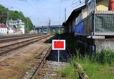
Symbol: weiss-rot-weiss
Website: https://www.oetk-klosterneuburg.at/index.php/unsere-wege/weginformation/406-kahlenberg-jaegerwiese
Ort
Land:
Austria
Region :
Wien
Abteilung/Provinz :
Unbekannt
Kommune :
Unbekannt
Standort:
Döbling
Gehen Sie:(Dec)
Gehen Sie:(UTM)
599176 ; 5347824 (33U) N.
Kommentare
Touren in der Umgebung
![Tour Zu Fuß Gemeinde Klosterneuburg - Kierling - Eichenhain - Photo](https://media.geolcdn.com/t/375/260/dac8ea3a-c503-4e65-8032-64dfd703fdc0.jpeg&format=jpg&maxdim=2)
![Zu Fuß Zu Fuß](https://static1.geolcdn.com/sitytour/trail-icons/100.png)
Kierling - Eichenhain
Zu Fuß
Einfach
Gemeinde Klosterneuburg,
Niederösterreich,
Bezirk Tulln,
Austria
![](/images/other/stat-length.png)
3,8 km | 6,3 km-effort
1h 26min
![](https://static1.geolcdn.com/siteimages/upload/files/16400158638029165_repeat_loop_refresh_sync_direction_icon.png)
Nein
![Tour Zu Fuß Gemeinde Klosterneuburg - Weidling - Kierling (Dr. Walter Brandstetter Weg) - Photo](https://media.geolcdn.com/t/375/260/4443d887-bb67-409e-9884-c1e7d6cd8438.jpeg&format=jpg&maxdim=2)
![Zu Fuß Zu Fuß](https://static1.geolcdn.com/sitytour/trail-icons/100.png)
Weidling - Kierling (Dr. Walter Brandstetter Weg)
Zu Fuß
Einfach
Gemeinde Klosterneuburg,
Niederösterreich,
Bezirk Tulln,
Austria
![](/images/other/stat-length.png)
3,6 km | 6 km-effort
1h 21min
![](https://static1.geolcdn.com/siteimages/upload/files/16400158638029165_repeat_loop_refresh_sync_direction_icon.png)
Nein
![Tour Zu Fuß Gemeinde Klosterneuburg - Weidling - Hohenauer Wiese - Photo](https://media.geolcdn.com/t/375/260/a3fef88e-6ffd-425c-81bc-63c3658ae9d6.jpeg&format=jpg&maxdim=2)
![Zu Fuß Zu Fuß](https://static1.geolcdn.com/sitytour/trail-icons/100.png)
Weidling - Hohenauer Wiese
Zu Fuß
Einfach
Gemeinde Klosterneuburg,
Niederösterreich,
Bezirk Tulln,
Austria
![](/images/other/stat-length.png)
4,7 km | 6,8 km-effort
1h 32min
![](https://static1.geolcdn.com/siteimages/upload/files/16400158638029165_repeat_loop_refresh_sync_direction_icon.png)
Nein
![Tour Zu Fuß Unbekannt - Kahlenbergerdorfer Weinrundwanderweg - Photo](https://media.geolcdn.com/t/375/260/e218559e-5d8c-463c-80d9-0b8152eec5ac.jpeg&format=jpg&maxdim=2)
![Zu Fuß Zu Fuß](https://static1.geolcdn.com/sitytour/trail-icons/100.png)
Kahlenbergerdorfer Weinrundwanderweg
Zu Fuß
Einfach
Unbekannt,
Wien,
Unbekannt,
Austria
![](/images/other/stat-length.png)
3,3 km | 5,5 km-effort
1h 14min
![](https://static1.geolcdn.com/siteimages/upload/files/16400158638029165_repeat_loop_refresh_sync_direction_icon.png)
Ja
![Tour Zu Fuß Unbekannt - Grüß di a Gott Wirt - Cobenzl - Photo](https://media.geolcdn.com/t/375/260/0343ff54-7543-4905-afff-c2d6aabb810a.jpeg&format=jpg&maxdim=2)
![Zu Fuß Zu Fuß](https://static1.geolcdn.com/sitytour/trail-icons/100.png)
Grüß di a Gott Wirt - Cobenzl
Zu Fuß
Einfach
Unbekannt,
Wien,
Unbekannt,
Austria
![](/images/other/stat-length.png)
3,1 km | 4,1 km-effort
55min
![](https://static1.geolcdn.com/siteimages/upload/files/16400158638029165_repeat_loop_refresh_sync_direction_icon.png)
Nein
![Tour Zu Fuß Unbekannt - Sievering/Gspöttgraben - Habsburgwarte - Photo](https://media.geolcdn.com/t/375/260/a0373cb7-e5a7-4848-9c81-91f4b5c5255d.jpeg&format=jpg&maxdim=2)
![Zu Fuß Zu Fuß](https://static1.geolcdn.com/sitytour/trail-icons/100.png)
Sievering/Gspöttgraben - Habsburgwarte
Zu Fuß
Einfach
Unbekannt,
Wien,
Unbekannt,
Austria
![](/images/other/stat-length.png)
3,5 km | 6,2 km-effort
1h 24min
![](https://static1.geolcdn.com/siteimages/upload/files/16400158638029165_repeat_loop_refresh_sync_direction_icon.png)
Nein
![Tour Zu Fuß Gemeinde Klosterneuburg - Klosterneuburg - Hinterweidling - Photo](https://media.geolcdn.com/t/375/260/f829833b-6801-4cba-96fc-04e334598f2f.jpeg&format=jpg&maxdim=2)
![Zu Fuß Zu Fuß](https://static1.geolcdn.com/sitytour/trail-icons/100.png)
Klosterneuburg - Hinterweidling
Zu Fuß
Einfach
Gemeinde Klosterneuburg,
Niederösterreich,
Bezirk Tulln,
Austria
![](/images/other/stat-length.png)
4,5 km | 5,6 km-effort
1h 15min
![](https://static1.geolcdn.com/siteimages/upload/files/16400158638029165_repeat_loop_refresh_sync_direction_icon.png)
Nein
![Tour Zu Fuß Unbekannt - Stadtwanderweg 12 - West-Ost - Photo](https://media.geolcdn.com/t/375/260/25d66604-db3d-404f-b3be-67ff4aeb2cea.jpeg&format=jpg&maxdim=2)
![Zu Fuß Zu Fuß](https://static1.geolcdn.com/sitytour/trail-icons/100.png)
Stadtwanderweg 12 - West-Ost
Zu Fuß
Medium
Unbekannt,
Wien,
Unbekannt,
Austria
![](/images/other/stat-length.png)
25 km | 28 km-effort
6h 16min
![](https://static1.geolcdn.com/siteimages/upload/files/16400158638029165_repeat_loop_refresh_sync_direction_icon.png)
Nein
![Tour Zu Fuß Unbekannt - Stadtwanderweg 1a - Leopoldsberg - Photo](https://media.geolcdn.com/t/375/260/9d3a3215-fcd1-4305-ae3d-c5ce3048d857.jpeg&format=jpg&maxdim=2)
![Zu Fuß Zu Fuß](https://static1.geolcdn.com/sitytour/trail-icons/100.png)
Stadtwanderweg 1a - Leopoldsberg
Zu Fuß
Einfach
Unbekannt,
Wien,
Unbekannt,
Austria
![](/images/other/stat-length.png)
3,5 km | 6,2 km-effort
1h 24min
![](https://static1.geolcdn.com/siteimages/upload/files/16400158638029165_repeat_loop_refresh_sync_direction_icon.png)
Nein