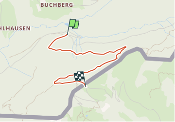
![](/images/other/stat-length.png)
![Tour Zu Fuß Nußdorf am Inn - Wanderweg 4 - Kranzhorn - Photo](https://media.geolcdn.com/t/1900/400/e3c5b70e-000e-4248-8f68-0461d1126b7e.jpeg&format=pjpeg&maxdim=2)
Wanderweg 4 - Kranzhorn
SityTrail - itinéraires balisés pédestres
Tous les sentiers balisés d’Europe GUIDE+
![Länge](/images/other/stat-length.png)
![Maximale Höhe](https://static1.geolcdn.com/siteimages/upload/files/1508320355ic_sort_altitude_max_24dp.png)
![Positive Höhendifferenz](https://static1.geolcdn.com/siteimages/upload/files/1508320355ic_sort_den_pos_24dp.png)
![Km-Effort](/images/other/stat-length.png)
![Min. Höhe](https://static1.geolcdn.com/siteimages/upload/files/1508320355ic_sort_altitude_min_24dp.png)
![Negative Höhendifferenz](https://static1.geolcdn.com/siteimages/upload/files/1508320355ic_sort_den_neg_24dp.png)
![Boucle](https://static1.geolcdn.com/siteimages/upload/files/16400158638029165_repeat_loop_refresh_sync_direction_icon.png)
![Zu Fuß](https://static1.geolcdn.com/sitytour/trail-icons/100.png)
1h25
Schwierigkeit : Einfach
![Scannen Sie diesen QR-Code, um die Tour in der SityTrail-Anwendung zu öffnen](https://capi.geolives.com/qq0zvz2zws4bq2lad0pu/sitytour/trails/3126890/qr.png?size=200)
Kostenlosegpshiking-Anwendung
Über SityTrail
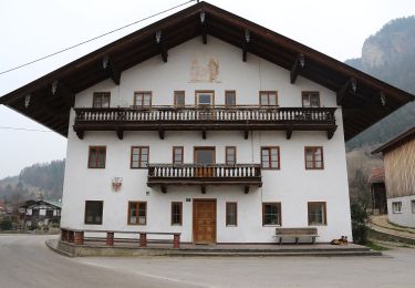
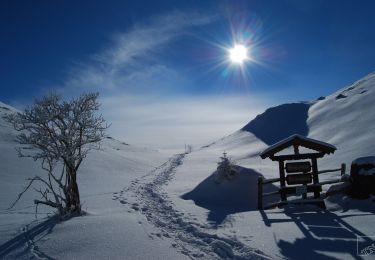
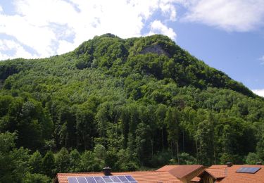
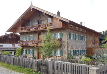
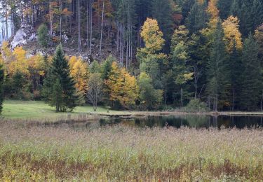
Tour Zu Fuß von 3 km verfügbar auf Bayern, Landkreis Rosenheim, Nußdorf am Inn. Diese Tour wird von SityTrail - itinéraires balisés pédestres vorgeschlagen.
Beschreibung
Beschilderung ist alt und nicht mehr durchgängig. Weg ist NICHT identisch mit Wanderweg 4-Nußdorf (Grüne Schilder mit weißer Zahl)
Symbol: Rot-Weiß-Rot mit schwarzer Zahl
Ort
Kommentare
Touren in der Umgebung
![Tour Zu Fuß Gemeinde Erl - Schönau-Runde - Photo](https://media.geolcdn.com/t/375/260/b1f09388-96e0-4eca-92f2-e261f74a2a6c.jpeg&format=jpg&maxdim=2)
![Zu Fuß Zu Fuß](https://static1.geolcdn.com/sitytour/trail-icons/100.png)
Zu Fuß
![](/images/other/stat-length.png)
![](https://static1.geolcdn.com/siteimages/upload/files/16400158638029165_repeat_loop_refresh_sync_direction_icon.png)
![Tour Zu Fuß Gemeinde Erl - Weidau-Runde - Photo](https://media.geolcdn.com/t/375/260/8ecaf8ec-7ce0-4d74-b523-83156d484c9f.jpeg&format=jpg&maxdim=2)
![Zu Fuß Zu Fuß](https://static1.geolcdn.com/sitytour/trail-icons/100.png)
Zu Fuß
![](/images/other/stat-length.png)
![](https://static1.geolcdn.com/siteimages/upload/files/16400158638029165_repeat_loop_refresh_sync_direction_icon.png)
![Tour Zu Fuß Gemeinde Erl - Dorf-Runde - Photo](https://media.geolcdn.com/t/375/260/44387dbd-2b6b-460b-8631-eded4687f55a.jpeg&format=jpg&maxdim=2)
![Zu Fuß Zu Fuß](https://static1.geolcdn.com/sitytour/trail-icons/100.png)
Zu Fuß
![](/images/other/stat-length.png)
![](https://static1.geolcdn.com/siteimages/upload/files/16400158638029165_repeat_loop_refresh_sync_direction_icon.png)
![Tour Zu Fuß Gemeinde Erl - Scheiben-Runde - Photo](https://media.geolcdn.com/t/375/260/56087dc7-ffa6-4102-a9bb-c8ee2599a932.jpeg&format=jpg&maxdim=2)
![Zu Fuß Zu Fuß](https://static1.geolcdn.com/sitytour/trail-icons/100.png)
Zu Fuß
![](/images/other/stat-length.png)
![](https://static1.geolcdn.com/siteimages/upload/files/16400158638029165_repeat_loop_refresh_sync_direction_icon.png)
![Tour Zu Fuß Nußdorf am Inn - Kranzhorn über Bubenaualm - Photo](https://media.geolcdn.com/t/375/260/e3c5b70e-000e-4248-8f68-0461d1126b7e.jpeg&format=jpg&maxdim=2)
![Zu Fuß Zu Fuß](https://static1.geolcdn.com/sitytour/trail-icons/100.png)
Zu Fuß
![](/images/other/stat-length.png)
![](https://static1.geolcdn.com/siteimages/upload/files/16400158638029165_repeat_loop_refresh_sync_direction_icon.png)
![Tour Zu Fuß Flintsbach am Inn - Wanderweg FL2 - Flintsbach - Photo](https://media.geolcdn.com/t/375/260/8271d66b-41b0-4bb8-a062-bef7c7529e5b.jpeg&format=jpg&maxdim=2)
![Zu Fuß Zu Fuß](https://static1.geolcdn.com/sitytour/trail-icons/100.png)
Zu Fuß
![](/images/other/stat-length.png)
![](https://static1.geolcdn.com/siteimages/upload/files/16400158638029165_repeat_loop_refresh_sync_direction_icon.png)
![Tour Zu Fuß Nußdorf am Inn - SalzAlpenZugweg Nußdorf/Daffnerwald-Almen - Photo](https://media.geolcdn.com/t/375/260/5e1c3d1c-01bf-4b0c-b23e-ae95a6e5f146.jpeg&format=jpg&maxdim=2)
![Zu Fuß Zu Fuß](https://static1.geolcdn.com/sitytour/trail-icons/100.png)
Zu Fuß
![](/images/other/stat-length.png)
![](https://static1.geolcdn.com/siteimages/upload/files/16400158638029165_repeat_loop_refresh_sync_direction_icon.png)
![Tour Zu Fuß Oberaudorf - Wanderweg 5d - Oberaudorf - Photo](https://media.geolcdn.com/t/375/260/c8f43682-0c41-4988-ae5e-461032357082.jpeg&format=jpg&maxdim=2)
![Zu Fuß Zu Fuß](https://static1.geolcdn.com/sitytour/trail-icons/100.png)
Zu Fuß
![](/images/other/stat-length.png)
![](https://static1.geolcdn.com/siteimages/upload/files/16400158638029165_repeat_loop_refresh_sync_direction_icon.png)
![Tour Zu Fuß Flintsbach am Inn - Flintsbach - Gletschergarten-Tour - Photo](https://media.geolcdn.com/t/375/260/8271d66b-41b0-4bb8-a062-bef7c7529e5b.jpeg&format=jpg&maxdim=2)
![Zu Fuß Zu Fuß](https://static1.geolcdn.com/sitytour/trail-icons/100.png)
Zu Fuß
![](/images/other/stat-length.png)
![](https://static1.geolcdn.com/siteimages/upload/files/16400158638029165_repeat_loop_refresh_sync_direction_icon.png)