![](/images/other/stat-length.png)
![Tour Zu Fuß Saint-Vallier-de-Thiey - Arche du Ponadieu - Photo](https://media.geolcdn.com/t/1900/400/7316e039-d176-446d-9243-83f74ffa2b21.jpeg&format=pjpeg&maxdim=2)
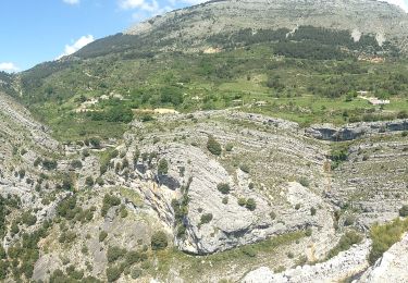
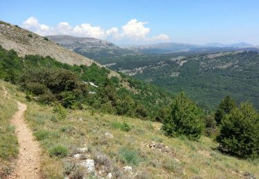
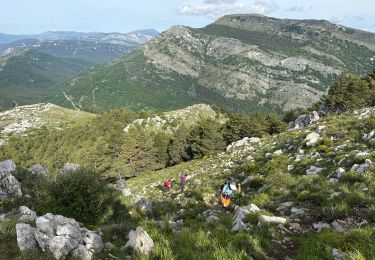
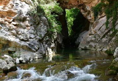
Arche du Ponadieu
SityTrail - itinéraires balisés pédestres
Tous les sentiers balisés d’Europe GUIDE+
![Länge](/images/other/stat-length.png)
![Maximale Höhe](https://static1.geolcdn.com/siteimages/upload/files/1508320355ic_sort_altitude_max_24dp.png)
![Positive Höhendifferenz](https://static1.geolcdn.com/siteimages/upload/files/1508320355ic_sort_den_pos_24dp.png)
![Km-Effort](/images/other/stat-length.png)
![Min. Höhe](https://static1.geolcdn.com/siteimages/upload/files/1508320355ic_sort_altitude_min_24dp.png)
![Negative Höhendifferenz](https://static1.geolcdn.com/siteimages/upload/files/1508320355ic_sort_den_neg_24dp.png)
![Boucle](https://static1.geolcdn.com/siteimages/upload/files/16400158638029165_repeat_loop_refresh_sync_direction_icon.png)
![Zu Fuß](https://static1.geolcdn.com/sitytour/trail-icons/100.png)
1h53
Schwierigkeit : Einfach
![Scannen Sie diesen QR-Code, um die Tour in der SityTrail-Anwendung zu öffnen](https://capi.geolives.com/qq0zvz2zws4bq2lad0pu/sitytour/trails/3123726/qr.png?size=200)
Kostenlosegpshiking-Anwendung
Über SityTrail
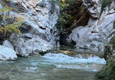
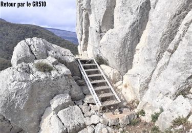
Tour Zu Fuß von 5 km verfügbar auf Provence-Alpes-Côte d'Azur, Seealpen, Saint-Vallier-de-Thiey. Diese Tour wird von SityTrail - itinéraires balisés pédestres vorgeschlagen.
Beschreibung
Randonnée pédestre - Au départ de Saint-Vallier-de-Thiey, parking du Calvaire (715 m)
Website: https://randoxygene.departement06.fr/siagne-loup/arche-du-ponadieu-9069.html
Ort
Kommentare
Touren in der Umgebung
![Tour Wandern Escragnolles - Casade du Ray (Clars) depuis les Gallants - Photo](https://media.geolcdn.com/t/375/260/a42f38d6-7773-4eff-b635-6c5634fe1592.jpg&format=jpg&maxdim=2)
![Wandern Wandern](https://static1.geolcdn.com/sitytour/trail-icons/101.png)
Wandern
![](/images/other/stat-length.png)
![](https://static1.geolcdn.com/siteimages/upload/files/16400158638029165_repeat_loop_refresh_sync_direction_icon.png)
![Tour Wandern Saint-Vallier-de-Thiey - Arche de Ponadieu Source de la Pare Baou Mourine Vieux Pont - Photo](https://media.geolcdn.com/t/375/260/7bf7c645-d759-4e3b-9f63-302e7218f005.jpg&format=jpg&maxdim=2)
![Wandern Wandern](https://static1.geolcdn.com/sitytour/trail-icons/101.png)
Wandern
![](/images/other/stat-length.png)
![](https://static1.geolcdn.com/siteimages/upload/files/16400158638029165_repeat_loop_refresh_sync_direction_icon.png)
![Tour Wandern Saint-Vallier-de-Thiey - St Vallier de Thiey - Aqueduc de Belletrud - Arche de Ponadieu - Photo](https://media.geolcdn.com/t/375/260/102f751b-e867-453b-847f-fc313f16fe9f.jpg&format=jpg&maxdim=2)
![Wandern Wandern](https://static1.geolcdn.com/sitytour/trail-icons/101.png)
Wandern
![](/images/other/stat-length.png)
![](https://static1.geolcdn.com/siteimages/upload/files/16400158638029165_repeat_loop_refresh_sync_direction_icon.png)
![Tour Wandern Saint-Vallier-de-Thiey - canau - Photo](https://media.geolcdn.com/t/375/260/ca899ab5-eb13-42e5-a84d-3c58455096f9.jpg&format=jpg&maxdim=2)
![Wandern Wandern](https://static1.geolcdn.com/sitytour/trail-icons/101.png)
Wandern
![](/images/other/stat-length.png)
![](https://static1.geolcdn.com/siteimages/upload/files/16400158638029165_repeat_loop_refresh_sync_direction_icon.png)
![Tour Wandern Escragnolles - escragnolles mourine - Photo](https://media.geolcdn.com/t/375/260/6cf5f747-cefb-423b-ae55-31ddf95937fc.jpg&format=jpg&maxdim=2)
![Wandern Wandern](https://static1.geolcdn.com/sitytour/trail-icons/101.png)
Wandern
![](/images/other/stat-length.png)
![](https://static1.geolcdn.com/siteimages/upload/files/16400158638029165_repeat_loop_refresh_sync_direction_icon.png)
![Tour Zu Fuß Escragnolles - Plateau de Briasq - Photo](https://media.geolcdn.com/t/375/260/3318d519-9f3b-4858-a9ae-b470b623f859.jpeg&format=jpg&maxdim=2)
![Zu Fuß Zu Fuß](https://static1.geolcdn.com/sitytour/trail-icons/100.png)
Zu Fuß
![](/images/other/stat-length.png)
![](https://static1.geolcdn.com/siteimages/upload/files/16400158638029165_repeat_loop_refresh_sync_direction_icon.png)
![Tour Wandern Saint-Vallier-de-Thiey - Grasse - Montagne de Thiey - Photo](https://media.geolcdn.com/t/375/260/ext.jpg?maxdim=2&url=https%3A%2F%2Fservices.sitytrail.com%2FGeolivesWS%2FDownloadMedia.ashx%3FTrailID%3D435403%26Media%3Dfix__20150611140933.jpg)
![Wandern Wandern](https://static1.geolcdn.com/sitytour/trail-icons/101.png)
Wandern
![](/images/other/stat-length.png)
![](https://static1.geolcdn.com/siteimages/upload/files/16400158638029165_repeat_loop_refresh_sync_direction_icon.png)
![Tour Wandern Saint-Vallier-de-Thiey - St Vallier : Colle du maçon doublier - Photo](https://media.geolcdn.com/t/375/260/4e394125-44db-4de9-b615-b5e106949b4d.jpg&format=jpg&maxdim=2)
![Wandern Wandern](https://static1.geolcdn.com/sitytour/trail-icons/101.png)
Wandern
![](/images/other/stat-length.png)
![](https://static1.geolcdn.com/siteimages/upload/files/16400158638029165_repeat_loop_refresh_sync_direction_icon.png)
![Wandern Wandern](https://static1.geolcdn.com/sitytour/trail-icons/101.png)
Wandern
![](/images/other/stat-length.png)
![](https://static1.geolcdn.com/siteimages/upload/files/16400158638029165_repeat_loop_refresh_sync_direction_icon.png)