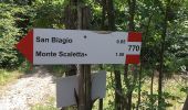

Castello di Ravarano - San Biagio - Monte Scaletta - Castello di Ravarano
SityTrail - itinéraires balisés pédestres
Tous les sentiers balisés d’Europe GUIDE+

Länge
5,4 km

Maximale Höhe
1115 m

Positive Höhendifferenz
286 m

Km-Effort
9,2 km

Min. Höhe
813 m

Negative Höhendifferenz
284 m
Boucle
Ja
Kennzeichnung
Erstellungsdatum :
2022-02-15 17:35:56.969
Letzte Änderung :
2022-03-01 21:16:40.152
2h04
Schwierigkeit : Einfach

Kostenlosegpshiking-Anwendung
Über SityTrail
Tour Zu Fuß von 5,4 km verfügbar auf Emilia-Romagna, Parma, Calestano. Diese Tour wird von SityTrail - itinéraires balisés pédestres vorgeschlagen.
Beschreibung
relation maintained by Capataz (CAI Parma)
Symbol: 770 on white red flags
Ort
Land:
Italy
Region :
Emilia-Romagna
Abteilung/Provinz :
Parma
Kommune :
Calestano
Standort:
Unknown
Gehen Sie:(Dec)
Gehen Sie:(UTM)
584345 ; 4936430 (32T) N.
Kommentare
Touren in der Umgebung
Calestano - Fragno - Fragnolo - Percorso 773


Zu Fuß
Einfach
Calestano,
Emilia-Romagna,
Parma,
Italy

7,9 km | 13,4 km-effort
3h 2min
Nein
Chiastre - Torrente Baganza - Cassio - Chiastra di San Benedetto


Zu Fuß
Einfach
Calestano,
Emilia-Romagna,
Parma,
Italy

4,6 km | 8,4 km-effort
1h 54min
Nein

Cassio - Torrente Baganza - Il Casino - Chiastre - Dente del Gigante


Zu Fuß
Einfach
Terenzo,
Emilia-Romagna,
Parma,
Italy

5,7 km | 10,1 km-effort
2h 17min
Nein

Monte Montagnana - Monte Cavalcalupo - Monte Cervellino - Monte Polo - Passo ...


Zu Fuß
Medium
Corniglio,
Emilia-Romagna,
Parma,
Italy

19,9 km | 31 km-effort
7h 1min
Nein
CR_Francigena_CB_26_Terenzo-Case-Storti_Berceto_20220608


Wandern
Schwierig
Terenzo,
Emilia-Romagna,
Parma,
Italy

19,3 km | 28 km-effort
5h 52min
Nein


 SityTrail


