Tour Zu Fuß Pieve Vergonte - A00a - Strada Francisca tappa 2 - Photo

A00a - Strada Francisca tappa 2

Tous les sentiers balisés d’Europe PRO

© OpenStreetMap contributors
Länge
Länge
23 km
Maximale Höhe
Maximale Höhe
307 m
Positive Höhendifferenz
423 m
Km-Effort
Km-Effort  
29 km
Min. Höhe
Min. Höhe
199 m
Negative Höhendifferenz
420 m
Boucle
Boucle
Nein
Kennzeichnung
Kennzeichnung
Erstellungsdatum :
2022-02-15 15:49:10.453
Letzte Änderung :
2022-03-01 16:35:30.975

(0 Nachricht)

Zu Fuß
Zu Fuß
6h28
Schwierigkeit : Medium

Scannen Sie diesen QR-Code, um die Tour in der SityTrail-Anwendung zu öffnen

Kostenlosegpshiking-Anwendung

Logo SityTrail SityTrail

IGN / Geografische Institute

SityTrail aus dem App Store herunterladen SityTrail von Google Play herunterladen

Logo SityTrail SityTrail World

Die Welt öffnet sich für Sie

SityTrail aus dem App Store herunterladen SityTrail von Google Play herunterladen SityTrail auf Huawei AppGallery herunterladen

Über SityTrail

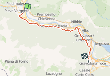
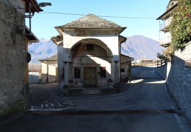
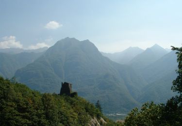
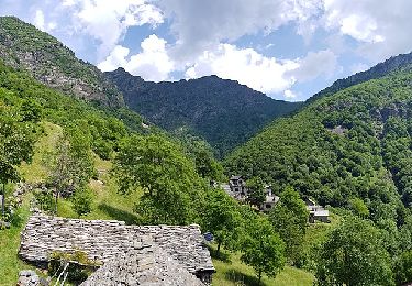
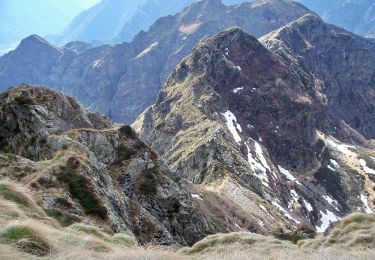
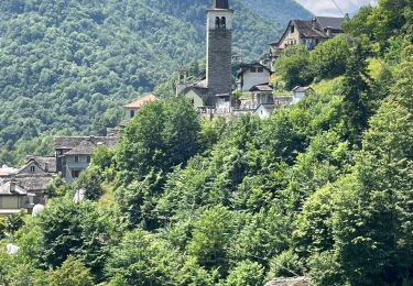
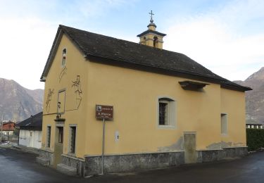
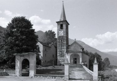
Tour Zu Fuß von 23 km verfügbar auf Piemont, Verbano-Cusio-Ossola, Pieve Vergonte. Diese Tour wird von SityTrail - itinéraires balisés pédestres vorgeschlagen.

Beschreibung

Relation with photos (click on → Web site) mantained by CAI Sezioni Est Monterosa

Symbol: some old white red flags


Website: http://www.estmonterosa.it/catasto-percorsi-vco-piana-del-toce-settore-a.html

Foto-Galerie

Ort

Land:
Italy
Region :
Piemont
Abteilung/Provinz :
Verbano-Cusio-Ossola
Kommune :
Pieve Vergonte
Standort:
Unknown
Gehen Sie:(UTM)
443956 ; 5095356 (32T) N.

Touren in der Umgebung

Tour Zu Fuß Premosello-Chiovenda - A36 - Premosello - bivio A34 Alpe Pianoni - Photo
Zu Fuß
PRO

Zu Fuß

Einfach
Premosello-Chiovenda, Piemont, Verbano-Cusio-Ossola, Italy
4,5 km | 12,7 km-effort
2h 53min
Nein
Tour Zu Fuß Vogogna - A28 - Prata - Pizzo Lacina - Photo
Zu Fuß
PRO

Zu Fuß

Medium
Vogogna, Piemont, Verbano-Cusio-Ossola, Italy
4,9 km | 21 km-effort
4h 48min
Nein
Tour Zu Fuß Vogogna - A32 - Vogogna - Alpe Ceresola - bivio A28 - Photo
Zu Fuß
PRO

Zu Fuß

Einfach
Vogogna, Piemont, Verbano-Cusio-Ossola, Italy
4,8 km | 15,1 km-effort
3h 26min
Nein
Tour Zu Fuß Vogogna - A34 - Vogogna - Pizzo Lacina - Photo
Zu Fuß
PRO

Zu Fuß

Medium
Vogogna, Piemont, Verbano-Cusio-Ossola, Italy
4,9 km | 22 km-effort
4h 53min
Nein
Tour Zu Fuß Premosello-Chiovenda - A38 - Premosello - Bocchetta di Saler - Photo
Zu Fuß
PRO

Zu Fuß

Einfach
Premosello-Chiovenda, Piemont, Verbano-Cusio-Ossola, Italy
5,3 km | 19,4 km-effort
4h 23min
Nein
Tour Zu Fuß Premosello-Chiovenda - A40 - Premosello - Pizzo Proman - Photo
Zu Fuß
PRO

Zu Fuß

Medium
Premosello-Chiovenda, Piemont, Verbano-Cusio-Ossola, Italy
10,6 km | 30 km-effort
6h 44min
Nein
Tour Zu Fuß Pieve Vergonte - A41 - Rumianca - Alpe Pian Lago bivio B97 - Photo
Zu Fuß
PRO

Zu Fuß

Medium
Pieve Vergonte, Piemont, Verbano-Cusio-Ossola, Italy
9,4 km | 25 km-effort
5h 44min
Nein
Tour Zu Fuß Pieve Vergonte - A39 - Megolo di Mezzo - Alpe Ventolaro - Photo
Zu Fuß
PRO

Zu Fuß

Medium
Pieve Vergonte, Piemont, Verbano-Cusio-Ossola, Italy
7,2 km | 23 km-effort
5h 10min
Nein
Tour Zu Fuß Beura-Cardezza - A26 - Cuzzego località Carale - bivio A24 Pizzo Colla Bassa - Photo
Zu Fuß
PRO

Zu Fuß

Einfach
Beura-Cardezza, Piemont, Verbano-Cusio-Ossola, Italy
4,3 km | 18,2 km-effort
4h 8min
Nein


Schließen
Meine Abonnements