![](/images/other/stat-length.png)
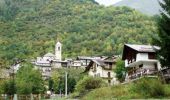
![Tour Zu Fuß Vinadio - (SI E13) Sant'Anna di Vinadio - Vinadio Frazione Strepeis - Photo](https://media.geolcdn.com/t/1900/400/2964e30b-263b-42c3-aa1c-ecaafebd0df1.jpeg&format=pjpeg&maxdim=2)
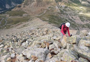
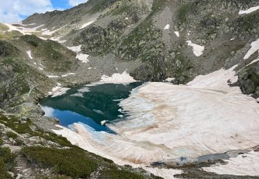
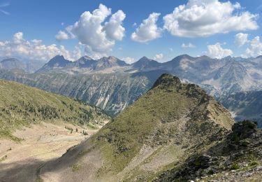
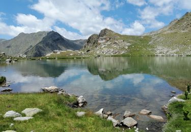
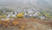
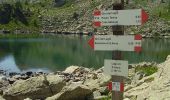
(SI E13) Sant'Anna di Vinadio - Vinadio Frazione Strepeis
SityTrail - itinéraires balisés pédestres
Tous les sentiers balisés d’Europe GUIDE+
![Länge](/images/other/stat-length.png)
Länge
9,1 km
![Maximale Höhe](https://static1.geolcdn.com/siteimages/upload/files/1508320355ic_sort_altitude_max_24dp.png)
Maximale Höhe
2299 m
![Positive Höhendifferenz](https://static1.geolcdn.com/siteimages/upload/files/1508320355ic_sort_den_pos_24dp.png)
Positive Höhendifferenz
345 m
![Km-Effort](/images/other/stat-length.png)
Km-Effort
16,1 km
![Min. Höhe](https://static1.geolcdn.com/siteimages/upload/files/1508320355ic_sort_altitude_min_24dp.png)
Min. Höhe
1266 m
![Negative Höhendifferenz](https://static1.geolcdn.com/siteimages/upload/files/1508320355ic_sort_den_neg_24dp.png)
Negative Höhendifferenz
1082 m
![Boucle](https://static1.geolcdn.com/siteimages/upload/files/16400158638029165_repeat_loop_refresh_sync_direction_icon.png)
Boucle
Nein
Kennzeichnung
Erstellungsdatum :
2022-02-15 12:38:13.499
Letzte Änderung :
2022-03-01 10:22:17.734
![Zu Fuß](https://static1.geolcdn.com/sitytour/trail-icons/100.png)
3h40
Schwierigkeit : Einfach
![Scannen Sie diesen QR-Code, um die Tour in der SityTrail-Anwendung zu öffnen](https://capi.geolives.com/qq0zvz2zws4bq2lad0pu/sitytour/trails/3118738/qr.png?size=200)
Kostenlosegpshiking-Anwendung
Über SityTrail
Tour Zu Fuß von 9,1 km verfügbar auf Piemont, Cuneo, Vinadio. Diese Tour wird von SityTrail - itinéraires balisés pédestres vorgeschlagen.
Beschreibung
Sentiero Italia CAI 2019
Ort
Land:
Italy
Region :
Piemont
Abteilung/Provinz :
Cuneo
Kommune :
Vinadio
Standort:
Unknown
Gehen Sie:(Dec)
Gehen Sie:(UTM)
348757 ; 4899310 (32T) N.
Kommentare
Touren in der Umgebung
![Tour Zu Fuß Vinadio - Tour du Lausfer - Photo](https://media.geolcdn.com/t/375/260/cc4c2b4d-e173-4a84-be7d-4686c9701dd6.jpeg&format=jpg&maxdim=2)
![Zu Fuß Zu Fuß](https://static1.geolcdn.com/sitytour/trail-icons/100.png)
![Tour Wandern Vinadio - Cime de la Lombarde 2800m 26.8.24 - Photo](https://media.geolcdn.com/t/375/260/a90fbc15-b832-4be5-b4ba-c6dcb34efb02.jpg&format=jpg&maxdim=2)
![Wandern Wandern](https://static1.geolcdn.com/sitytour/trail-icons/101.png)
Cime de la Lombarde 2800m 26.8.24
Wandern
Sehr schwierig
Vinadio,
Piemont,
Cuneo,
Italy
![](/images/other/stat-length.png)
3,4 km | 9,1 km-effort
2h 30min
![](https://static1.geolcdn.com/siteimages/upload/files/16400158638029165_repeat_loop_refresh_sync_direction_icon.png)
Ja
![Tour Wandern Vinadio - Tour du Lausfer 25.8.24 - Photo](https://media.geolcdn.com/t/375/260/72863bea-5e16-4036-8653-9180a45481ca.jpg&format=jpg&maxdim=2)
![Wandern Wandern](https://static1.geolcdn.com/sitytour/trail-icons/101.png)
Tour du Lausfer 25.8.24
Wandern
Medium
Vinadio,
Piemont,
Cuneo,
Italy
![](/images/other/stat-length.png)
9 km | 16,2 km-effort
3h 30min
![](https://static1.geolcdn.com/siteimages/upload/files/16400158638029165_repeat_loop_refresh_sync_direction_icon.png)
Ja
![Tour sport Vinadio - Lacs de laisser - Photo](https://media.geolcdn.com/t/375/260/3bdd8a54-1c52-4a56-821f-1ccd76f561b6.jpg&format=jpg&maxdim=2)
Lacs de laisser
sport
Sehr leicht
Vinadio,
Piemont,
Cuneo,
Italy
![](/images/other/stat-length.png)
12,4 km | 21 km-effort
Unbekannt
![](https://static1.geolcdn.com/siteimages/upload/files/16400158638029165_repeat_loop_refresh_sync_direction_icon.png)
Ja
![Tour Schneeschuhwandern Isola - Mont St Sauveur - Photo](https://media.geolcdn.com/t/375/260/d6eeec8b-d4a4-4556-9425-5c4c8488a001.jpg&format=jpg&maxdim=2)
![Schneeschuhwandern Schneeschuhwandern](https://static1.geolcdn.com/sitytour/trail-icons/504.png)
Mont St Sauveur
Schneeschuhwandern
Schwierig
Isola,
Provence-Alpes-Côte d'Azur,
Seealpen,
France
![](/images/other/stat-length.png)
8,7 km | 20 km-effort
3h 52min
![](https://static1.geolcdn.com/siteimages/upload/files/16400158638029165_repeat_loop_refresh_sync_direction_icon.png)
Ja
![Tour Wandern Isola - Lacs du Lausfer / pas de Ste Anne - Photo](https://media.geolcdn.com/t/375/260/c67485b0-6dd2-402f-93b8-4ef26648110e.jpg&format=jpg&maxdim=2)
![Wandern Wandern](https://static1.geolcdn.com/sitytour/trail-icons/101.png)
Lacs du Lausfer / pas de Ste Anne
Wandern
Einfach
Isola,
Provence-Alpes-Côte d'Azur,
Seealpen,
France
![](/images/other/stat-length.png)
9,7 km | 20 km-effort
3h 9min
![](https://static1.geolcdn.com/siteimages/upload/files/16400158638029165_repeat_loop_refresh_sync_direction_icon.png)
Ja
![Tour Wandern Isola - Cime Moravachère Est - Photo](https://media.geolcdn.com/t/375/260/29beb1e1-ab75-4fcc-a813-e239bd567261.jpg&format=jpg&maxdim=2)
![Wandern Wandern](https://static1.geolcdn.com/sitytour/trail-icons/101.png)
Cime Moravachère Est
Wandern
Einfach
Isola,
Provence-Alpes-Côte d'Azur,
Seealpen,
France
![](/images/other/stat-length.png)
8,6 km | 12,2 km-effort
2h 32min
![](https://static1.geolcdn.com/siteimages/upload/files/16400158638029165_repeat_loop_refresh_sync_direction_icon.png)
Ja
![Tour Wandern Isola - Cîme de Sistron - Photo](https://media.geolcdn.com/t/375/260/8eb5e432-ee61-4397-8d76-907421cf758f.jpg&format=jpg&maxdim=2)
![Wandern Wandern](https://static1.geolcdn.com/sitytour/trail-icons/101.png)
Cîme de Sistron
Wandern
Medium
Isola,
Provence-Alpes-Côte d'Azur,
Seealpen,
France
![](/images/other/stat-length.png)
10,2 km | 21 km-effort
3h 27min
![](https://static1.geolcdn.com/siteimages/upload/files/16400158638029165_repeat_loop_refresh_sync_direction_icon.png)
Ja
![Tour Wandern Isola - Cimes et lacs de Lausfer - Photo](https://media.geolcdn.com/t/375/260/8458cb4f-7948-4b07-b934-4be31ee8dbe8.jpg&format=jpg&maxdim=2)
![Wandern Wandern](https://static1.geolcdn.com/sitytour/trail-icons/101.png)
Cimes et lacs de Lausfer
Wandern
Schwierig
Isola,
Provence-Alpes-Côte d'Azur,
Seealpen,
France
![](/images/other/stat-length.png)
10,8 km | 23 km-effort
6h 6min
![](https://static1.geolcdn.com/siteimages/upload/files/16400158638029165_repeat_loop_refresh_sync_direction_icon.png)
Ja