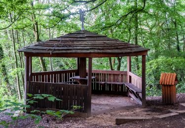
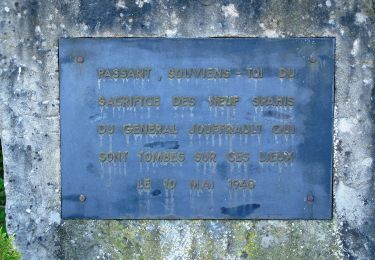
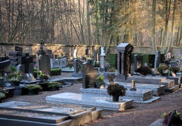
![](/images/other/stat-length.png)
![Tour Zu Fuß Differdingen - Auto-Pédestre Differdange - Photo](https://media.geolcdn.com/t/1900/400/ext.pjpeg?maxdim=2&url=https%3A%2F%2Fstatic1.geolcdn.com%2Fsiteimages%2Fupload%2Ffiles%2F1545311037marcheuse_200dpi.jpg)
Auto-Pédestre Differdange
SityTrail - itinéraires balisés pédestres
Tous les sentiers balisés d’Europe GUIDE+
![Länge](/images/other/stat-length.png)
Länge
10,6 km
![Maximale Höhe](https://static1.geolcdn.com/siteimages/upload/files/1508320355ic_sort_altitude_max_24dp.png)
Maximale Höhe
427 m
![Positive Höhendifferenz](https://static1.geolcdn.com/siteimages/upload/files/1508320355ic_sort_den_pos_24dp.png)
Positive Höhendifferenz
286 m
![Km-Effort](/images/other/stat-length.png)
Km-Effort
14,4 km
![Min. Höhe](https://static1.geolcdn.com/siteimages/upload/files/1508320355ic_sort_altitude_min_24dp.png)
Min. Höhe
291 m
![Negative Höhendifferenz](https://static1.geolcdn.com/siteimages/upload/files/1508320355ic_sort_den_neg_24dp.png)
Negative Höhendifferenz
290 m
![Boucle](https://static1.geolcdn.com/siteimages/upload/files/16400158638029165_repeat_loop_refresh_sync_direction_icon.png)
Boucle
Ja
Kennzeichnung
Erstellungsdatum :
2022-02-15 11:39:57.591
Letzte Änderung :
2022-02-15 11:39:57.591
![Zu Fuß](https://static1.geolcdn.com/sitytour/trail-icons/100.png)
3h17
Schwierigkeit : Einfach
![Scannen Sie diesen QR-Code, um die Tour in der SityTrail-Anwendung zu öffnen](https://capi.geolives.com/qq0zvz2zws4bq2lad0pu/sitytour/trails/3118198/qr.png?size=200)
Kostenlosegpshiking-Anwendung
Über SityTrail
Tour Zu Fuß von 10,6 km verfügbar auf Unbekannt, Kanton Esch an der Alzette, Differdingen. Diese Tour wird von SityTrail - itinéraires balisés pédestres vorgeschlagen.
Beschreibung
Trail created by Ministère de l´Économie.
Website: https://map.geoportail.lu/theme/tourisme?fid=176_4608064
Ort
Land:
Luxembourg
Region :
Unbekannt
Abteilung/Provinz :
Kanton Esch an der Alzette
Kommune :
Differdingen
Standort:
Unknown
Gehen Sie:(Dec)
Gehen Sie:(UTM)
706105 ; 5489403 (31U) N.
Kommentare
Touren in der Umgebung
![Tour Zu Fuß Petingen - Auto-Pédestre Pétange - Photo](https://media.geolcdn.com/t/375/260/3bda8901-8a45-455f-a0d9-28619ac75e15.jpeg&format=jpg&maxdim=2)
![Zu Fuß Zu Fuß](https://static1.geolcdn.com/sitytour/trail-icons/100.png)
Auto-Pédestre Pétange
Zu Fuß
Einfach
Petingen,
Unbekannt,
Kanton Esch an der Alzette,
Luxembourg
![](/images/other/stat-length.png)
8,3 km | 10,4 km-effort
2h 21min
![](https://static1.geolcdn.com/siteimages/upload/files/16400158638029165_repeat_loop_refresh_sync_direction_icon.png)
Ja
![Tour Zu Fuß Petingen - Auto-Pédestre Lamadelaine - Photo](https://media.geolcdn.com/t/375/260/b8abde83-d7ee-4d08-8b56-7c6d44fc17fc.jpeg&format=jpg&maxdim=2)
![Zu Fuß Zu Fuß](https://static1.geolcdn.com/sitytour/trail-icons/100.png)
Auto-Pédestre Lamadelaine
Zu Fuß
Einfach
Petingen,
Unbekannt,
Kanton Esch an der Alzette,
Luxembourg
![](/images/other/stat-length.png)
10,8 km | 13,4 km-effort
3h 2min
![](https://static1.geolcdn.com/siteimages/upload/files/16400158638029165_repeat_loop_refresh_sync_direction_icon.png)
Ja
![Tour Zu Fuß Käerjeng - Auto-Pédestre Bascharage - Photo](https://media.geolcdn.com/t/375/260/f1279973-8e1f-4680-90f5-548cd507bf83.jpeg&format=jpg&maxdim=2)
![Zu Fuß Zu Fuß](https://static1.geolcdn.com/sitytour/trail-icons/100.png)
Auto-Pédestre Bascharage
Zu Fuß
Einfach
Käerjeng,
Unbekannt,
Kanton Kapellen,
Luxembourg
![](/images/other/stat-length.png)
9 km | 10,6 km-effort
2h 24min
![](https://static1.geolcdn.com/siteimages/upload/files/16400158638029165_repeat_loop_refresh_sync_direction_icon.png)
Ja
![Tour Zu Fuß Haucourt-Moulaine - Sentier du Beau Chêne - Photo](https://media.geolcdn.com/t/375/260/f060c4d5-b3a7-4872-84e5-b1f11835f082.jpeg&format=jpg&maxdim=2)
![Zu Fuß Zu Fuß](https://static1.geolcdn.com/sitytour/trail-icons/100.png)
Sentier du Beau Chêne
Zu Fuß
Einfach
Haucourt-Moulaine,
Großer Osten,
Mörthe und Mosel,
France
![](/images/other/stat-length.png)
10,8 km | 13,7 km-effort
3h 6min
![](https://static1.geolcdn.com/siteimages/upload/files/16400158638029165_repeat_loop_refresh_sync_direction_icon.png)
Ja
![Tour Zu Fuß Hussingen-Godbringen - Sentier de la Moulaine - Photo](https://media.geolcdn.com/t/375/260/dbdc8fc0-418c-4eae-8168-1ef4ad662970.jpeg&format=jpg&maxdim=2)
![Zu Fuß Zu Fuß](https://static1.geolcdn.com/sitytour/trail-icons/100.png)
Sentier de la Moulaine
Zu Fuß
Einfach
Hussingen-Godbringen,
Großer Osten,
Mörthe und Mosel,
France
![](/images/other/stat-length.png)
15,6 km | 19,5 km-effort
4h 25min
![](https://static1.geolcdn.com/siteimages/upload/files/16400158638029165_repeat_loop_refresh_sync_direction_icon.png)
Nein
![Tour Zu Fuß Differdingen - Sentier du Temps Perdu - Photo](https://media.geolcdn.com/t/375/260/f2ec4c4a-e3b0-42a8-a4b9-f770a42da903.jpeg&format=jpg&maxdim=2)
![Zu Fuß Zu Fuß](https://static1.geolcdn.com/sitytour/trail-icons/100.png)
Sentier du Temps Perdu
Zu Fuß
Einfach
Differdingen,
Unbekannt,
Kanton Esch an der Alzette,
Luxembourg
![](/images/other/stat-length.png)
6,6 km | 9,1 km-effort
2h 4min
![](https://static1.geolcdn.com/siteimages/upload/files/16400158638029165_repeat_loop_refresh_sync_direction_icon.png)
Ja
![Tour Zu Fuß Ibingen - Le Joli Bois à Athus - Photo](https://media.geolcdn.com/t/375/260/ext.jpg?maxdim=2&url=https%3A%2F%2Fpivotmedia.tourismewallonie.be%2FOTH-A0-0067-0TIT%2FOTH-A0-0067-0TIT.jpg)
![Zu Fuß Zu Fuß](https://static1.geolcdn.com/sitytour/trail-icons/100.png)
Le Joli Bois à Athus
Zu Fuß
Einfach
(1)
Ibingen,
Wallonien,
Luxemburg,
Belgium
![](/images/other/stat-length.png)
8,8 km | 12 km-effort
2h 43min
![](https://static1.geolcdn.com/siteimages/upload/files/16400158638029165_repeat_loop_refresh_sync_direction_icon.png)
Ja
![Tour Wandern Ibingen - le joli bois - Photo](https://media.geolcdn.com/t/375/260/ext.jpg?maxdim=2&url=https%3A%2F%2Fservices.sitytrail.com%2FGeolivesWS%2FDownloadMedia.ashx%3FTrailID%3D388599%26Media%3Dfix__20150221162927.jpg)
![Wandern Wandern](https://static1.geolcdn.com/sitytour/trail-icons/101.png)
le joli bois
Wandern
Einfach
Ibingen,
Wallonien,
Luxemburg,
Belgium
![](/images/other/stat-length.png)
6,7 km | 9 km-effort
1h 57min
![](https://static1.geolcdn.com/siteimages/upload/files/16400158638029165_repeat_loop_refresh_sync_direction_icon.png)
Ja
![Tour Mountainbike Sassenheim - Pistes_VTT : Belvaux VTT/MTB - Photo](https://media.geolcdn.com/t/375/260/ext.jpg?maxdim=2&url=https%3A%2F%2Fstatic1.geolcdn.com%2Fsiteimages%2Fupload%2Ffiles%2F1524743154velo.jpg)
![Mountainbike Mountainbike](https://static1.geolcdn.com/sitytour/trail-icons/202.png)
Pistes_VTT : Belvaux VTT/MTB
Mountainbike
Sehr leicht
(2)
Sassenheim,
Unbekannt,
Kanton Esch an der Alzette,
Luxembourg
![](/images/other/stat-length.png)
2,6 km | 3 km-effort
Unbekannt
![](https://static1.geolcdn.com/siteimages/upload/files/16400158638029165_repeat_loop_refresh_sync_direction_icon.png)
Ja