


11,8 km | 18,6 km-effort

Tous les sentiers balisés d’Europe GUIDE+


Kostenlosegpshiking-Anwendung
 SityTrail
IGN / Geografische Institute
SityTrail World
Die Welt öffnet sich für Sie
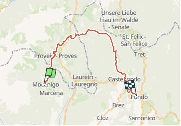
Tour Zu Fuß von 23 km verfügbar auf Trentino-Südtirol, Provincia di Trento, Rumo. Diese Tour wird von SityTrail - itinéraires balisés pédestres vorgeschlagen.
Sentiero Italia CAI 2019
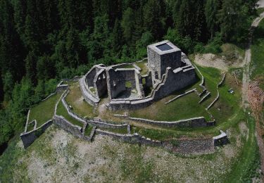
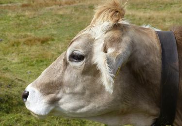
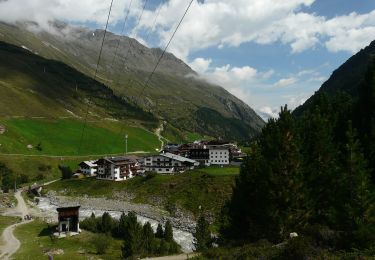
 Mocenigo di Rumo - Passo Fresna - Provés - Malga di Lauregno - Pedra del Gal - Prà della Regola - Castelfondo - Ponte Alto - Fondo - Photo 1")
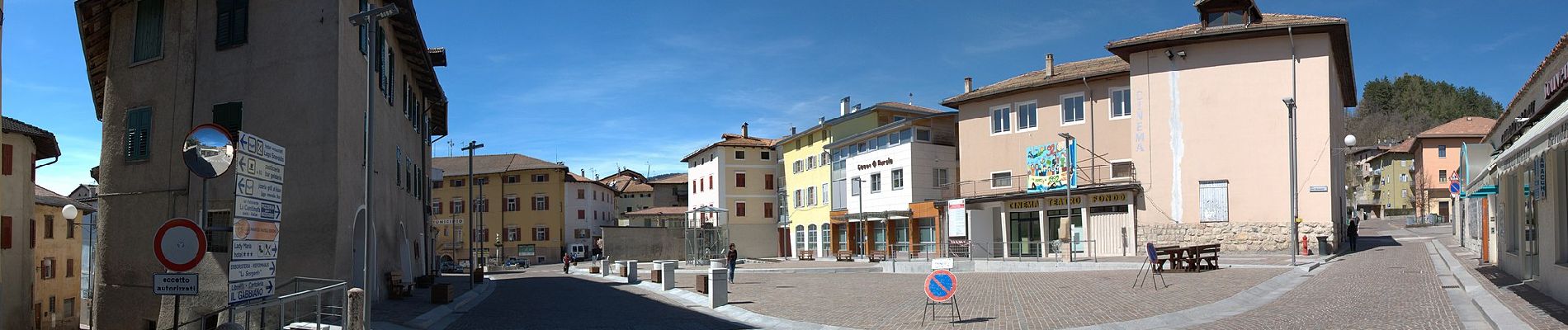
 Mocenigo di Rumo - Passo Fresna - Provés - Malga di Lauregno - Pedra del Gal - Prà della Regola - Castelfondo - Ponte Alto - Fondo - Photo 2")
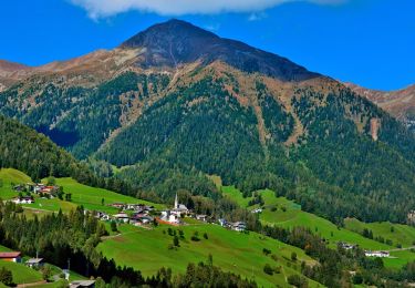
 Mocenigo di Rumo - Passo Fresna - Provés - Malga di Lauregno - Pedra del Gal - Prà della Regola - Castelfondo - Ponte Alto - Fondo - Photo 3")
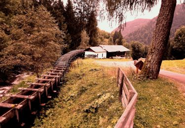
 Mocenigo di Rumo - Passo Fresna - Provés - Malga di Lauregno - Pedra del Gal - Prà della Regola - Castelfondo - Ponte Alto - Fondo - Photo 4")
 Mocenigo di Rumo - Passo Fresna - Provés - Malga di Lauregno - Pedra del Gal - Prà della Regola - Castelfondo - Ponte Alto - Fondo - Photo 5")
 Mocenigo di Rumo - Passo Fresna - Provés - Malga di Lauregno - Pedra del Gal - Prà della Regola - Castelfondo - Ponte Alto - Fondo - Photo 6")
 Mocenigo di Rumo - Passo Fresna - Provés - Malga di Lauregno - Pedra del Gal - Prà della Regola - Castelfondo - Ponte Alto - Fondo - Photo 7")
 Mocenigo di Rumo - Passo Fresna - Provés - Malga di Lauregno - Pedra del Gal - Prà della Regola - Castelfondo - Ponte Alto - Fondo - Photo 8")
 Mocenigo di Rumo - Passo Fresna - Provés - Malga di Lauregno - Pedra del Gal - Prà della Regola - Castelfondo - Ponte Alto - Fondo - Photo 9")
 Mocenigo di Rumo - Passo Fresna - Provés - Malga di Lauregno - Pedra del Gal - Prà della Regola - Castelfondo - Ponte Alto - Fondo - Photo 10")
Zu Fuß
Zu Fuß
Zu Fuß
Zu Fuß
Zu Fuß
Zu Fuß

Zu Fuß
Zu Fuß