

IT-423
SityTrail - itinéraires balisés pédestres
Tous les sentiers balisés d’Europe GUIDE+

Länge
4,1 km

Maximale Höhe
823 m

Positive Höhendifferenz
45 m

Km-Effort
6,2 km

Min. Höhe
362 m

Negative Höhendifferenz
497 m
Boucle
Nein
Kennzeichnung
Erstellungsdatum :
2022-02-15 03:08:36.642
Letzte Änderung :
2022-02-28 23:58:20.981
1h24
Schwierigkeit : Einfach

Kostenlosegpshiking-Anwendung
Über SityTrail
Tour Zu Fuß von 4,1 km verfügbar auf Emilia-Romagna, Forlì-Cesena, Portico e San Benedetto. Diese Tour wird von SityTrail - itinéraires balisés pédestres vorgeschlagen.
Beschreibung
Trail created by CAI Forlì.
Symbol: 423 on white red flag
Website: http://www.caiforli.it/
Ort
Land:
Italy
Region :
Emilia-Romagna
Abteilung/Provinz :
Forlì-Cesena
Kommune :
Portico e San Benedetto
Standort:
Unknown
Gehen Sie:(Dec)
Gehen Sie:(UTM)
721309 ; 4874431 (32T) N.
Kommentare
Touren in der Umgebung
Un grande anello sopra a Castel dell’Alpe


Zu Fuß
Medium
Portico e San Benedetto,
Emilia-Romagna,
Forlì-Cesena,
Italy

14,5 km | 23 km-effort
5h 12min
Ja
Il Monte Tiravento


Zu Fuß
Medium
Premilcuore,
Emilia-Romagna,
Forlì-Cesena,
Italy

15,6 km | 27 km-effort
6h 6min
Ja
I Monti Gemelli


Zu Fuß
Medium
Premilcuore,
Emilia-Romagna,
Forlì-Cesena,
Italy

16,9 km | 30 km-effort
6h 42min
Ja
Da Bocconi verso i Monti Gemelli


Zu Fuß
Medium
Portico e San Benedetto,
Emilia-Romagna,
Forlì-Cesena,
Italy

11,2 km | 22 km-effort
4h 54min
Nein
Valli selvagge tra Rabbi e Montone


Zu Fuß
Medium
Portico e San Benedetto,
Emilia-Romagna,
Forlì-Cesena,
Italy

15,6 km | 31 km-effort
7h 1min
Nein
L’Acquacheta e l’Alto Montone


Zu Fuß
Sehr schwierig
Tredozio,
Emilia-Romagna,
Forlì-Cesena,
Italy

24 km | 41 km-effort
9h 19min
Nein
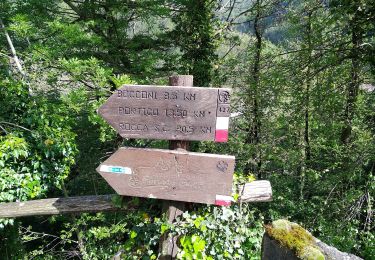
IT-417


Zu Fuß
Einfach
Premilcuore,
Emilia-Romagna,
Forlì-Cesena,
Italy

4,8 km | 7,1 km-effort
1h 36min
Nein

IT-317


Zu Fuß
Einfach
Premilcuore,
Emilia-Romagna,
Forlì-Cesena,
Italy

3,4 km | 4,9 km-effort
1h 6min
Nein

IT-421


Zu Fuß
Einfach
Premilcuore,
Emilia-Romagna,
Forlì-Cesena,
Italy

4,2 km | 6,6 km-effort
1h 29min
Nein


 SityTrail


