![](/images/other/stat-length.png)
![Tour Zu Fuß Tredozio - IT-565 - Photo](https://media.geolcdn.com/t/1900/400/597a9649-eb40-4e02-b5bc-c9bebd6c184e.jpeg&format=pjpeg&maxdim=2)
IT-565
SityTrail - itinéraires balisés pédestres
Tous les sentiers balisés d’Europe GUIDE+
![Länge](/images/other/stat-length.png)
Länge
4,4 km
![Maximale Höhe](https://static1.geolcdn.com/siteimages/upload/files/1508320355ic_sort_altitude_max_24dp.png)
Maximale Höhe
950 m
![Positive Höhendifferenz](https://static1.geolcdn.com/siteimages/upload/files/1508320355ic_sort_den_pos_24dp.png)
Positive Höhendifferenz
398 m
![Km-Effort](/images/other/stat-length.png)
Km-Effort
8,5 km
![Min. Höhe](https://static1.geolcdn.com/siteimages/upload/files/1508320355ic_sort_altitude_min_24dp.png)
Min. Höhe
548 m
![Negative Höhendifferenz](https://static1.geolcdn.com/siteimages/upload/files/1508320355ic_sort_den_neg_24dp.png)
Negative Höhendifferenz
28 m
![Boucle](https://static1.geolcdn.com/siteimages/upload/files/16400158638029165_repeat_loop_refresh_sync_direction_icon.png)
Boucle
Nein
Kennzeichnung
Erstellungsdatum :
2022-02-15 03:06:59.517
Letzte Änderung :
2022-02-28 23:57:59.744
![Zu Fuß](https://static1.geolcdn.com/sitytour/trail-icons/100.png)
1h55
Schwierigkeit : Einfach
![Scannen Sie diesen QR-Code, um die Tour in der SityTrail-Anwendung zu öffnen](https://capi.geolives.com/qq0zvz2zws4bq2lad0pu/sitytour/trails/3114397/qr.png?size=200)
Kostenlosegpshiking-Anwendung
Über SityTrail
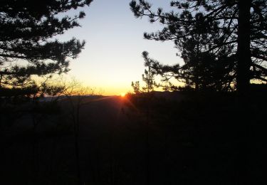
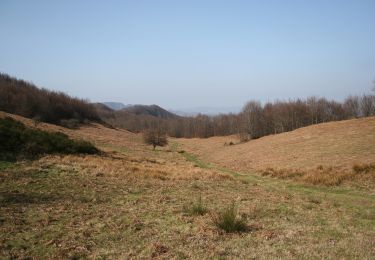
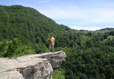
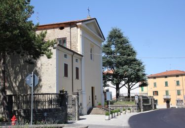
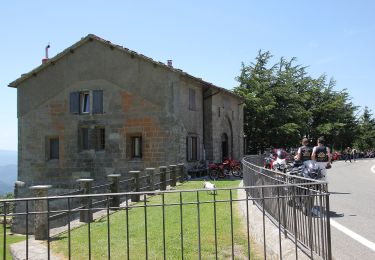
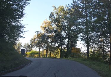
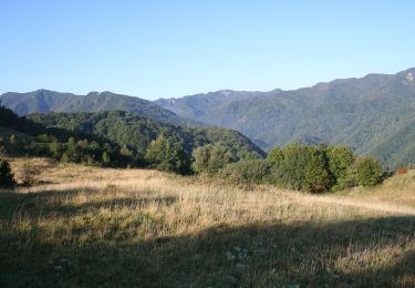
Tour Zu Fuß von 4,4 km verfügbar auf Emilia-Romagna, Forlì-Cesena, Tredozio. Diese Tour wird von SityTrail - itinéraires balisés pédestres vorgeschlagen.
Beschreibung
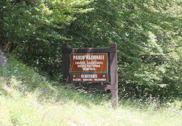
Trail created by CAI Faenza.
Relation maintened by Gabriele Sani (CAI-FA)
Symbol: 565 on white red flag
Website: http://www.caifaenza.it
Ort
Land:
Italy
Region :
Emilia-Romagna
Abteilung/Provinz :
Forlì-Cesena
Kommune :
Tredozio
Standort:
Unknown
Gehen Sie:(Dec)
Gehen Sie:(UTM)
716868 ; 4879664 (32T) N.
Kommentare
Touren in der Umgebung
![Tour Zu Fuß Portico e San Benedetto - Da Bocconi verso i Monti Gemelli - Photo](https://media.geolcdn.com/t/375/260/c40944b8-5279-493d-97d9-4cd00eba42c5.jpeg&format=jpg&maxdim=2)
![Zu Fuß Zu Fuß](https://static1.geolcdn.com/sitytour/trail-icons/100.png)
Da Bocconi verso i Monti Gemelli
Zu Fuß
Medium
Portico e San Benedetto,
Emilia-Romagna,
Forlì-Cesena,
Italy
![](/images/other/stat-length.png)
11,2 km | 22 km-effort
4h 54min
![](https://static1.geolcdn.com/siteimages/upload/files/16400158638029165_repeat_loop_refresh_sync_direction_icon.png)
Nein
![Tour Zu Fuß Marradi - L’Acquacheta e il Monte Lavane - Photo](https://media.geolcdn.com/t/375/260/73c97019-1353-4905-9a28-67cb30531393.jpeg&format=jpg&maxdim=2)
![Zu Fuß Zu Fuß](https://static1.geolcdn.com/sitytour/trail-icons/100.png)
L’Acquacheta e il Monte Lavane
Zu Fuß
Medium
Marradi,
Toskana,
Firenze,
Italy
![](/images/other/stat-length.png)
14 km | 25 km-effort
5h 43min
![](https://static1.geolcdn.com/siteimages/upload/files/16400158638029165_repeat_loop_refresh_sync_direction_icon.png)
Nein
![Tour Zu Fuß Portico e San Benedetto - Tra i giganti della Val Tramazzo - Photo](https://media.geolcdn.com/t/375/260/ff2fdc6b-7a3c-4e1d-8ca2-846b130f5ad3.jpeg&format=jpg&maxdim=2)
![Zu Fuß Zu Fuß](https://static1.geolcdn.com/sitytour/trail-icons/100.png)
Tra i giganti della Val Tramazzo
Zu Fuß
Einfach
Portico e San Benedetto,
Emilia-Romagna,
Forlì-Cesena,
Italy
![](/images/other/stat-length.png)
8,5 km | 14,7 km-effort
3h 19min
![](https://static1.geolcdn.com/siteimages/upload/files/16400158638029165_repeat_loop_refresh_sync_direction_icon.png)
Ja
![Tour Zu Fuß Portico e San Benedetto - Valli selvagge tra Rabbi e Montone - Photo](https://media.geolcdn.com/t/375/260/53c89d03-85e0-435e-890b-ef4151cd30e6.jpeg&format=jpg&maxdim=2)
![Zu Fuß Zu Fuß](https://static1.geolcdn.com/sitytour/trail-icons/100.png)
Valli selvagge tra Rabbi e Montone
Zu Fuß
Medium
Portico e San Benedetto,
Emilia-Romagna,
Forlì-Cesena,
Italy
![](/images/other/stat-length.png)
15,6 km | 31 km-effort
7h 1min
![](https://static1.geolcdn.com/siteimages/upload/files/16400158638029165_repeat_loop_refresh_sync_direction_icon.png)
Nein
![Tour Zu Fuß Tredozio - L’Acquacheta e l’Alto Montone - Photo](https://media.geolcdn.com/t/375/260/130d3e21-ebaa-4aab-ad63-5ee7456f7c76.jpeg&format=jpg&maxdim=2)
![Zu Fuß Zu Fuß](https://static1.geolcdn.com/sitytour/trail-icons/100.png)
L’Acquacheta e l’Alto Montone
Zu Fuß
Sehr schwierig
Tredozio,
Emilia-Romagna,
Forlì-Cesena,
Italy
![](/images/other/stat-length.png)
24 km | 41 km-effort
9h 19min
![](https://static1.geolcdn.com/siteimages/upload/files/16400158638029165_repeat_loop_refresh_sync_direction_icon.png)
Nein
![Tour Zu Fuß Marradi - L'Acquacheta e l'Alto Tramazzo - Photo](https://media.geolcdn.com/t/375/260/ext.jpg?maxdim=2&url=https%3A%2F%2Fupload.wikimedia.org%2Fwikipedia%2Fcommons%2Fthumb%2Fb%2Fb4%2FParco_nazionale_delle_Foreste_Casentinesi_%252801%2529.jpg%2F2000px-Parco_nazionale_delle_Foreste_Casentinesi_%252801%2529.jpg)
![Zu Fuß Zu Fuß](https://static1.geolcdn.com/sitytour/trail-icons/100.png)
L'Acquacheta e l'Alto Tramazzo
Zu Fuß
Einfach
Marradi,
Toskana,
Firenze,
Italy
![](/images/other/stat-length.png)
10 km | 16,3 km-effort
3h 41min
![](https://static1.geolcdn.com/siteimages/upload/files/16400158638029165_repeat_loop_refresh_sync_direction_icon.png)
Nein
![Tour Zu Fuß Tredozio - IT-571 - Photo](https://media.geolcdn.com/t/375/260/c13955c1-1969-44e2-9522-f93c383deee9.jpeg&format=jpg&maxdim=2)
![Zu Fuß Zu Fuß](https://static1.geolcdn.com/sitytour/trail-icons/100.png)
IT-571
Zu Fuß
Einfach
Tredozio,
Emilia-Romagna,
Forlì-Cesena,
Italy
![](/images/other/stat-length.png)
4,3 km | 8,1 km-effort
1h 49min
![](https://static1.geolcdn.com/siteimages/upload/files/16400158638029165_repeat_loop_refresh_sync_direction_icon.png)
Nein
![Tour Zu Fuß Tredozio - IT-569 - Photo](https://media.geolcdn.com/t/375/260/b16381a1-2a12-4156-bc27-9bcb6160dceb.jpeg&format=jpg&maxdim=2)
![Zu Fuß Zu Fuß](https://static1.geolcdn.com/sitytour/trail-icons/100.png)
IT-569
Zu Fuß
Einfach
Tredozio,
Emilia-Romagna,
Forlì-Cesena,
Italy
![](/images/other/stat-length.png)
5,8 km | 10,4 km-effort
2h 21min
![](https://static1.geolcdn.com/siteimages/upload/files/16400158638029165_repeat_loop_refresh_sync_direction_icon.png)
Nein
![Tour Zu Fuß Portico e San Benedetto - IT-555 - Photo](https://media.geolcdn.com/t/375/260/a2d8eaba-d795-4e7f-9a08-00b864a5c67a.jpeg&format=jpg&maxdim=2)
![Zu Fuß Zu Fuß](https://static1.geolcdn.com/sitytour/trail-icons/100.png)
IT-555
Zu Fuß
Einfach
Portico e San Benedetto,
Emilia-Romagna,
Forlì-Cesena,
Italy
![](/images/other/stat-length.png)
8,3 km | 13,8 km-effort
3h 7min
![](https://static1.geolcdn.com/siteimages/upload/files/16400158638029165_repeat_loop_refresh_sync_direction_icon.png)
Nein