![](/images/other/stat-length.png)
![Tour Zu Fuß Sale Marasino - Gardone Val Trompia - Punta Almana - Photo](https://media.geolcdn.com/t/1900/400/1857ca58-0c79-453f-bb2a-e49d93361044.jpeg&format=pjpeg&maxdim=2)
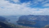
Gardone Val Trompia - Punta Almana
SityTrail - itinéraires balisés pédestres
Tous les sentiers balisés d’Europe GUIDE+
![Länge](/images/other/stat-length.png)
Länge
5,5 km
![Maximale Höhe](https://static1.geolcdn.com/siteimages/upload/files/1508320355ic_sort_altitude_max_24dp.png)
Maximale Höhe
1357 m
![Positive Höhendifferenz](https://static1.geolcdn.com/siteimages/upload/files/1508320355ic_sort_den_pos_24dp.png)
Positive Höhendifferenz
1 m
![Km-Effort](/images/other/stat-length.png)
Km-Effort
8,9 km
![Min. Höhe](https://static1.geolcdn.com/siteimages/upload/files/1508320355ic_sort_altitude_min_24dp.png)
Min. Höhe
343 m
![Negative Höhendifferenz](https://static1.geolcdn.com/siteimages/upload/files/1508320355ic_sort_den_neg_24dp.png)
Negative Höhendifferenz
1005 m
![Boucle](https://static1.geolcdn.com/siteimages/upload/files/16400158638029165_repeat_loop_refresh_sync_direction_icon.png)
Boucle
Nein
Kennzeichnung
Erstellungsdatum :
2022-02-15 00:57:10.269
Letzte Änderung :
2022-02-28 19:55:15.646
![Zu Fuß](https://static1.geolcdn.com/sitytour/trail-icons/100.png)
2h00
Schwierigkeit : Einfach
![Scannen Sie diesen QR-Code, um die Tour in der SityTrail-Anwendung zu öffnen](https://capi.geolives.com/qq0zvz2zws4bq2lad0pu/sitytour/trails/3113037/qr.png?size=200)
Kostenlosegpshiking-Anwendung
Über SityTrail
Tour Zu Fuß von 5,5 km verfügbar auf Lombardei, Brescia, Sale Marasino. Diese Tour wird von SityTrail - itinéraires balisés pédestres vorgeschlagen.
Beschreibung
Trail created by Club Alpino Italiano - Sezione di Gardone Val Trompia.
Symbol: 313 on white red flag
Ort
Land:
Italy
Region :
Lombardei
Abteilung/Provinz :
Brescia
Kommune :
Sale Marasino
Standort:
Unknown
Gehen Sie:(Dec)
Gehen Sie:(UTM)
589770 ; 5062862 (32T) N.
Kommentare
Touren in der Umgebung
![Tour Zu Fuß Sale Marasino - Malghe in Rete - Trekking - Le Creste Tappa 1 - Photo](https://media.geolcdn.com/t/375/260/884c0d3f-f682-4647-a05d-b605a4d82631.jpeg&format=jpg&maxdim=2)
![Zu Fuß Zu Fuß](https://static1.geolcdn.com/sitytour/trail-icons/100.png)
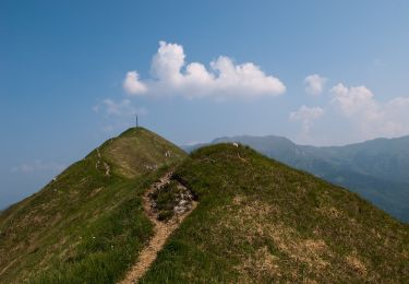
Malghe in Rete - Trekking - Le Creste Tappa 1
Zu Fuß
Einfach
Sale Marasino,
Lombardei,
Brescia,
Italy
![](/images/other/stat-length.png)
3,1 km | 4,6 km-effort
1h 2min
![](https://static1.geolcdn.com/siteimages/upload/files/16400158638029165_repeat_loop_refresh_sync_direction_icon.png)
Nein
![Tour Zu Fuß Zone - Malghe in Rete - Anello 4 - Punta Caravina - Photo](https://media.geolcdn.com/t/375/260/3b68b97d-5728-4ef9-b237-22c5f47408b8.jpeg&format=jpg&maxdim=2)
![Zu Fuß Zu Fuß](https://static1.geolcdn.com/sitytour/trail-icons/100.png)
Malghe in Rete - Anello 4 - Punta Caravina
Zu Fuß
Medium
Zone,
Lombardei,
Brescia,
Italy
![](/images/other/stat-length.png)
13,5 km | 25 km-effort
5h 36min
![](https://static1.geolcdn.com/siteimages/upload/files/16400158638029165_repeat_loop_refresh_sync_direction_icon.png)
Ja
![Tour Zu Fuß Sale Marasino - Malghe in Rete - Anello 1 - Punta Almana - Photo](https://media.geolcdn.com/t/375/260/137222f4-a6e5-471c-b19c-95331109b02c.jpeg&format=jpg&maxdim=2)
![Zu Fuß Zu Fuß](https://static1.geolcdn.com/sitytour/trail-icons/100.png)
Malghe in Rete - Anello 1 - Punta Almana
Zu Fuß
Medium
Sale Marasino,
Lombardei,
Brescia,
Italy
![](/images/other/stat-length.png)
12,1 km | 25 km-effort
5h 41min
![](https://static1.geolcdn.com/siteimages/upload/files/16400158638029165_repeat_loop_refresh_sync_direction_icon.png)
Ja
![Tour Zu Fuß Zone - Sentiero della Valle di Gasso - Photo](https://media.geolcdn.com/t/375/260/dea9f247-8519-44ec-b533-13c0c0851dff.jpeg&format=jpg&maxdim=2)
![Zu Fuß Zu Fuß](https://static1.geolcdn.com/sitytour/trail-icons/100.png)
Sentiero della Valle di Gasso
Zu Fuß
Einfach
Zone,
Lombardei,
Brescia,
Italy
![](/images/other/stat-length.png)
5,7 km | 11,1 km-effort
2h 31min
![](https://static1.geolcdn.com/siteimages/upload/files/16400158638029165_repeat_loop_refresh_sync_direction_icon.png)
Nein
![Tour Zu Fuß Zone - Sentiero di Tress - Passei - I Gnaf - Photo](https://media.geolcdn.com/t/375/260/04a4dfc8-fe1b-469b-b045-dc7d7afe0f16.jpeg&format=jpg&maxdim=2)
![Zu Fuß Zu Fuß](https://static1.geolcdn.com/sitytour/trail-icons/100.png)
Sentiero di Tress - Passei - I Gnaf
Zu Fuß
Einfach
Zone,
Lombardei,
Brescia,
Italy
![](/images/other/stat-length.png)
6,9 km | 18,2 km-effort
4h 8min
![](https://static1.geolcdn.com/siteimages/upload/files/16400158638029165_repeat_loop_refresh_sync_direction_icon.png)
Nein
![Tour Zu Fuß Zone - Sentiero di Monte Pura - Photo](https://media.geolcdn.com/t/375/260/d35c6ef0-bdf8-43a8-8325-12bb327c4fb8.jpeg&format=jpg&maxdim=2)
![Zu Fuß Zu Fuß](https://static1.geolcdn.com/sitytour/trail-icons/100.png)
Sentiero di Monte Pura
Zu Fuß
Einfach
Zone,
Lombardei,
Brescia,
Italy
![](/images/other/stat-length.png)
4,9 km | 12,4 km-effort
2h 49min
![](https://static1.geolcdn.com/siteimages/upload/files/16400158638029165_repeat_loop_refresh_sync_direction_icon.png)
Nein
![Tour Zu Fuß Zone - Antica Strada Valeriana - Photo](https://media.geolcdn.com/t/375/260/7c1f7435-8170-45af-a9d7-23bb896e8849.jpeg&format=jpg&maxdim=2)
![Zu Fuß Zu Fuß](https://static1.geolcdn.com/sitytour/trail-icons/100.png)
Antica Strada Valeriana
Zu Fuß
Einfach
Zone,
Lombardei,
Brescia,
Italy
![](/images/other/stat-length.png)
5,1 km | 6,7 km-effort
1h 31min
![](https://static1.geolcdn.com/siteimages/upload/files/16400158638029165_repeat_loop_refresh_sync_direction_icon.png)
Nein
![Tour Zu Fuß Zone - Inzino (Innesto Sentiero 315) - Monte Guglielmo - Photo](https://media.geolcdn.com/t/375/260/0f58ae6d-3bdd-4d12-b52b-d0a800295881.jpeg&format=jpg&maxdim=2)
![Zu Fuß Zu Fuß](https://static1.geolcdn.com/sitytour/trail-icons/100.png)
Inzino (Innesto Sentiero 315) - Monte Guglielmo
Zu Fuß
Einfach
Zone,
Lombardei,
Brescia,
Italy
![](/images/other/stat-length.png)
5,7 km | 10,1 km-effort
2h 17min
![](https://static1.geolcdn.com/siteimages/upload/files/16400158638029165_repeat_loop_refresh_sync_direction_icon.png)
Nein
![Tour Zu Fuß Polaveno - Sentiero degli Elfi - Photo](https://media.geolcdn.com/t/375/260/911a3f10-11d4-4e2e-a80c-2c78d8906975.jpeg&format=jpg&maxdim=2)
![Zu Fuß Zu Fuß](https://static1.geolcdn.com/sitytour/trail-icons/100.png)
Sentiero degli Elfi
Zu Fuß
Einfach
Polaveno,
Lombardei,
Brescia,
Italy
![](/images/other/stat-length.png)
9 km | 14,4 km-effort
3h 17min
![](https://static1.geolcdn.com/siteimages/upload/files/16400158638029165_repeat_loop_refresh_sync_direction_icon.png)
Ja