


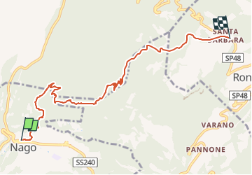

4,7 km | 11,3 km-effort


Tous les sentiers balisés d’Europe GUIDE+


Kostenlosegpshiking-Anwendung
 SityTrail
IGN / Geografische Institute
SityTrail World
Die Welt öffnet sich für Sie
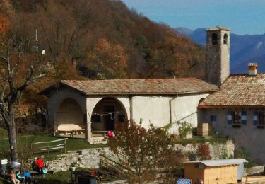
Tour Zu Fuß von 7,7 km verfügbar auf Trentino-Südtirol, Provincia di Trento, Nago-Torbole. Diese Tour wird von SityTrail - itinéraires balisés pédestres vorgeschlagen.
Trail created by Società degli Alpinisti Tridentini.
Website: http://www.sat.tn.it/


Zu Fuß
Zu Fuß
Zu Fuß
Zu Fuß
Zu Fuß
Zu Fuß

Zu Fuß

Zu Fuß

Wandern