![](/images/other/stat-length.png)
![Tour Zu Fuß Campomorone - Passo della Bocchetta - Passo dei Giovi - Photo](https://media.geolcdn.com/t/1900/400/ext.pjpeg?maxdim=2&url=https%3A%2F%2Fmedia.geolcdn.com%2Ff%2F06cc6ca7-a049-4f32-914e-fba4c18bb1cf.jpeg)
Passo della Bocchetta - Passo dei Giovi
SityTrail - itinéraires balisés pédestres
Tous les sentiers balisés d’Europe PRO
![Länge](/images/other/stat-length.png)
Länge
6,3 km
![Maximale Höhe](https://static1.geolcdn.com/siteimages/upload/files/1508320355ic_sort_altitude_max_24dp.png)
Maximale Höhe
812 m
![Positive Höhendifferenz](https://static1.geolcdn.com/siteimages/upload/files/1508320355ic_sort_den_pos_24dp.png)
Positive Höhendifferenz
55 m
![Km-Effort](/images/other/stat-length.png)
Km-Effort
8,1 km
![Min. Höhe](https://static1.geolcdn.com/siteimages/upload/files/1508320355ic_sort_altitude_min_24dp.png)
Min. Höhe
473 m
![Negative Höhendifferenz](https://static1.geolcdn.com/siteimages/upload/files/1508320355ic_sort_den_neg_24dp.png)
Negative Höhendifferenz
361 m
![Boucle](https://static1.geolcdn.com/siteimages/upload/files/16400158638029165_repeat_loop_refresh_sync_direction_icon.png)
Boucle
Nein
Kennzeichnung
Erstellungsdatum :
2022-02-14 21:28:42.831
Letzte Änderung :
2022-02-28 13:06:42.584
![Zu Fuß](https://static1.geolcdn.com/sitytour/trail-icons/100.png)
1h50
Schwierigkeit : Einfach
![Scannen Sie diesen QR-Code, um die Tour in der SityTrail-Anwendung zu öffnen](https://capi.geolives.com/qq0zvz2zws4bq2lad0pu/sitytour/trails/3111437/qr.png?size=200)
Kostenlosegpshiking-Anwendung
Über SityTrail
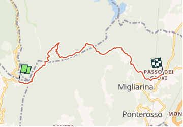
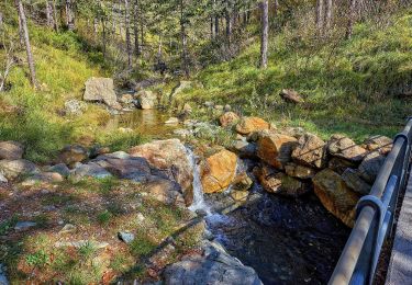
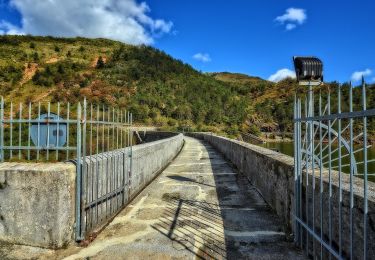
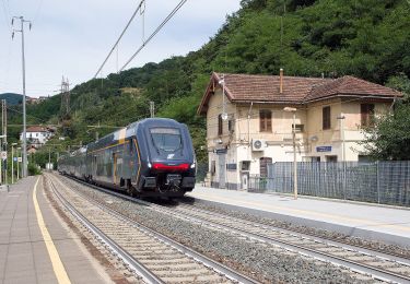
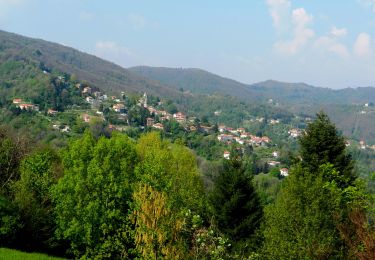
Tour Zu Fuß von 6,3 km verfügbar auf Ligurien, Genua, Campomorone. Diese Tour wird von SityTrail - itinéraires balisés pédestres vorgeschlagen.
Beschreibung
Trail created by Club Alpino Italiano.
Sentiero Italia CAI 2019
Symbol: AV on white red flag
Ort
Land:
Italy
Region :
Ligurien
Abteilung/Provinz :
Genua
Kommune :
Campomorone
Standort:
Unknown
Gehen Sie:(Dec)
Gehen Sie:(UTM)
491088 ; 4933045 (32T) N.
Kommentare
Touren in der Umgebung
![Tour Zu Fuß Campomorone - Busalla - Passo della Bocchetta - M. Leco - Photo](https://media.geolcdn.com/t/375/260/ext.jpg?maxdim=2&url=https%3A%2F%2Fmedia.geolcdn.com%2Ff%2F26bedb0b-a319-4871-b0d2-9245d62603f4.jpeg)
![Zu Fuß Zu Fuß](https://static1.geolcdn.com/sitytour/trail-icons/100.png)
Busalla - Passo della Bocchetta - M. Leco
Zu Fuß
Einfach
Campomorone,
Ligurien,
Genua,
Italy
![](/images/other/stat-length.png)
10,1 km | 13,6 km-effort
3h 5min
![](https://static1.geolcdn.com/siteimages/upload/files/16400158638029165_repeat_loop_refresh_sync_direction_icon.png)
Nein
![Tour Zu Fuß Campomorone - Isoverde (Acquedotto Galliera) - Passo Prato Leone - Photo](https://media.geolcdn.com/t/375/260/ext.jpg?maxdim=2&url=https%3A%2F%2Fmedia.geolcdn.com%2Ff%2F4977278c-fe16-47d9-89fc-cf9e1c4687fd.jpeg)
![Zu Fuß Zu Fuß](https://static1.geolcdn.com/sitytour/trail-icons/100.png)
Isoverde (Acquedotto Galliera) - Passo Prato Leone
Zu Fuß
Einfach
Campomorone,
Ligurien,
Genua,
Italy
![](/images/other/stat-length.png)
4,2 km | 10 km-effort
2h 15min
![](https://static1.geolcdn.com/siteimages/upload/files/16400158638029165_repeat_loop_refresh_sync_direction_icon.png)
Nein
![Tour Zu Fuß Campomorone - Sentiero naturalistico dei Laghi del Gorzente - Photo](https://media.geolcdn.com/t/375/260/ext.jpg?maxdim=2&url=https%3A%2F%2Fmedia.geolcdn.com%2Ff%2F725bd8a9-2350-4061-bd58-5e6144c1522c.jpeg)
![Zu Fuß Zu Fuß](https://static1.geolcdn.com/sitytour/trail-icons/100.png)
Sentiero naturalistico dei Laghi del Gorzente
Zu Fuß
Einfach
Campomorone,
Ligurien,
Genua,
Italy
![](/images/other/stat-length.png)
3,7 km | 5,2 km-effort
1h 10min
![](https://static1.geolcdn.com/siteimages/upload/files/16400158638029165_repeat_loop_refresh_sync_direction_icon.png)
Nein
![Tour Zu Fuß Campomorone - Passo Prato Leone - Laghi del Gorzente - Photo](https://media.geolcdn.com/t/375/260/ext.jpg?maxdim=2&url=https%3A%2F%2Fmedia.geolcdn.com%2Ff%2F128f0a0c-b853-45b9-bb9a-11b3f17a1bad.jpeg)
![Zu Fuß Zu Fuß](https://static1.geolcdn.com/sitytour/trail-icons/100.png)
Passo Prato Leone - Laghi del Gorzente
Zu Fuß
Einfach
Campomorone,
Ligurien,
Genua,
Italy
![](/images/other/stat-length.png)
4,2 km | 5,2 km-effort
1h 11min
![](https://static1.geolcdn.com/siteimages/upload/files/16400158638029165_repeat_loop_refresh_sync_direction_icon.png)
Nein
![Tour Zu Fuß Busalla - Busalla - Santuario della Vittoria - Photo](https://media.geolcdn.com/t/375/260/ext.jpg?maxdim=2&url=https%3A%2F%2Fmedia.geolcdn.com%2Ff%2F51e393e5-aa54-47e2-af08-c2a7f8210eea.jpeg)
![Zu Fuß Zu Fuß](https://static1.geolcdn.com/sitytour/trail-icons/100.png)
Busalla - Santuario della Vittoria
Zu Fuß
Einfach
Busalla,
Ligurien,
Genua,
Italy
![](/images/other/stat-length.png)
4,1 km | 7 km-effort
1h 36min
![](https://static1.geolcdn.com/siteimages/upload/files/16400158638029165_repeat_loop_refresh_sync_direction_icon.png)
Nein
![Tour Zu Fuß Mignanego - Ponterosso - Montanesi - Santuario N.S. della Vittoria - Photo](https://media.geolcdn.com/t/375/260/ext.jpg?maxdim=2&url=https%3A%2F%2Fmedia.geolcdn.com%2Ff%2Fad69383a-2a9e-4083-8b45-a42323dbfe42.jpeg)
![Zu Fuß Zu Fuß](https://static1.geolcdn.com/sitytour/trail-icons/100.png)
Ponterosso - Montanesi - Santuario N.S. della Vittoria
Zu Fuß
Einfach
Mignanego,
Ligurien,
Genua,
Italy
![](/images/other/stat-length.png)
4 km | 7,7 km-effort
1h 44min
![](https://static1.geolcdn.com/siteimages/upload/files/16400158638029165_repeat_loop_refresh_sync_direction_icon.png)
Nein
![Tour Zu Fuß Mignanego - Passo dei Giovi - Crocetta d'Orero - Photo](https://media.geolcdn.com/t/375/260/ext.jpg?maxdim=2&url=https%3A%2F%2Fmedia.geolcdn.com%2Ff%2F1edf9fba-d676-499f-89b6-27238d837fea.jpeg)
![Zu Fuß Zu Fuß](https://static1.geolcdn.com/sitytour/trail-icons/100.png)
Passo dei Giovi - Crocetta d'Orero
Zu Fuß
Einfach
Mignanego,
Ligurien,
Genua,
Italy
![](/images/other/stat-length.png)
7,2 km | 11,2 km-effort
2h 32min
![](https://static1.geolcdn.com/siteimages/upload/files/16400158638029165_repeat_loop_refresh_sync_direction_icon.png)
Nein
![Tour Zu Fuß Mignanego - Piano Orizzontale dei Giovi - Fumeri - Scala Santa - Pendici ovest Bric Montaldo - Photo](https://media.geolcdn.com/t/375/260/ext.jpg?maxdim=2&url=https%3A%2F%2Fmedia.geolcdn.com%2Ff%2F5aba10fc-6e14-459d-9526-c2ae508b6839.jpeg)
![Zu Fuß Zu Fuß](https://static1.geolcdn.com/sitytour/trail-icons/100.png)
Piano Orizzontale dei Giovi - Fumeri - Scala Santa - Pendici ovest Bric Montaldo
Zu Fuß
Einfach
Mignanego,
Ligurien,
Genua,
Italy
![](/images/other/stat-length.png)
3,7 km | 8 km-effort
1h 48min
![](https://static1.geolcdn.com/siteimages/upload/files/16400158638029165_repeat_loop_refresh_sync_direction_icon.png)
Nein
![Tour Zu Fuß Mignanego - Ponte dell'Acqua - Pian di Reste - Photo](https://media.geolcdn.com/t/375/260/ext.jpg?maxdim=2&url=https%3A%2F%2Fmedia.geolcdn.com%2Ff%2F5cc390f9-8430-4ebc-afbe-7bba97248ae9.jpeg)
![Zu Fuß Zu Fuß](https://static1.geolcdn.com/sitytour/trail-icons/100.png)
Ponte dell'Acqua - Pian di Reste
Zu Fuß
Einfach
Mignanego,
Ligurien,
Genua,
Italy
![](/images/other/stat-length.png)
5,5 km | 11,7 km-effort
2h 39min
![](https://static1.geolcdn.com/siteimages/upload/files/16400158638029165_repeat_loop_refresh_sync_direction_icon.png)
Nein