![](/images/other/stat-length.png)
![Tour Zu Fuß Lochem - Oolde route - Photo](https://media.geolcdn.com/t/1900/400/3ea46db5-fe8c-4045-8f3b-ee1a32549e12.jpeg&format=pjpeg&maxdim=2)
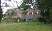
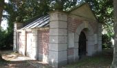
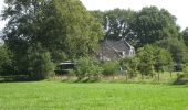
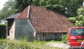
Oolde route
SityTrail - itinéraires balisés pédestres
Tous les sentiers balisés d’Europe GUIDE+
![Länge](/images/other/stat-length.png)
Länge
9,4 km
![Maximale Höhe](https://static1.geolcdn.com/siteimages/upload/files/1508320355ic_sort_altitude_max_24dp.png)
Maximale Höhe
20 m
![Positive Höhendifferenz](https://static1.geolcdn.com/siteimages/upload/files/1508320355ic_sort_den_pos_24dp.png)
Positive Höhendifferenz
42 m
![Km-Effort](/images/other/stat-length.png)
Km-Effort
10 km
![Min. Höhe](https://static1.geolcdn.com/siteimages/upload/files/1508320355ic_sort_altitude_min_24dp.png)
Min. Höhe
8 m
![Negative Höhendifferenz](https://static1.geolcdn.com/siteimages/upload/files/1508320355ic_sort_den_neg_24dp.png)
Negative Höhendifferenz
42 m
![Boucle](https://static1.geolcdn.com/siteimages/upload/files/16400158638029165_repeat_loop_refresh_sync_direction_icon.png)
Boucle
Ja
Kennzeichnung
Erstellungsdatum :
2022-02-14 15:53:54.127
Letzte Änderung :
2022-02-14 15:53:54.127
![Zu Fuß](https://static1.geolcdn.com/sitytour/trail-icons/100.png)
2h15
Schwierigkeit : Einfach
![Scannen Sie diesen QR-Code, um die Tour in der SityTrail-Anwendung zu öffnen](https://capi.geolives.com/qq0zvz2zws4bq2lad0pu/sitytour/trails/3110913/qr.png?size=200)
Kostenlosegpshiking-Anwendung
Über SityTrail
Tour Zu Fuß von 9,4 km verfügbar auf Geldern, Unbekannt, Lochem. Diese Tour wird von SityTrail - itinéraires balisés pédestres vorgeschlagen.
Beschreibung
Trail created by Recreatieschap Achterhoek Liemers.
Website: http://www.recreatieschap.nl/startpunten/top_de_zonnebloem.aspx
Ort
Land:
Netherlands
Region :
Geldern
Abteilung/Provinz :
Unbekannt
Kommune :
Lochem
Standort:
Unknown
Gehen Sie:(Dec)
Gehen Sie:(UTM)
319401 ; 5786164 (32U) N.
Kommentare
Touren in der Umgebung
![Tour Zu Fuß Lochem - Rondje Velhorst - Photo](https://media.geolcdn.com/t/375/260/55919bbd-4040-4eb2-9b13-521e584d1f27.jpeg&format=jpg&maxdim=2)
![Zu Fuß Zu Fuß](https://static1.geolcdn.com/sitytour/trail-icons/100.png)
Rondje Velhorst
Zu Fuß
Einfach
Lochem,
Geldern,
Unbekannt,
Netherlands
![](/images/other/stat-length.png)
3,6 km | 4 km-effort
55min
![](https://static1.geolcdn.com/siteimages/upload/files/16400158638029165_repeat_loop_refresh_sync_direction_icon.png)
Ja
![Tour Zu Fuß Lochem - Klompenpad De Schoolt - Photo](https://media.geolcdn.com/t/375/260/f59dc5f3-fc55-417e-921d-d3a0e5f94b9f.jpeg&format=jpg&maxdim=2)
![Zu Fuß Zu Fuß](https://static1.geolcdn.com/sitytour/trail-icons/100.png)
Klompenpad De Schoolt
Zu Fuß
Einfach
Lochem,
Geldern,
Unbekannt,
Netherlands
![](/images/other/stat-length.png)
9,3 km | 9,8 km-effort
2h 14min
![](https://static1.geolcdn.com/siteimages/upload/files/16400158638029165_repeat_loop_refresh_sync_direction_icon.png)
Ja
![Tour Zu Fuß Lochem - Kring van Dorth route - Photo](https://media.geolcdn.com/t/375/260/cdb6f195-109f-4757-ac64-d28e1fe40842.jpeg&format=jpg&maxdim=2)
![Zu Fuß Zu Fuß](https://static1.geolcdn.com/sitytour/trail-icons/100.png)
Kring van Dorth route
Zu Fuß
Einfach
Lochem,
Geldern,
Unbekannt,
Netherlands
![](/images/other/stat-length.png)
15,9 km | 17,3 km-effort
3h 55min
![](https://static1.geolcdn.com/siteimages/upload/files/16400158638029165_repeat_loop_refresh_sync_direction_icon.png)
Ja
![Tour Zu Fuß Lochem - Rondje Dortherbeek - Photo](https://media.geolcdn.com/t/375/260/58446372-02e2-4511-9a30-efa0229e12c8.jpeg&format=jpg&maxdim=2)
![Zu Fuß Zu Fuß](https://static1.geolcdn.com/sitytour/trail-icons/100.png)
Rondje Dortherbeek
Zu Fuß
Einfach
Lochem,
Geldern,
Unbekannt,
Netherlands
![](/images/other/stat-length.png)
9,4 km | 10,1 km-effort
2h 17min
![](https://static1.geolcdn.com/siteimages/upload/files/16400158638029165_repeat_loop_refresh_sync_direction_icon.png)
Ja
![Tour Zu Fuß Lochem - Molenbeek route - Photo](https://media.geolcdn.com/t/375/260/3ea46db5-fe8c-4045-8f3b-ee1a32549e12.jpeg&format=jpg&maxdim=2)
![Zu Fuß Zu Fuß](https://static1.geolcdn.com/sitytour/trail-icons/100.png)
Molenbeek route
Zu Fuß
Einfach
Lochem,
Geldern,
Unbekannt,
Netherlands
![](/images/other/stat-length.png)
6,6 km | 6,9 km-effort
1h 34min
![](https://static1.geolcdn.com/siteimages/upload/files/16400158638029165_repeat_loop_refresh_sync_direction_icon.png)
Ja
![Tour Zu Fuß Lochem - Rondje Laren - Photo](https://media.geolcdn.com/t/375/260/3ea46db5-fe8c-4045-8f3b-ee1a32549e12.jpeg&format=jpg&maxdim=2)
![Zu Fuß Zu Fuß](https://static1.geolcdn.com/sitytour/trail-icons/100.png)
Rondje Laren
Zu Fuß
Einfach
Lochem,
Geldern,
Unbekannt,
Netherlands
![](/images/other/stat-length.png)
11 km | 11,8 km-effort
2h 40min
![](https://static1.geolcdn.com/siteimages/upload/files/16400158638029165_repeat_loop_refresh_sync_direction_icon.png)
Ja
![Tour Zu Fuß Lochem - Rondje Almen - Photo](https://media.geolcdn.com/t/375/260/9448f3cc-3218-4985-8aea-1eaf9a59cd1e.jpeg&format=jpg&maxdim=2)
![Zu Fuß Zu Fuß](https://static1.geolcdn.com/sitytour/trail-icons/100.png)
Rondje Almen
Zu Fuß
Einfach
Lochem,
Geldern,
Unbekannt,
Netherlands
![](/images/other/stat-length.png)
4,6 km | 4,8 km-effort
1h 5min
![](https://static1.geolcdn.com/siteimages/upload/files/16400158638029165_repeat_loop_refresh_sync_direction_icon.png)
Ja
![Tour Zu Fuß Lochem - Rondje Twentekanaal - Photo](https://media.geolcdn.com/t/375/260/9ce72cfc-4f01-405e-8354-54a0e629964d.jpeg&format=jpg&maxdim=2)
![Zu Fuß Zu Fuß](https://static1.geolcdn.com/sitytour/trail-icons/100.png)
Rondje Twentekanaal
Zu Fuß
Einfach
Lochem,
Geldern,
Unbekannt,
Netherlands
![](/images/other/stat-length.png)
11,8 km | 13,1 km-effort
2h 59min
![](https://static1.geolcdn.com/siteimages/upload/files/16400158638029165_repeat_loop_refresh_sync_direction_icon.png)
Ja
![Tour Zu Fuß Lochem - Staring Route - Photo](https://media.geolcdn.com/t/375/260/b41bc411-eaa0-4edc-9dc8-c4d9bb11682f.jpeg&format=jpg&maxdim=2)
![Zu Fuß Zu Fuß](https://static1.geolcdn.com/sitytour/trail-icons/100.png)
Staring Route
Zu Fuß
Einfach
Lochem,
Geldern,
Unbekannt,
Netherlands
![](/images/other/stat-length.png)
4,6 km | 5 km-effort
1h 8min
![](https://static1.geolcdn.com/siteimages/upload/files/16400158638029165_repeat_loop_refresh_sync_direction_icon.png)
Ja