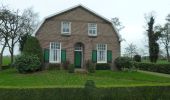
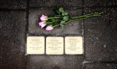
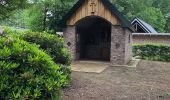
![](/images/other/stat-length.png)
![Tour Zu Fuß Raalte - WNW Salland - Het Raan - gele route - Photo](https://media.geolcdn.com/t/1900/400/5b1666dc-d9d7-4737-a40f-c4a775c293fa.jpeg&format=pjpeg&maxdim=2)
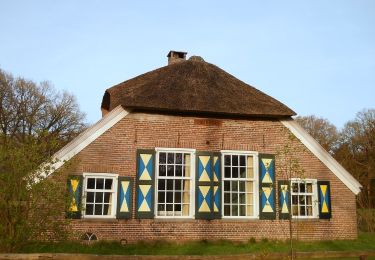
WNW Salland - Het Raan - gele route
SityTrail - itinéraires balisés pédestres
Tous les sentiers balisés d’Europe GUIDE+
![Länge](/images/other/stat-length.png)
Länge
10,2 km
![Maximale Höhe](https://static1.geolcdn.com/siteimages/upload/files/1508320355ic_sort_altitude_max_24dp.png)
Maximale Höhe
11 m
![Positive Höhendifferenz](https://static1.geolcdn.com/siteimages/upload/files/1508320355ic_sort_den_pos_24dp.png)
Positive Höhendifferenz
42 m
![Km-Effort](/images/other/stat-length.png)
Km-Effort
10,7 km
![Min. Höhe](https://static1.geolcdn.com/siteimages/upload/files/1508320355ic_sort_altitude_min_24dp.png)
Min. Höhe
2 m
![Negative Höhendifferenz](https://static1.geolcdn.com/siteimages/upload/files/1508320355ic_sort_den_neg_24dp.png)
Negative Höhendifferenz
43 m
![Boucle](https://static1.geolcdn.com/siteimages/upload/files/16400158638029165_repeat_loop_refresh_sync_direction_icon.png)
Boucle
Ja
Kennzeichnung
Erstellungsdatum :
2022-02-14 15:14:04.196
Letzte Änderung :
2022-02-14 15:14:04.196
![Zu Fuß](https://static1.geolcdn.com/sitytour/trail-icons/100.png)
2h26
Schwierigkeit : Einfach
![Scannen Sie diesen QR-Code, um die Tour in der SityTrail-Anwendung zu öffnen](https://capi.geolives.com/qq0zvz2zws4bq2lad0pu/sitytour/trails/3109805/qr.png?size=200)
Kostenlosegpshiking-Anwendung
Über SityTrail
Tour Zu Fuß von 10,2 km verfügbar auf Overijssel, Unbekannt, Raalte. Diese Tour wird von SityTrail - itinéraires balisés pédestres vorgeschlagen.
Beschreibung
Trail created by Recreatiegemeenschap Salland.
Ort
Land:
Netherlands
Region :
Overijssel
Abteilung/Provinz :
Unbekannt
Kommune :
Raalte
Standort:
Unknown
Gehen Sie:(Dec)
Gehen Sie:(UTM)
315411 ; 5808120 (32U) N.
Kommentare
Touren in der Umgebung
![Tour Zu Fuß Raalte - WNW Salland - Krieghuisbelten - paarse route - Photo](https://media.geolcdn.com/t/375/260/9e903b47-0196-40f6-936c-6d31c7f0d0e5.jpeg&format=jpg&maxdim=2)
![Zu Fuß Zu Fuß](https://static1.geolcdn.com/sitytour/trail-icons/100.png)
WNW Salland - Krieghuisbelten - paarse route
Zu Fuß
Einfach
Raalte,
Overijssel,
Unbekannt,
Netherlands
![](/images/other/stat-length.png)
12,5 km | 13,3 km-effort
3h 1min
![](https://static1.geolcdn.com/siteimages/upload/files/16400158638029165_repeat_loop_refresh_sync_direction_icon.png)
Ja
![Tour Zu Fuß Raalte - WNW Salland - Ramelerbrug - blauwe route - Photo](https://media.geolcdn.com/t/375/260/bc28ed18-40cd-4e97-b197-79826e1efaa1.jpeg&format=jpg&maxdim=2)
![Zu Fuß Zu Fuß](https://static1.geolcdn.com/sitytour/trail-icons/100.png)
WNW Salland - Ramelerbrug - blauwe route
Zu Fuß
Einfach
Raalte,
Overijssel,
Unbekannt,
Netherlands
![](/images/other/stat-length.png)
9,7 km | 10,2 km-effort
2h 19min
![](https://static1.geolcdn.com/siteimages/upload/files/16400158638029165_repeat_loop_refresh_sync_direction_icon.png)
Ja
![Tour Zu Fuß Raalte - WNW Salland - Heino/Den Alerdinck/De Colckhof - gele route - Photo](https://media.geolcdn.com/t/375/260/76931cd2-6785-4ce7-a435-b2cd8c1722bb.jpeg&format=jpg&maxdim=2)
![Zu Fuß Zu Fuß](https://static1.geolcdn.com/sitytour/trail-icons/100.png)
WNW Salland - Heino/Den Alerdinck/De Colckhof - gele route
Zu Fuß
Einfach
Raalte,
Overijssel,
Unbekannt,
Netherlands
![](/images/other/stat-length.png)
12,5 km | 13,6 km-effort
3h 5min
![](https://static1.geolcdn.com/siteimages/upload/files/16400158638029165_repeat_loop_refresh_sync_direction_icon.png)
Ja
![Tour Zu Fuß Raalte - WNW Salland - Raalte - oranje route - Photo](https://media.geolcdn.com/t/375/260/51f1502c-f157-4d5b-9455-32c7e21548be.jpeg&format=jpg&maxdim=2)
![Zu Fuß Zu Fuß](https://static1.geolcdn.com/sitytour/trail-icons/100.png)
WNW Salland - Raalte - oranje route
Zu Fuß
Einfach
Raalte,
Overijssel,
Unbekannt,
Netherlands
![](/images/other/stat-length.png)
11 km | 11,5 km-effort
2h 37min
![](https://static1.geolcdn.com/siteimages/upload/files/16400158638029165_repeat_loop_refresh_sync_direction_icon.png)
Ja
![Tour Zu Fuß Raalte - WNW Salland - Raalte - rode route - Photo](https://media.geolcdn.com/t/375/260/51f1502c-f157-4d5b-9455-32c7e21548be.jpeg&format=jpg&maxdim=2)
![Zu Fuß Zu Fuß](https://static1.geolcdn.com/sitytour/trail-icons/100.png)
WNW Salland - Raalte - rode route
Zu Fuß
Einfach
Raalte,
Overijssel,
Unbekannt,
Netherlands
![](/images/other/stat-length.png)
7 km | 7,4 km-effort
1h 40min
![](https://static1.geolcdn.com/siteimages/upload/files/16400158638029165_repeat_loop_refresh_sync_direction_icon.png)
Ja
![Tour Zu Fuß Raalte - WNW Salland - Raalte/Motormuseum - groene route - Photo](https://media.geolcdn.com/t/375/260/51f1502c-f157-4d5b-9455-32c7e21548be.jpeg&format=jpg&maxdim=2)
![Zu Fuß Zu Fuß](https://static1.geolcdn.com/sitytour/trail-icons/100.png)
WNW Salland - Raalte/Motormuseum - groene route
Zu Fuß
Einfach
Raalte,
Overijssel,
Unbekannt,
Netherlands
![](/images/other/stat-length.png)
3,6 km | 3,9 km-effort
53min
![](https://static1.geolcdn.com/siteimages/upload/files/16400158638029165_repeat_loop_refresh_sync_direction_icon.png)
Ja
![Tour Zu Fuß Raalte - WNW Salland - Het Raan - rode route - Photo](https://media.geolcdn.com/t/375/260/acdef8d2-207f-4935-92b3-f6af96591342.jpeg&format=jpg&maxdim=2)
![Zu Fuß Zu Fuß](https://static1.geolcdn.com/sitytour/trail-icons/100.png)
WNW Salland - Het Raan - rode route
Zu Fuß
Einfach
Raalte,
Overijssel,
Unbekannt,
Netherlands
![](/images/other/stat-length.png)
3,9 km | 4 km-effort
55min
![](https://static1.geolcdn.com/siteimages/upload/files/16400158638029165_repeat_loop_refresh_sync_direction_icon.png)
Ja
![Tour Zu Fuß Raalte - WNW Salland - Het Raan/Krieghuisbelten - blauwe route - Photo](https://media.geolcdn.com/t/375/260/7f412cd8-89ce-4002-b3f1-2d927b3e701b.jpeg&format=jpg&maxdim=2)
![Zu Fuß Zu Fuß](https://static1.geolcdn.com/sitytour/trail-icons/100.png)
WNW Salland - Het Raan/Krieghuisbelten - blauwe route
Zu Fuß
Einfach
Raalte,
Overijssel,
Unbekannt,
Netherlands
![](/images/other/stat-length.png)
16,3 km | 17,6 km-effort
4h 0min
![](https://static1.geolcdn.com/siteimages/upload/files/16400158638029165_repeat_loop_refresh_sync_direction_icon.png)
Ja
![Tour Zu Fuß Raalte - WNW Salland - Ramelerbrug - oranje route - Photo](https://media.geolcdn.com/t/375/260/c3d326b7-6058-40f9-9aa4-d07a92863aa0.jpeg&format=jpg&maxdim=2)
![Zu Fuß Zu Fuß](https://static1.geolcdn.com/sitytour/trail-icons/100.png)
WNW Salland - Ramelerbrug - oranje route
Zu Fuß
Einfach
Raalte,
Overijssel,
Unbekannt,
Netherlands
![](/images/other/stat-length.png)
11,6 km | 12,6 km-effort
2h 51min
![](https://static1.geolcdn.com/siteimages/upload/files/16400158638029165_repeat_loop_refresh_sync_direction_icon.png)
Ja