![](/images/other/stat-length.png)
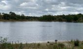
![Tour Zu Fuß Amersfoort - Groene Wissel: Amersfoort - Photo](https://media.geolcdn.com/t/1900/400/7bee5ad7-fb39-4b11-bcbf-5132c417483a.jpeg&format=pjpeg&maxdim=2)
Groene Wissel: Amersfoort
SityTrail - itinéraires balisés pédestres
Tous les sentiers balisés d’Europe GUIDE+
![Länge](/images/other/stat-length.png)
Länge
6,4 km
![Maximale Höhe](https://static1.geolcdn.com/siteimages/upload/files/1508320355ic_sort_altitude_max_24dp.png)
Maximale Höhe
53 m
![Positive Höhendifferenz](https://static1.geolcdn.com/siteimages/upload/files/1508320355ic_sort_den_pos_24dp.png)
Positive Höhendifferenz
64 m
![Km-Effort](/images/other/stat-length.png)
Km-Effort
7,2 km
![Min. Höhe](https://static1.geolcdn.com/siteimages/upload/files/1508320355ic_sort_altitude_min_24dp.png)
Min. Höhe
6 m
![Negative Höhendifferenz](https://static1.geolcdn.com/siteimages/upload/files/1508320355ic_sort_den_neg_24dp.png)
Negative Höhendifferenz
66 m
![Boucle](https://static1.geolcdn.com/siteimages/upload/files/16400158638029165_repeat_loop_refresh_sync_direction_icon.png)
Boucle
Nein
Kennzeichnung
Erstellungsdatum :
2022-02-14 14:23:19.602
Letzte Änderung :
2022-02-14 14:23:19.602
![Zu Fuß](https://static1.geolcdn.com/sitytour/trail-icons/100.png)
1h38
Schwierigkeit : Einfach
![Scannen Sie diesen QR-Code, um die Tour in der SityTrail-Anwendung zu öffnen](https://capi.geolives.com/qq0zvz2zws4bq2lad0pu/sitytour/trails/3108412/qr.png?size=200)
Kostenlosegpshiking-Anwendung
Über SityTrail
Tour Zu Fuß von 6,4 km verfügbar auf Utrecht, Unbekannt, Amersfoort. Diese Tour wird von SityTrail - itinéraires balisés pédestres vorgeschlagen.
Beschreibung
Website: https://www.wandelzoekpagina.nl/groene_wissels/lijst.php
Ort
Land:
Netherlands
Region :
Utrecht
Abteilung/Provinz :
Unbekannt
Kommune :
Amersfoort
Standort:
Unknown
Gehen Sie:(Dec)
Gehen Sie:(UTM)
662412 ; 5780733 (31U) N.
Kommentare
Touren in der Umgebung
![Tour Zu Fuß Leusden - Wandelroute Ringheuvels - Photo](https://media.geolcdn.com/t/375/260/77fc2be0-d63a-4895-a789-d0db89dd16fa.jpeg&format=jpg&maxdim=2)
![Zu Fuß Zu Fuß](https://static1.geolcdn.com/sitytour/trail-icons/100.png)
Wandelroute Ringheuvels
Zu Fuß
Einfach
Leusden,
Utrecht,
Unbekannt,
Netherlands
![](/images/other/stat-length.png)
4,4 km | 4,8 km-effort
1h 4min
![](https://static1.geolcdn.com/siteimages/upload/files/16400158638029165_repeat_loop_refresh_sync_direction_icon.png)
Ja
![Tour Zu Fuß Leusden - Rondwandeling De Troet - Photo](https://media.geolcdn.com/t/375/260/aa357892-9030-45cc-996b-fc44d363a8ff.jpeg&format=jpg&maxdim=2)
![Zu Fuß Zu Fuß](https://static1.geolcdn.com/sitytour/trail-icons/100.png)
Rondwandeling De Troet
Zu Fuß
Einfach
Leusden,
Utrecht,
Unbekannt,
Netherlands
![](/images/other/stat-length.png)
3,8 km | 4,1 km-effort
55min
![](https://static1.geolcdn.com/siteimages/upload/files/16400158638029165_repeat_loop_refresh_sync_direction_icon.png)
Ja
![Tour Zu Fuß Amersfoort - Landschapspad Hoogland-West - Photo](https://media.geolcdn.com/t/375/260/dev_ae8727c9-2a43-4354-9b71-4bbc10edd0e8.jpeg&format=jpg&maxdim=2)
![Zu Fuß Zu Fuß](https://static1.geolcdn.com/sitytour/trail-icons/100.png)
Landschapspad Hoogland-West
Zu Fuß
Einfach
Amersfoort,
Utrecht,
Unbekannt,
Netherlands
![](/images/other/stat-length.png)
3,6 km | 3,7 km-effort
51min
![](https://static1.geolcdn.com/siteimages/upload/files/16400158638029165_repeat_loop_refresh_sync_direction_icon.png)
Ja
![Tour Zu Fuß Soest - Derde Erfpad - Photo](https://media.geolcdn.com/t/375/260/ext.jpg?maxdim=2&url=https%3A%2F%2Fstatic1.geolcdn.com%2Fsiteimages%2Fupload%2Ffiles%2F1545311037marcheuse_200dpi.jpg)
![Zu Fuß Zu Fuß](https://static1.geolcdn.com/sitytour/trail-icons/100.png)
Derde Erfpad
Zu Fuß
Einfach
Soest,
Utrecht,
Unbekannt,
Netherlands
![](/images/other/stat-length.png)
8,9 km | 9,5 km-effort
2h 9min
![](https://static1.geolcdn.com/siteimages/upload/files/16400158638029165_repeat_loop_refresh_sync_direction_icon.png)
Ja
![Tour Zu Fuß Amersfoort - NS-wandeltocht Lange Duinen - Photo](https://media.geolcdn.com/t/375/260/ext.jpg?maxdim=2&url=https%3A%2F%2Fstatic1.geolcdn.com%2Fsiteimages%2Fupload%2Ffiles%2F1545311037marcheuse_200dpi.jpg)
![Zu Fuß Zu Fuß](https://static1.geolcdn.com/sitytour/trail-icons/100.png)
NS-wandeltocht Lange Duinen
Zu Fuß
Medium
Amersfoort,
Utrecht,
Unbekannt,
Netherlands
![](/images/other/stat-length.png)
21 km | 23 km-effort
5h 18min
![](https://static1.geolcdn.com/siteimages/upload/files/16400158638029165_repeat_loop_refresh_sync_direction_icon.png)
Nein
![Tour Motor Leusden - a-gelderland-rondje-betuwe - Photo](https://media.geolcdn.com/t/375/260/ext.jpg?maxdim=2&url=https%3A%2F%2Fstatic1.geolcdn.com%2Fsiteimages%2Fupload%2Ffiles%2F15247431544x4.jpg)
![Motor Motor](https://static1.geolcdn.com/sitytour/trail-icons/400.png)
a-gelderland-rondje-betuwe
Motor
Sehr leicht
Leusden,
Utrecht,
Unbekannt,
Netherlands
![](/images/other/stat-length.png)
231 km | 244 km-effort
Unbekannt
![](https://static1.geolcdn.com/siteimages/upload/files/16400158638029165_repeat_loop_refresh_sync_direction_icon.png)
Nein
![Tour Motor Leusden - a-gelderland-rondje-amersfoort-harderwijk-zwolle-aperdoorn-nozw - Photo](https://media.geolcdn.com/t/375/260/ext.jpg?maxdim=2&url=https%3A%2F%2Fstatic1.geolcdn.com%2Fsiteimages%2Fupload%2Ffiles%2F15247431544x4.jpg)
![Motor Motor](https://static1.geolcdn.com/sitytour/trail-icons/400.png)
a-gelderland-rondje-amersfoort-harderwijk-zwolle-aperdoorn-nozw
Motor
Sehr leicht
Leusden,
Utrecht,
Unbekannt,
Netherlands
![](/images/other/stat-length.png)
202 km | 216 km-effort
Unbekannt
![](https://static1.geolcdn.com/siteimages/upload/files/16400158638029165_repeat_loop_refresh_sync_direction_icon.png)
Ja
![Tour Fahrrad Leusden - Utrecht - Toeractief Fietsroute Prachtig boerenland - Photo](https://media.geolcdn.com/t/375/260/ext.jpg?maxdim=2&url=https%3A%2F%2Fstatic1.geolcdn.com%2Fsiteimages%2Fupload%2Ffiles%2F1524743154velo.jpg)
![Fahrrad Fahrrad](https://static1.geolcdn.com/sitytour/trail-icons/200.png)
Utrecht - Toeractief Fietsroute Prachtig boerenland
Fahrrad
Sehr leicht
Leusden,
Utrecht,
Unbekannt,
Netherlands
![](/images/other/stat-length.png)
78 km | 83 km-effort
Unbekannt
![](https://static1.geolcdn.com/siteimages/upload/files/16400158638029165_repeat_loop_refresh_sync_direction_icon.png)
Ja
![Tour Fahrrad Soest - Utrecht - Route Wasmeer-Pluismeer - Photo](https://media.geolcdn.com/t/375/260/ext.jpg?maxdim=2&url=https%3A%2F%2Fstatic1.geolcdn.com%2Fsiteimages%2Fupload%2Ffiles%2F1524743154velo.jpg)
![Fahrrad Fahrrad](https://static1.geolcdn.com/sitytour/trail-icons/200.png)
Utrecht - Route Wasmeer-Pluismeer
Fahrrad
Sehr leicht
Soest,
Utrecht,
Unbekannt,
Netherlands
![](/images/other/stat-length.png)
32 km | 35 km-effort
Unbekannt
![](https://static1.geolcdn.com/siteimages/upload/files/16400158638029165_repeat_loop_refresh_sync_direction_icon.png)
Ja