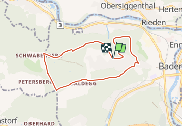
![](/images/other/stat-length.png)
![Tour Zu Fuß Baden - Badener Running Walking Trail Mittel - Photo](https://media.geolcdn.com/t/1900/400/dd5850e2-21fc-42a6-9061-93cd0ae9d18d.jpeg&format=pjpeg&maxdim=2)
Badener Running Walking Trail Mittel
SityTrail - itinéraires balisés pédestres
Tous les sentiers balisés d’Europe GUIDE+
![Länge](/images/other/stat-length.png)
![Maximale Höhe](https://static1.geolcdn.com/siteimages/upload/files/1508320355ic_sort_altitude_max_24dp.png)
![Positive Höhendifferenz](https://static1.geolcdn.com/siteimages/upload/files/1508320355ic_sort_den_pos_24dp.png)
![Km-Effort](/images/other/stat-length.png)
![Min. Höhe](https://static1.geolcdn.com/siteimages/upload/files/1508320355ic_sort_altitude_min_24dp.png)
![Negative Höhendifferenz](https://static1.geolcdn.com/siteimages/upload/files/1508320355ic_sort_den_neg_24dp.png)
![Boucle](https://static1.geolcdn.com/siteimages/upload/files/16400158638029165_repeat_loop_refresh_sync_direction_icon.png)
![Zu Fuß](https://static1.geolcdn.com/sitytour/trail-icons/100.png)
2h14
Schwierigkeit : Einfach
![Scannen Sie diesen QR-Code, um die Tour in der SityTrail-Anwendung zu öffnen](https://capi.geolives.com/qq0zvz2zws4bq2lad0pu/sitytour/trails/3107654/qr.png?size=200)
Kostenlosegpshiking-Anwendung
Über SityTrail
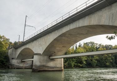
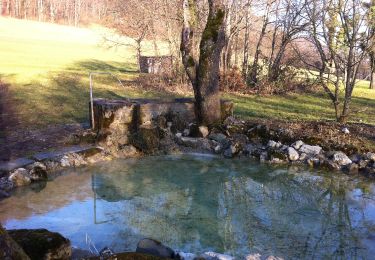
Tour Zu Fuß von 7,5 km verfügbar auf Aargau, Bezirk Baden, Baden. Diese Tour wird von SityTrail - itinéraires balisés pédestres vorgeschlagen.
Beschreibung
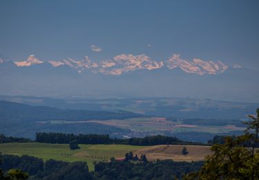
Welcome to the culture and spa town! Baden is ready and presents itself for the upcoming opening of the FORTYSEVEN wellness therme with a new appearance and refreshing ideas.Let yourself be carried away and discover the cultural highlights in Baden. Here you are at the source of culinary diversity and lived hospitality. With us, you will reach your own personal feel-good temperature of adventure, relaxation and inspiration.Immerse yourself in the cultural and spa town of Baden.
Website: https://your.baden.ch/en/experience/activities/sport-and-exercise/running-and-walking-trail
Ort
Kommentare
Touren in der Umgebung
![Tour Zu Fuß Gebenstorf - Badener Running Walking Trail Lang - Photo](https://media.geolcdn.com/t/375/260/b306e09f-ce53-41f2-a365-fb16a0ef0bfa.jpeg&format=jpg&maxdim=2)
![Zu Fuß Zu Fuß](https://static1.geolcdn.com/sitytour/trail-icons/100.png)
Zu Fuß
![](/images/other/stat-length.png)
![](https://static1.geolcdn.com/siteimages/upload/files/16400158638029165_repeat_loop_refresh_sync_direction_icon.png)
![Tour Zu Fuß Wettingen - Wettigen Route 1 - fixme - Photo](https://media.geolcdn.com/t/375/260/2f1437f9-07ea-4430-9508-10e545f7f774.jpeg&format=jpg&maxdim=2)
![Zu Fuß Zu Fuß](https://static1.geolcdn.com/sitytour/trail-icons/100.png)
Zu Fuß
![](/images/other/stat-length.png)
![](https://static1.geolcdn.com/siteimages/upload/files/16400158638029165_repeat_loop_refresh_sync_direction_icon.png)
![Tour Zu Fuß Wettingen - Wettingen Route 2 - fixme - Photo](https://media.geolcdn.com/t/375/260/2f1437f9-07ea-4430-9508-10e545f7f774.jpeg&format=jpg&maxdim=2)
![Zu Fuß Zu Fuß](https://static1.geolcdn.com/sitytour/trail-icons/100.png)
Zu Fuß
![](/images/other/stat-length.png)
![](https://static1.geolcdn.com/siteimages/upload/files/16400158638029165_repeat_loop_refresh_sync_direction_icon.png)
![Tour Zu Fuß Wettingen - Wettingen Route 5 - Photo](https://media.geolcdn.com/t/375/260/f74f41ab-bc3a-44f3-b4e2-9d13b775b92f.jpeg&format=jpg&maxdim=2)
![Zu Fuß Zu Fuß](https://static1.geolcdn.com/sitytour/trail-icons/100.png)
Zu Fuß
![](/images/other/stat-length.png)
![](https://static1.geolcdn.com/siteimages/upload/files/16400158638029165_repeat_loop_refresh_sync_direction_icon.png)
![Tour Zu Fuß Wettingen - Wettingen Route 7 - fixme - Photo](https://media.geolcdn.com/t/375/260/c4fa4598-0d88-4dae-b9cb-acab5ebd66ef.jpeg&format=jpg&maxdim=2)
![Zu Fuß Zu Fuß](https://static1.geolcdn.com/sitytour/trail-icons/100.png)
Zu Fuß
![](/images/other/stat-length.png)
![](https://static1.geolcdn.com/siteimages/upload/files/16400158638029165_repeat_loop_refresh_sync_direction_icon.png)
![Tour Zu Fuß Baden - Baden - Dielsdorf - Photo](https://media.geolcdn.com/t/375/260/6b22d9b1-23b1-494c-bf28-ff18f505fb29.jpeg&format=jpg&maxdim=2)
![Zu Fuß Zu Fuß](https://static1.geolcdn.com/sitytour/trail-icons/100.png)
Zu Fuß
![](/images/other/stat-length.png)
![](https://static1.geolcdn.com/siteimages/upload/files/16400158638029165_repeat_loop_refresh_sync_direction_icon.png)
![Tour Zu Fuß Baden - Baden - Spittelau - Photo](https://media.geolcdn.com/t/375/260/5feb0d43-856f-4697-a619-af3e4ea1d161.jpeg&format=jpg&maxdim=2)
![Zu Fuß Zu Fuß](https://static1.geolcdn.com/sitytour/trail-icons/100.png)
Zu Fuß
![](/images/other/stat-length.png)
![](https://static1.geolcdn.com/siteimages/upload/files/16400158638029165_repeat_loop_refresh_sync_direction_icon.png)
![Tour Zu Fuß Untersiggenthal - Ennetturgi Holzbrücke - Steinenbüel - Photo](https://media.geolcdn.com/t/375/260/3e121540-fcae-4f8d-b61e-2fef7935c935.jpeg&format=jpg&maxdim=2)
![Zu Fuß Zu Fuß](https://static1.geolcdn.com/sitytour/trail-icons/100.png)
Zu Fuß
![](/images/other/stat-length.png)
![](https://static1.geolcdn.com/siteimages/upload/files/16400158638029165_repeat_loop_refresh_sync_direction_icon.png)
![Tour Zu Fuß Wettingen - Mooshalden - Eggetsacher - Photo](https://media.geolcdn.com/t/375/260/22329087-68dc-43b8-9169-79610da5ca1c.jpeg&format=jpg&maxdim=2)
![Zu Fuß Zu Fuß](https://static1.geolcdn.com/sitytour/trail-icons/100.png)
Zu Fuß
![](/images/other/stat-length.png)
![](https://static1.geolcdn.com/siteimages/upload/files/16400158638029165_repeat_loop_refresh_sync_direction_icon.png)