


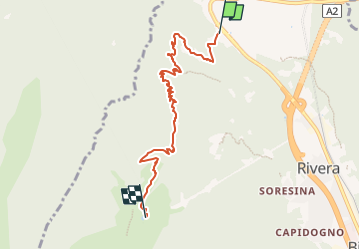

3,7 km | 6,1 km-effort

Tous les sentiers balisés d’Europe GUIDE+


Kostenlosegpshiking-Anwendung
 SityTrail
IGN / Geografische Institute
SityTrail World
Die Welt öffnet sich für Sie
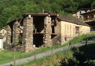
Tour Zu Fuß von 6,1 km verfügbar auf Tessin, Bezirk Lugano, Monteceneri. Diese Tour wird von SityTrail - itinéraires balisés pédestres vorgeschlagen.
Monte Ceneri - Alpe Foppa
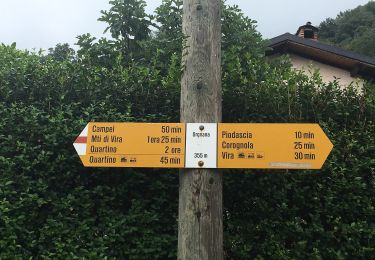
Symbol: bianco-rosso-bianco


Zu Fuß
Zu Fuß
Zu Fuß
Zu Fuß
Zu Fuß
Zu Fuß

Zu Fuß

Wandern

Mountainbike