![](/images/other/stat-length.png)
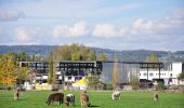
![Tour Zu Fuß Freienbach - Pfäffikon - Lidwil - Photo](https://media.geolcdn.com/t/1900/400/548e42ce-9ed1-4b93-afe2-c6254eb618d7.jpeg&format=pjpeg&maxdim=2)
Pfäffikon - Lidwil
SityTrail - itinéraires balisés pédestres
Tous les sentiers balisés d’Europe GUIDE+
![Länge](/images/other/stat-length.png)
Länge
3,1 km
![Maximale Höhe](https://static1.geolcdn.com/siteimages/upload/files/1508320355ic_sort_altitude_max_24dp.png)
Maximale Höhe
419 m
![Positive Höhendifferenz](https://static1.geolcdn.com/siteimages/upload/files/1508320355ic_sort_den_pos_24dp.png)
Positive Höhendifferenz
31 m
![Km-Effort](/images/other/stat-length.png)
Km-Effort
3,5 km
![Min. Höhe](https://static1.geolcdn.com/siteimages/upload/files/1508320355ic_sort_altitude_min_24dp.png)
Min. Höhe
402 m
![Negative Höhendifferenz](https://static1.geolcdn.com/siteimages/upload/files/1508320355ic_sort_den_neg_24dp.png)
Negative Höhendifferenz
27 m
![Boucle](https://static1.geolcdn.com/siteimages/upload/files/16400158638029165_repeat_loop_refresh_sync_direction_icon.png)
Boucle
Nein
Kennzeichnung
Erstellungsdatum :
2022-02-14 08:43:59.176
Letzte Änderung :
2022-02-14 08:43:59.176
![Zu Fuß](https://static1.geolcdn.com/sitytour/trail-icons/100.png)
47m
Schwierigkeit : Einfach
![Scannen Sie diesen QR-Code, um die Tour in der SityTrail-Anwendung zu öffnen](https://capi.geolives.com/qq0zvz2zws4bq2lad0pu/sitytour/trails/3105738/qr.png?size=200)
Kostenlosegpshiking-Anwendung
Über SityTrail
Tour Zu Fuß von 3,1 km verfügbar auf Schwyz, Höfe, Freienbach. Diese Tour wird von SityTrail - itinéraires balisés pédestres vorgeschlagen.
Beschreibung
Trail created by Umweltdepartement Kt Schwyz.
Pfäffikon - Lidwil
Symbol: gelber Diamant
Ort
Land:
Switzerland
Region :
Schwyz
Abteilung/Provinz :
Höfe
Kommune :
Freienbach
Standort:
Unknown
Gehen Sie:(Dec)
Gehen Sie:(UTM)
483218 ; 5227720 (32T) N.
Kommentare
Touren in der Umgebung
![Tour Zu Fuß Rapperswil-Jona - Rapperswil - Wetzikon - Photo](https://media.geolcdn.com/t/375/260/ecda989d-d743-4124-a29c-4e9364e35623.jpeg&format=jpg&maxdim=2)
![Zu Fuß Zu Fuß](https://static1.geolcdn.com/sitytour/trail-icons/100.png)
Rapperswil - Wetzikon
Zu Fuß
Einfach
Rapperswil-Jona,
Sankt Gallen,
Wahlkreis See-Gaster,
Switzerland
![](/images/other/stat-length.png)
14,4 km | 18,5 km-effort
4h 12min
![](https://static1.geolcdn.com/siteimages/upload/files/16400158638029165_repeat_loop_refresh_sync_direction_icon.png)
Nein
![Tour Zu Fuß Stäfa - Stäfa. Ein Dorf bewegt: Mutzmalen - Lattenberg - Photo](https://media.geolcdn.com/t/375/260/1029bbd8-d2a8-45f5-9b2d-3c662c8683de.jpeg&format=jpg&maxdim=2)
![Zu Fuß Zu Fuß](https://static1.geolcdn.com/sitytour/trail-icons/100.png)
Stäfa. Ein Dorf bewegt: Mutzmalen - Lattenberg
Zu Fuß
Einfach
Stäfa,
Zürich,
Bezirk Meilen,
Switzerland
![](/images/other/stat-length.png)
4,2 km | 5,2 km-effort
1h 10min
![](https://static1.geolcdn.com/siteimages/upload/files/16400158638029165_repeat_loop_refresh_sync_direction_icon.png)
Ja
![Tour Zu Fuß Stäfa - Stäfa-ein Dorf bewegt: Risitobel - Püntacher - Photo](https://media.geolcdn.com/t/375/260/1029bbd8-d2a8-45f5-9b2d-3c662c8683de.jpeg&format=jpg&maxdim=2)
![Zu Fuß Zu Fuß](https://static1.geolcdn.com/sitytour/trail-icons/100.png)
Stäfa-ein Dorf bewegt: Risitobel - Püntacher
Zu Fuß
Einfach
Stäfa,
Zürich,
Bezirk Meilen,
Switzerland
![](/images/other/stat-length.png)
5,2 km | 7,7 km-effort
1h 44min
![](https://static1.geolcdn.com/siteimages/upload/files/16400158638029165_repeat_loop_refresh_sync_direction_icon.png)
Ja
![Tour Zu Fuß Stäfa - Stäfa Schiff - Oetwil - Photo](https://media.geolcdn.com/t/375/260/bb2d22e2-3f3d-448f-8f20-84a0edbd4662.jpeg&format=jpg&maxdim=2)
![Zu Fuß Zu Fuß](https://static1.geolcdn.com/sitytour/trail-icons/100.png)
Stäfa Schiff - Oetwil
Zu Fuß
Einfach
Stäfa,
Zürich,
Bezirk Meilen,
Switzerland
![](/images/other/stat-length.png)
4,6 km | 7,1 km-effort
1h 37min
![](https://static1.geolcdn.com/siteimages/upload/files/16400158638029165_repeat_loop_refresh_sync_direction_icon.png)
Nein
![Tour Zu Fuß Stäfa - Stäfa-ein Dorf bewegt: Top of Stäfa - Photo](https://media.geolcdn.com/t/375/260/1b4ad704-896b-46b1-b224-c31437822c2d.jpeg&format=jpg&maxdim=2)
![Zu Fuß Zu Fuß](https://static1.geolcdn.com/sitytour/trail-icons/100.png)
Stäfa-ein Dorf bewegt: Top of Stäfa
Zu Fuß
Einfach
Stäfa,
Zürich,
Bezirk Meilen,
Switzerland
![](/images/other/stat-length.png)
8 km | 11,1 km-effort
2h 30min
![](https://static1.geolcdn.com/siteimages/upload/files/16400158638029165_repeat_loop_refresh_sync_direction_icon.png)
Ja
![Tour Zu Fuß Stäfa - Grüningen Haufland - Stäfa Schiff - Photo](https://media.geolcdn.com/t/375/260/bb2d22e2-3f3d-448f-8f20-84a0edbd4662.jpeg&format=jpg&maxdim=2)
![Zu Fuß Zu Fuß](https://static1.geolcdn.com/sitytour/trail-icons/100.png)
Grüningen Haufland - Stäfa Schiff
Zu Fuß
Einfach
Stäfa,
Zürich,
Bezirk Meilen,
Switzerland
![](/images/other/stat-length.png)
8,5 km | 11,9 km-effort
2h 42min
![](https://static1.geolcdn.com/siteimages/upload/files/16400158638029165_repeat_loop_refresh_sync_direction_icon.png)
Nein
![Tour Zu Fuß Stäfa - Stäfa-ein Dorf bewegt: Frohberg - Torlen - Photo](https://media.geolcdn.com/t/375/260/1b4ad704-896b-46b1-b224-c31437822c2d.jpeg&format=jpg&maxdim=2)
![Zu Fuß Zu Fuß](https://static1.geolcdn.com/sitytour/trail-icons/100.png)
Stäfa-ein Dorf bewegt: Frohberg - Torlen
Zu Fuß
Einfach
Stäfa,
Zürich,
Bezirk Meilen,
Switzerland
![](/images/other/stat-length.png)
4,5 km | 5,4 km-effort
1h 14min
![](https://static1.geolcdn.com/siteimages/upload/files/16400158638029165_repeat_loop_refresh_sync_direction_icon.png)
Ja
![Tour Zu Fuß Einsiedeln - Egg - Büel - Photo](https://media.geolcdn.com/t/375/260/5fd4ef73-33a4-48f8-a156-ebf9170db81e.jpeg&format=jpg&maxdim=2)
![Zu Fuß Zu Fuß](https://static1.geolcdn.com/sitytour/trail-icons/100.png)
Egg - Büel
Zu Fuß
Einfach
Einsiedeln,
Schwyz,
Einsiedeln,
Switzerland
![](/images/other/stat-length.png)
4,2 km | 6,4 km-effort
1h 27min
![](https://static1.geolcdn.com/siteimages/upload/files/16400158638029165_repeat_loop_refresh_sync_direction_icon.png)
Nein
![Tour Zu Fuß Freienbach - Pfäffikon - Schwändi - Photo](https://media.geolcdn.com/t/375/260/548e42ce-9ed1-4b93-afe2-c6254eb618d7.jpeg&format=jpg&maxdim=2)
![Zu Fuß Zu Fuß](https://static1.geolcdn.com/sitytour/trail-icons/100.png)
Pfäffikon - Schwändi
Zu Fuß
Einfach
Freienbach,
Schwyz,
Höfe,
Switzerland
![](/images/other/stat-length.png)
3,2 km | 6,3 km-effort
1h 25min
![](https://static1.geolcdn.com/siteimages/upload/files/16400158638029165_repeat_loop_refresh_sync_direction_icon.png)
Nein