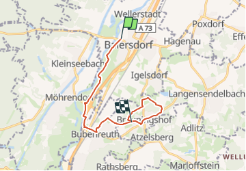
![](/images/other/stat-length.png)
![Tour Zu Fuß Baiersdorf - Meerrettichweg - Photo](https://media.geolcdn.com/t/1900/400/92896cfd-f5cd-48c4-b2fd-c760b6de8ffd.jpeg&format=pjpeg&maxdim=2)
Meerrettichweg
SityTrail - itinéraires balisés pédestres
Tous les sentiers balisés d’Europe GUIDE+
![Länge](/images/other/stat-length.png)
![Maximale Höhe](https://static1.geolcdn.com/siteimages/upload/files/1508320355ic_sort_altitude_max_24dp.png)
![Positive Höhendifferenz](https://static1.geolcdn.com/siteimages/upload/files/1508320355ic_sort_den_pos_24dp.png)
![Km-Effort](/images/other/stat-length.png)
![Min. Höhe](https://static1.geolcdn.com/siteimages/upload/files/1508320355ic_sort_altitude_min_24dp.png)
![Negative Höhendifferenz](https://static1.geolcdn.com/siteimages/upload/files/1508320355ic_sort_den_neg_24dp.png)
![Boucle](https://static1.geolcdn.com/siteimages/upload/files/16400158638029165_repeat_loop_refresh_sync_direction_icon.png)
![Zu Fuß](https://static1.geolcdn.com/sitytour/trail-icons/100.png)
2h27
Schwierigkeit : Einfach
![Scannen Sie diesen QR-Code, um die Tour in der SityTrail-Anwendung zu öffnen](https://capi.geolives.com/qq0zvz2zws4bq2lad0pu/sitytour/trails/3100906/qr.png?size=200)
Kostenlosegpshiking-Anwendung
Über SityTrail
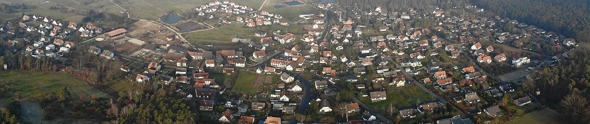
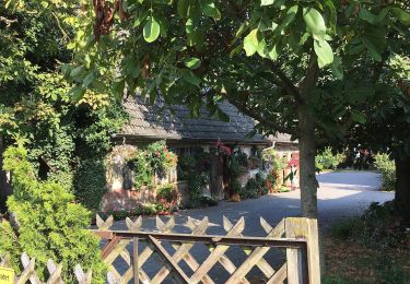
Tour Zu Fuß von 9,5 km verfügbar auf Bayern, Landkreis Erlangen-Höchstadt, Baiersdorf. Diese Tour wird von SityTrail - itinéraires balisés pédestres vorgeschlagen.
Beschreibung
Trail created by Fränkischer Albverein.
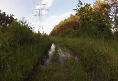
Durch Baiersdorf fehlt aktuell (Juni 2020) eine durchgängige Markierung
Symbol: Schwarzer Ring auf weißem Hintergrund
Ort
Kommentare
Touren in der Umgebung
![Tour Zu Fuß Bubenreuth - Hochwasserweg - Photo](https://media.geolcdn.com/t/375/260/0d4ced9c-0240-4646-a9bb-3ad2a492dab7.jpeg&format=jpg&maxdim=2)
![Zu Fuß Zu Fuß](https://static1.geolcdn.com/sitytour/trail-icons/100.png)
Zu Fuß
![](/images/other/stat-length.png)
![](https://static1.geolcdn.com/siteimages/upload/files/16400158638029165_repeat_loop_refresh_sync_direction_icon.png)
![Tour Zu Fuß Forchheim - Jubiläumsweg 1914 - Photo](https://media.geolcdn.com/t/375/260/3c94f5e2-8d5c-478a-bffe-ecaca4655e99.jpeg&format=jpg&maxdim=2)
![Zu Fuß Zu Fuß](https://static1.geolcdn.com/sitytour/trail-icons/100.png)
Zu Fuß
![](/images/other/stat-length.png)
![](https://static1.geolcdn.com/siteimages/upload/files/16400158638029165_repeat_loop_refresh_sync_direction_icon.png)
![Tour Zu Fuß Marloffstein - Berg & Talpfad - Photo](https://media.geolcdn.com/t/375/260/0d4ced9c-0240-4646-a9bb-3ad2a492dab7.jpeg&format=jpg&maxdim=2)
![Zu Fuß Zu Fuß](https://static1.geolcdn.com/sitytour/trail-icons/100.png)
Zu Fuß
![](/images/other/stat-length.png)
![](https://static1.geolcdn.com/siteimages/upload/files/16400158638029165_repeat_loop_refresh_sync_direction_icon.png)
![Tour Zu Fuß Forchheim - Kersbach-Schlaifhausen - Photo](https://media.geolcdn.com/t/375/260/e4986558-fafa-48e1-b585-99a6745c78af.jpeg&format=jpg&maxdim=2)
![Zu Fuß Zu Fuß](https://static1.geolcdn.com/sitytour/trail-icons/100.png)
Zu Fuß
![](/images/other/stat-length.png)
![](https://static1.geolcdn.com/siteimages/upload/files/16400158638029165_repeat_loop_refresh_sync_direction_icon.png)
![Tour Zu Fuß Möhrendorf - Wanderweg Südlicher Möhrendorfer Rundweg - Photo](https://media.geolcdn.com/t/375/260/ea22ba3f-a9ef-4aa3-9503-4a65b8526407.jpeg&format=jpg&maxdim=2)
![Zu Fuß Zu Fuß](https://static1.geolcdn.com/sitytour/trail-icons/100.png)
Zu Fuß
![](/images/other/stat-length.png)
![](https://static1.geolcdn.com/siteimages/upload/files/16400158638029165_repeat_loop_refresh_sync_direction_icon.png)
![Tour Zu Fuß Möhrendorf - Wanderweg Nördlicher Möhrendorfer Rundweg - Photo](https://media.geolcdn.com/t/375/260/e180760a-0888-4e24-92e4-d287ef34491e.jpeg&format=jpg&maxdim=2)
![Zu Fuß Zu Fuß](https://static1.geolcdn.com/sitytour/trail-icons/100.png)
Zu Fuß
![](/images/other/stat-length.png)
![](https://static1.geolcdn.com/siteimages/upload/files/16400158638029165_repeat_loop_refresh_sync_direction_icon.png)
![Tour Zu Fuß Mark - Wanderweg Erlangen 1 grün - Photo](https://media.geolcdn.com/t/375/260/ea22ba3f-a9ef-4aa3-9503-4a65b8526407.jpeg&format=jpg&maxdim=2)
![Zu Fuß Zu Fuß](https://static1.geolcdn.com/sitytour/trail-icons/100.png)
Zu Fuß
![](/images/other/stat-length.png)
![](https://static1.geolcdn.com/siteimages/upload/files/16400158638029165_repeat_loop_refresh_sync_direction_icon.png)
![Tour Zu Fuß Möhrendorf - Naturerlebnispfad Erlangen - Photo](https://media.geolcdn.com/t/375/260/ea22ba3f-a9ef-4aa3-9503-4a65b8526407.jpeg&format=jpg&maxdim=2)
![Zu Fuß Zu Fuß](https://static1.geolcdn.com/sitytour/trail-icons/100.png)
Zu Fuß
![](/images/other/stat-length.png)
![](https://static1.geolcdn.com/siteimages/upload/files/16400158638029165_repeat_loop_refresh_sync_direction_icon.png)
![Tour Zu Fuß Möhrendorf - Wanderweg Dechsendorfer Weiher - Bhf Bubenreuth - Photo](https://media.geolcdn.com/t/375/260/1852110c-558f-4702-a0aa-8c9bd87b7f06.jpeg&format=jpg&maxdim=2)
![Zu Fuß Zu Fuß](https://static1.geolcdn.com/sitytour/trail-icons/100.png)
Zu Fuß
![](/images/other/stat-length.png)
![](https://static1.geolcdn.com/siteimages/upload/files/16400158638029165_repeat_loop_refresh_sync_direction_icon.png)