![](/images/other/stat-length.png)
![Tour Zu Fuß Eichenbühl - Rundwanderweg Eichenbühl Guggenberger Höhe 3: Scheidberg-Weg - Photo](https://media.geolcdn.com/t/1900/400/16d29f94-7216-4037-93f8-379232627de3.jpeg&format=pjpeg&maxdim=2)
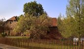
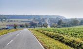
Rundwanderweg Eichenbühl Guggenberger Höhe 3: Scheidberg-Weg
SityTrail - itinéraires balisés pédestres
Tous les sentiers balisés d’Europe GUIDE+
![Länge](/images/other/stat-length.png)
Länge
4,8 km
![Maximale Höhe](https://static1.geolcdn.com/siteimages/upload/files/1508320355ic_sort_altitude_max_24dp.png)
Maximale Höhe
403 m
![Positive Höhendifferenz](https://static1.geolcdn.com/siteimages/upload/files/1508320355ic_sort_den_pos_24dp.png)
Positive Höhendifferenz
97 m
![Km-Effort](/images/other/stat-length.png)
Km-Effort
6,1 km
![Min. Höhe](https://static1.geolcdn.com/siteimages/upload/files/1508320355ic_sort_altitude_min_24dp.png)
Min. Höhe
309 m
![Negative Höhendifferenz](https://static1.geolcdn.com/siteimages/upload/files/1508320355ic_sort_den_neg_24dp.png)
Negative Höhendifferenz
97 m
![Boucle](https://static1.geolcdn.com/siteimages/upload/files/16400158638029165_repeat_loop_refresh_sync_direction_icon.png)
Boucle
Ja
Kennzeichnung
Erstellungsdatum :
2022-02-11 19:35:04.835
Letzte Änderung :
2022-02-11 19:35:04.835
![Zu Fuß](https://static1.geolcdn.com/sitytour/trail-icons/100.png)
1h22
Schwierigkeit : Einfach
![Scannen Sie diesen QR-Code, um die Tour in der SityTrail-Anwendung zu öffnen](https://capi.geolives.com/qq0zvz2zws4bq2lad0pu/sitytour/trails/3100856/qr.png?size=200)
Kostenlosegpshiking-Anwendung
Über SityTrail
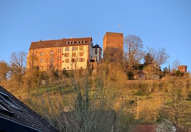
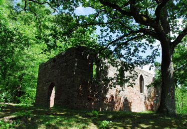
Tour Zu Fuß von 4,8 km verfügbar auf Bayern, Landkreis Miltenberg, Eichenbühl. Diese Tour wird von SityTrail - itinéraires balisés pédestres vorgeschlagen.
Beschreibung
Trail created by Geo-Naturpark Bergstraße-Odenwald.
Symbol: Gelbe 3 in gelbem Kreis
Ort
Land:
Germany
Region :
Bayern
Abteilung/Provinz :
Landkreis Miltenberg
Kommune :
Eichenbühl
Standort:
Unknown
Gehen Sie:(Dec)
Gehen Sie:(UTM)
528292 ; 5500848 (32U) N.
Kommentare
Touren in der Umgebung
![Tour Zu Fuß Erlenbach am Main - Untermain Planetenweg - Photo](https://media.geolcdn.com/t/375/260/c9b0be19-85d6-4147-8c49-d1185a6fa752.jpeg&format=jpg&maxdim=2)
![Zu Fuß Zu Fuß](https://static1.geolcdn.com/sitytour/trail-icons/100.png)
Untermain Planetenweg
Zu Fuß
Einfach
Erlenbach am Main,
Bayern,
Landkreis Miltenberg,
Germany
![](/images/other/stat-length.png)
6,8 km | 7,3 km-effort
1h 39min
![](https://static1.geolcdn.com/siteimages/upload/files/16400158638029165_repeat_loop_refresh_sync_direction_icon.png)
Nein
![Tour Zu Fuß Collenberg - Burgberg-Ausblick - Photo](https://media.geolcdn.com/t/375/260/47184e0d-c747-4127-bc7d-1a17777a0e98.jpeg&format=jpg&maxdim=2)
![Zu Fuß Zu Fuß](https://static1.geolcdn.com/sitytour/trail-icons/100.png)
Burgberg-Ausblick
Zu Fuß
Einfach
Collenberg,
Bayern,
Landkreis Miltenberg,
Germany
![](/images/other/stat-length.png)
6,4 km | 9,9 km-effort
2h 15min
![](https://static1.geolcdn.com/siteimages/upload/files/16400158638029165_repeat_loop_refresh_sync_direction_icon.png)
Ja
![Tour Zu Fuß Walldürn - Biotoplehrpfad - Variante 3 - Über die Eiderbach zum Fledermausturm - Photo](https://media.geolcdn.com/t/375/260/d331c0f5-fec8-4e9f-adaa-1f1b1a6d56c6.jpeg&format=jpg&maxdim=2)
![Zu Fuß Zu Fuß](https://static1.geolcdn.com/sitytour/trail-icons/100.png)
Biotoplehrpfad - Variante 3 - Über die Eiderbach zum Fledermausturm
Zu Fuß
Einfach
Walldürn,
Baden-Württemberg,
Neckar-Odenwald-Kreis,
Germany
![](/images/other/stat-length.png)
4,4 km | 5,2 km-effort
1h 11min
![](https://static1.geolcdn.com/siteimages/upload/files/16400158638029165_repeat_loop_refresh_sync_direction_icon.png)
Nein
![Tour Zu Fuß Walldürn - Biotoplehrpfad Walldürn - Photo](https://media.geolcdn.com/t/375/260/cfdbebf0-e900-484a-b402-9a1766e396d2.jpeg&format=jpg&maxdim=2)
![Zu Fuß Zu Fuß](https://static1.geolcdn.com/sitytour/trail-icons/100.png)
Biotoplehrpfad Walldürn
Zu Fuß
Einfach
Walldürn,
Baden-Württemberg,
Neckar-Odenwald-Kreis,
Germany
![](/images/other/stat-length.png)
8,7 km | 9,7 km-effort
2h 12min
![](https://static1.geolcdn.com/siteimages/upload/files/16400158638029165_repeat_loop_refresh_sync_direction_icon.png)
Ja
![Tour Zu Fuß Wertheim - Kulturweg Bronnbach Höhefeld - Photo](https://media.geolcdn.com/t/375/260/d419287f-d06a-4f1a-8bf9-699abcc1ffba.jpeg&format=jpg&maxdim=2)
![Zu Fuß Zu Fuß](https://static1.geolcdn.com/sitytour/trail-icons/100.png)
Kulturweg Bronnbach Höhefeld
Zu Fuß
Einfach
Wertheim,
Baden-Württemberg,
Main-Tauber-Kreis,
Germany
![](/images/other/stat-length.png)
7,2 km | 10,4 km-effort
2h 21min
![](https://static1.geolcdn.com/siteimages/upload/files/16400158638029165_repeat_loop_refresh_sync_direction_icon.png)
Nein
![Tour Zu Fuß Werbach - Rundwanderweg Gamburg 1 - Photo](https://media.geolcdn.com/t/375/260/bf6f2131-076c-419d-9b06-e72ce843a917.jpeg&format=jpg&maxdim=2)
![Zu Fuß Zu Fuß](https://static1.geolcdn.com/sitytour/trail-icons/100.png)
Rundwanderweg Gamburg 1
Zu Fuß
Einfach
Werbach,
Baden-Württemberg,
Main-Tauber-Kreis,
Germany
![](/images/other/stat-length.png)
6,7 km | 9,9 km-effort
2h 14min
![](https://static1.geolcdn.com/siteimages/upload/files/16400158638029165_repeat_loop_refresh_sync_direction_icon.png)
Ja
![Tour Zu Fuß Buchen (Odenwald) - Rundwanderweg Waldhausen 2 Grauer-Forst-Weg - Photo](https://media.geolcdn.com/t/375/260/43f759de-271e-42a4-89f7-37a9e659078b.jpeg&format=jpg&maxdim=2)
![Zu Fuß Zu Fuß](https://static1.geolcdn.com/sitytour/trail-icons/100.png)
Rundwanderweg Waldhausen 2 Grauer-Forst-Weg
Zu Fuß
Einfach
Buchen (Odenwald),
Baden-Württemberg,
Neckar-Odenwald-Kreis,
Germany
![](/images/other/stat-length.png)
10,2 km | 12,8 km-effort
2h 54min
![](https://static1.geolcdn.com/siteimages/upload/files/16400158638029165_repeat_loop_refresh_sync_direction_icon.png)
Ja
![Tour Zu Fuß Freudenberg - Liebliches Taubertal 1 - Photo](https://media.geolcdn.com/t/375/260/a1a1ddd0-299d-46dc-a79b-92d4fb751b83.jpeg&format=jpg&maxdim=2)
![Zu Fuß Zu Fuß](https://static1.geolcdn.com/sitytour/trail-icons/100.png)
Liebliches Taubertal 1
Zu Fuß
Einfach
Freudenberg,
Baden-Württemberg,
Main-Tauber-Kreis,
Germany
![](/images/other/stat-length.png)
3,2 km | 4,1 km-effort
56min
![](https://static1.geolcdn.com/siteimages/upload/files/16400158638029165_repeat_loop_refresh_sync_direction_icon.png)
Nein
![Tour Zu Fuß Bürgstadt - Rundwanderweg Bürgstadt Stutz 3: Ringwall-Weg - Photo](https://media.geolcdn.com/t/375/260/859545fc-75c4-4048-bc9f-115ae79da6f9.jpeg&format=jpg&maxdim=2)
![Zu Fuß Zu Fuß](https://static1.geolcdn.com/sitytour/trail-icons/100.png)
Rundwanderweg Bürgstadt Stutz 3: Ringwall-Weg
Zu Fuß
Einfach
Bürgstadt,
Bayern,
Landkreis Miltenberg,
Germany
![](/images/other/stat-length.png)
6,5 km | 10 km-effort
2h 16min
![](https://static1.geolcdn.com/siteimages/upload/files/16400158638029165_repeat_loop_refresh_sync_direction_icon.png)
Ja