![](/images/other/stat-length.png)
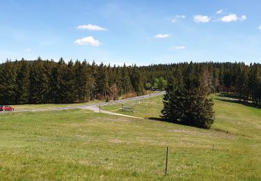
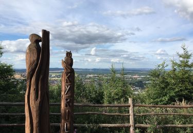
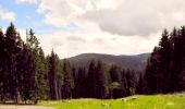
![Tour Zu Fuß Ilmenau - Grüner Balken - Photo](https://media.geolcdn.com/t/1900/400/173904bf-b758-4252-9b7d-31eb7c94fefc.jpeg&format=pjpeg&maxdim=2)
Grüner Balken
SityTrail - itinéraires balisés pédestres
Tous les sentiers balisés d’Europe GUIDE+
![Länge](/images/other/stat-length.png)
Länge
6,9 km
![Maximale Höhe](https://static1.geolcdn.com/siteimages/upload/files/1508320355ic_sort_altitude_max_24dp.png)
Maximale Höhe
773 m
![Positive Höhendifferenz](https://static1.geolcdn.com/siteimages/upload/files/1508320355ic_sort_den_pos_24dp.png)
Positive Höhendifferenz
161 m
![Km-Effort](/images/other/stat-length.png)
Km-Effort
9,1 km
![Min. Höhe](https://static1.geolcdn.com/siteimages/upload/files/1508320355ic_sort_altitude_min_24dp.png)
Min. Höhe
613 m
![Negative Höhendifferenz](https://static1.geolcdn.com/siteimages/upload/files/1508320355ic_sort_den_neg_24dp.png)
Negative Höhendifferenz
170 m
![Boucle](https://static1.geolcdn.com/siteimages/upload/files/16400158638029165_repeat_loop_refresh_sync_direction_icon.png)
Boucle
Nein
Kennzeichnung
Erstellungsdatum :
2022-02-11 18:56:24.873
Letzte Änderung :
2022-02-11 18:56:24.873
![Zu Fuß](https://static1.geolcdn.com/sitytour/trail-icons/100.png)
2h04
Schwierigkeit : Einfach
![Scannen Sie diesen QR-Code, um die Tour in der SityTrail-Anwendung zu öffnen](https://capi.geolives.com/qq0zvz2zws4bq2lad0pu/sitytour/trails/3100057/qr.png?size=200)
Kostenlosegpshiking-Anwendung
Über SityTrail
Tour Zu Fuß von 6,9 km verfügbar auf Thüringen, Ilm-Kreis, Ilmenau. Diese Tour wird von SityTrail - itinéraires balisés pédestres vorgeschlagen.
Beschreibung
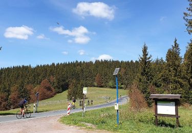
Symbol: Grüner balken auf weißem Grund
Ort
Land:
Germany
Region :
Thüringen
Abteilung/Provinz :
Ilm-Kreis
Kommune :
Ilmenau
Standort:
Manebach
Gehen Sie:(Dec)
Gehen Sie:(UTM)
630156 ; 5612397 (32U) N.
Kommentare
Touren in der Umgebung
![Tour Zu Fuß Unbekannt - Rennsteigleiter Gehlberg - Photo](https://media.geolcdn.com/t/375/260/bc48c4bd-89db-491c-8e32-3a2849d2c331.jpeg&format=jpg&maxdim=2)
![Zu Fuß Zu Fuß](https://static1.geolcdn.com/sitytour/trail-icons/100.png)
Rennsteigleiter Gehlberg
Zu Fuß
Einfach
Unbekannt,
Thüringen,
Suhl,
Germany
![](/images/other/stat-length.png)
3,2 km | 4,2 km-effort
57min
![](https://static1.geolcdn.com/siteimages/upload/files/16400158638029165_repeat_loop_refresh_sync_direction_icon.png)
Nein
![Tour Zu Fuß Ilmenau - Rennsteigleiter Manebach - Photo](https://media.geolcdn.com/t/375/260/565b5fa6-709a-4899-b332-00776560450d.jpeg&format=jpg&maxdim=2)
![Zu Fuß Zu Fuß](https://static1.geolcdn.com/sitytour/trail-icons/100.png)
Rennsteigleiter Manebach
Zu Fuß
Einfach
Ilmenau,
Thüringen,
Ilm-Kreis,
Germany
![](/images/other/stat-length.png)
9,6 km | 14,2 km-effort
3h 13min
![](https://static1.geolcdn.com/siteimages/upload/files/16400158638029165_repeat_loop_refresh_sync_direction_icon.png)
Nein
![Tour Zu Fuß Unbekannt - Rennsteigleiter Ilmenau - Photo](https://media.geolcdn.com/t/375/260/77f4d708-20d9-4ade-9955-5dac40d6aaf1.jpeg&format=jpg&maxdim=2)
![Zu Fuß Zu Fuß](https://static1.geolcdn.com/sitytour/trail-icons/100.png)
Rennsteigleiter Ilmenau
Zu Fuß
Einfach
Unbekannt,
Thüringen,
Suhl,
Germany
![](/images/other/stat-length.png)
13,5 km | 16,1 km-effort
3h 39min
![](https://static1.geolcdn.com/siteimages/upload/files/16400158638029165_repeat_loop_refresh_sync_direction_icon.png)
Nein
![Tour Zu Fuß Ilmenau - DE-rotes Dreieck - Photo](https://media.geolcdn.com/t/375/260/725f7a5d-5ba1-420b-9fa5-98a774a12ce6.jpeg&format=jpg&maxdim=2)
![Zu Fuß Zu Fuß](https://static1.geolcdn.com/sitytour/trail-icons/100.png)
DE-rotes Dreieck
Zu Fuß
Einfach
Ilmenau,
Thüringen,
Ilm-Kreis,
Germany
![](/images/other/stat-length.png)
5,4 km | 6,4 km-effort
1h 27min
![](https://static1.geolcdn.com/siteimages/upload/files/16400158638029165_repeat_loop_refresh_sync_direction_icon.png)
Nein
![Tour Zu Fuß - Bergbaupfad Crux-Zechen - Photo](https://media.geolcdn.com/t/375/260/9ff2d3ac-c5fc-44b7-953a-c881d507a846.jpeg&format=jpg&maxdim=2)
![Zu Fuß Zu Fuß](https://static1.geolcdn.com/sitytour/trail-icons/100.png)
Bergbaupfad Crux-Zechen
Zu Fuß
Einfach
,
Thüringen,
Suhl,
Germany
![](/images/other/stat-length.png)
4 km | 5,5 km-effort
1h 15min
![](https://static1.geolcdn.com/siteimages/upload/files/16400158638029165_repeat_loop_refresh_sync_direction_icon.png)
Nein
![Tour Zu Fuß Ilmenau - Rund um Ilmenau - Photo](https://media.geolcdn.com/t/375/260/e3a0754c-0f90-4197-9d5d-7932ac43308c.jpeg&format=jpg&maxdim=2)
![Zu Fuß Zu Fuß](https://static1.geolcdn.com/sitytour/trail-icons/100.png)
Rund um Ilmenau
Zu Fuß
Medium
Ilmenau,
Thüringen,
Ilm-Kreis,
Germany
![](/images/other/stat-length.png)
21 km | 27 km-effort
6h 13min
![](https://static1.geolcdn.com/siteimages/upload/files/16400158638029165_repeat_loop_refresh_sync_direction_icon.png)
Nein
![Tour Zu Fuß Unbekannt - Gipfelwanderweg Suhl (Thüringer Wald) - Photo](https://media.geolcdn.com/t/375/260/6bb7536f-38cf-4075-ab68-998255e07ff8.jpeg&format=jpg&maxdim=2)
![Zu Fuß Zu Fuß](https://static1.geolcdn.com/sitytour/trail-icons/100.png)
Gipfelwanderweg Suhl (Thüringer Wald)
Zu Fuß
Medium
Unbekannt,
Thüringen,
Suhl,
Germany
![](/images/other/stat-length.png)
18 km | 24 km-effort
5h 31min
![](https://static1.geolcdn.com/siteimages/upload/files/16400158638029165_repeat_loop_refresh_sync_direction_icon.png)
Nein
![Tour Zu Fuß Ilmenau - Rund um den Kickelhahn - Photo](https://media.geolcdn.com/t/375/260/22c210e3-bcc0-4ed7-acc0-a5cfa2860469.jpeg&format=jpg&maxdim=2)
![Zu Fuß Zu Fuß](https://static1.geolcdn.com/sitytour/trail-icons/100.png)
Rund um den Kickelhahn
Zu Fuß
Einfach
Ilmenau,
Thüringen,
Ilm-Kreis,
Germany
![](/images/other/stat-length.png)
7,7 km | 12,6 km-effort
2h 51min
![](https://static1.geolcdn.com/siteimages/upload/files/16400158638029165_repeat_loop_refresh_sync_direction_icon.png)
Nein
![Tour Zu Fuß Ilmenau - Roter Punkt, Alte Straße - Photo](https://media.geolcdn.com/t/375/260/565b5fa6-709a-4899-b332-00776560450d.jpeg&format=jpg&maxdim=2)
![Zu Fuß Zu Fuß](https://static1.geolcdn.com/sitytour/trail-icons/100.png)
Roter Punkt, Alte Straße
Zu Fuß
Einfach
Ilmenau,
Thüringen,
Ilm-Kreis,
Germany
![](/images/other/stat-length.png)
9,6 km | 12,8 km-effort
2h 54min
![](https://static1.geolcdn.com/siteimages/upload/files/16400158638029165_repeat_loop_refresh_sync_direction_icon.png)
Nein