![](/images/other/stat-length.png)
![Tour Zu Fuß Kiedrich - Kiedrich 8: - Photo](https://media.geolcdn.com/t/1900/400/ext.pjpeg?maxdim=2&url=https%3A%2F%2Fmedia.geolcdn.com%2Ff%2F2c023441-fc39-40c2-b5a2-5f669c44ef98.jpeg)
Kiedrich 8:
SityTrail - itinéraires balisés pédestres
Tous les sentiers balisés d’Europe PRO
![Länge](/images/other/stat-length.png)
Länge
5,7 km
![Maximale Höhe](https://static1.geolcdn.com/siteimages/upload/files/1508320355ic_sort_altitude_max_24dp.png)
Maximale Höhe
387 m
![Positive Höhendifferenz](https://static1.geolcdn.com/siteimages/upload/files/1508320355ic_sort_den_pos_24dp.png)
Positive Höhendifferenz
72 m
![Km-Effort](/images/other/stat-length.png)
Km-Effort
7,2 km
![Min. Höhe](https://static1.geolcdn.com/siteimages/upload/files/1508320355ic_sort_altitude_min_24dp.png)
Min. Höhe
170 m
![Negative Höhendifferenz](https://static1.geolcdn.com/siteimages/upload/files/1508320355ic_sort_den_neg_24dp.png)
Negative Höhendifferenz
240 m
![Boucle](https://static1.geolcdn.com/siteimages/upload/files/16400158638029165_repeat_loop_refresh_sync_direction_icon.png)
Boucle
Nein
Kennzeichnung
Erstellungsdatum :
2022-02-11 18:45:30.812
Letzte Änderung :
2022-02-11 18:45:30.812
![Zu Fuß](https://static1.geolcdn.com/sitytour/trail-icons/100.png)
1h38
Schwierigkeit : Einfach
![Scannen Sie diesen QR-Code, um die Tour in der SityTrail-Anwendung zu öffnen](https://capi.geolives.com/qq0zvz2zws4bq2lad0pu/sitytour/trails/3099799/qr.png?size=200)
Kostenlosegpshiking-Anwendung
Über SityTrail
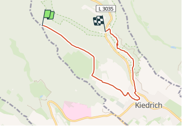
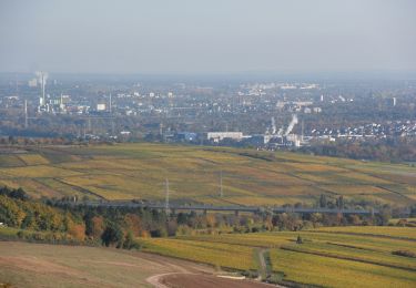
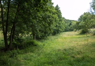
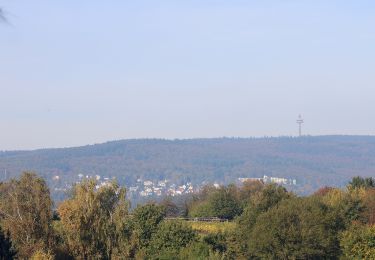
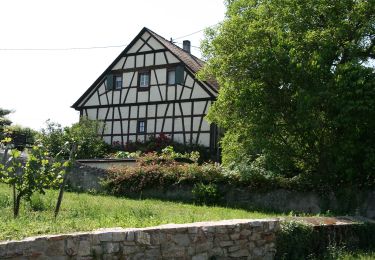
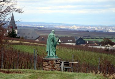
Tour Zu Fuß von 5,7 km verfügbar auf Hessen, Rheingau-Taunus-Kreis, Kiedrich. Diese Tour wird von SityTrail - itinéraires balisés pédestres vorgeschlagen.
Beschreibung
Symbol: blaues, rechteckiges Schild mit einer weißen 8
Ort
Land:
Germany
Region :
Hessen
Abteilung/Provinz :
Rheingau-Taunus-Kreis
Kommune :
Kiedrich
Standort:
Unknown
Gehen Sie:(Dec)
Gehen Sie:(UTM)
431876 ; 5545448 (32U) N.
Kommentare
Touren in der Umgebung
![Tour Zu Fuß Schlangenbad - Glaabacher Almauftrieb - Photo](https://media.geolcdn.com/t/375/260/ext.jpg?maxdim=2&url=https%3A%2F%2Fmedia.geolcdn.com%2Ff%2F049417cf-441f-4e72-9098-4b7831623d7a.jpeg)
![Zu Fuß Zu Fuß](https://static1.geolcdn.com/sitytour/trail-icons/100.png)
Glaabacher Almauftrieb
Zu Fuß
Medium
Schlangenbad,
Hessen,
Rheingau-Taunus-Kreis,
Germany
![](/images/other/stat-length.png)
18,8 km | 27 km-effort
6h 6min
![](https://static1.geolcdn.com/siteimages/upload/files/16400158638029165_repeat_loop_refresh_sync_direction_icon.png)
Ja
![Tour Zu Fuß Eltville am Rhein - Rheinsteig-Zuweg Eltville - Photo](https://media.geolcdn.com/t/375/260/ext.jpg?maxdim=2&url=https%3A%2F%2Fmedia.geolcdn.com%2Ff%2F27ade83c-c43d-4b74-8817-38b2f29ada10.jpeg)
![Zu Fuß Zu Fuß](https://static1.geolcdn.com/sitytour/trail-icons/100.png)
Rheinsteig-Zuweg Eltville
Zu Fuß
Einfach
Eltville am Rhein,
Hessen,
Rheingau-Taunus-Kreis,
Germany
![](/images/other/stat-length.png)
3,2 km | 3,6 km-effort
48min
![](https://static1.geolcdn.com/siteimages/upload/files/16400158638029165_repeat_loop_refresh_sync_direction_icon.png)
Nein
![Tour Zu Fuß Kiedrich - Kiedrich 7: - Photo](https://media.geolcdn.com/t/375/260/ext.jpg?maxdim=2&url=https%3A%2F%2Fmedia.geolcdn.com%2Ff%2F2c023441-fc39-40c2-b5a2-5f669c44ef98.jpeg)
![Zu Fuß Zu Fuß](https://static1.geolcdn.com/sitytour/trail-icons/100.png)
Kiedrich 7:
Zu Fuß
Einfach
Kiedrich,
Hessen,
Rheingau-Taunus-Kreis,
Germany
![](/images/other/stat-length.png)
5,8 km | 7,7 km-effort
1h 45min
![](https://static1.geolcdn.com/siteimages/upload/files/16400158638029165_repeat_loop_refresh_sync_direction_icon.png)
Nein
![Tour Zu Fuß Eltville am Rhein - Rheinsteig-Zuweg Niederwalluf (West) - Photo](https://media.geolcdn.com/t/375/260/ext.jpg?maxdim=2&url=https%3A%2F%2Fmedia.geolcdn.com%2Ff%2F37c3ad44-bffd-4d35-9f40-789cd2c4f541.jpeg)
![Zu Fuß Zu Fuß](https://static1.geolcdn.com/sitytour/trail-icons/100.png)
Rheinsteig-Zuweg Niederwalluf (West)
Zu Fuß
Einfach
Eltville am Rhein,
Hessen,
Rheingau-Taunus-Kreis,
Germany
![](/images/other/stat-length.png)
5,8 km | 8,2 km-effort
1h 51min
![](https://static1.geolcdn.com/siteimages/upload/files/16400158638029165_repeat_loop_refresh_sync_direction_icon.png)
Nein
![Tour Zu Fuß Eltville am Rhein - Rheinsteig Rundtour: Rauenthaler Spange - Photo](https://media.geolcdn.com/t/375/260/ext.jpg?maxdim=2&url=https%3A%2F%2Fmedia.geolcdn.com%2Ff%2Ff17f7bce-e902-429b-8a92-95a9e738d243.jpeg)
![Zu Fuß Zu Fuß](https://static1.geolcdn.com/sitytour/trail-icons/100.png)
Rheinsteig Rundtour: Rauenthaler Spange
Zu Fuß
Einfach
Eltville am Rhein,
Hessen,
Rheingau-Taunus-Kreis,
Germany
![](/images/other/stat-length.png)
7,5 km | 9,8 km-effort
2h 13min
![](https://static1.geolcdn.com/siteimages/upload/files/16400158638029165_repeat_loop_refresh_sync_direction_icon.png)
Nein
![Tour Zu Fuß Oestrich-Winkel - Rheinsteig-Zuweg Oestrich - Photo](https://media.geolcdn.com/t/375/260/ext.jpg?maxdim=2&url=https%3A%2F%2Fmedia.geolcdn.com%2Ff%2Fcd091fed-3575-471c-85b8-e8e4faab10a4.jpeg)
![Zu Fuß Zu Fuß](https://static1.geolcdn.com/sitytour/trail-icons/100.png)
Rheinsteig-Zuweg Oestrich
Zu Fuß
Einfach
Oestrich-Winkel,
Hessen,
Rheingau-Taunus-Kreis,
Germany
![](/images/other/stat-length.png)
3,1 km | 3,4 km-effort
46min
![](https://static1.geolcdn.com/siteimages/upload/files/16400158638029165_repeat_loop_refresh_sync_direction_icon.png)
Nein
![Tour Zu Fuß Oestrich-Winkel - Oestricher Flötenweg - Photo](https://media.geolcdn.com/t/375/260/ext.jpg?maxdim=2&url=https%3A%2F%2Fmedia.geolcdn.com%2Ff%2F1d02bcef-020c-43bf-8f6f-996adca7a9a9.jpeg)
![Zu Fuß Zu Fuß](https://static1.geolcdn.com/sitytour/trail-icons/100.png)
Oestricher Flötenweg
Zu Fuß
Einfach
Oestrich-Winkel,
Hessen,
Rheingau-Taunus-Kreis,
Germany
![](/images/other/stat-length.png)
3,4 km | 3,9 km-effort
52min
![](https://static1.geolcdn.com/siteimages/upload/files/16400158638029165_repeat_loop_refresh_sync_direction_icon.png)
Nein
![Tour Zu Fuß Eltville am Rhein - Parkplatz](https://media.geolcdn.com/t/375/260/ext.jpg?maxdim=2&url=https%3A%2F%2Fmedia.geolcdn.com%2Ff%2Fa5fa8808-7bc4-471d-87b3-b17e6f02ba71.jpeg)
![Zu Fuß Zu Fuß](https://static1.geolcdn.com/sitytour/trail-icons/100.png)
Parkplatz "Rausch": Rundwanderweg Pilz
Zu Fuß
Einfach
Eltville am Rhein,
Hessen,
Rheingau-Taunus-Kreis,
Germany
![](/images/other/stat-length.png)
5,5 km | 8,2 km-effort
1h 51min
![](https://static1.geolcdn.com/siteimages/upload/files/16400158638029165_repeat_loop_refresh_sync_direction_icon.png)
Ja
![Tour Zu Fuß Oestrich-Winkel - Quer-Flötenweg - Photo](https://media.geolcdn.com/t/375/260/ext.jpg?maxdim=2&url=https%3A%2F%2Fmedia.geolcdn.com%2Ff%2Ff0ed43c9-212e-4979-9325-1ab2244a8844.jpeg)
![Zu Fuß Zu Fuß](https://static1.geolcdn.com/sitytour/trail-icons/100.png)
Quer-Flötenweg
Zu Fuß
Einfach
Oestrich-Winkel,
Hessen,
Rheingau-Taunus-Kreis,
Germany
![](/images/other/stat-length.png)
4,9 km | 6,4 km-effort
1h 27min
![](https://static1.geolcdn.com/siteimages/upload/files/16400158638029165_repeat_loop_refresh_sync_direction_icon.png)
Nein